ORH_wxman
-
Posts
93,095 -
Joined
-
Last visited
Content Type
Profiles
Blogs
Forums
American Weather
Media Demo
Store
Gallery
Everything posted by ORH_wxman
-
NAM has really strong confluence, but the main shortwave is so far west we wouldn't get the nice WCB thump....that would be out in the Great Lakes.
-
Yeah we need solid rates. Which I have right now. Hopefully it maintains. Best stuff is actually supposed to be later. Models had only light stuff right now but they are having some trouble handling trust N stream interaction I think.
-
If it’s gonna snow like this, we’ll accumulate fine today. Already starting to get stickage on pavement again.
-
Massive fatties falling here. Giant quarters.
-
CF pushed through here. Went from 27 to 32 in about 30 min.
-
That area just along and south of pike there got smoked last night. I wish it had translated a few more miles east to here.
-
Can’t trust the euro these days.
-
Eyeballing about 3 too but haven’t measured yet. Hoping to crack 6 later.
-
A lot of guidance has a lull for a couple hours this morning before stuff blossoms again…we’ll have to see how that plays out over the next few hours.
-
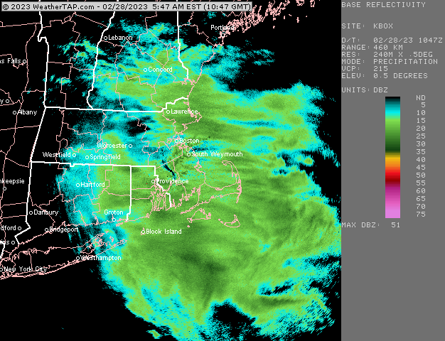
Pounding in this little enhanced area right now
-
Euro went from the most suppressed model about 4-5 runs ago to the most amped. Lol. It will be interesting to see what happens tomorrow given all of the other guidance trended south at 00z.
-
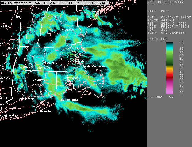
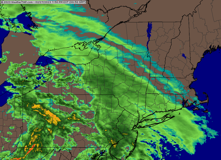
Radar looks pretty solid
-
Feb 28th-March 1st long duration Miller B threat
ORH_wxman replied to George001's topic in New England
The problem with snow maps is if they are 10 to 1, they will be too high in marginal areas…and that’s not because the model was wrong, it’s because people forecasted using 10 to 1. That’s one reason I like the QPF maps better. Easier to verify the model performance. But in your area, it’s prob fairly safe to use 10 to 1 since most of your snow is falling early with a cold column. -
Feb 28th-March 1st long duration Miller B threat
ORH_wxman replied to George001's topic in New England
It’s going to be marginal after early morning tomorrow along the coast. Onshore flow will creep temps up above freezing. If rates are decent, it matter a ton, but in lighter snow it could be the type that doesn’t really accumulate. -
Feb 28th-March 1st long duration Miller B threat
ORH_wxman replied to George001's topic in New England
18z euro ramped up again a bit. Prob warning snows for everyone more than 10 miles away from coast. -
All the 18z runs so far have strengthened the confluence in Quebec. Granted, rgem and NAM are in clown range for them but same trend as GFS and ICON.
-
Feb 28th-March 1st long duration Miller B threat
ORH_wxman replied to George001's topic in New England
Haha, he subverted your own joke. That was well-played. 18z gfs is going nuts tomorrow midday/afternoon. Really interested to see how that plays out in the 128 to 495 belt. -
Feb 28th-March 1st long duration Miller B threat
ORH_wxman replied to George001's topic in New England
I like that area tomorrow if they can stay around 31-32. Should be some decent convergence there. Anywhere with even a few hundred feet of weenie elevation should do well. My modest 350-400 feet may help a lot tomorrow down here near 495. -
Feb 28th-March 1st long duration Miller B threat
ORH_wxman replied to George001's topic in New England
Pretty uniform easterly flow from sfc to 925 tomorrow morning/midday....that's gonna be good for central/eastern hills. Wonder if that Foxborough area can get in on that action a bit too. -
Feb 28th-March 1st long duration Miller B threat
ORH_wxman replied to George001's topic in New England
Been the trend all day today -
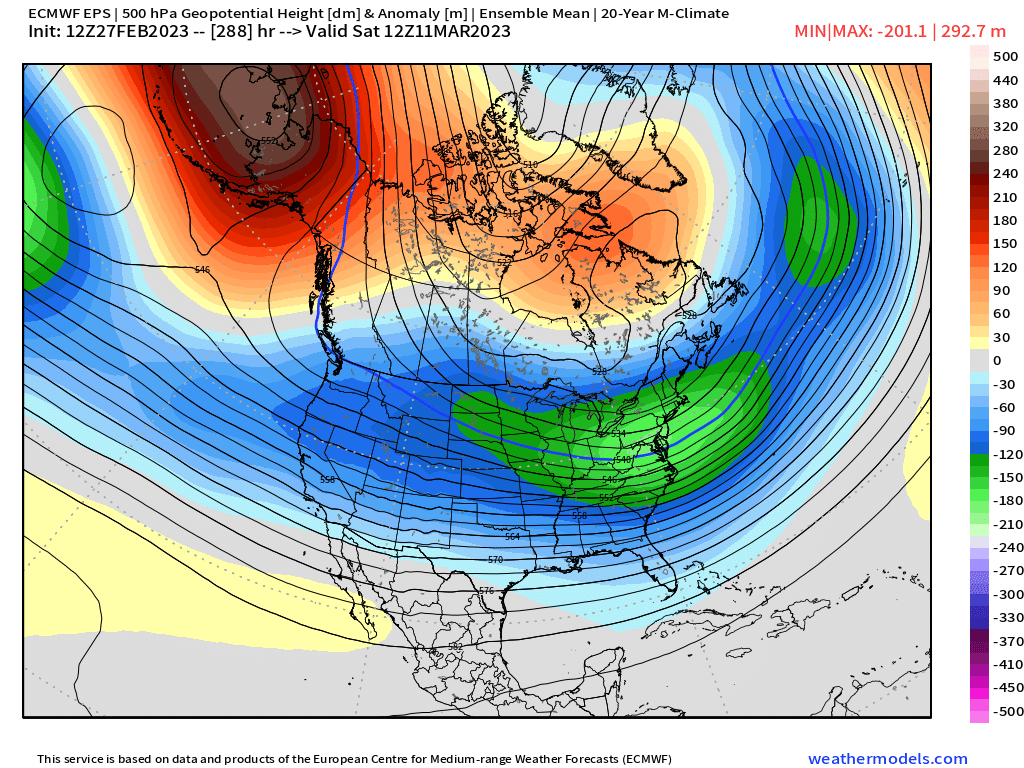
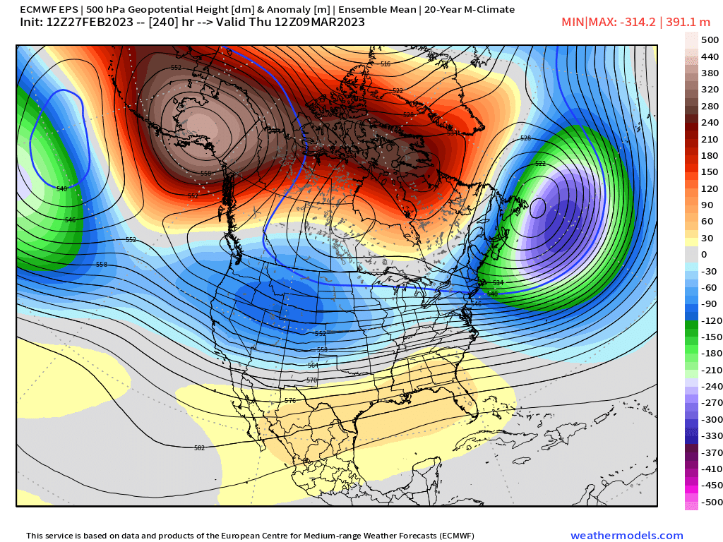
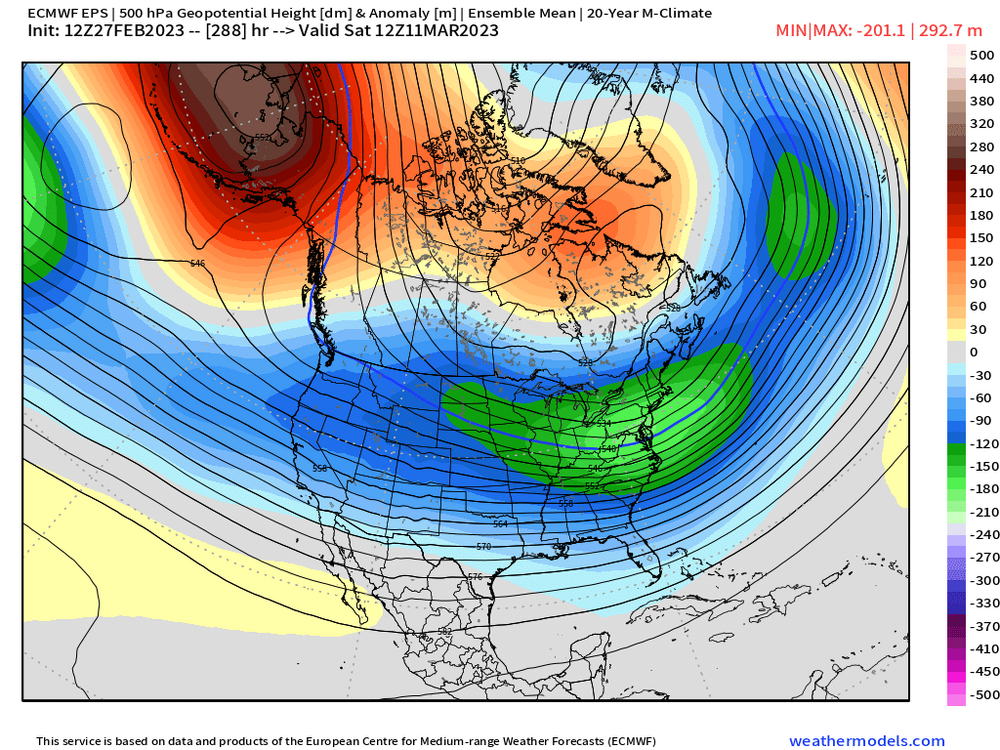
Suppression can happen, but I always love seeing the best negative height anomalies going through the southern mid-atlantic for big snows in New England.
-
48 hours later on EPS
-
Does have support from the EPS

-
Feb 28th-March 1st long duration Miller B threat
ORH_wxman replied to George001's topic in New England
The IVT tomorrow really would favor eastern slopes of ORH hills with that light easterly glide. The enhancement has been showing up on a lot of mesos. -
Feb 28th-March 1st long duration Miller B threat
ORH_wxman replied to George001's topic in New England
18z RAP continues to really amped up that leading band for the pike region....12z run had almost nothing for BOS prior to 09-10z but now it has like 3" of snow in that band by that point.