Jump to content

ORH_wxman

Moderator Meteorologist
  • Posts

    90,902
  • Joined

  • Last visited

Everything posted by ORH_wxman

  1. Man you really blew up my quote out of context. I didn’t say just flurries, I’m pretty sure I said ground whitened (aka, measurable) with flakes in the air. For 12/11? Yeah I’ll take that. It wasn’t supposed to imply that was all I would take in this particular pattern. I know there will be more chances.
  2. Yeah flakes flying and whitening the ground is a win this time of year. Get a good holiday mood going on Sunday while people are watching football or doing whatever.
  3. Might have to watch your hood for some decent OES bands and those could enhance the synoptic stuff. 3km clobbered your area…now I don’t think you’ll get warning snows like it showed but there’s some potential upside in a few lucky spots.
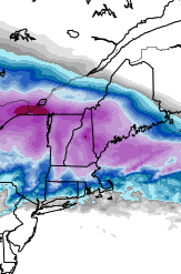
  4. 18z GFS QPF map was kind of funny…Ray and TBlizz can have their own pity party.
  5. 18z GFS coming back in a bit more amped. If you recall, the 12z run was the least amplified of the 12z guidance so this is bringing it back toward the model consensus.
  6. Scooter will take 5.5 C/Km pulsers and like it.
  7. Yeah hes in a bad spot for this one....but for much of the rest of SNE, I think this one could be a fun little first event of the met winter season. As long as the shortwave doesn't get totally crunched, there could be a few surprises. It's a pretty strong/vigorous shortwave tracking in a nice spot for many, so wouldn't be surprised a few heavier bursts of snow. Esp for the southwest half of SNE. But can't rule out a bit further east either. The 3km actually teamed up the synoptic stuff with the OES in SE MA and gave some extra enhancement there....which might be something to watch. Lot of mesoscale variables to keep on eye on in an otherwise smallish event. But the first one of the season is always a little more interesting than if this occurred in late January or something like that.
  8. Yeah that 3km run has an intense norlun-esque trough starting in SE NY/N NJ and then moving south to the Jersey shore.
  9. These are some crazy soundings....there's a reasonable shot at TSSN if these soundings verify....look at how steep the lapse rate is between 850-500 This is near Ginxy's hood for sunday evening
  10. 18z NAM with a bit more confluence, but the shortwave looks a bit more compact and vigorous so it's prob going to produce a nice band regardless
  11. I mentioned 1/12/11....but I started trying to recall others and the first big one in March '93 also achieved that feat....it gets overlooked by the Superstorm obviously, but it was a big storm in New England. I think we had about a foot. But it was a "tumbler" as you say.... http://www.meteo.psu.edu/fxg1/NARR/1993/us0301.php http://www.meteo.psu.edu/fxg1/NARR/1993/us0302.php http://www.meteo.psu.edu/fxg1/NARR/1993/us0303.php http://www.meteo.psu.edu/fxg1/NARR/1993/us0304.php http://www.meteo.psu.edu/fxg1/NARR/1993/us0305.php
  12. Pretty sure the 1/12/11 storm was a closed low almost the entire length of the CONUS. It wasn't as deep as the current modeled system though.
  13. I think the reason for this is that the ocean storm (50/50 low) from 12/12 is further east on the 12z EPS than 00z, so there is a bit more room for the huggers.
  14. Kind of interesting toggling the 12z and 00z EPS individual cyclone members. The primary is weaker and further south, the high to the north is stronger, but there are definitely more huggers in the 12z EPS suite despite those two previous variables.
  15. Destroys N ORH county to Berks and CNE. Kind of like a Dec '92 shifted north a bit.
  16. Trending a bit more southeast, but still gonna be a hugger I think
  17. Prob solid advisory snows for central and western zones. I'd be plenty happy if we got 2-3". Still gotta watch further southwest for an IVT/Norlun as it exits.
  18. Euro looks pretty juiced for sunday night.
  19. Just remind him he already cancelled the first 3 weeks of the month.
  20. I like where ens mean is at with plenty of spread NW at this lead time.
  21. For a pattern as chaotic and unpredictable as this one is at 6-7 days lead, I think it's hard to be too upset about where guidance is. Are we getting a huge snowstorm? Probably not, but we have a legit shot at one and that's all you can ask for a week out.
  22. Ukie is pretty amped for next week. Hopefully we split the difference between it and the GFS.
  23. We may have to watch for a few snow showers or light snow Tues/Wed from that retrograding 50/50 ULL.
×
×
  • Create New...