

ORH_wxman
-
Posts
93,095 -
Joined
-
Last visited
Content Type
Profiles
Blogs
Forums
American Weather
Media Demo
Store
Gallery
Everything posted by ORH_wxman
-
Feb 28th-March 1st long duration Miller B threat
ORH_wxman replied to George001's topic in New England
You’re in a pretty good spot for this one. I’d feel good in CT right now. I may have to resign myself to limping to 3 inches…assuming it doesn’t trend worse. But I am an empirical man and statistical man…I don’t just assume this will keep trending worse because of previous failures. There’s always a point where it stops and starts wobbling…just like the 2/23 event did and actually gave us pike-dwellers a real semblance of a snow pack. -
I was shocked to see Logan airport at 18F at 2pm in late February. Esp in a winter like this. Actual real cold airmass.
-
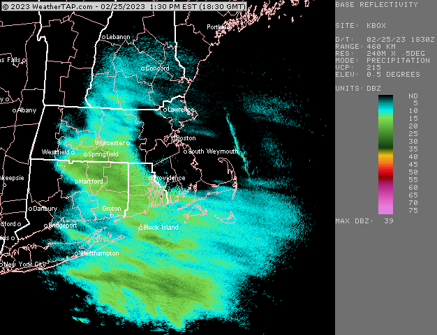
Actually looks like a nice weenie band near @radarman’s hood down into windham county CT
-
Euro did make a nice jump north for 3/4. Still whiffs us but not by much. A GFS/Euro compromise would be pretty sweet.
-
Feb 28th-March 1st long duration Miller B threat
ORH_wxman replied to George001's topic in New England
Ugh. That’s brutal. Only consolation is id rather need a shift north than one south right now…but that is ugly. Just gets ground up. -
Feb 28th-March 1st long duration Miller B threat
ORH_wxman replied to George001's topic in New England
Ukie is definitely not going to get it done for us easterners. Good run for CT though. -
Feb 28th-March 1st long duration Miller B threat
ORH_wxman replied to George001's topic in New England
I was fine with most guidance this morning minus the Canadian twins. We’ll see what ukie and euro do. -
Feb 28th-March 1st long duration Miller B threat
ORH_wxman replied to George001's topic in New England
GFS had a nice weenie band sig up near the pike to the NH border region. -
Feb 28th-March 1st long duration Miller B threat
ORH_wxman replied to George001's topic in New England
I mean, look at the 12/23/97 shortwave…it really wasn’t that impressive. But it had a nice neg tilt and held together just enough to pull that moisture in. We’re still not sure what caused the 6-8” per hour rates in that. Really bizarre. -
Feb 28th-March 1st long duration Miller B threat
ORH_wxman replied to George001's topic in New England
Just keep ticking that shortwave a little stronger and I think it would pay dividends. -
Feb 28th-March 1st long duration Miller B threat
ORH_wxman replied to George001's topic in New England
NAM def better looking. Not totally surprising though as it was the most paltry at 00z and 06z. So it wa a probably going to trend toward others. -
Feb 28th-March 1st long duration Miller B threat
ORH_wxman replied to George001's topic in New England
Shortwave looks a little more vigorous on the NAM through 48. The block though also looks like it is holding a bit tougher too so not sure if we’ll see much trend here. -
Feb 28th-March 1st long duration Miller B threat
ORH_wxman replied to George001's topic in New England
I think their record low is 8.2” for a season so they are in epic territory. This system is starting to look pretty decent for them though. -
Sequoia gets pretty high though. There’s also lower parts of the park but like several of the main parts of the park (like general Sherman tree) are around 7k. There was this little town one time I passed through called Coalfax just east of Sacramento in the Sierra foothills. I think the elevation was around 2,000 feet. That’s the type of town that is probably getting crushed in this.
-
Feb 28th-March 1st long duration Miller B threat
ORH_wxman replied to George001's topic in New England
There’s competing forces going on. The SE ridges always make me leery of northward shifts. However, with the block in place opposing the SE ridge, we run a risk of a weaker shortwave getting sheared/shredded in the meat grinder between those two. So I’m kind of expecting a shift north, but worried that it may come with a weaker system smeared out into like a 3-6” type event. That’s why I’m rooting for the stronger shortwave ejection on these next few cycles. If we can get it a touch stronger, it’s going to produce some really nice fronto bands with that geopotential gradient in place. -
Feb 28th-March 1st long duration Miller B threat
ORH_wxman replied to George001's topic in New England
There’s still some upside to this one too. Get that weenie E-W band going and there could be some nice surprises. But we don’t want this shortwave coming in any weaker that’s for sure. Would feel a lot better about ticking this a little more potent at 12z. -
Feb 28th-March 1st long duration Miller B threat
ORH_wxman replied to George001's topic in New England
Euro looked pretty good for CT. Maybe even up to the pike with a bit of ML banding…but I’m def gonna want to see a stronger shortwave ejecting on the 12z runs today. -
Really sneaky cold shot..esp up there in NNE.
-
Feb 28th-March 1st long duration Miller B threat
ORH_wxman replied to George001's topic in New England
Just catching up on overnight…Euro was pretty meh and that’s a concern. GFS still looks pretty solid, 06z NAM was still garbage. Looks like RGEM bumped north and Icon was pretty much status quo. -
Feb 28th-March 1st long duration Miller B threat
ORH_wxman replied to George001's topic in New England
I don’t hate this being a touch south right now with the stout SE ridge. I’m a little worried about a weaker shortwave, but these often come in more potent as we get closer. -
Feb 28th-March 1st long duration Miller B threat
ORH_wxman replied to George001's topic in New England
The shortwave ejected a bit weaker this run which I think is the main culprit. I didn’t see a huge difference in the block this run. -
Feb 28th-March 1st long duration Miller B threat
ORH_wxman replied to George001's topic in New England
GFS looks like it’s going to be south of 18z too. Def a south trend so far tonight. -
Feb 28th-March 1st long duration Miller B threat
ORH_wxman replied to George001's topic in New England
I didn’t really see much change at all..maybe the 1” area shrunk just a smidge
-
You had a good amount of ice too. Usually that would cause a decent number of outages. The wind factor probably helped with the damage further east.
-
Feb 28th-March 1st long duration Miller B threat
ORH_wxman replied to George001's topic in New England
More snow tomorrow than 2/28?

