cardinalland
-
Posts
516 -
Joined
-
Last visited
Content Type
Profiles
Blogs
Forums
American Weather
Media Demo
Store
Gallery
Everything posted by cardinalland
-
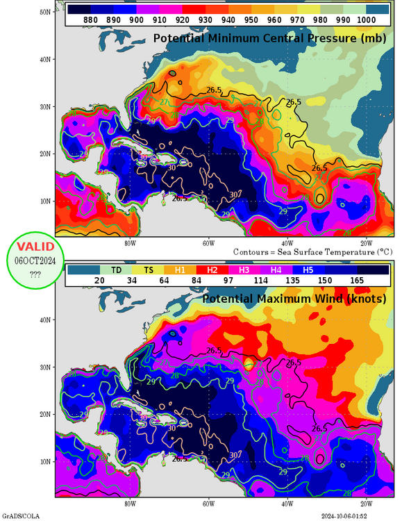
looks like this storm is gonna push us over the 160.1 ACE hyperactive threshold this is why not to call bust on a hurricane season too early
-
i wonder how much digital snow we’ll get this season maybe there should be a contest for that

-
i think 2 suns would get the job done, tatooine style
-
I'm not sure what the problem is, I think the post aligns pretty well with your statement. One could say it's sensationalized a little bit but that's just twitter for ya
-
tropical moisture may be our best bet in this region right now. it's the only way any model shows us getting rain
-
 KNYC 9" KLGA 9" KJFK 9" KEWR 11" KBDR 13" novembtorch decembtorch jorchuary forchbuary morch
 -
2024 Atlantic Hurricane Season
cardinalland replied to Stormchaserchuck1's topic in Tropical Headquarters
Sandy was a week before election day but I know it still complicated things here in the NY Metro -
never been the biggest fan of apple maps, but i gotta admit this feature is pretty cool.

-
the 3 best analogs I could find (for a dry 60 period leading up to 10/15 and a La Niña) are 1964 (24.4" snow at KNYC), 1973 (23.5" snow at KNYC) and 1984 (24.1" snow at KNYC). A remarkably average set of years, for snowfall at least...
-
shades of last winter on the 2 week forecast, with the greatest positive departures over the midwest and central canada.
-
new york diego, ca
-
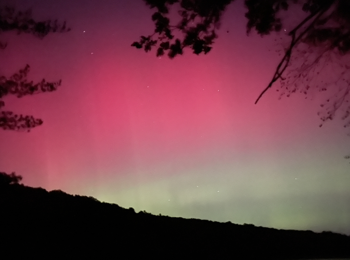
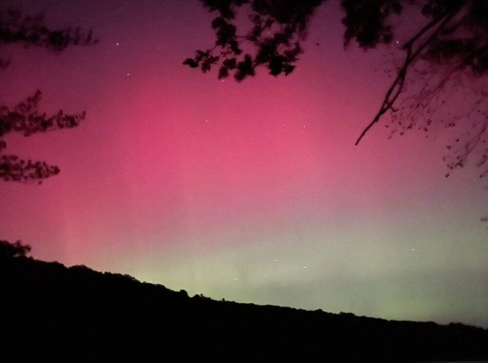
what a night in new haven. saw an incredible aurora (visible to the naked eye), light pillars, and a bright shooting star. peaked around 7:30pm and 10pm.
-
for all those looking for more, i think we get another peak in about 20 minutes as electron density increases (as per spaceweatherlive)
-
insane in new haven very visible to the eye
-
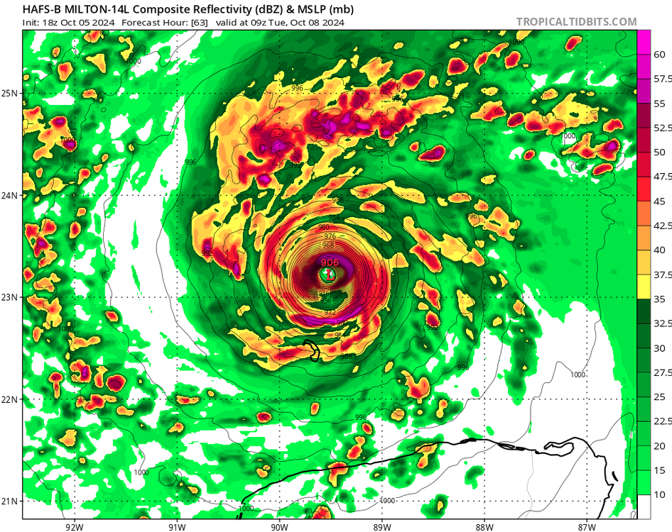
well first atlantic storm in the 800s since i started tracking.
-
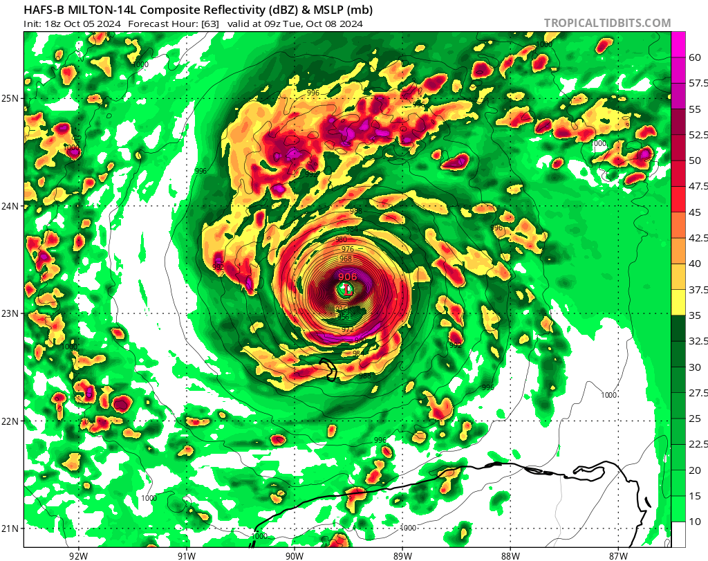
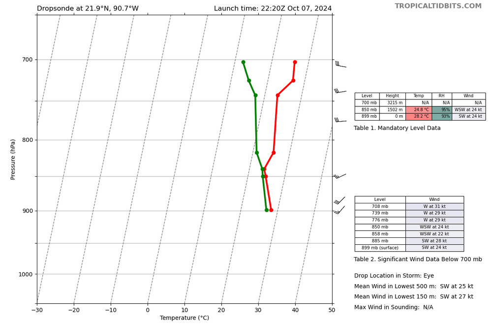
dropsonde above shows 185 mph winds at the surface and 215 mph winds at ~300 ft altitude in the NE eyewall.
-
plane at 22.0N 90.3W as of 6:14 PM EDT
-
-
yep the HAFS seems to do that too sometimes, plus this HAFS-B run initialized at a pressure of 997MB. But yeah, agreed. This HAFS-B run is also quite a bit slower, with a position about 1 degree west and maybe 2/3rds of a degree south of the prior run.
-
geez the ceiling looks to be pretty high
-
this season has really been relentless on CONUS
-
HAFS-B with a 944mb landfall just south of Homosassa Springs. Not a good track for the Tampa Bay
-
GFS slams a 951mb cane right into tampa bay :/
-
2024 Atlantic Hurricane Season
cardinalland replied to Stormchaserchuck1's topic in Tropical Headquarters
I've been thinking/speculating as to if the recent trend of storms strengthening to landfall has to do with stronger AGW effects near landmasses, as land has seen greater warming than ocean. Also speculating as to if the Atlantic storm increase (over the Pacific) has to do with enhanced warming in the North Atlantic basin due to it being more surrounded by continents than other basins. -
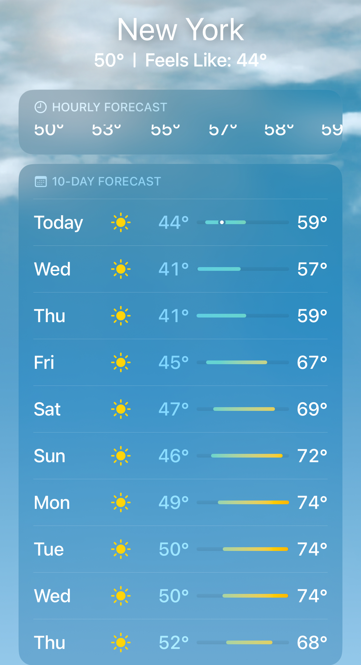
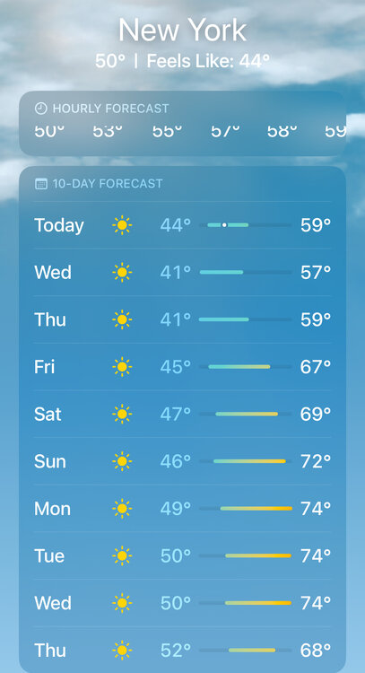
i've recently gotten into running and so at least i can look forward to many months of my ideal running weather ahead (35-55F)