cardinalland
-
Posts
516 -
Joined
-
Last visited
Content Type
Profiles
Blogs
Forums
American Weather
Media Demo
Store
Gallery
Everything posted by cardinalland
-
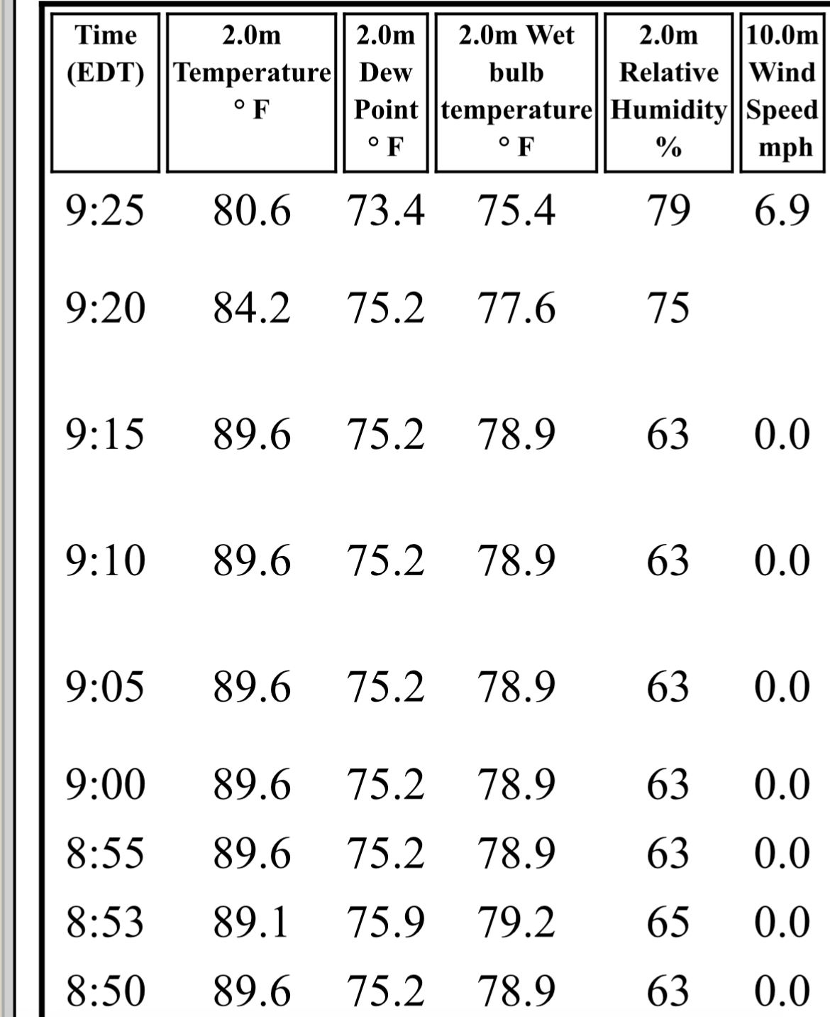
data from new haven airport KHVN. sea breeze has arrived there already.

-
jfk currently 90/79 with a heat index of 106. and it’s not even 9am yet
-
high of 86F, low of 74F Aug 1944 had an average high of 88.0F, Aug 1988 had an average high of 87.0F
-

2025 Atlantic Hurricane Season
cardinalland replied to BarryStantonGBP's topic in Tropical Headquarters
I had some free time today and decided to correlate Atlantic ACE with temperatures around the world for the month of May (which, over oceans, roughly correspond with sea surface temperatures.) One can see a strong positive influence from sea surface temperatures across the Tropical Atlantic, as well as the East Atlantic, Labrador Sea (hmm) and tropical West Pacific/Maritime Continent. Now there's definitely a lot of noise in here, but I found it helpful for my analysis. I also produced temperature correlation coefficients for number of TS/H/MH (didn't differ too much from this) and precipitation correlation coefficients (pretty much just noise, no trend.)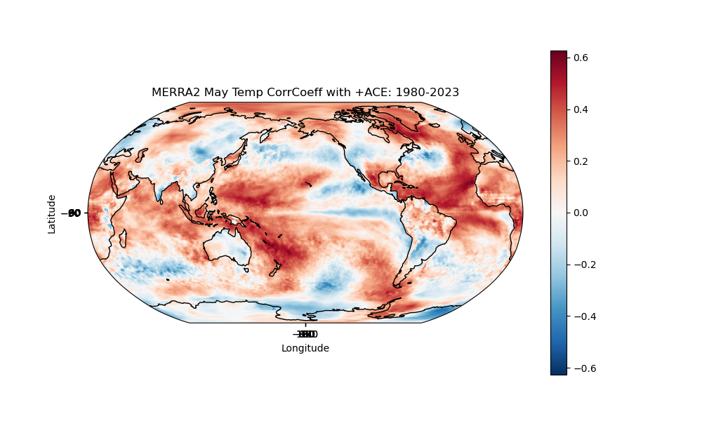
-
2025 Atlantic Hurricane Season
cardinalland replied to BarryStantonGBP's topic in Tropical Headquarters
my analysis... Factors in favor of a more intense hurricane season: - warm Caribbean and waters surrounding Florida - warm West Pacific and Maritime Continent - negative PDO - positive OHC anomalies around Caribbean and loop current Factors in favor of a less intense hurricane season: - a cool Tropical East Atlantic - some modelling showing convergence aloft over Atlantic during hurricane season Slightly above average sounds right to me. Things aren't screaming hyperactive like 2024 but the factors are slightly in favor of more storms. I'm feeling more homegrown seasons this season... not so many Cape Verde long trackers. Maybe near average ACE but slightly above average storm numbers. I'll write a storm # prediction in the thread at some point. -
just got to stand on my porch saying "we needed this" LFG
-
i think we should spring forward 3 hours when DST begins and stay there
-
69-70 had 25.6" snow, 76-77 had 24.5" snow with 3 BN months. but that was barely below the mean of 25.7", as opposed to the 50% of mean we've gotten so far
-
i'm ready for a march 2012 style torch now
-
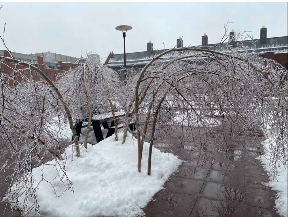
still drizzling at 33 here which seems to be enough to produce more rime ice. also i was walking around new haven today and the puddles are giant, like up to 6" deep and covering half of the road, so tonight's freeze may be an issue :/ snowpack is cement now lol
-
brutal
-
still 33F in new haven and there's been serious ice riming. trees are incredibly flaccid
-
i went to get takeout about 20 minutes ago and measured 2” in new haven with fat flakes (meaning sleet imminent). still fat flakes falling, but i think i hear a little sleet mixing in now.
-
about 1.7” here in new haven. still snowing, but by the looks of it we don’t have much longer before the changeover.
-
OBS-Nowcast Noon Saturday 2/15-Noon Monday 2/17
cardinalland replied to wdrag's topic in New York City Metro
seems like 0.75"ish here in new haven. but it seems we're not long from being slotted -
OBS-Nowcast Noon Saturday 2/15-Noon Monday 2/17
cardinalland replied to wdrag's topic in New York City Metro
1 hour of moderate snow in new haven. coating on all surfaces. -
flakes falling in new haven. game on at 29F
-
i think i get 2-3 up here but the rain immediately after is gonna wash much of the pack away so it’s less exciting
-
it's gotten hyped by tech bros as "solving weather" but now 2 years out it feels like just another model to add to the pile... and sometimes it's right and sometimes it's kinda off
-
snain here at this point no more accumulations, just gonna eventually turn to rain and start melting things a bit
-
still snowing in new haven. roads wet but cars getting a dusting. wouldn’t have thought our area would ever be a local jackpot, but for the past few events, here we are
-
South shore Obs/Nowcast for Feb 11-12 light snow
cardinalland replied to Sey-Mour Snow's topic in New England
snowing in new haven. coating on car tops so far. -
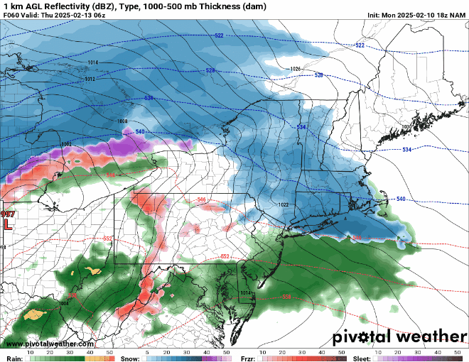
what a model LOL
-
that’s a wicked dry slot