
cardinalland
-
Posts
516 -
Joined
-
Last visited
Content Type
Profiles
Blogs
Forums
American Weather
Media Demo
Store
Gallery
Everything posted by cardinalland
-
 the pattern will shift in 3 weeks (march 10th) and then we'll finally get our snow
 -
Snapmap is insane in the Asheville/Hendersonville area. So many flooded out roads and buildings, trees down, power lines down... hoping for a speedy recovery for all affected.
-
Hurricane Helene's center is approx. 100 miles from Clearwater right now. It will likely get as close as 90 miles away before it begins gaining distance as it moves toward the Panhandle.
-
i imagine highest winds will be southerlies displaced to the east, but there will still be quite strong westerlies and easterlies
-
that's always true in new england but less so in this setup (even though the storm will be moving fast)
-
meanwhile in the 2020s, we’ve already had 13 hurricane landfalls and 5 major hurricane landfalls… yowza!
-
Deepening appears to have stagnated for the past couple hours. I imagine it has to do with the dry air intrusion that you can see on satellite and radar. Once that mixes out strengthening will resume...
-
i imagine a CAG system like this one will continue to wobble quite a bit as it coalesces
-
This storm's got that look that John in the EPAC just had while it was developing. I'm expecting Hurricane Helene by 11am tomorrow. I also imagine that surge could be a bigger deal for this one than for some others recently, because it has a little more time over water, its larger size/lower pressure, and the interaction that it will have with the trough over the deep south.
-
It’s interesting how many hurricanes have targeted CONUS, despite this year’s failure to meet expectations. If Helena makes landfall at hurricane strength, 2024 will have 4 CONUS landfalling storms. The only years since 1950 to see 4+ CONUS landfalling storms were 1964, 1985, 2004, 2005 and 2020.
-
PTC 9 will become Helena 09L, PTC 8 never became a tropical storm so 08L is unused this year for tropical storms… hope that clears things up!
-
a potential tropical cyclone that never formed
-
Generally one waits until a depression has formed to rely on hurricane models, since a lot can change based on where the low forms and how long it takes to actually form. Hurricane models can overestimate intensity of a storm before it has formed because they sometimes assume the depression has already formed and that intensification can start immediately, when that is not the case.
-
some westerly shear is evident and recon seems to indicate that the storm isn't perfectly stacked. the MLC seems to be east of the LLC. but hurricane doesn't seem far off at all.
-
crawling over some rocket fuel.
-
September vibes - Last 90s for some, 1st frost for others
cardinalland replied to tamarack's topic in New England
what does coc stand for? (i’m a former NYC poster…) -
once in middle school i told a classmate about “corn sweat” and he said he would never eat a corn ever again
-
LOL but that’s the only way i know how to describe it occasional giant drops, like every couple seconds a fat drop falls
-
drizzling here but the drops are MASSIVE
-
haven't heard that name in years
-
that's true, i think about 2/25 this year is when i felt pretty safe on a "no more snow" call for southern CT
-
dew haven has got you covered
-
Plenty of research has been done on this question, for the general case: https://www.gfdl.noaa.gov/global-warming-and-hurricanes/ As for this year, it's been quite active up to this point, as the last eight years have been generally...
-
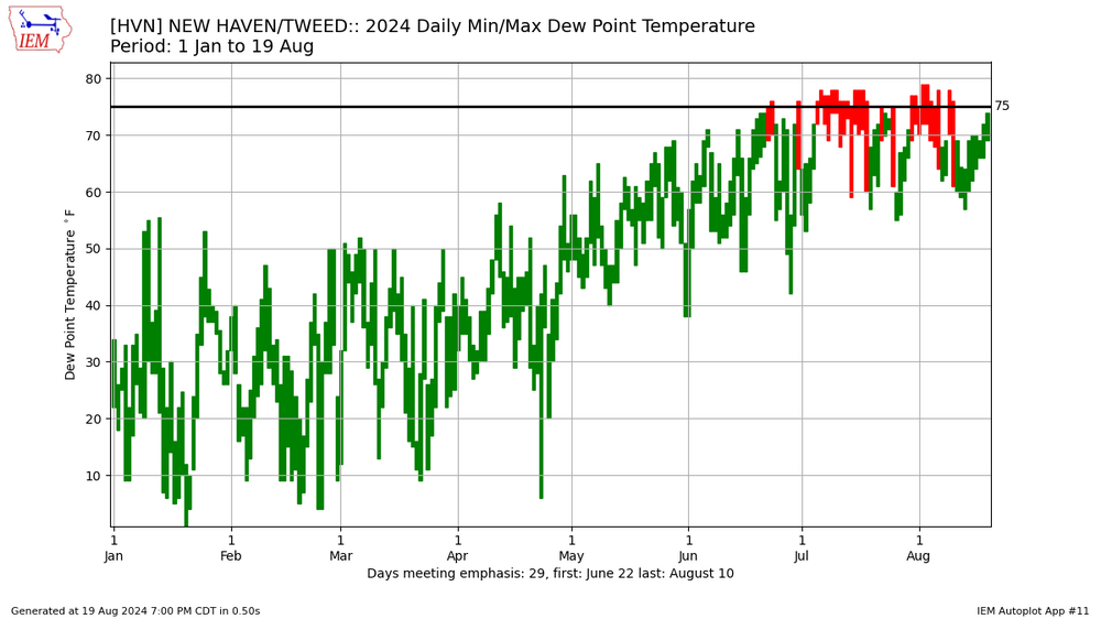
my dewpoint hit 74 today
-
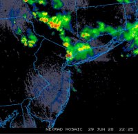
new haven CT just had a loud CTG strike and then immediately started pouring


