cardinalland
-
Posts
516 -
Joined
-
Last visited
Content Type
Profiles
Blogs
Forums
American Weather
Media Demo
Store
Gallery
Everything posted by cardinalland
-
1/10 storm is a rainer to mainer on GFS. high in a worse location
-
traced the storms back to the present/hour 0 and they are still quite far away at present. don't know enough to determine how this impacts prediction, but wanted to share anyways
-
verbatim 12z GFS crushes NNJ NYC SNE. gotta keep an eye on that north trend though
-
storm more amped through GFS hour 165. hopefully this doesn't become another cutter
-
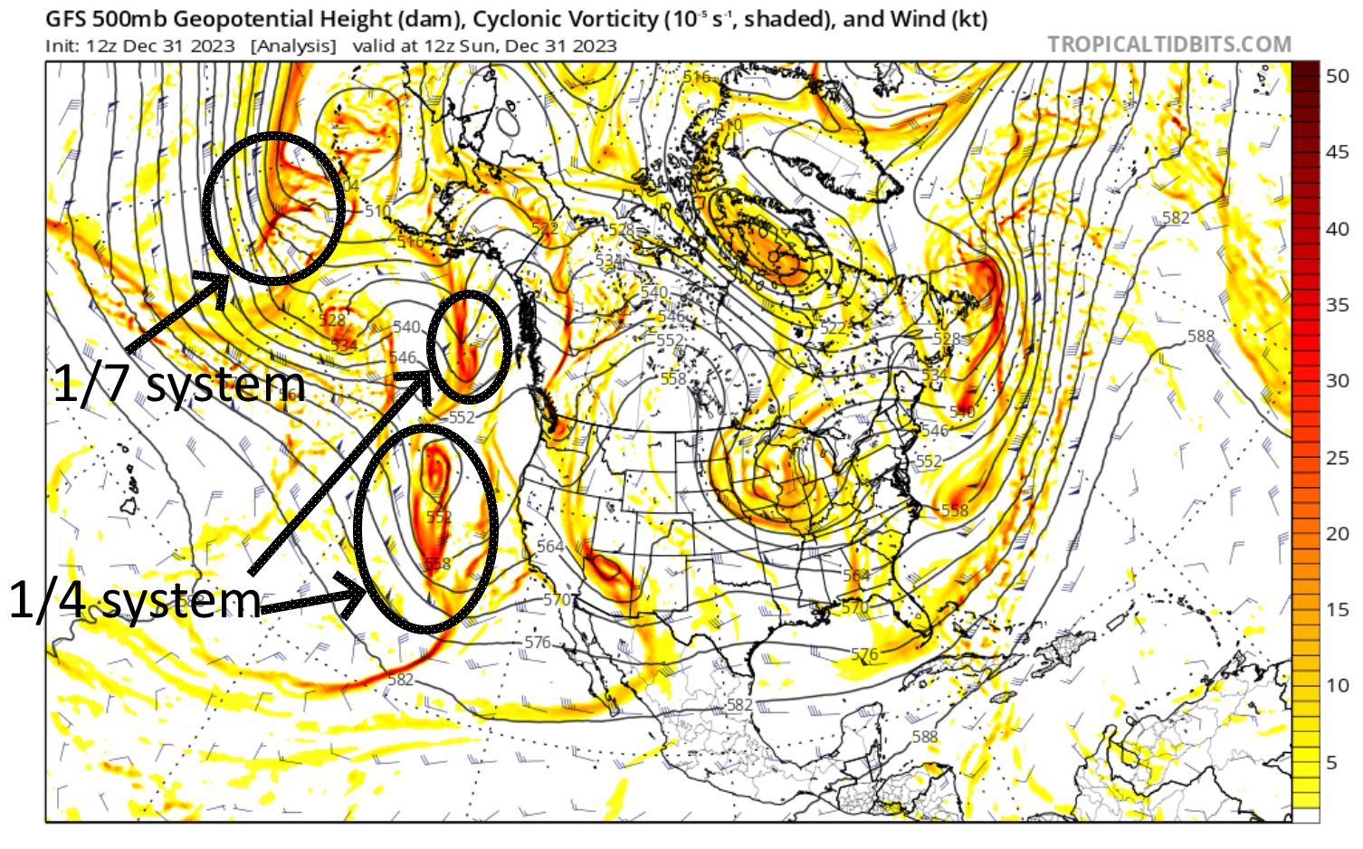
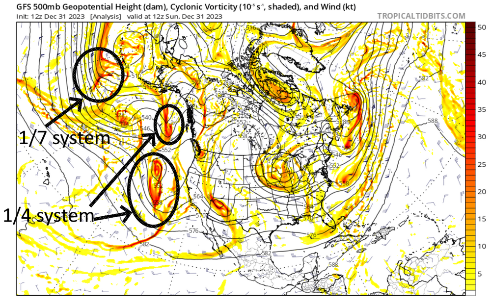
there's a legit 50-50 low on GFS for 1.7.24
-
beautiful spring day today
-
last strong niño wasn’t too far off in most of the region. definitely less snow in 2023 up north though. and in N Central US
-
that’s odd in new haven/west haven we got a 29 on like november 2 i believe. it was an impressive frost edit missed the 10 comments on this lol
-

Sunday, December 17 - Monday, December 18, 2023 Storm
cardinalland replied to weatherwiz's topic in New England
maine’s taking the biggest hit power wise it seems… 27% without power per poweroutage.us -
Sunday, December 17 - Monday, December 18, 2023 Storm
cardinalland replied to weatherwiz's topic in New England
just some drizzle in fairfield county where i am now but foggy -
Sunday, December 17 - Monday, December 18, 2023 Storm
cardinalland replied to weatherwiz's topic in New England
wow sustained 32 at bradley. that’s intense. here in new haven it hasn’t felt too windy but the airport gusted to 46, mostly happened overnight though so i missed it -
i’m worried about the inflatable santas getting scattered around the state of CT
-
2.2-2.5" in my general area i think we make a run at 5" rain IMBY
-
HVN rain gauge appears to be down but nearby PWS are reporting in the 1.7-2.1" range
-
already past 1” in new haven we’ll see how this goes
-
another spry weekend day ruined by Big Rain
-
i just saw like 6 snowflakes guys
-
you can use the amount of optimism on this board in november to predict how bad last year’s winter was
-
low of 29F brick outside this morning
-
first freeze in the new haven area. ice forming off all the plants made it almost look like it snowed a dusting
-
what’s the over/under on flakes to the coast? in CT especially lol
-
Octorcher or Roctober 2023 Discussion Thread
cardinalland replied to Damage In Tolland's topic in New England
Do you have a chart like this for HVN? I've been suspecting it's a little high for a while. -
the main band is getting slowly closer to new haven. we’ve escaped the worst of it so far
-
GFS did horribly with this storm new haven is down to drizzle right now but the main band is moving closer slowly
-
new round of heavy showers off the coast heading for queens brooklyn nassau