CheeselandSkies
-
Posts
3,369 -
Joined
-
Last visited
Content Type
Profiles
Blogs
Forums
American Weather
Media Demo
Store
Gallery
Everything posted by CheeselandSkies
-

2024 Short/Medium Range Severe Weather Discussion
CheeselandSkies replied to Chicago Storm's topic in Lakes/Ohio Valley
Looks like another 2% MCV threat popped up for the WI/IL stateline region on the Day 2 outlook (marginal was way down in S MO on yesterday's Day 3 outlook). SPC is on top of this one so it probably won't do anything. -
2024 Atlantic Hurricane Season
CheeselandSkies replied to Stormchaserchuck1's topic in Tropical Headquarters
True; but that's one of the variables that can come into play with a long-tracker. -
Latest HRRR and the abundance of sunshine in Illinois (despite overcast and steady rain here all morning and early afternoon) has me thinking "Not so fast" to my above, despite SPC's lack of even a 2% tornado contour in NE-NC IL/SE WI on the current outlook.
-
Well, my chase today is hosed. Had expected/hoped the OFB would end up closer to/merge with the synoptic warm front extending east from a low near Quincy through the Springfield, IL area and possibly east into west-central IN as per the forecast thinking from about 3 days ago. If I wanted to chase in the jungle, I'd stay in Wisconsin.
-
2024 Atlantic Hurricane Season
CheeselandSkies replied to Stormchaserchuck1's topic in Tropical Headquarters
Yup...seems it's always in the close-in quick RI'ers that make the 130kt+ landfalls...Michael, Ida, Ian, etc. The 10-day basin crossing ACE machines like Ivan and Irma are less likely to be as intense at U.S. landfall (if they make one), even if multiple model runs and NHC advisories call for them to be. Hugo was actually something of an anomaly in that regard, remaining a 115-120kt (sources seem to vary) Cat. 4 at time of SC landfall. -
May 16 - June 4, 2024 Severe Weather
CheeselandSkies replied to Quincy's topic in Central/Western States
That's the supercell composite; STP is 15.7 (cin)/11.8 (fix). Still very impressive numbers. -
Oh, my goodness.
-
Reality must have set in for the HRRR as the 18-19Z runs have considerably backed off on the intensity/updraft helicity with the simulated cells that redevelop in the 22-00Z timeframe compared to the 15Z-17Z runs. Although, we are just now finally seeing some peeks of sunshine here.
-
Surprisingly, HRRR is rather insistent over multiple runs that we will get enough destabilization for a renewed severe threat this evening here in southern WI.
-
Looks like HRRR was right yesterday per SPC's 13Z update, ongoing complex and its cold pool will bollox afternoon supercell chances north of IL/WI line. NWS, and the mets at my work were way off predicting a sunny morning with storms holding off till mid/late afternoon.
-
Meanwhile, 18Z 3K NAM wants a Tuesday redux for Wisconsin, with UH tracks extending way north of where SPC has the slight.
-
I'll spark the kindling again. Tomorrow snuck up with a 5% contour right over southern Wisconsin, as well as far eastern Iowa and northern IL on the SWODY2 update. CAM solutions vary though; if the HRRR were to verify it looks like the 5% would end up being too far north, with WI mostly getting mid-morning MCS activity (which goes against the forecast from the NWS, which calls for morning sun followed by PM storms). Saturday the focus looks to be mainly west of the sub over in the Plains (Central/Western); but Sunday as mentioned in the general severe thread looks quite interesting and potentially significant; further east and south of the parts of the sub that were impacted on Tuesday although the NAM solution suggests northern IL and even southern WI could be in play again.
-
Did it do any clear-cut instances of textbook EF5 damage, though? It was unquestionably a violent tornado; but did it completely sweep away at least one anchor-bolted frame house? The problem I have is when tornadoes actually do this and are still rated EF4, such as Vilonia, AR April 2014.
-
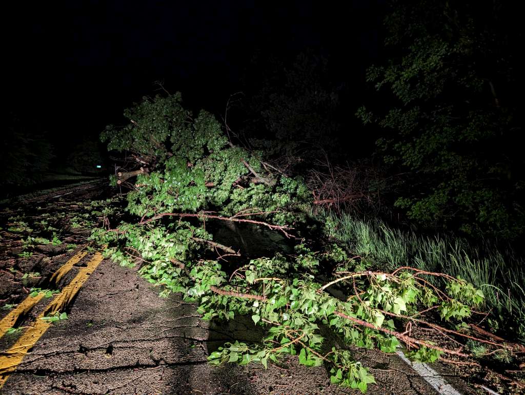
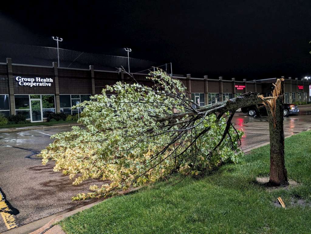
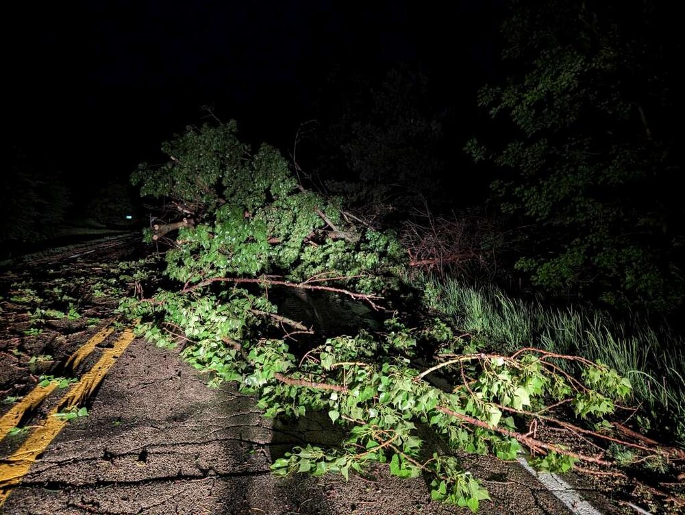
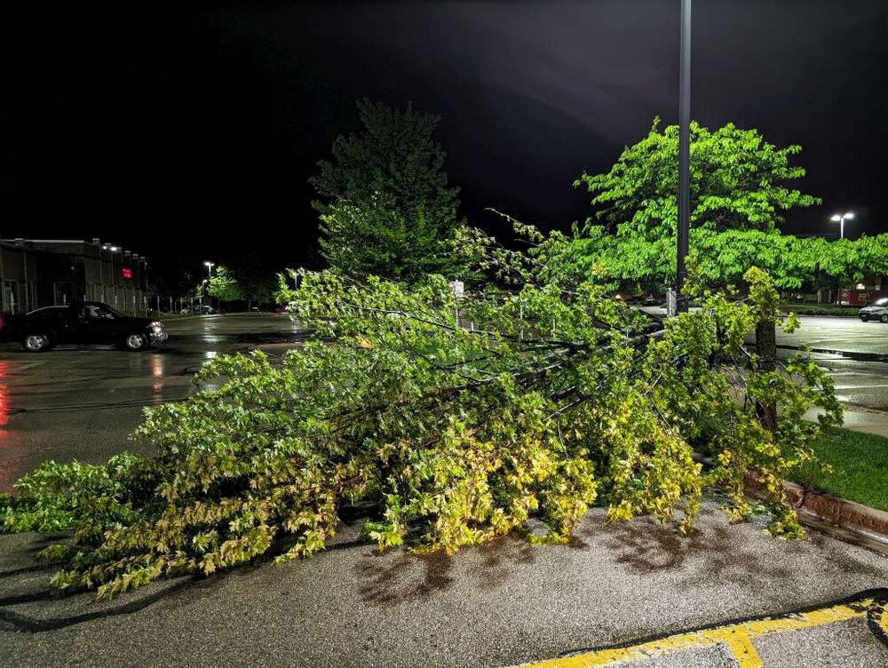
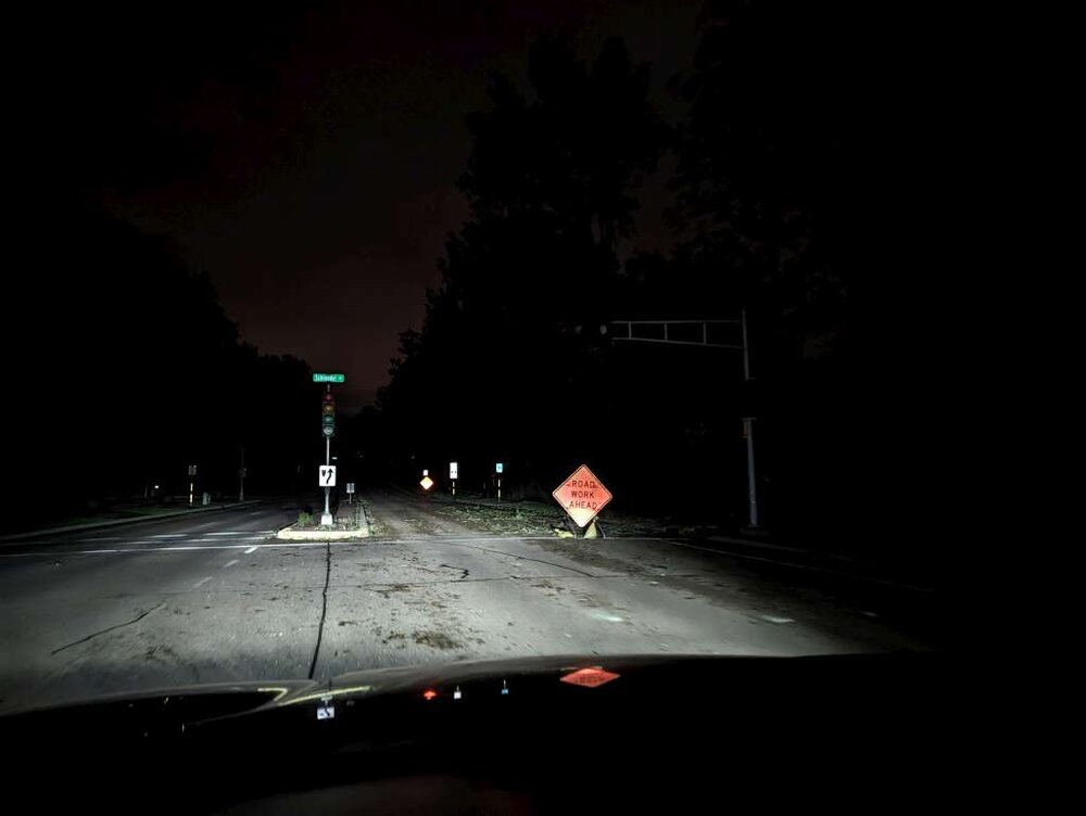
The biggest excitement from my chase yesterday (didn't go far enough southwest to catch the tornadoes; thought storms would continue to produce further east at least most of the way across Iowa, SPC apparently did too; ended up on the storm which was tornado-warned near Corydon but it didn't look too impressive and the warning was dropped shortly after it got away from me over Eddyville) was when I was almost home. Multiple roads blocked/obstructed by downed power lines, trees (including a broken tree a block from my apartment building), and road construction signs/cones/barricades blown over and scattered in the travel lanes. Some neighborhoods were pitch-black with streetlights and even traffic lights out.

-
Thinking about targeting the Waterloo-Webster City area. Multiple HRRR runs and the 06Z 3K NAM suggest slightly better backing of the surface winds in north-central to northeast Iowa, with a relative maximum of 3CAPE/EHI and some discrete-ish cells making their way through there in the afternoon. Besides, along and north of the US-20 corridor is the best chase terrain in Iowa. Almost as flat and open as western Kansas. I got lucky that Keota was in a fairly open spot along Highway 92 but encountered issues with hills and trees while trying to chase it toward Wellman/Kalona.
-
CAM solutions have varied wildly from model to model and run to run since this event came into range. Still clear as mud how tomorrow might evolve.
-
***Edit: Added tomorrow (Monday) to the thread title as there is broad agreement among the CAMS in an MCV-driven setup along the IL/WI border region tomorrow (SPC added a small slight risk to the updated SWODY2 to account for this). These events are subtle with generally modest parameters depicted beyond Day 1, but if everything comes together just right they are capable of producing some prolific localized outbreaks in this area, such as 8/9/21 and 7/12/23.*** Guidance has been in good agreement for several days now that a compact, negatively tilted shortwave will impinge upon the IA/MN/WI/NW IL region on Tuesday with strong southwesterly flow at 500mb. At the surface, a low will deepen throughout the day with warm sector dewpoints well into the 60s, if not upper 60s by 00Z Wednesday. Basic pattern recognition suggests a very high ceiling and I'm frankly baffled why SPC's day 3 outlook does not at least include an all-hazards hatched area for wind potential if nothing else. That said, strictly in terms ofchase potential, there are several potential flies in the ointment as it seems there always are. One of them is, exactly how many rounds of storms initiate, where and when? For example, models have EXTREME levels of SRH along the warm front in southern Wisconsin, but suggest late-morning/early afternoon convection preventing that area from destabilizing. Other models suggest supercells might initiate in western Iowa, but might not be colocated with the best tornado parameters until they have begun to congeal into a QLCS (of course, this was also a concern with 3/31/23). Regardless, I think this day will end up a noteworthy regional severe weather event and worthy of its own thread.
-
2024 Short/Medium Range Severe Weather Discussion
CheeselandSkies replied to Chicago Storm's topic in Lakes/Ohio Valley
The 30% contour alone (doesn't need a hatched area) drives an "Enhanced" category; but pattern recognition alone (compact, negatively tilted shortwave, deepening surface low with rich moisture in the warm sector) suggests this event will be capable of producing significant severe weather of some type, perhaps widespread. -
2024 Short/Medium Range Severe Weather Discussion
CheeselandSkies replied to Chicago Storm's topic in Lakes/Ohio Valley
Either way, I don't understand SPC's lack of even a hatched area for any hazard on the Day 3 outlook... -
2024 Short/Medium Range Severe Weather Discussion
CheeselandSkies replied to Chicago Storm's topic in Lakes/Ohio Valley
Just like the days that align for MI/IN/OH are too far east for me... -
2024 Short/Medium Range Severe Weather Discussion
CheeselandSkies replied to Chicago Storm's topic in Lakes/Ohio Valley
Next potential round coming up and this time it looks to be timed right for E IA/WI/IL. SPC has a large Day 5 area highlighted for Tuesday 5/21. Lots of important details yet TBD of course but moisture/instability doesn't look to be much of an issue. -
2012 sucked. Too stupid hot for March and even early April; but also bone dry which set us up for the drought that summer...and despite all that early season warmth there was no severe weather to go with it. When we got 80s into Wisconsin in March I fully expected an abundance of Rochelle, Winterset or Keota type setups (although we were years prior to knowing what those were)...instead it was just straight .
-
May 16 - June 4, 2024 Severe Weather
CheeselandSkies replied to Quincy's topic in Central/Western States
GFS suggests Sunday/Monday in KS/possibly down the dryline into OK, Tuesday further east somewhere in the MS and/or OH Valley, somewhat more localized potential in the southern Plains Wednesday followed by another potentially big round Thursday-Saturday. All subject to how each day evolves on the mesoscale of course; but can't complain about another string of chances like this if you're out chasing. -
4/25-4/28 Severe and Heavy Rain Threat
CheeselandSkies replied to Geoboy645's topic in Lakes/Ohio Valley
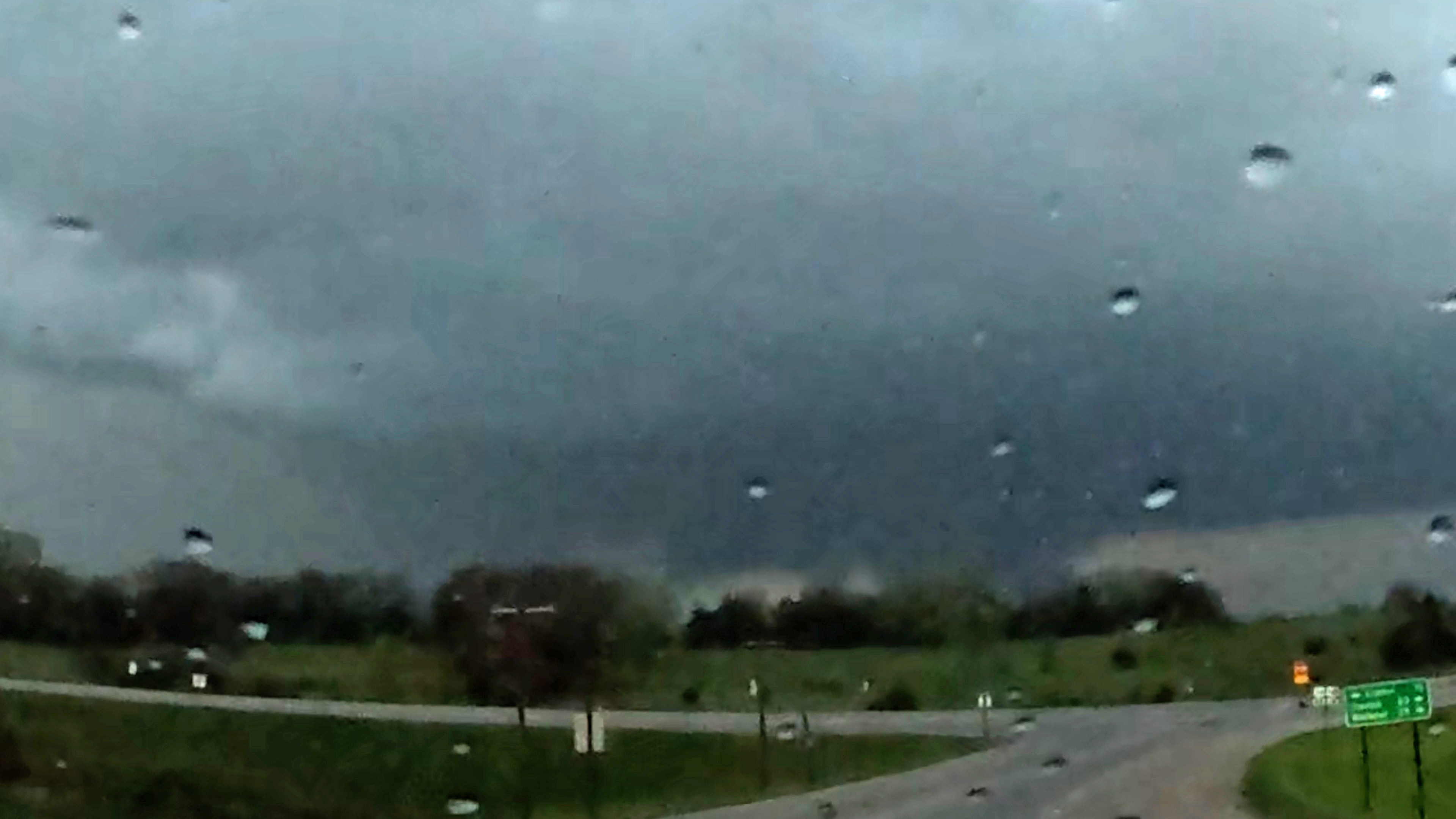
Yep. That's exactly what happened. I had committed to following 169 north (which involved going east on 34 from Afton) after the storm that produced the second of the three Creston-Afton-Macksburg area EF2s. Here is a lightning-backlit and contrast enhanced 500% zoomed-in grab from my GoPro as I was passing through Afton. I think I have a distant glimpse of it here, but that's it. As I said in my earlier post, by the time I finally got a good view under the base near Lorimor, the tornado was gone (as evidenced by the relatively weak couplet in your RadarScope grab) and the storm didn't produce for me again before dark. Meanwhile, the view toward the third couplet was completely blocked by hills and trees west of 169, so I just considered it as something to avoid getting run over by rather than try to catch.
-
Severe Weather 5-6 through 5-9-24
CheeselandSkies replied to cheese007's topic in Central/Western States
It is rather rare. Only used when an abnormally significant derecho (such as 8/10/20) appears imminent and the tornado threat is relatively low enough to not warrant a tornado watch.