SRRTA22
-
Posts
1,874 -
Joined
-
Last visited
Content Type
Profiles
Blogs
Forums
American Weather
Media Demo
Store
Gallery
Everything posted by SRRTA22
-
 Thanks for the update ant. Stay safe out there This is epic level training
- 1,603 replies
-
- 1
-

-
- hurricane gusts
- flooding rains
- (and 2 more)
-
Manhattan,queens,kings for ny and hudson essex and bergen for nj counties currently under flash flood emergencies
- 1,603 replies
-
- 2
-
-
- hurricane gusts
- flooding rains
- (and 2 more)
-
A PDS flash flood emergency rang across the phone. Ive never seen a FF emergency issued before
-
Nature is a jokester... Trolls us with this beautiful inverted trough in the summer. Never around in the winter haha
-
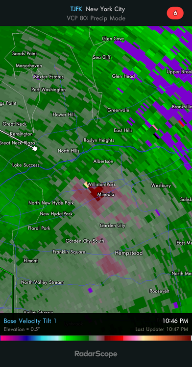
I wouldnt be surprised if a very brief spin up occured over the williston park area
- 1,603 replies
-
- 1
-
-
- hurricane gusts
- flooding rains
- (and 2 more)
-
Showing up on tjfk too
-
FFW parts of NE NJ
-
This rain is crazy and im loving the feel of it. Very tropical as youve guys mentioned. "We soak"
- 1,603 replies
-
- 1
-
-
- hurricane gusts
- flooding rains
- (and 2 more)
-
I think it was elevated as i didnt see much on TJFK Also died out it looks like
- 1,603 replies
-
- 1
-
-
- hurricane gusts
- flooding rains
- (and 2 more)
-
Theres some possible waterspout action with those storms off shore
.thumb.png.b24118051b9578050c6c76950d7af8bc.png)
- 1,603 replies
-
- 1
-
-
- hurricane gusts
- flooding rains
- (and 2 more)
-
People are panic buying in Jersey City
-
I dont give out weenie emojis too often... Stay safe my friends in ct/r.i/ma. Even a west l.i landfall puts you guys in the rfq
-
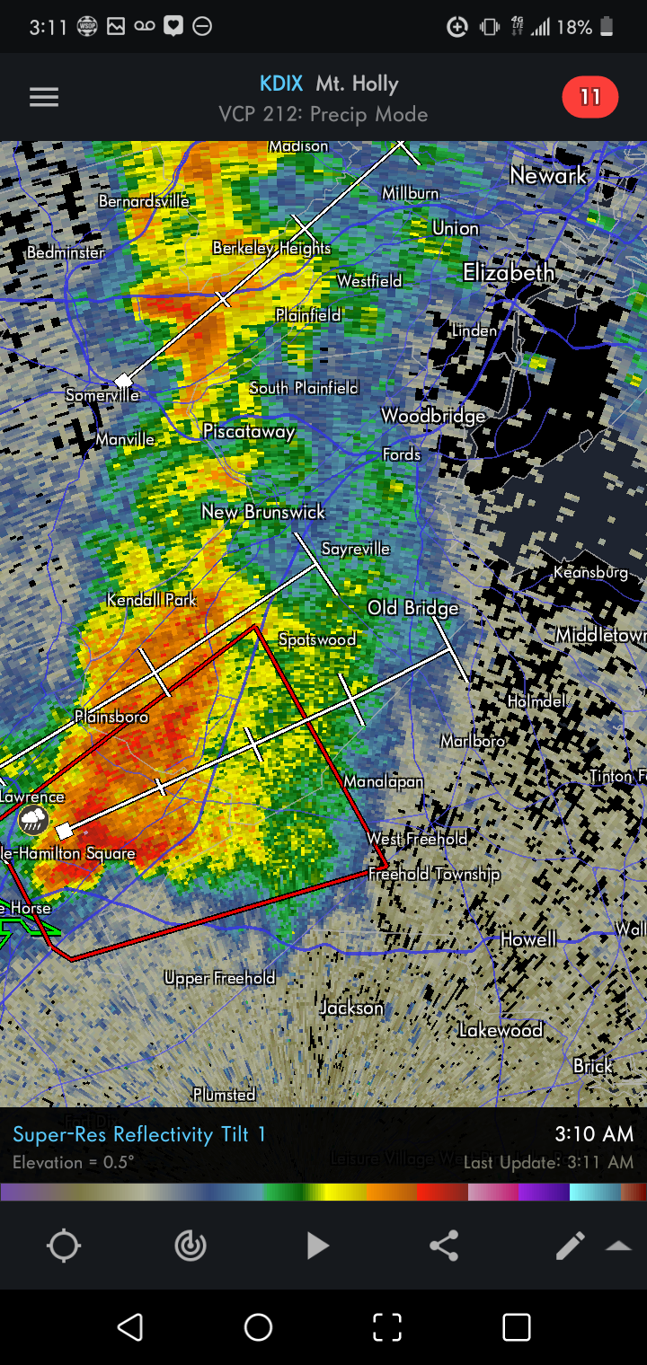
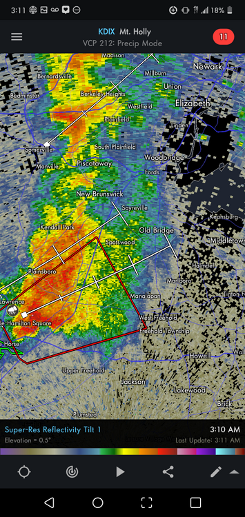
Multiple late night TOR warnings. To see a storm like this at 3am....in NEW JERSEY?
-
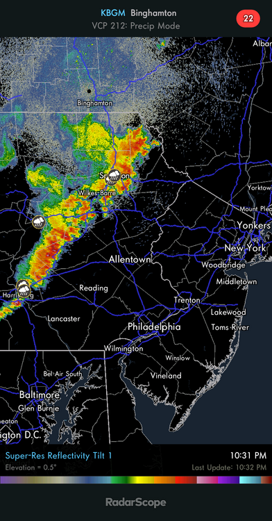
Currently awaiting the line
-
Color me a weenie but im quite impressed by ex fred
-
Though mundane, wind gusts are stronger than i thought they'd be. ~25-30g right now.
-
6z holds. Just a tick west from 00z and makes direct LF on Rhode Island
-
@Rtd208 maybe?
-
August Disco 2021. Do record dews continue?
SRRTA22 replied to Damage In Tolland's topic in New England
Walking in ~90/70 is better than walking in 65/50?! Im calling that bluff every single time lol -
in the words of forkmeister.... "Meh" The better dynamics look northwest of us. I want storms just as much as the next guy but tomorrow aint it
-
"This is our last heatwave" you said. Im holding you to that
-
Nams been pretty good lately
-
I remember when storms used to die in ne nj and reform over long island. These last few years have been really good for ne nj, s.i to elizabeth/new brunswick
-
This is my favorite thing about storms. The lightning on the backside. Living so close to the city makes for an awesome and erratic lightning display


.png.b7aec0d12396838e847cfbe2db334d24.png)