SRRTA22
-
Posts
1,879 -
Joined
-
Last visited
Content Type
Profiles
Blogs
Forums
American Weather
Media Demo
Store
Gallery
Everything posted by SRRTA22
-
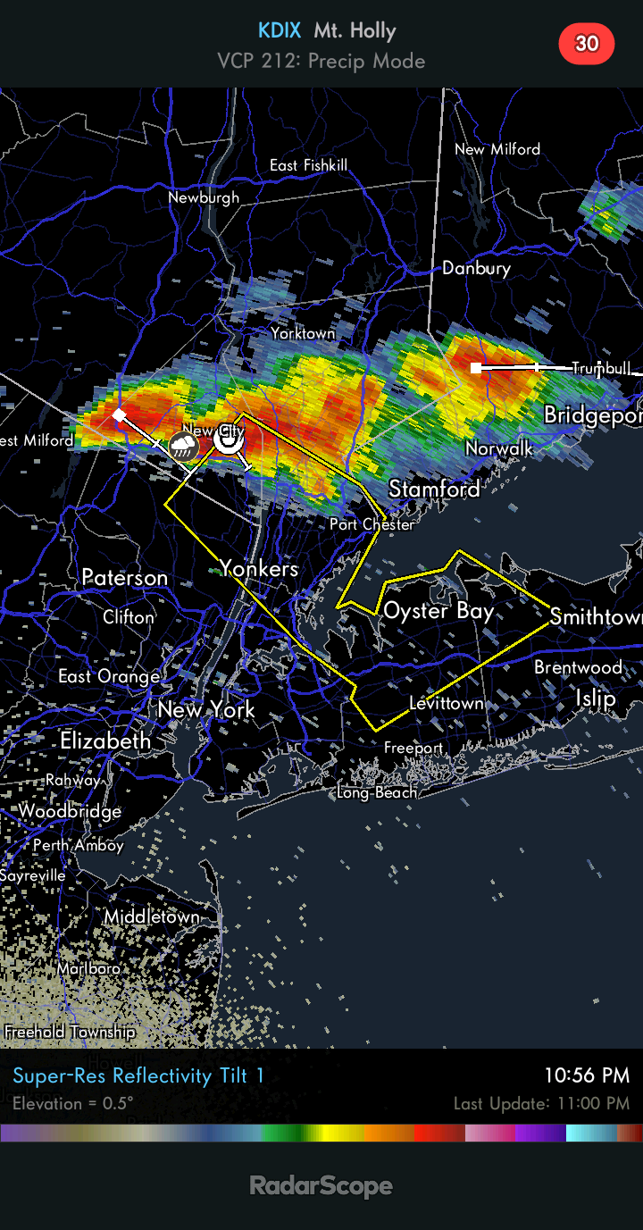
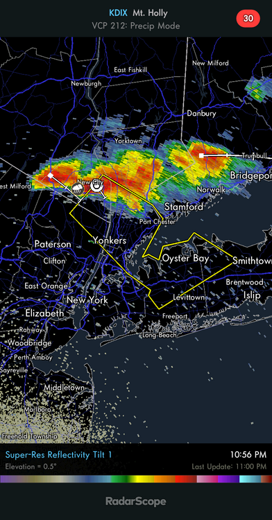
Oyster bay area getting nailed. Wouldnt be surprised to see a ffw
-
Not weakening nor getting stronger. Maintaining but like you said does seem like its slowing its movement. FF possible for W li..as noted by upton
-
That storm looks good hopefully it holds for you guys in the path
-
Stw for some of you
-
You guys in LI may get a good storm
-
Saw a "bolt from the blue" from storms 40mi away. Impressive
-
Quite a lightning show with those storms to the north. Kind of surprised to see it from JC.
-
What? Lol
-
It feels amazing. GFS is also super consistent with giving the outer burbs quite a chill come early august. Low 50s for lows. Gotta watch if that trough pans out
-
Its planet X! great photos don and dmills
-
Laternflys are running wild here and I still haven't heard a cicada
-
I this weather right now kind of hoping we can dry out a bit
-

Sun July 11-Mon July 19 Pockets of FF/SVR and a modest heat wave
SRRTA22 replied to wdrag's topic in New York City Metro
Theres enough elevated instability to keep this going for you guys on L.I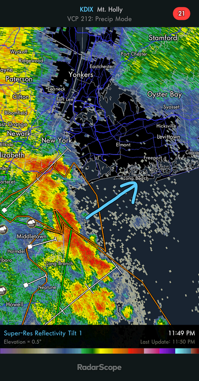
-
Sun July 11-Mon July 19 Pockets of FF/SVR and a modest heat wave
SRRTA22 replied to wdrag's topic in New York City Metro
It fell apart...just in south jersey i hope you guys get in on the action. I think you guys will .. -
Sun July 11-Mon July 19 Pockets of FF/SVR and a modest heat wave
SRRTA22 replied to wdrag's topic in New York City Metro
MCV headed towards the metro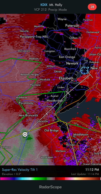
-
Sun July 11-Mon July 19 Pockets of FF/SVR and a modest heat wave
SRRTA22 replied to wdrag's topic in New York City Metro
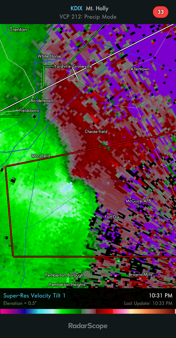
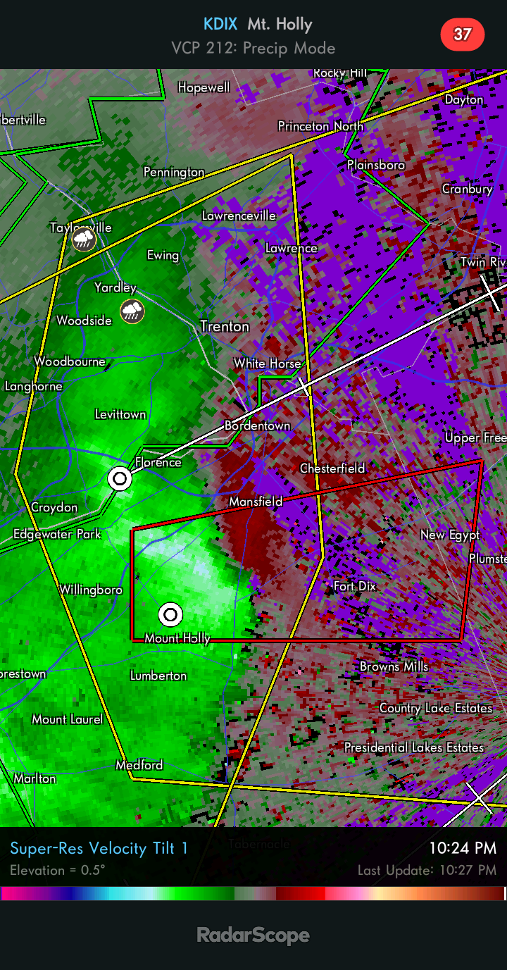
Thats the same storm that was tor warn. You can still see the meso on kdix albeit elevated -
Sun July 11-Mon July 19 Pockets of FF/SVR and a modest heat wave
SRRTA22 replied to wdrag's topic in New York City Metro
I think that prev tor warned storm just did a left split. Headed nne now away from the main line. Craziness -
Gotta love SNJ you guys get the goods!

-
Sun July 11-Mon July 19 Pockets of FF/SVR and a modest heat wave
SRRTA22 replied to wdrag's topic in New York City Metro
This is the definite wow of the day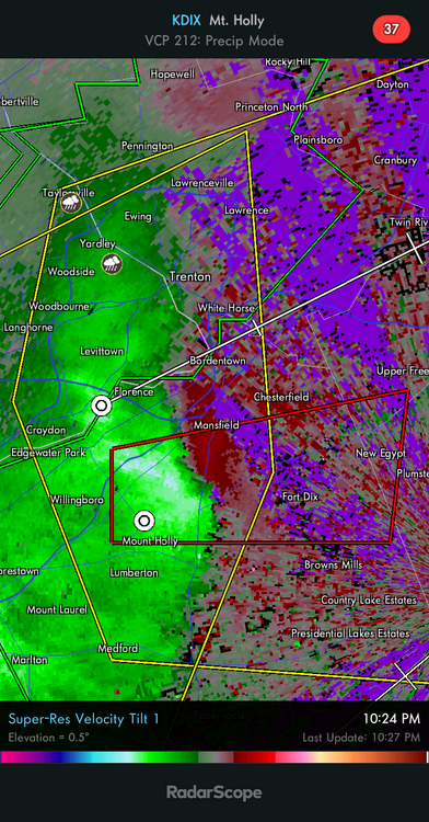
-
Sun July 11-Mon July 19 Pockets of FF/SVR and a modest heat wave
SRRTA22 replied to wdrag's topic in New York City Metro
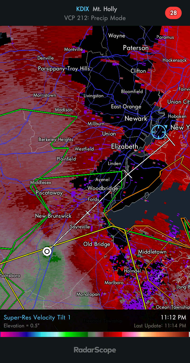
We had time to recover but the tor warned storm in west nj said nope....blew its anvil right over us so svr def looked off the table for us for round 2 -
Sun July 11-Mon July 19 Pockets of FF/SVR and a modest heat wave
SRRTA22 replied to wdrag's topic in New York City Metro
Literally the ghost of earliers storm
-
Sun July 11-Mon July 19 Pockets of FF/SVR and a modest heat wave
SRRTA22 replied to wdrag's topic in New York City Metro
That storm is intense. We deal with stratiform rain and lightning. Ill take it L.I may get hit while you guys are asleep -
Sun July 11-Mon July 19 Pockets of FF/SVR and a modest heat wave
SRRTA22 replied to wdrag's topic in New York City Metro
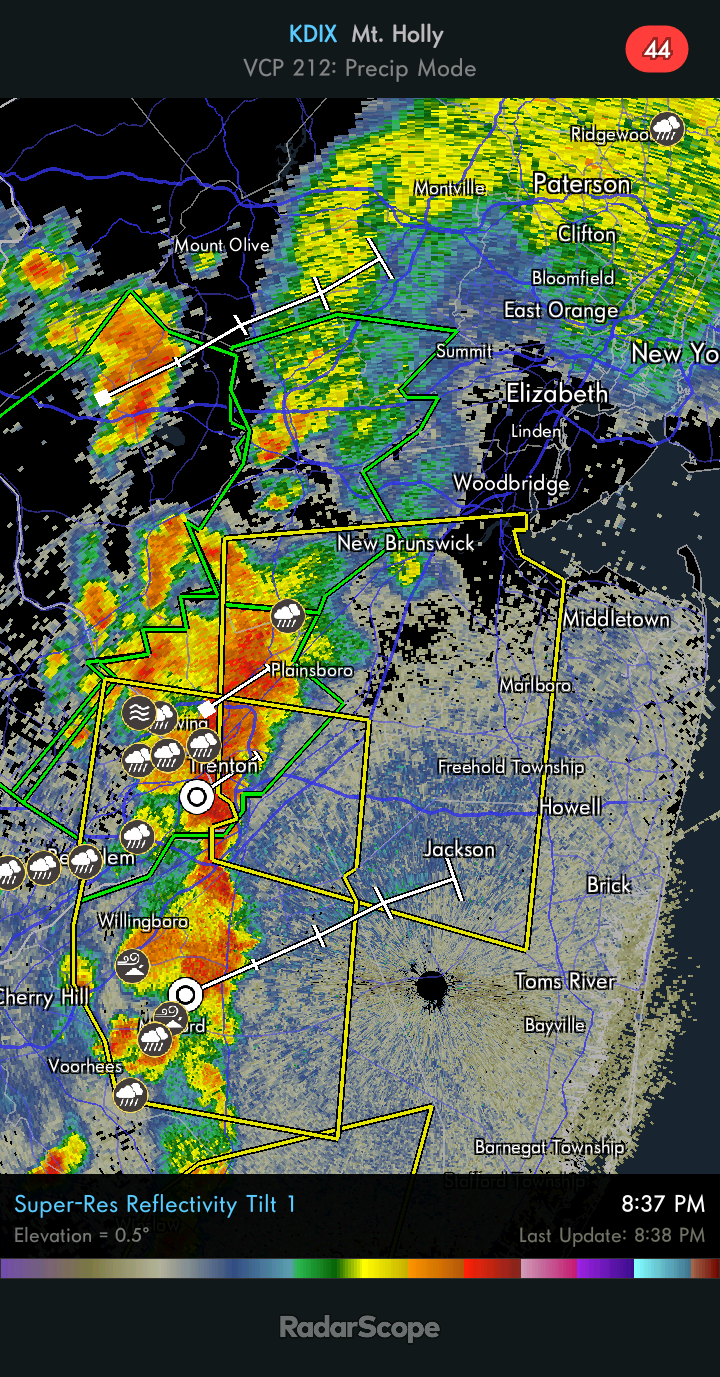
Some love for our friends in central jersey
-
Sun July 11-Mon July 19 Pockets of FF/SVR and a modest heat wave
SRRTA22 replied to wdrag's topic in New York City Metro
Its not as unstable as earlier but there seems to be enough juice left per latest mesoanalysis for some elevated convection. Decent amount of lightning in the area as well -
Sun July 11-Mon July 19 Pockets of FF/SVR and a modest heat wave
SRRTA22 replied to wdrag's topic in New York City Metro
Outflow bndry came through here looking mean for no reason. Bonafide shelf