

George BM
-
Posts
2,610 -
Joined
-
Last visited
Content Type
Profiles
Blogs
Forums
American Weather
Media Demo
Store
Gallery
Posts posted by George BM
-
-
Flurries started 5 minutes ago in Herndon, VA.
-
Just now, EastCoast NPZ said:
Coming down good now.
IYBY?! Are any pigs flying yet?
In all seriousness congrats.
Currently 40/23 at IAD at 10:57am est on Tuesday, January 7th, 2020.
-
2 minutes ago, mattie g said:
I suppose it's a question of whether the meatballs are Swedish or Italian.
Good point.
Meanwhile 31/22 at IAD as of 8:27am est on Tuesday January 7th (not 8th!), 2020.
-
Just now, Buddy1987 said:
Meatball flakes headed toward the DC crew. Picked up an inch here just in last 30 min I'd say. Its REALLY coming down.
What is the estimated diameter of the flakes IYBY you'd say?
-
3 minutes ago, cbmclean said:
So hypothetical question for you guys, since I have nothing else to do down in my neck of the woods.
Say that you have been guaranteed 20" of snow over the course of one month and you could choose how to distribute it? Would you take
-1 big dog wtih 20"
-2 nice 10" slams
-4 respectable 5"'
-10 2" nuggets
or something else. Lengthy discussion of reasonings are welcome.
Let me see...
I'd be very happy with a quick hitting 20" storm with extreme snowfall rates with lightning/thunder.
I'd also be very happy to have 10 snow squalls that quickly drop 2" each within a half-hour with lightning/thunder and strong gusty winds.
Even better would be a Quebec polar vortex/ strongly +PNA pattern bringing 4 particularly intense snow squalls that each drop 5" in a very short amount of time... with lightning/thunder and severe wind gusts.
-
 1
1
-
-
7 hours ago, usedtobe said:
I think the dewpoints tomorrow at 12Z are forecast to be in the upper teens west of the city and around 20 in the city so the cooling looks real especially if we get close to 09.25 " in 3 hours or so. That's a pretty good thump. Still, I'd only go with a coating to an inch aroudn the city and maybe 1 to 2 out west even though the models are showing the most precip south of us.
Over 3"/hr liquid equivalent rates meaning snowfall rates of as much as 30"+/hr?! Me thinks this will have RDMs glacier experience beat bigly! I'm so far in that I'm actually now trapped inside and don't even know whether I can get back out. It's strange and dark in here with faint clouds of what look like memories or hypothetical fantasies of Armaggeddon-like storms crushing my neighborhood? Should I call 911? Will they even be able to reach me here?
3 minutes ago, Bob Chill said:I'm already working on new material for the obs thread. Things like "dendrites are so fat they're setting off car alarms" and stuff.
I'll say this.... if these soundings and fronto panels are right, it's going to be quite a show for some people tomorrow. Might be best rates since Jan 2016...
I've heard of a strange phenomenon that can sometimes occur when snowfall rates get very heavy. People say that the sky will flash (kind of like a camera flash) with either the color white, pink or sometimes even blue. They will then hear a crashing noise usually a couple seconds later... but in some cases within that second and loud. I hear of this happening quite a bit with lake-effect snow squalls from the Great Lakes. I've never experienced this phenomenon in person but it certainly sounds cool and unique. What exactly do you call this phenomenon and do we at least have the slightest chance ( at least a 1 in 100 chance) of seeing this phenomenon occur somewhere within this region if we can get strong enough lift tomorrow?
-
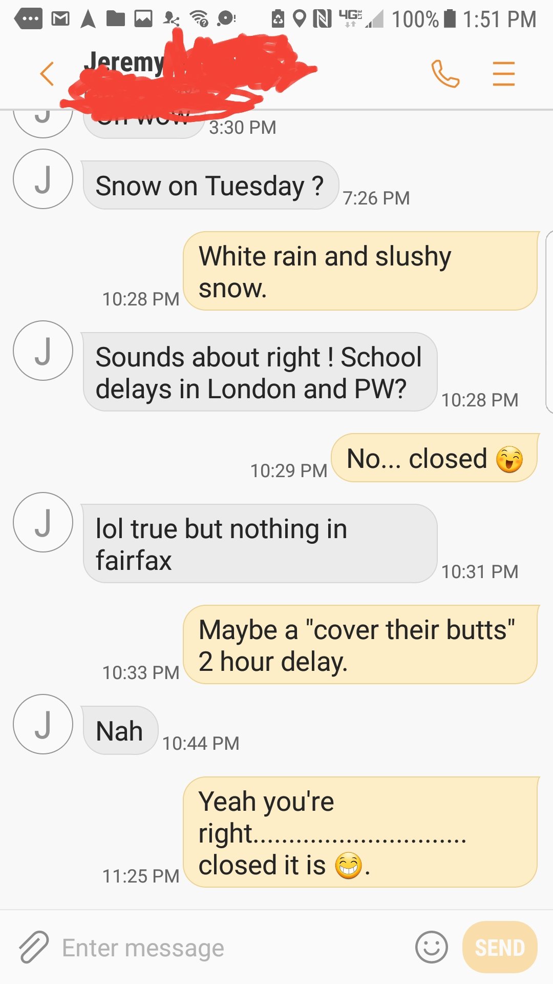
1 hour ago, mappy said:
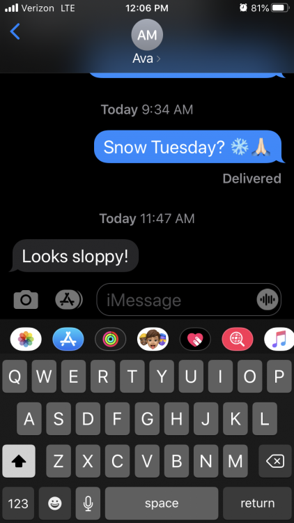
Funny... I had a similar conversation with my friend last night about Tuesday.

-
1
-
 1
1
-
-
On 1/2/2020 at 10:52 AM, NorthArlington101 said:
July 2019 rainstorm is the event of the year for me.
3" of rain in an hour is a crazy thing to witness. I've never seen that much water, and places here flooded that I never thought could.
3 hours ago, MN Transplant said:This is it. That was an amazing wall of water.
Lots of talk about the rainfall rates from this event... where a watched the rain-curtain miss me to my east by about a mile or so.
How did the rainfall rates compare with the rates you see during normal summer thunderstorms? What was the visibility like during the heaviest part of the storm?
-
Another year is over and I'm Curious George.
What weather event stood out for you personally in the past year?
For me it is a little bit harder this year... but I'll go with a thunderstorm that hit my house on August 20th. There was torrential rain, 40+ mph wind gusts and nickel to perhaps quarter sized hail. The storm lasted a relatively long time for me (~20 minutes). A few leaves were down from the hail and a tree fell on a light-pole snapping it in half about half a mile down the street from my house.
Yeah not very exciting IMBY this year... The January snowstorm was also okay though...
As was the late February wind event.
-
5 hours ago, psuhoffman said:
It’s been 17 years since there was a season without a warning level snowfall up here. The longtime average here is 1 skunk year about every 12 years. So we’re due...
I will track every possible threat until the last flake regardless. Just saying the fact we’re due up here for a total skunk year has been in the back of my mind.
How in the flippity flop-a-dippery dop did you miss out on PDII and all the other warning-level snows that happened that winter?! Did you get fringed to the underworld or something?
")
-
Happy New Decade WxWeenies.
-
1
-
-
2020ing.
-
Just now, HighStakes said:
The 90 storm was between Christmas and new years that year. Not a good snow season at all but that storm was an unexpected surprise.
The 92 storm really was a bomb.
Did either you or @losetoa6 experience any thunder snow from the 92 bomb?
-
@psuhoffman I don't have anything to add but thank you so much for the time and effort put into this!
-
19 minutes ago, psuhoffman said:
@frd only issue I have is the “Nina” thing. We have most definitely not been in a typical Nina pattern.
December H5 for Nina’s in the last 25 years

This December

The coming pattern does resemble a Jan Nina profile a bit more, at least wrt the central pac ridge, but it still has some massive differences in other places such as the WPO and STJ departments. It’s a weird hybrid pattern. It’s a crap look. It’s actually way worse than a typical Nina look honestly. Lol
Perhaps Tom was only referring to the similarities wrt the central pac ridge and didn’t want to explain all that.
What's the site that you get data to customize time periods of these plots from?
May I have a link to it please? - TIA
-
11 hours ago, losetoa6 said:
I actually take a 3" snow in late April at 6am even if it melted by 10am
One thing about March is with the clash of air masses and deeper moisture potential....a big qpf bomb is always possible. One of these days a March 58' or 42' will happen again and when u think about it ...its only the last 150 years we've had reliable records. Earth is how many millions of years old...lol. Just something that's always in the back of my mind. Who knows when the next 100 yr storm, or 500 yr storm, or heck even 100,000 yr. Storm is coming

You know I always have wondered what the most anomalous weather event in the last say 50,000 or 100,000 years was in the region, the US, and in the world.
Was there a 2+ foot blizzard in Miami... in May?
A 200 mph category 5 hurricane... striking Newfoundland?
Has it snowed... at sea-level in Jamaica?
I wish there was an easy way to figure these things out.
-
1
-
-
3 minutes ago, RDM said:
Couldn't agree more. Give us something tangible that represents winter - anything... snow, ice, sleet, FZR, wind, sub-0F, anything...
Three meters of snow in 2 days or 18"+/hr snowfall rates from a thundersnow squall would do.
-
Merry Christmas to you all and Happy Hanukkah to you Jewish posters!
Be Merry!
Enjoy the vultures tearing up presents and flying around the house at F-18 speeds!
Be Bright!
Listen to your oldest relatives crazy (and probably exaggerated stories) of all of the extreme weather events that they've been through... like tornadoes that gobbled them up from Kansas and spit them out into a strange colorful wonderland!
Get Drunk!
But not too drunk... eh what the hey!
From this weenie to all you weenies. Have a wonderful holiday season.
-
2
-
-
IAD got down to 23F this morning with heavy frost.
Trace accumulations everywhere. I'm counting it.
Merry White Christmas fellow Wxweenies!
-

My friends my friends! Heads-up my friends!
Area Forecast Discussion
NWS GeorgeBM Headquarters
1:57PM EST Tuesday, December 24, 2019
A Potentially Life-Threatening Winter Storm will impact the region this afternoon into tonight
Heavy rain and thunderstorms will move into the region this afternoon. These storms may contain severe hail. The most intense storms may have strong enough downdrafts to penetrate the low-level stable layer and bring some strong wind gusts to the surface. Precip will then change over to very heavy snow from west to east through the late afternoon/early evening hours as temps drop from the lower 50sF to near freezing. Snowfall rates may exceed 6 inches per hour and with the surface low bombing out over the central Chesapeake Bay wind gusts of around 70 to 75+ mph across the region will lead to whiteout conditions through the evening. The dangerous winds combined with the heavy wet snow will lead to widespread power outages and widespread tree damage. Blizzard Warnings have been hoisted for the entire forecast area. Areas from Northern VA, the WV Panhandle, through DC and much of Maryland and into North/Central Delaware will see snow totals of 30”-45”+ with snow-drifts that may exceed 20 feet. The snow will taper-off from west to east across the region between 1z and 5z before skies start clearing overnight with Wind Advisory-level winds continuing and temps slowly dropping into the upper 20sF. This is a potentially life-threatening storm that should not be taken too lightly. You should be prepared to be without power for an extended period of time.
Near term... GBM
-
 2
2
-
 1
1
-
-
Other WxWeenies... Happy Ten-Year Anniversary of (probably) the best December snowstorm of your lives (in this region, at least).
-
2
-
-
@mappy Happy Ten-Year Anniversary of (what's probably (I'm not you, of course)) the best December day of your life!
-
On 1/31/2019 at 8:26 PM, Zanclidae said:
Best squall I've experienced in my life was in Harford County MD near Jarrettsville.
It was Friday, January 25, 1985. Story time!
I just got finished up with dinner. Turned on the TV and was flipping through channels. WTTG (Channel 5 in DC) was always sensitive to sferics and I used that to know in the summer when TRW was nearby or so. Never expected to see white static and crashes through the speaker in Jan. WTF! So I watched and again, not even a minute later, another one! So, I take a look out my den window facing due west and sure enough, I can see lightning in the distance. While this would be no biggie in May, in Jan it is and this area rarely sees thundersnow. As I kept watching, I noticed what I thought was a dog that got loose from one of the neighbors. It waddled closer in and to my surprise it was a HUGE Canadian goose! Well that surely was strange. And then there was another flash that was bright enough that it took my attention off the goose. I noticed a few flurries coming down as well. There were two more flashes and I heard thunder. This was sounding just like a decent thunderstorm approaching in the spring or summer. But! It was snow. And boy did it snow. The streetlights up on the main road disappeared and I thought perhaps the power went out, then the houses across the street completely obscured from view! Not foggy-ish, just gone. Then I realized what was happening. It arrived. What would normally be a torrential downpour was an intense snow squall that was a total white out. Looking out the window was like looking out there with a white sheet over the glass. Simply amazing. There was a blinding flash followed by thunder less than a second later. It was exceeding blue-white brilliant like a huge high intensity discharge (HMI) lamp starting up. The wind was also roaring. I ran downstairs to my shack and checked and the wind speed on my Heathkit ID4000 was at 49 mph. It was a very high sustained wind during the event. The peak gust was 53mph. The anemometer was mounted at 10 meters on a free standing Rohn 25G tower so those numbers are legit.
The funniest part of the story is when I pulled the curtain back to look outside, there was a blinding flash of light and right outside the window was that damn goose! I scared him and he spread his wings and jumped in the air and I nearly fell backwards away from the window. I actually recall screaming, it was that bad. If you've ever seen the movie Free Willy, near the beginning where the kids were at the aquarium painting the tank windows with graffiti and the lightning flashes and Jessie sees Willy for the first time with mouth open and screams, well there you go, that's it right there!
")
Anyhow, after that was over, we had a good 6 or 7" of new snow in well under an hour, 40-45 minutes tops and most of that was in that heavy burst. I would not want to be caught driving in something like that for sure. Those are the kind of *instant whiteout* that cause big traffic pileups on the interstate. Because someone is going to stop and someone isn't.
I've never seen this happen before. Have seen thundersnow several times, but that was truly legit and it was wonderful.
Probably the most recent winter event that was exciting for me was January 26, 2011. That was a pretty good "flash freeze" event for us. And the second time I had to get help with clearing snow off the lane. The Cyprus trees took a terrible beating with that one.
On 1/31/2019 at 8:33 PM, C.A.P.E. said:I remember that event. I was living in Carroll County then. Was just about to go out for the evening and there was talk of thundersnow to the NW. I looked outside and it was calm and sort of foggy- By the time I got my coat on and went out the front door it was instant whiteout. I didn't go out lol. It was awesome to watch. My brother was out already with friends and got stuck on the roads in the flash freeze. Temps dropped from the upper 30s to low 20s very quickly. Ended up with around 4" in 45 mins as I recall.
On 1/31/2019 at 9:02 PM, HighStakes said:Finally some people remember this event. The most intense squall I've ever seen and probably this region outside of garret county ever saw. I was 12 at the time. My father and I got caught in it. Snow was coming down so heavy I has to get out of the car to clear the windshield for him. We were about 10 minutes from home when it hit and took us 2 hours to get home on reisterstown rd. About 4 inches sounds right. Haven't seen anything close since.
How in the boogie woogies am I only hearing about this event now? This seemed like it was a good bit more epic than the already cool February 14, 2015 snow squall. Funny how this event is not brought up more frequently whenever we reminisce about past snow squalls. A bigly congrats on all of you snow weenies that were alive to witness this magical event in this region in person.
-
2
-
-
On 12/17/2019 at 2:43 PM, Always in Zugzwang said:
Yeah, he might be tempted to kick puppies again!!
That's @stormtracker.
@Bob Chill has the bunny-strangling issue.
-
2
-

January Banter 2020
in Mid Atlantic
Posted
The BEST time ...
...
It should be back shortly.
ETA: Around 12:00pm cst according to them via twitter.