

George BM
-
Posts
2,603 -
Joined
-
Last visited
Content Type
Profiles
Blogs
Forums
American Weather
Media Demo
Store
Gallery
Posts posted by George BM
-
-
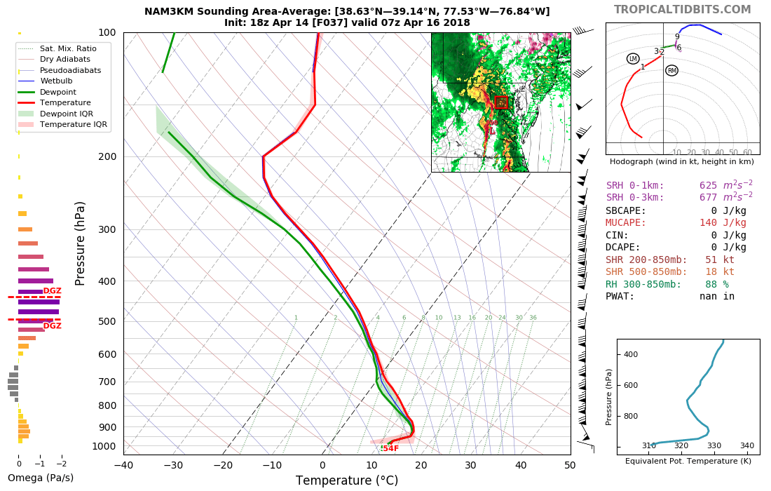
According to the 3km NAM Caddy Waddy is still holding on a bit right in front of the line with a surface inversion. It has warmed from the 40's at the surface by then but the LLJ would still have some CAD to eat off of the immediate area. But I'm of course just stating what already obvious to you all.

-
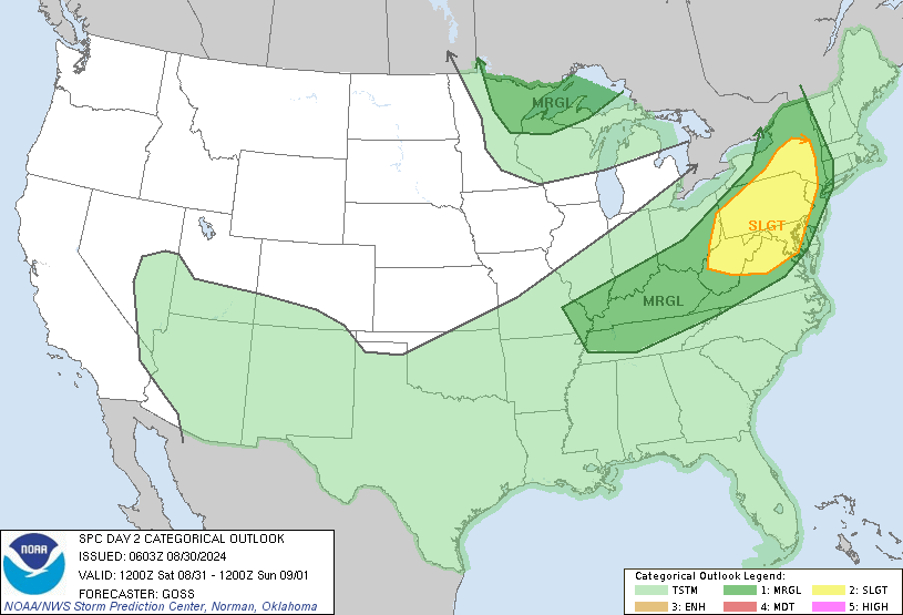
Day 2 outlook..... Fringed.
-
3 minutes ago, csnavywx said:
It's V-B-V, making that prospect even tougher than normal. It's definitely favored for a narrow forced line. On the upside, there's a bit of a remnant EML in there, especially further south, so with low WBZs and decent mid-level CAPE, small hail might be common.
Excuse my ignorance but what is "V-B-V"?
-
For Wednesday, 4/04/2018.
-
On 3/3/2018 at 8:51 AM, Kmlwx said:
One thing to consider for us severe weenies...the wind event we are just getting through might be the biggest severe event of 2018
")
Sadly that's probably true.
Heck this was the best event for me since a particular line of storms that came through this region around the end of June of (maybe) 2012?...... I'll look into that. One can still hope and dream and track and weenie though. You never know.
-
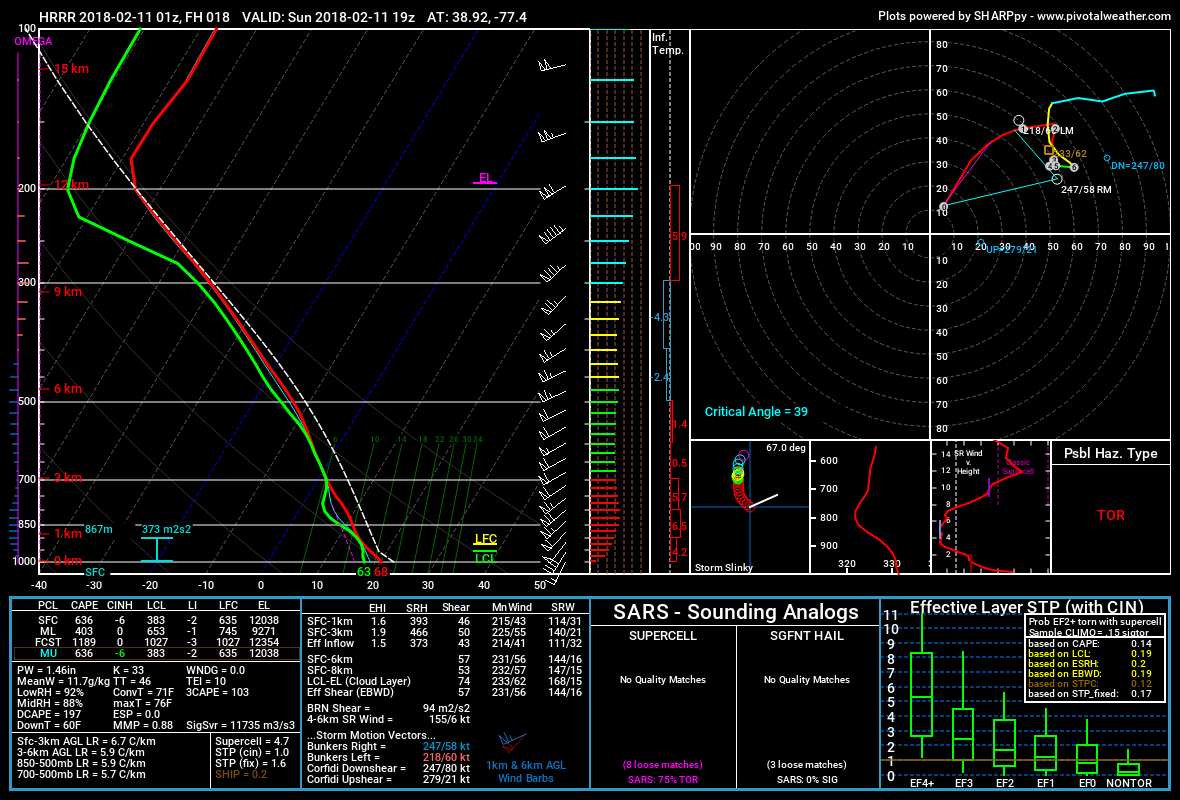
30 minutes ago, high risk said:
There is little doubt that shear tomorrow afternoon will be fabulous; it's a question of whether we can have any src-based instability. Both the HRRR and NAM3 suggest small amounts of cape; the chances of severe seem to be low, but they're likely non-zero.
Oh yeah definitely not an absolute 0%. A trend that I've been noticing through today with the models is for a few more of us to make it into the warm sector for tomorrow with sfc temps into the mid/upper 60's w/ dwepts 60+ owing to the surface low tracking a bit further to the west. Perhaps some enhanced wind gusts if something gets going tomorrow and we get more sfc-based cape like you said. Nothing big though...at least I don't think (not an expert).
We watch.
-
 1
1
-
-
Probably WAY overdone but lol hrrr for tomorrow afternoon.

2018 Mid-Atlantic General Severe Discussion
in Mid Atlantic
Posted
I'm definitely no expert but I would think that with some "okay" looking inverted-v profiles and fairly swift cloud layer motion any storms that do manage to pop may bring down some stronger wind gusts......Any storms that do manage to pop. The obvious limiting factor today is CAPE.