

George BM
-
Posts
2,607 -
Joined
-
Last visited
Content Type
Profiles
Blogs
Forums
American Weather
Media Demo
Store
Gallery
Posts posted by George BM
-
-
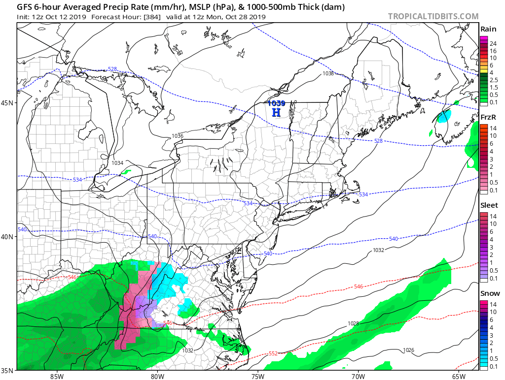
HRRR at range of course but the 12z says sorry trick or treaters west of I-95.
-
2 minutes ago, Kmlwx said:
I think there was also a day (was it that one?) that had tornado watches for all or part of the area for like 24 straight hours or something. And I think a day in June 2013 that had a long track EF-0 tornado in MoCo.
Probably April 27-28, 2011.
-
Widespread severe winds from cold front forced "storms" are so rare at this time of the year unless we can get an October 2010-like bomb to bomb out further east through the Ohio Valley, Great Lakes, interior Northeast region. That worked out well from the Midwest into the Ohio Valley then.
But of course you all probably know that. Just rambling.
")
-
4 minutes ago, Kmlwx said:
I think even with it coming in during peak heating it'll probably have very limited instability to work with. Ultimately it'll probably turn out very similar to the other day...tough for us to get anything of significance this late.
November 16, 2006 had a 10% hatched tornado locally. It was exciting but not a whole lot happened. I remember rushing home from school. I think there was some isolated flooding. The reports from that day are very anemic on the SPC archive.
ETA link for reference: https://www.spc.noaa.gov/exper/archive/event.php?date=20061116I too remember that day. I just remember it raining heavily at times (with some lightning early in the afternoon) through about 3pm followed by skies rapidly clearing for late afternoon sunshine.
That day was certainly nothing compared to your favorite event two springs later on a June 4th afternoon. I wouldn't make it out of school to see that one though.
-
7 minutes ago, Kmlwx said:
The timing looks pretty poor for now. 3km NAM and GFS seem to bring any sort of line in here at bad times in the diurnal cycle. I know this time of year the cycle matters a little less than it would in summer. But that doesn't bode well for having a peak of instability. Would like to see it either speed up to arrive Thursday afternoon - or slow down and nudge into the day on Friday. Shear looks excellent as you said. Assume we'll just get a pencil thin squall with no thunder/lightning with some gusty winds. Sub-severe would be my guess.
Would be interesting to get the line through the region between 6 and 9pm.

-
Day 2 Convective Outlook
   NWS Storm Prediction Center Norman OK
   1225 PM CDT Sat Oct 26 2019

   Valid 271200Z - 281200Z
...Shower activity ahead of the main frontal convection will limit
   instability and heating across northern and central VA northward.
   However, surface dewpoints in the mid to upper 60s are forecast,
   resulting in SBCAPE less than 250 J/kg across northern VA into the
   northern Chesapeake Bay vicinity. Ahead of the front, backed
   southeasterly winds in the vicinity of a pre-frontal trough will
   result in effective shear values around 30-40 kt. This should allow
   for some organized bowing segments within the QLCS and a few
   damaging wind gusts will be possible as convection quickly moves
   east/northeast.  Strong wind profiles as low as around 1000 feet,
   and backed southeast surface winds will lead to large, curved
   hodographs. If pockets of greater instability occur and
   surface-based convection develops, a weak/brief tornado cannot be
   ruled out across northern VA toward coastal MD....
-
-
-
Yeap.

-
4 hours ago, arlwx said:
Dewpoints stayed up high enough for the airports to (officially) escape freezing this morning.
DCA 44, BWI 39, IAD 34, RIC 39.
But Manassas hit 30 and many Shenandoah Valley freezing obs.
IAD actually hit 33F.
-
1 hour ago, C.A.P.E. said:
Yeah it sure is. Almost NAM like. Gets my yard on the half inch line.
0z run..... NAM'd.

-
 1
1
-
-
More areas added to the Wind Advisory.

URGENT - WEATHER MESSAGE
National Weather Service Baltimore MD/Washington DC
905 AM EDT Thu Oct 17 2019

DCZ001-MDZ003>006-011-013-014-016>018-501>508-VAZ028-031-052>054-
501-503-505-506-WVZ050>053-501-503>505-172115-
/O.CON.KLWX.WI.Y.0016.000000T0000Z-191017T2200Z/
District of Columbia-Washington-Frederick MD-Carroll-
Northern Baltimore-Southern Baltimore-Prince Georges-Anne Arundel-
Charles-St. Marys-Calvert-Extreme Western Allegany-
Central and Eastern Allegany-Northwest Montgomery-
Central and Southeast Montgomery-Northwest Howard-
Central and Southeast Howard-Northwest Harford-Southeast Harford-
Frederick VA-Clarke-Prince William/Manassas/Manassas Park-Fairfax-
Arlington/Falls Church/Alexandria-Northern Fauquier-
Western Highland-Western Loudoun-Eastern Loudoun-Hampshire-Morgan-
Berkeley-Jefferson-Western Grant-Western Mineral-Eastern Mineral-
Western Pendleton-
Including the cities of Washington, Hagerstown, Frederick,
Ballenger Creek, Eldersburg, Westminster, Reisterstown,
Cockeysville, Baltimore, Bowie, Suitland-Silver Hill, Clinton,
College Park, Greenbelt, Laurel, Camp Springs, Glen Burnie,
Annapolis, Severn, South Gate, Severna Park, Arnold, Odenton,
St. Charles, Waldorf, Lexington Park, California,
Chesapeake Beach, Huntingtown, Dunkirk, North Beach, Lusby,
Prince Frederick, Frostburg, Cumberland, Germantown, Damascus,
Bethesda, Rockville, Gaithersburg, Silver Spring, Lisbon,
Columbia, Ellicott City, Jarrettsville, Aberdeen, Winchester,
Berryville, Dale City, Manassas, Woodbridge, Lake Ridge,
Montclair, Reston, Herndon, Annandale, Centreville, Chantilly,
McLean, Franconia, Arlington, Alexandria, Falls Church,
Warrenton, Hightown, Purcellville, Leesburg, Ashburn, Sterling,
Romney, Paw Paw, Martinsburg, Charles Town, Shepherdstown,
Bayard, Mount Storm, Elk Garden, Antioch, Keyser, New Creek,
Ridgeville, Russelldale, Headsville, Fort Ashby, and Riverton
905 AM EDT Thu Oct 17 2019

...WIND ADVISORY REMAINS IN EFFECT UNTIL 6 PM EDT THIS EVENING...

* WHAT...West winds 15 to 25 mph with gusts up to 50 mph.

* WHERE...Portions of The District of Columbia, central, north
  central, northern, southern and western Maryland, northern,
  northwest and western Virginia and eastern and panhandle West
  Virginia.

* WHEN...Until 6 PM EDT this evening.

* IMPACTS...Gusty winds could blow around unsecured objects.
  Tree limbs could be blown down and a few power outages may
  result.

PRECAUTIONARY/PREPAREDNESS ACTIONS...

Use extra caution when driving, especially if operating a high
profile vehicle. Secure outdoor objects.

&&

$$
-
1 minute ago, C.A.P.E. said:
Yeah I noticed that. Looking at the wider view it extends across to the eastern shore as well.
 Yeah. Sorry to leave you out.

-
2
-
 1
1
-
-
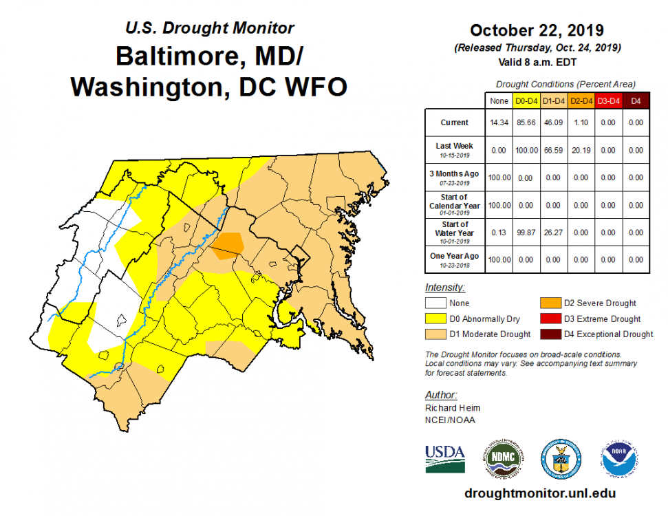
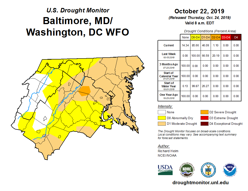
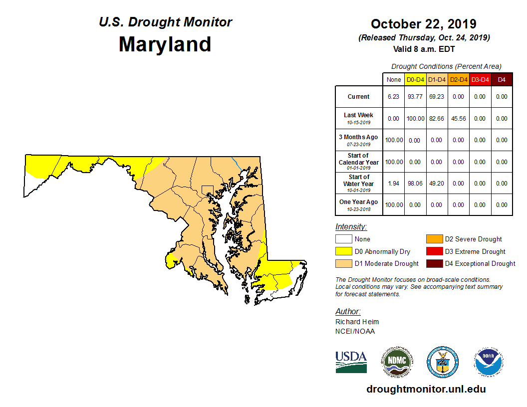
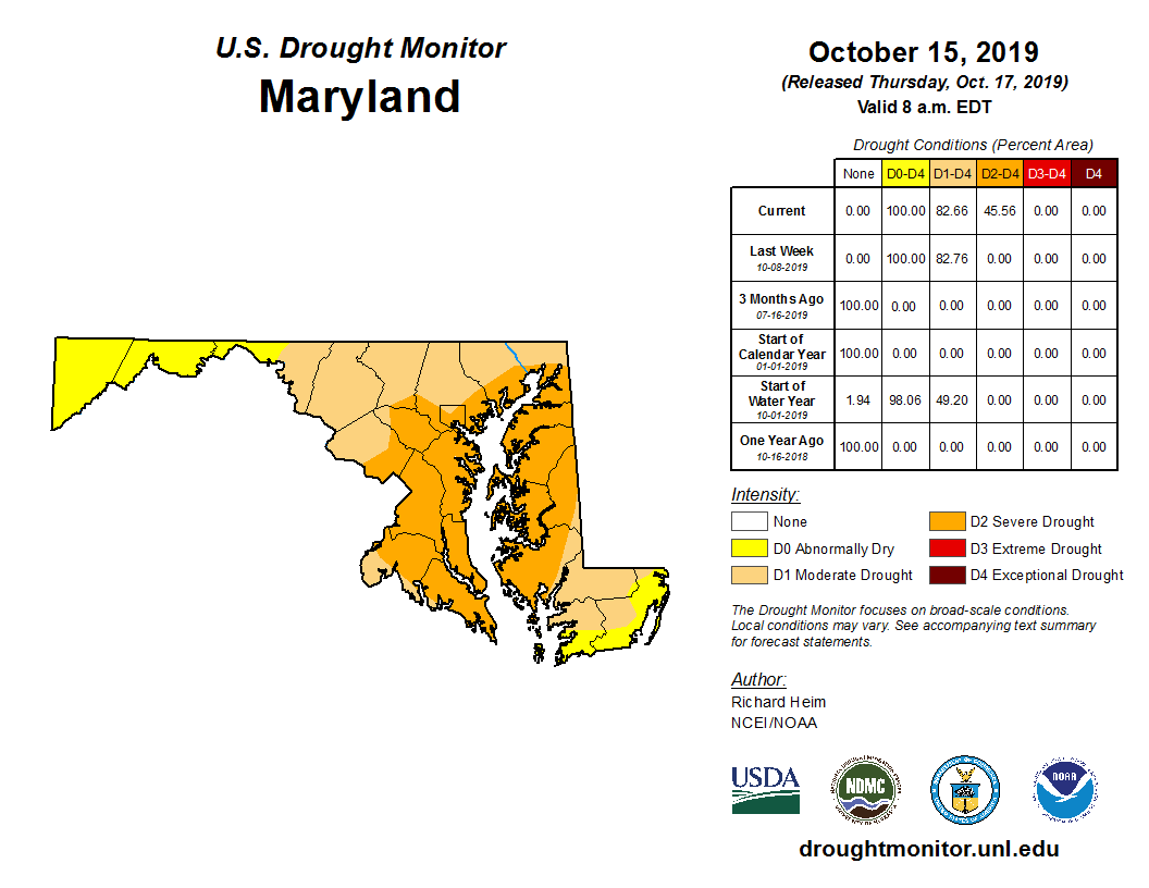
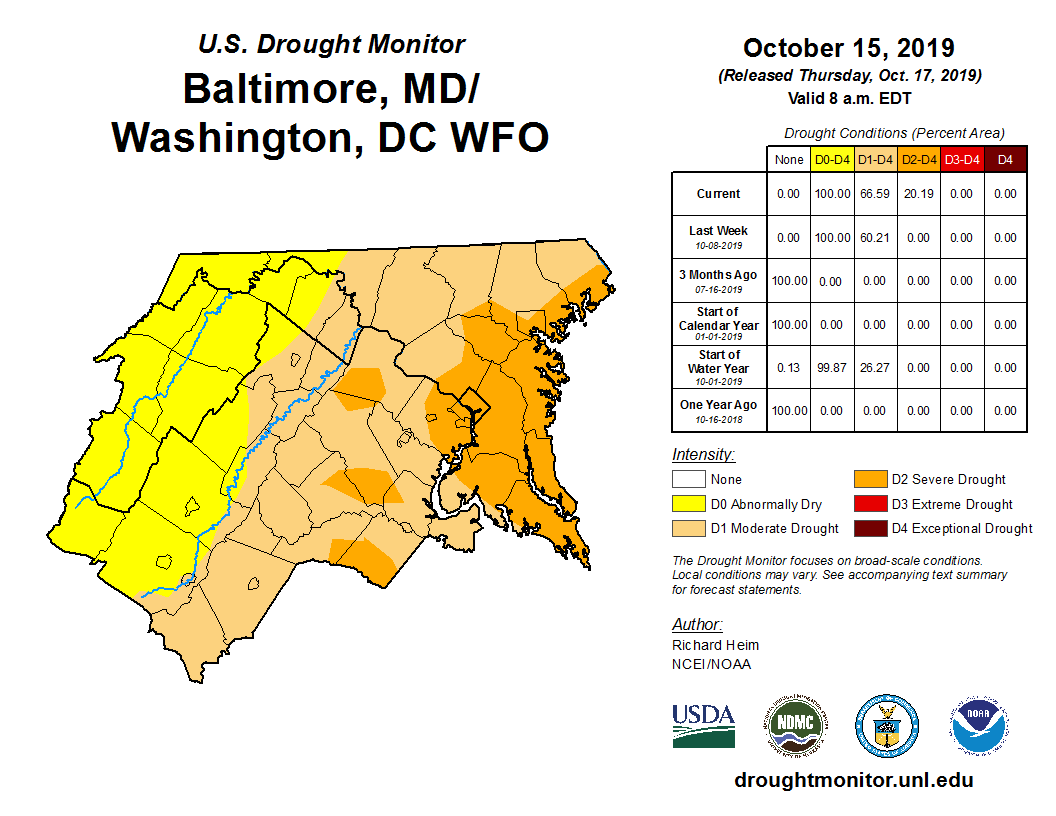
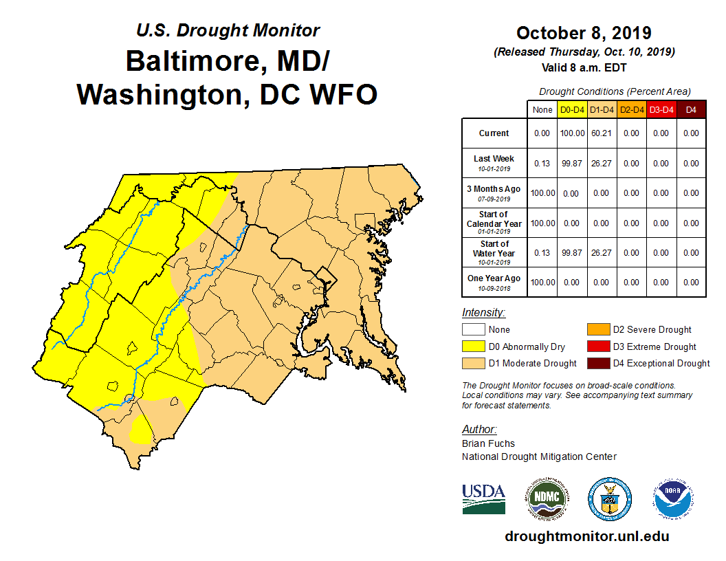
Looks like some areas locally briefly made it into severe drought category pre-yesterdays rain.

It will probably be slightly less severe for next weeks update.
-
1
-
-
2 minutes ago, wxdude64 said:
Don't worry about getting rain next week, I am on vacation and planned on cutting firewood for the winter (16 dead trees standing, 75% ash), so rain is basically guaranteed!!
Thanks so much for your generous sacrifice.
-
1
-
-
Has anyone else noticed a pinkish tinge to the western sky in the twilight after sunset? I've been noticing it for the past couple of weeks.
-
#Unicorn

-
2
-
-
1 hour ago, MDstorm said:
Very cool!
Looks like an EF5
Meh. It's just a 200mph EF-4. Just one mile per hour short.
-
2
-
-
1 hour ago, PrinceFrederickWx said:
My wife always makes themed cakes for everyone's birthdays (the kids, me, my family, etc.). I thought I'd share this one with you all since it's tornado themed- our middle son loves tornadoes so she made this one for his birthday tomorrow (he turns 3). By the way, in January she's making a hurricane themed one for my mother, who is literally the biggest tropical weenie I've ever known (this disorder seems to run in the family, if you've noticed).

This is so cool! I'm very happy for your family! Hopefully this region aka Teaseville Central doesn't ruin his innocence too soon.

Perhaps some storm-chasing trips are inbound soon?......
-
1
-
-
57 minutes ago, high risk said:
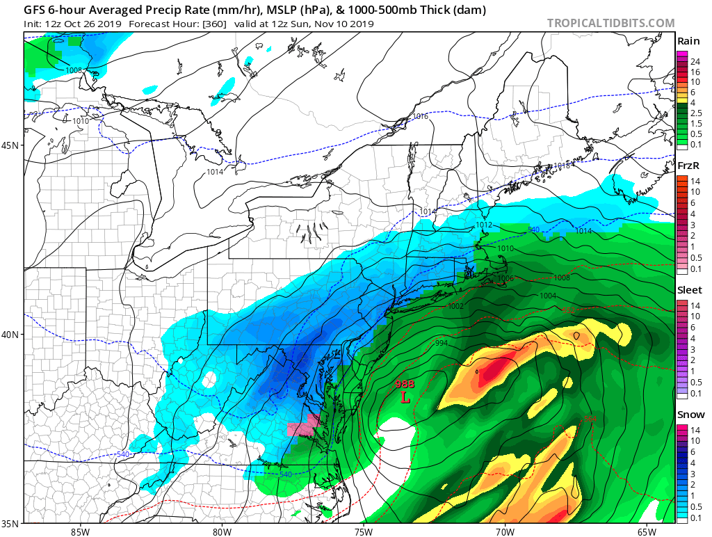
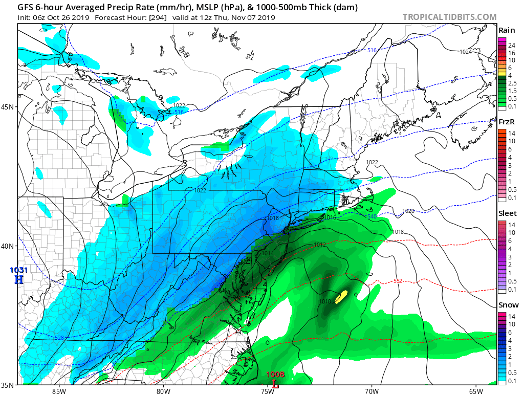
I love the GFS solution for the middle of next week in which the wave on the front passes too far southeast to give us rain but sufficiently kills convergence along the front in our area, leaving us in a giant precip hole. T
Winter already?
* * *
63/33 IAD 1015am edt Friday, October 11, 2019
-
-
10 hours ago, yoda said:
Well I didnt graduate that long ago lol... graduated from Mason in 2009
Cool. I'm at Mason right now. What did you major in?
-
A @Subtropics TM October day... oh wait dewpoints are only in the low 60's. Nevermind. Not humid enough.
-
IAD has now hit 96F.

October Discobs 2019
in Mid Atlantic
Posted
With preference for the latter of course for the best heating.