

George BM
-
Posts
2,629 -
Joined
-
Last visited
Content Type
Profiles
Blogs
Forums
American Weather
Media Demo
Store
Gallery
Posts posted by George BM
-
-
Just one of at least 11 EF5s during the 2020 Super Outbreak. This is near Fredericksburg, VA.
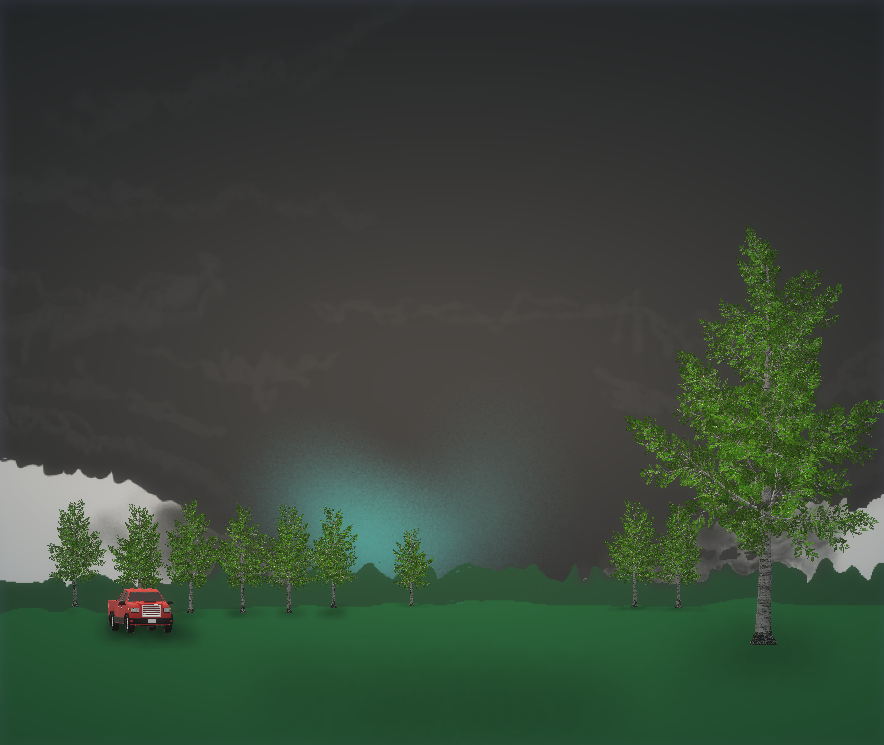
I'm the blue bot facing the tornado. This tornado was moving east at 60 to 65mph at this time.
-
 2
2
-
-
@WxWatcher007 You and your family will be in my thoughts and prayers. Keep safe and well friend.
-
 1
1
-
 1
1
-
-
A chilly light drizzly rain.
-
What's your go to IPA during this time AND have your kids tried to get some of that good stuff?...
Go!
-
I haven't really stepped into this much vocally (there are lots on here that look way more indepth to this and have added some great info) but while the deceleration in the rate of the increasing number of daily new cases is a good thing to see... that might just be that only so many people are being tested in a day. I mean we all know that there are probably millions who already have it (I know... not exactly big news (limited testing availability)). But the daily death rate is probably more representative of how things are shaping up here.
This, of course, is just my opinion.
-
2 minutes ago, nj2va said:
Balmy 74 in Deep Creek.
...With fairly decent storms to the north.
-
Just now, high risk said:
1500 is probably enough cape to handle that kind of instability, especially given that it's not "tall, skinny" cape, and there is enough low-level instability for good parcel accelerations. The forecasted soundings keep getting better, and SPC now has a day 2 MDT which looks justified. Still questions about evolution of elevated convection earlier in the day and resulting impact on how far north the warm front can get, but areas just south of wherever the warm front ends up look primed.
Thank for the reply. Yeah the latest long-range HRRR has some loltastic soundings. I mean check out this uncontaminated sounding below. I mean 3,000+ J/kg MLCAPE, LI near -10 with effective bulk-shear around 100kts. Lol!

-
55 minutes ago, yoda said:
Looks like our first chance in a while of some thunderstorms, maybe even an isolated severe threat is on Sunday afternoon
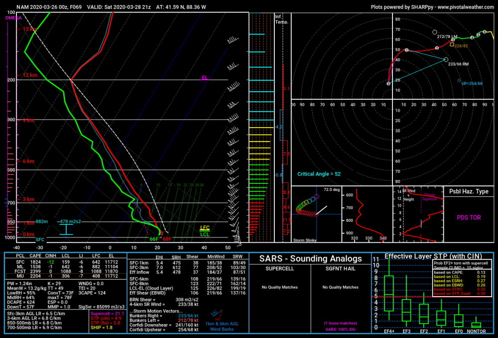
Now this is not for our region (SW of Chicago)... AND it's just one run from last night's 0z NAM at range but... it's not too often that you see 100+ knot EBWD with 1,000+ J/kg MLCAPE.
(Also, please ignore the fact that I accidentally called these files as the 3kNAM... the images below are actually from the lower-res NAM)

The following is just me thinking out loud. I'm not making assumptions about the severe threat over yonder.
I wonder if 1,500+ J/kg mlcape and LIs of -5 to -6 would be enough instability for storms to not get ripped apart by this kind of shear verbatim (Is CAPE fat enough?).
Yeah 1,500 J/kg mlcape is not all that weak but... that shear though...
Of course I'm not trying to take away from the high-ceiling that storms will have should they take advantage of their environment.
@high risk @csnavywx thoughts on this?
Also I realize now that I have a problem with using too many ellipses and parentheses.
-
MD schools closed through April 24th.
-
21 minutes ago, nw baltimore wx said:
I didn’t get to the yard today but my gf and I did a nice walk/hike on the Red Run trail in Owings Mills. Very quiet and peaceful. It was very easy to maintain a safe distance from the 10-20 people we saw over the course of an hour.
Cushwa Fog at Daybreak as a reward.
Yesterday I went for a walk around my neighborhood and I've never seen so many people/families out and about just walking. Obviously the 80 degree Fahrenheit weather had a big hand in that.
I kept a safe distance from others.
-
17 minutes ago, PrinceFrederickWx said:
Let’s all hope that the experts dire predictions end up being as accurate as the predictions most of you made for this winter.


-
1
-
-
There's actually a gust front with this rain/sleet activity. Temp at IAD just fell from 54F to 47F. I saw gusts of 25-30 mph.
-
@MillvilleWx How many tornado warnings did your WFO issue during the past 12-24 hours?
-
10 hours ago, yoda said:
Whats this? No mention of the 00z GFS for next Thursday of next week? Its a quick wet snow bomb for like 4-8 hours... soundings even support heavy wet snow into DC proper at 12z THUR and even 15z THUR... better run for Ji than 18z was lol
Corona virus tracking is the new thing these days.

-
4 minutes ago, WxWatcher007 said:
To add context to this, my mom lives in a county where there’s been multiple coronavirus cases and a death.
Today she needed to go to the emergency room. This was at 4pm today, ambulance and all, under a physician’s order.
The local hospital is a madhouse. It’s 11pm and she still doesn’t have a room. Now imagine dozens of coronavirus patients needing care at the same time in rural areas. Imagine hundreds or thousands in urban understaffed hospitals.
Us young and healthy folks have to stop looking at it from our narrow personalized perspective.
I'm pulling for your mother to make a full recovery.
-
Just now, supernovasky said:
Thanks Mattie. I’ll be fine. Today was better than yesterday so I think I’m finally turning the corner. WHATEVER it is I have, I wouldn’t wish it on anyone.
I echo everyone else on here in saying I hope you make a full recovery.
-
1
-
-
3 minutes ago, C.A.P.E. said:
You think there might be a spike in the birth rate, in say, 9 or so months from now?
Absolutely definitely.
-
-
1 hour ago, yoda said:
And there goes the NHL season... suspended per sources - https://www.prohockeyrumors.com/2020/03/nhl-cancels-practices-will-issue-update-on-season-status.html
Official twitter statement.
-
-
1 hour ago, yoda said:
Yay controlled burns

https://mobile.twitter.com/ffxfirerescue/status/1236716590286147585
49 minutes ago, WxUSAF said:A little smoky in Columbia from that burn. Keep your trash to yourself virginia!
Gunny. I thought that the clouds had a bit of a smoky look to them... though I'm at the west end of Fairfax county with winds in the lower-levels of the atmosphere out of the west. So it may be my imagination after all... hopefully... there was an area of smoke rising from about a mile or a few NNW of the Costco in Sterling, VA as I was leaving there around 5:30pm...
61/12 at IAD currently. A 49F dewpoint depression and 14% relative humidity. Great day for outside burning.
-
Just got a burst of heavy graupel from said cell in Herndon, VA.
Neat.
-
4 hours ago, mappy said:
fun fact
March 3 of 2019 also had an EF4 tornado kill people. in Alabama.
Yeah. March 3rd is getting a tornadic streak lately.
-
1
-
-
19 minutes ago, Icefishingrocks said:
I'm going to have a ceremonial burning of the snow shovel tonight at sunset. I'm done
How many are showing up to the ceremony?


April Banter 2020
in Mid Atlantic
Posted
I got totally and utterly PUMMELED here! The snow started in earnest here during the morning coming down moderately heavily until about midday when it got dark and wind gusts suddenly kicked up to the 50 to 60 mph range out of the north with temperatures quickly falling from near freezing to the upper teens! The snow was blinding and I could not even see the end of my normally sized and not long driveway at several instances all afternoon! The snowfall rates had to be at least 4 if not 5+ inches per hour at times. Also, yes I heard thunder several times throughout the afternoon. I ended up with 25.2" of pure crystal joy by the time the snow tapered off near sunset. This was my favorite blizzard and I have no idea how no thread was made for it . Meanwhile it's still fairly windy here today with 30-40 mph wind gusts.
How much snow did you end up with over there and did you experience the same crazy rates, winds and thunder/lightning?