RDRY
-
Posts
795 -
Joined
-
Last visited
Content Type
Profiles
Blogs
Forums
American Weather
Media Demo
Store
Gallery
Everything posted by RDRY
-
The high-res'es like to jump around the low signature. Precip field looks similar to 18z, though definitely a smidge south which could really help the city.
-
Active mid December with multiple event potential
RDRY replied to Typhoon Tip's topic in New England
NYC resident hiding in the Berks. Looks like a win-win for this one. -
Active mid December with multiple event potential
RDRY replied to Typhoon Tip's topic in New England
Euro might be the closest? -
Active mid December with multiple event potential
RDRY replied to Typhoon Tip's topic in New England
I'm in the Berks for this one. -
Active mid December with multiple event potential
RDRY replied to Typhoon Tip's topic in New England
GFS way south, NAM way north and everything in between -- New York City is always sitting pretty. -
Active mid December with multiple event potential
RDRY replied to Typhoon Tip's topic in New England
Northeast winter storm forecasting is just brutal. What a humbling profession. -
Active mid December with multiple event potential
RDRY replied to Typhoon Tip's topic in New England
Banding at 60 not as robust for them. -
Active mid December with multiple event potential
RDRY replied to Typhoon Tip's topic in New England
Lost maybe a few hours of that norlun feature from 18z, which is a must for higher totals in western MA. -
Active mid December with multiple event potential
RDRY replied to Typhoon Tip's topic in New England
RGEM is an absurd weather model -- it had its 15 minutes of fame several winters back, and now resides in Snookyville. This low is not driving heavy precip halfway through Vermont and New Hampshire. -
Active mid December with multiple event potential
RDRY replied to Typhoon Tip's topic in New England
I wonder if it would be preferable to have super-accurate forecast models (say, 5-day forecasts being as reliable as current 1-day forecasts). Definitely be a lot fewer posts here. -
Active mid December with multiple event potential
RDRY replied to Typhoon Tip's topic in New England
Heh. Baby steps on the GFS. That's just how it rolls. -
Active mid December with multiple event potential
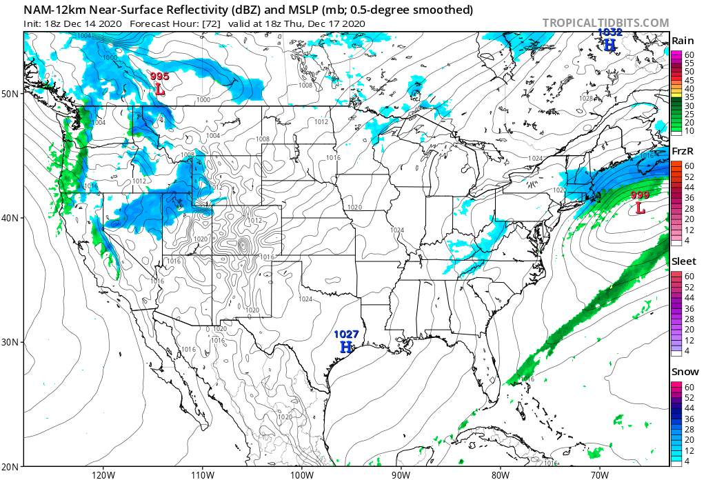
RDRY replied to Typhoon Tip's topic in New England
Precip hangs on several hours longer on the 12k compared to 6z -- almost looks like a norlun trough.
-
Active mid December with multiple event potential
RDRY replied to Typhoon Tip's topic in New England
On 12/11/2020 at 11:19 PM, RDRY said: Upper levels just don't support this hitting north of pike. The 500 MB trough orientation is more east-west than north-south. -
Active mid December with multiple event potential
RDRY replied to Typhoon Tip's topic in New England
The para is the upgraded GFS? Seems very erratic. -
Active mid December with multiple event potential
RDRY replied to Typhoon Tip's topic in New England
Of the 4 main globals, I assume Euro verification is still #1. Which one is 2nd? -
Active mid December with multiple event potential
RDRY replied to Typhoon Tip's topic in New England
Not surprised. GFS does this -- goes off on its own and holds for several runs. It's always possible it has the better read on this storm, but it's not likely. The ICON in its corner like Jack the Ripper as the cutman. -
Active mid December with multiple event potential
RDRY replied to Typhoon Tip's topic in New England
Nitpicking the end of a 12k NAM run, but it's weird that the low doesn't deepen (996) between 78 and 84 hours. -
Active mid December with multiple event potential
RDRY replied to Typhoon Tip's topic in New England
Classic GFS at this range. It goes rogue and holds its solution for several runs before joining the party. -
Active mid December with multiple event potential
RDRY replied to Typhoon Tip's topic in New England
Does the ICON have any known biases? To my very untrained eye, it just always seems to be erratic. -
Active mid December with multiple event potential
RDRY replied to Typhoon Tip's topic in New England
GFS has about the same low position approaching Jersey. But the high wins the battle with the weaker system. -
Active mid December with multiple event potential
RDRY replied to Typhoon Tip's topic in New England
Strong shortwave -- check Arctic high + block -- check Gulf moisture -- check Atlantic moisture -- check -
Active mid December with multiple event potential
RDRY replied to Typhoon Tip's topic in New England
Steve Cohen and a mid-December nor'easter. Spoiled. -
Active mid December with multiple event potential
RDRY replied to Typhoon Tip's topic in New England
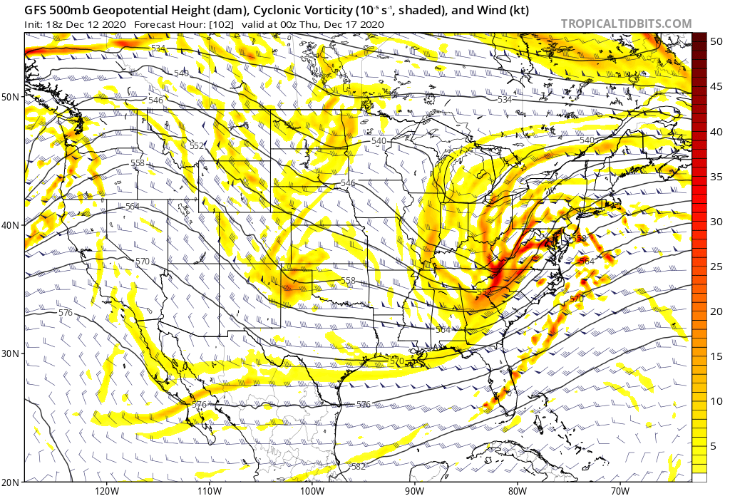
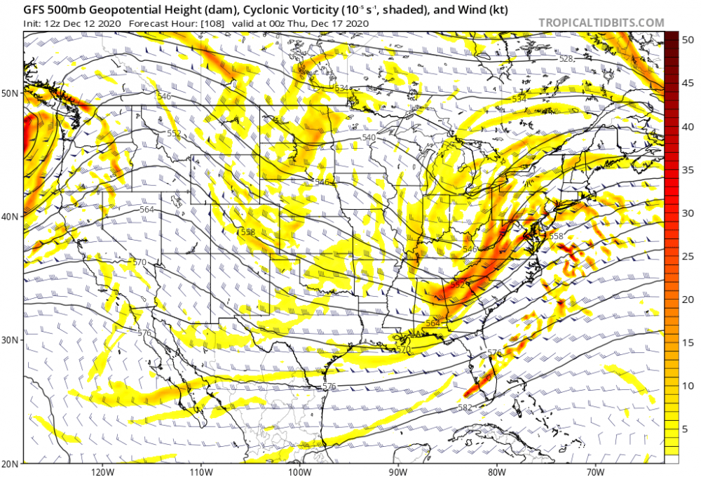
Trough sharpened up at 102. Makes the difference.
-
Active mid December with multiple event potential
RDRY replied to Typhoon Tip's topic in New England
Alrighty then.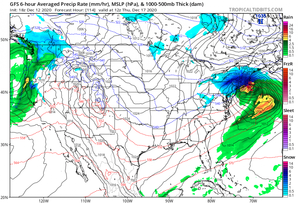
-
Active mid December with multiple event potential
RDRY replied to Typhoon Tip's topic in New England