RDRY
-
Posts
795 -
Joined
-
Last visited
Content Type
Profiles
Blogs
Forums
American Weather
Media Demo
Store
Gallery
Everything posted by RDRY
-
GFS V16 really amping the CAD for the 5th.
-
Latest Euro cuts way back on the cutter precip. Hope that holds.
-
Watching closely .. February 1-3rd for moderate to major coastal event
RDRY replied to Typhoon Tip's topic in New England
This Euro run doesn't have the dry slot from hell. The initial fronto band looks less impressive, but at least it doesn't fly right through. Eastern NE really cleans up. -
Watching closely .. February 1-3rd for moderate to major coastal event
RDRY replied to Typhoon Tip's topic in New England
The absence of a high to the northwest of the system allows the CCB to fan out north and west instead of pivoting, followed by the dry slot. Not a classic set-up at all. -
Watching closely .. February 1-3rd for moderate to major coastal event
RDRY replied to Typhoon Tip's topic in New England
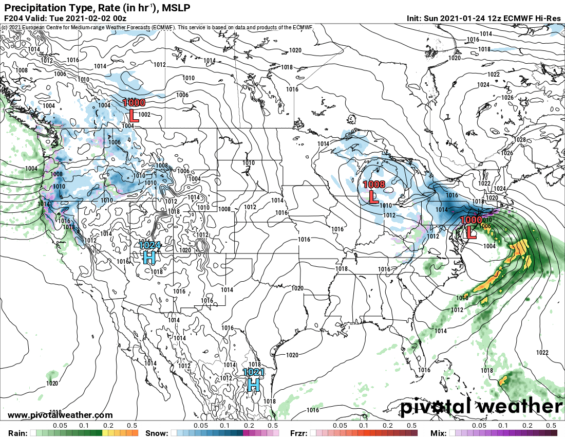
Yeah. The 114 panel does the damage.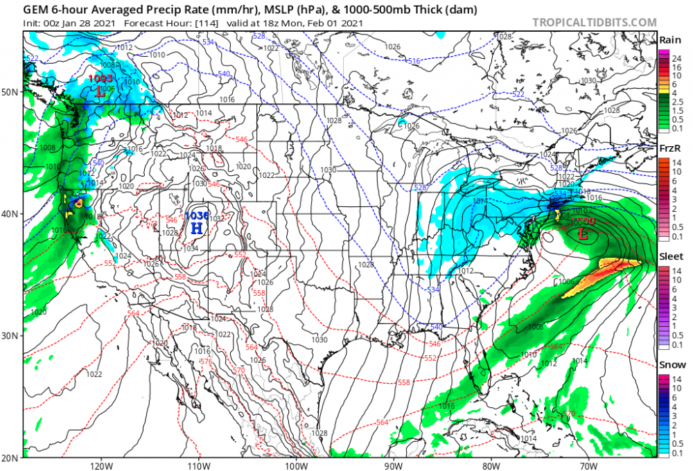
-
Watching closely .. February 1-3rd for moderate to major coastal event
RDRY replied to Typhoon Tip's topic in New England
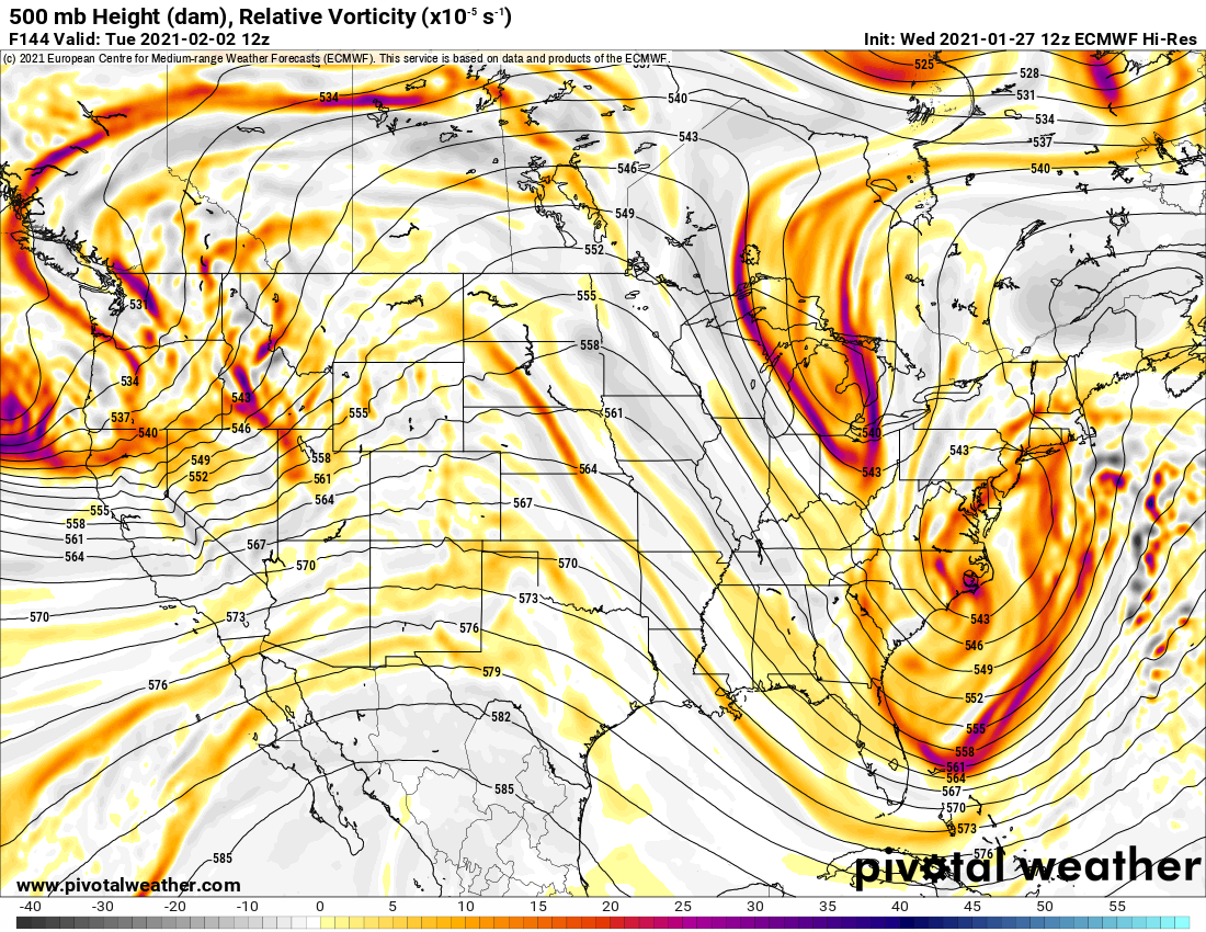
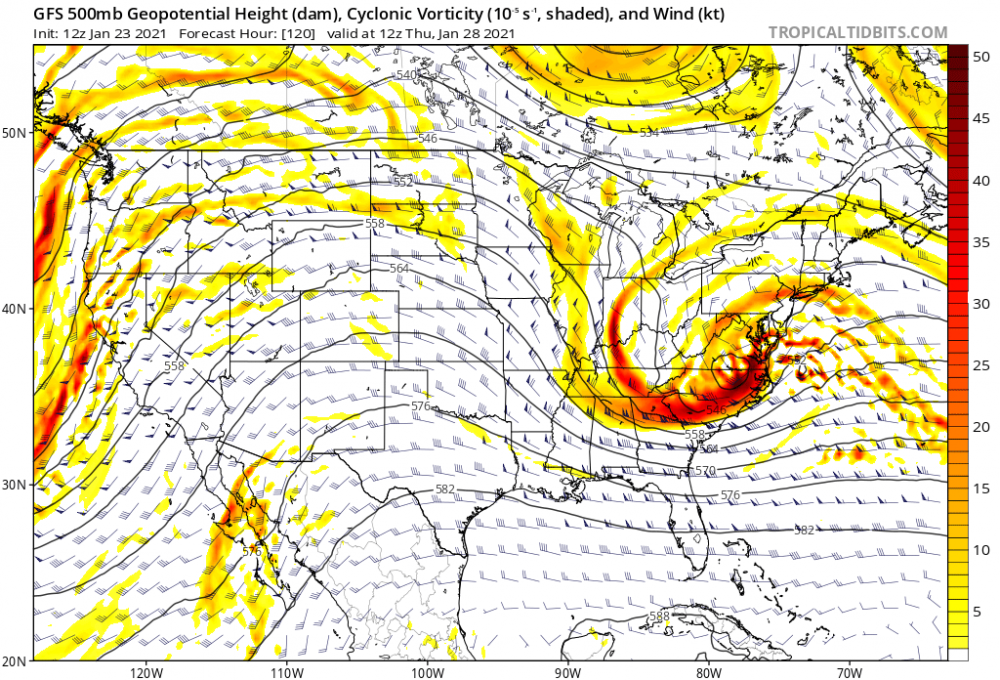
Euro back to a regionwide powerhouse. The 144 panel is just scary. Heavy snows already entrenched throughout SNE and CNE, with a monster vortex still poised to drop in.
-
Not so fun. Trough delays going negative, and the system can't gain latitude. But this is a ridiculous setup, and all the ingredients are still there.
- 2,426 replies
-
- 1
-

-
- heavy snow
- ice pellets
- (and 3 more)
-
Watching closely .. February 1-3rd for moderate to major coastal event
RDRY replied to Typhoon Tip's topic in New England
That run was obscene. The storm parks itself over the benchmark for three days while energy just keeps dropping in. -
Is that because of all the energy diving in from the Midwest?
-
The Euro Hi-res is insistent on a PD redux.
-
Schroeder was the piano player.

-
If you ski out of your league, you're gonna have a bad time.
-
I know. Good look, but way early.
-
Those models deserve a good flogging!! "GFS, I don't want to hear your lame excuses about fast flow, destructive wave interference or Hadley Cells. Go sit in the corner! We're replacing you this cycle with the JMA."
-
Per the Euro, the 28th is not much of a snow event for anyone, even the MA.
-
https://www.youtube.com/watch?v=CtGxusvUT3k
-
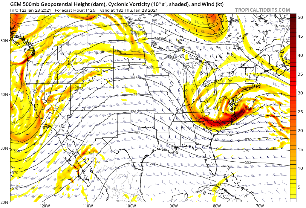
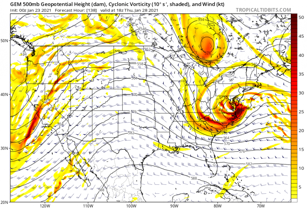
On the GGEM, the PV shifted well north. But the system then went from closed to a flatter, open wave. Can't figure out why -- it almost looks like the PV diving further south spiked the eastern edge of the ridge, which amplified the storm.

-
29th -- ridge better out west, but the PV from the north and the northeast both pressing in.
-
At least the 29th looks to have a broad precip shield. Won't take much of a bump north to do some damage.
-
Looks like the confluence northeast of Maine eased off a bit.
-
An absolute beast. Come on, get up here dammit!!
-
Just took a Jeb walk in the woods since this may be the last accumulating snow for quite a while.
-
The northeast vortex on the 29th looks like someone programmed it to block and then follow any storm in its domain. The timing is impeccable.
-
It's funny to watch that PV hover over and then bully the 29th system right out to sea.