SENC
-
Posts
892 -
Joined
-
Last visited
Content Type
Profiles
Blogs
Forums
American Weather
Media Demo
Store
Gallery
Everything posted by SENC
-
Mine too! I "mean" at least a trace to maybe a inch or two, maybe 3.. I'll take a 3"..
-
Another Historical "quote" for the Forum here..
-
@TARHEELPRORGRAMMER88,, Dear Sir, You & I have had these "discos" where you have been a "EEYORE",, (no disrespect intended), come on guy, It's a El Nino, lets bet against "Climo".. (You know I been dead on these past couple Winters for ILM).. We gotten "something".. That said Look at OUR OWN NWS forecast, (long Range), when they start mentioning P-Type Issues, This far out, We just need to cast the Right Bait too bring it in.. **The fact that there is split flow will lead to some interesting and highly uncertain weather in the east over the weekend. In classic form the southern branch will lead to cyclogenesis over the Gulf and then East Coast while the northern branch helps to keep cool air locked in place. This far south it just looks like a wet weekend though some p-type issues cannot be ruled out inland. Deep moisture will be off the coast according to most guidance but the lagging shortwave energy could be strong enough to wring out a few sprinkles (or flurries??). The GFS idea of a cutoff southern branch feature and a new coastal low is relatively new at least this far south. *** Sounds promising considering Our Storm is this far out.. YOU KNOW HOW Conservative OUR local NWS is! just mentioning "p-type" issues this far out! should be,, well,, use your own judgement.. I say,,Let it RUN! Mor Suppression! lets reeel this Sucka IN! To Our Weenies inland,, when ILM mentions "p-type" issues, your in the game! Either cold rain for us via WAA, or ("warm nose" issues) are Often our Downfall here in ILM because we are "on the Ocean", Or the LP placement is too close to the coast, though We can get the "backside" P-types most often..
-
Almost a match..
-
I'm right along With Orangeburg.. Thus; I Do Have Parachutes at the ready for everyone, when Cliffdiving commences .. (Lets hope it doesn't come to that).. Until then,, Lets TRY to reel this sucka in!
-
TY @Orangeburgwx , I do have a "rudimentary" understanding.. (sorry), The "Florence" example is what I was trying to get at.. TY for making it "clearer".. So We want "suppression" Alil more.. As in I'm not buying, (quite yet) what the further in time, panels are advertising.. The Low, pushing up that far into these "Highs".. Ideally, We would want this "Low" to cut down to say, Mid-Florida (following the Contours) .. then up the Coast..
-
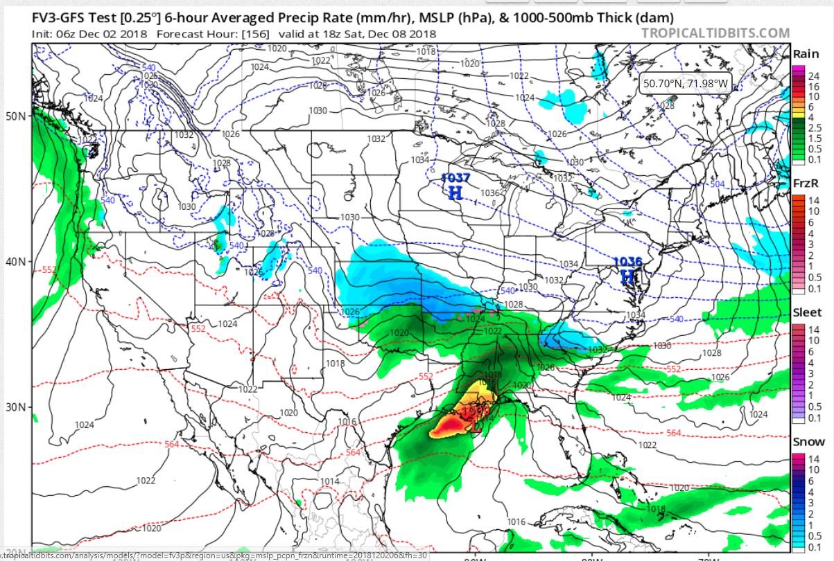
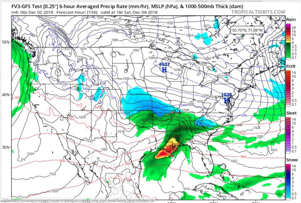
(I hope the picture is allowed).. My Apologies if it isn't.. Looks like Everyone starts out with Flakes.. though the next panel shows change-over to Mix/Rain.. Hopefully, More knowledgeable Mets can answer this.. How is this possible; the "Low" "BullDogs" (for the lack of a better term), into these pair of Strong highs? Shouldn't the Low track further South off the Coast? As Neither High budges AT ALL in the further panels.. .. 1037 & 1036 highs? This is What is referred to as a "Banana High"? I heard the term mention before, just trying to learn something here..
-
Well dern @Orangeburgwx, We are just about the same Latitude, (well, more south & West), though you are West of Me.. I had to look up your local.. I Always have the Warm~nose worries as I'm, "on the Beach".. Though those Ensemble members are starting to look promising for Us?.. We need just alil more Southward "trend".. Sorry upstate Folks.. Hopefully It's Our Turn, though I hope Everyone see some Flakes!
-
Just another 50~100 miles, I'm game..
-
Haven't posted in a few.. (sorry massive Hernia).. Went Trout fishing yesterday & today, very productive, along with puffers, (blowfish).. Caught several SST, (lots of "spikes) kept 2 over 14 inches,, for my "legal limit" .. Lots of Blues in the water.. Saw a Bluefin tuna jump out the water yesterday... (chasing Menhaden) off the beach.. currently.. 62 & Rain T-storms.. Water temp is 67..
-
You dynamiting my hopes.. By 30 days.. I'm going by the fishing bite, (if you don't mind) Fish don't lie.. Squirrels are ravaging my area.. Of course there's NO nuts, acorns etc fell due to Florence, so there's that.. Sorry "WOW" I look at natures signs..
-
yes,, We did get this?.. high 60's & low 70's,, Did I win the chicken/oyster dinner? (EDIT) We, well I on the coast have the same conditions as last year.. We already have had "several" thunder events, (Including today/tomorrow), Same set-up (almost).. ? Went SST fishing, yesterday, (speckled sea trout) fishing the bite was off the hook literally, same as last year before the above event..
-
Like to see this again.. Edit excited about "possible chances with the secondary low"

-
south 75~100 miles please.. Or the "secondary Low" too "overperform"
-
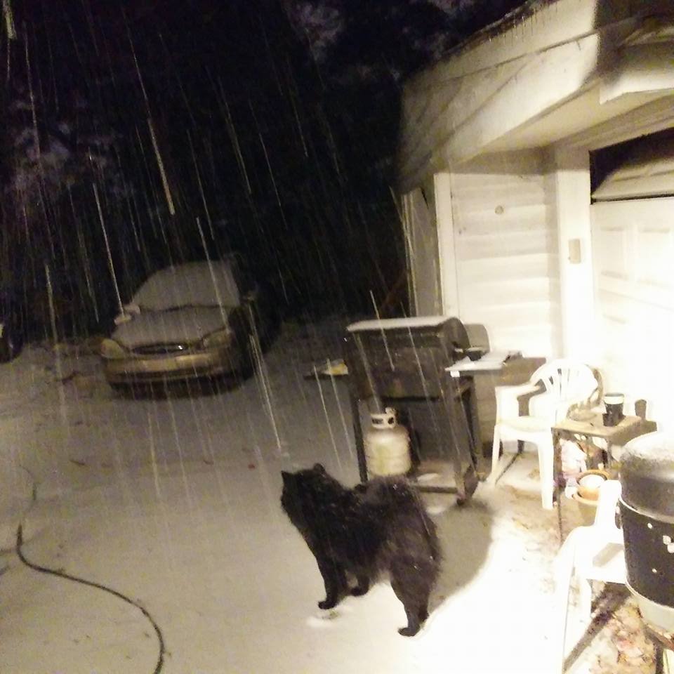
Oh MY.. NO WAY! SST Temps are still in the low 70's Massive warm nose! Wilmywood getting snow in Nov? Bah Bah Bah!
-
So you didn't have a portable anemometer? you left Wilmington, after your home was flooded" to chase a cane?
-
I'm Monitoring... Givin some of the videos/pictures coming out, I'll give My assessment.. Here in a couple Days (On Mexico Beach Landfall).. I was volunteering yesterday & Today,,, , re: Cajun Navy and other folks,, running Supplies into West Pender/ Eastern Brunswick Counites yesterday.. So I wasn't able too participate in the Discussion yesterday.. God Bless everyone... Again, I've said.. I've a OPEN Mind.. It's not closed folks.. I'm all for Healthy Debate and Discussions.. I'll BRB gotta run another Load of Supplies' to Currie, NC
-
ok Lets go to Port Saint Joe.. Weather Station,, Gulf County Emergency Operations Center WeatherSTEM Station 11.4 miles from Landfall.. (Mexico beach) I DO NOT see Cat 4 or 5 Winds do you?
-
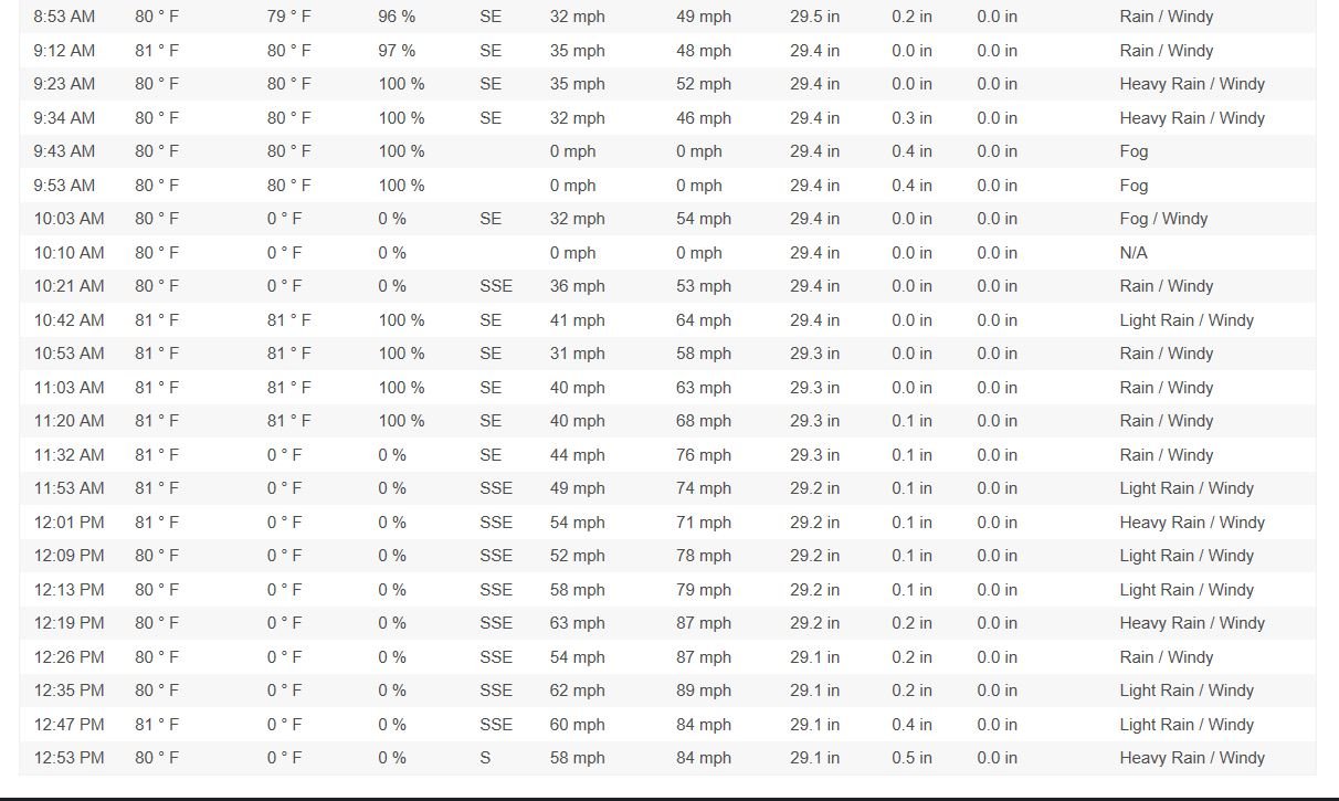
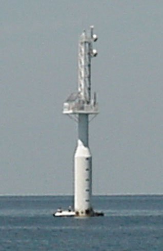
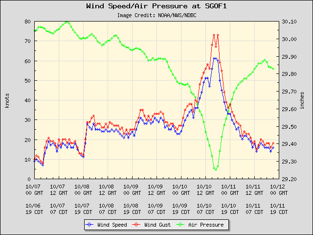
Lets not beat a dead horse on this,,, Though, Multiple stations going "dead" all at the same time? With FED .GOV are there not "back-ups", Generators, things called "Redundancy"? Are We to believe Cell towers were still in operation, YET Anemometers were "destroyed", or not reporting? Reference to Storm Chasers, broadcasting.., Still broadcasting Live video,, yet ,, Anemometers & related equipment destroyed? Every Anemometer in the Landfall area(s)? So folks bashed Me on a "buoy" that I said looked like a "lighthouse".. WELL? here's a picture of it.. THE Anemometer & instrument(s) are "offshore" of the Airforce base.. It HAS Batts & generators with-in it.. It's maintained by the Air Force.. So lets TAKE AGAIN Hard Data.. (I had to look hard for this).. Folks "claimed" It FAILED.. No it didn't.. I got the "data" right HERE... Station SGOF1 - Tyndall AFB Tower C (N4), FL
-
110 MPH Peak Gust(s), before My instrument got taking out by a live Oak.. We had A strong Cat 1 here.. I NEVER claimed Armageddon.. Lost My computer due to power surges, thus, unable to retrieve that data.. (Off the hard drive it was corrupted) Though the Surrounding Weather Stations support, in line, what I reported, With Hard Data that was recorded.. NO HYPE here..
-
Well? Lets have a BEER together & discuss.. NO Insults.. Healthy Debate.. Is all I'm asking..
-
Just returned from doing errands.. @Rjay Why? because of a different or opposing view? Really, honestly? My views are Supported by actual Data.. ? Is this how Science works? Silencing someone or banning them? that's good to hear.. Listen to yourself.. BTW anyone here that has HARD DATA, supporting a Cat 4 (Or Cat 5) Landfall, present it please.. I wish to see it.. I'm asking, ya'll, too change MY MIND.. I'm open Ears & Mind.. not based on feelings either..
-
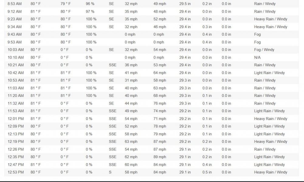
Had Tropical Storm Force Winds most of the day here.. Peak Gust was 53MPH @ 1:10 pm..
-
Mappy, see that's the thing, everyone is screaming CAT 4 or CAT 5.. Yet there is NO DATA too support this.. Not being 'snarky here" Just please bear withme.. I'm NOT trying to insult you or anyone here.. https://www.nhc.noaa.gov/archive/2018/al14/al142018.update.10101853.shtml? “Recently reported wind gusts include: Tyndall Air Force Base: 119 mph (191 km/h) Florida State University Panama City Campus: 116 mph (187 km/h) University of Florida/Weatherflow Mexico Beach: 104 mph (167 km/h)” The differences make sense, since Tyndall is right in the firing line, however in the summary: “MAXIMUM SUSTAINED WINDS…150 MPH” I guess that must be historical, somewhere out where it would affect only boats and seagulls. See Link https://tidesandcurrents.noaa.gov/met.html?id=8729210 Now reads maximum gusts of 76kn and sustained of a “terrifying” 142 + kn
-
your screaming MUH FEELING, MUH FEELINGS..!!! While not presenting one IOTA of hard Data..