SENC
-
Posts
892 -
Joined
-
Last visited
Content Type
Profiles
Blogs
Forums
American Weather
Media Demo
Store
Gallery
Everything posted by SENC
-
You have to remember, several quotes here from other members.. building(s) in the area(s) were 30+ years old, in other words, NOT up to "Hurricane" codes, AND Lotsa Mobile homes.. They said so them selves.. NOW they, (you know who you are) claiming Cat 5 Winds "destroyed" everything,, on Winds that didn't exist? (based on destruction)? double Standard don't you think? ON 30+ year old homes? And yet DENY Data from Buoys? sorry @Lookout, I gotta say my piece.. I'm Sincerely, sorry Dude.. I've lived through so MANY Canes since 1969, this was a CAT 2 at Landfall.. Hypocrites..
-
I'm not a troll, I'm a truth teller
-
Lets get too the Hull Truth This is BANTER RIGHT..?? I'm calling you out. There was no 155mph sustained wind anywhere on the ground in Michael's path. There was no 140mph sustained wind anywhere on the ground in Michael's path. There was no 130mph sustained wind anywhere on the ground in Michael's path. There were 100-110mph sustained winds. That's a nasty Cat 2, but not a 4 or 5. There was a stormchaser on the ground, in a truck, that went through the eyewall and into the eye at Mexico Beach. I know exactly where he was because I've been over there, (visiting a good friend.) There were also multiple wind gauge readings in the same vicinity -- 110ish gusts, 90-100mph sustained. Entirely believable given what I saw happen on several live on that streams watching the eyewall and eye pass over him, but not 155. At 155 his truck would have been lifted and thrown; AKA Rusty Wallace @ Talladega,, I would have watched him die on live video. It didn't happen. Yes, Mexico Beach and parts of PC got trashed -- mostly by surge. No big shock there. But most of those buildings you're seeing have intact roofs. Not all (there's a fair bit of older stuff over there that was not designed to modern codes) THEY are 30 years old, but most. And that's important because in a Cat4+ storm there's damn near nothing left; that's an EF3 tornado! Hurricanes are nasty but let's stop with the bull****. The video coming in (and the livestreams) do not support Cat 4 or 5 winds -- and neither does the available set of data from wind gauges right at impact. In the same videos you see someone's roof go flying there's a billboard that's standing proud, tall and undamaged. That does not happen in a Cat 4 storm. The reason you board up your house is in evidence right there in those videos. In a Cat 4 or 5 it does not matter as the entire building, unless it's reinforced concrete or similar, will be flattened. If you get surged you're screwed. The reason you board up your house is that in a Cat 1, 2 and moderate 3 if your house and roof is up to code and if you do not get hit with surge it will remain intact right up until the guy down the street, who doesn't have a place up to said code or has a bunch of crap laying around in his yard winds up generating missiles that go through your windows! The "homes that were there and were moved" and are destroyed are nearly all mobile homes - and there are a lot of them in that area.That's very typical Cat 2 damage; most to all mobile homes will be destroyed in a Cat 2. They simply cannot take 100mph winds. Peace out.. Experienced Hurricane Survivor, Since 1969
-
24 MPH SE "sustained" Winds moderate Rain ATM here on the beach..
-
Gotcha @Lookout, I'll keep my opinions to myself.. TIA for the warning.. MeanWhile "sustained" 24MPH SE Winds) here on the beach..
-
Lordy, what Weenies, & groupthink I called a decent Cat 2 based on buoy Data sets.. & video obs..
-
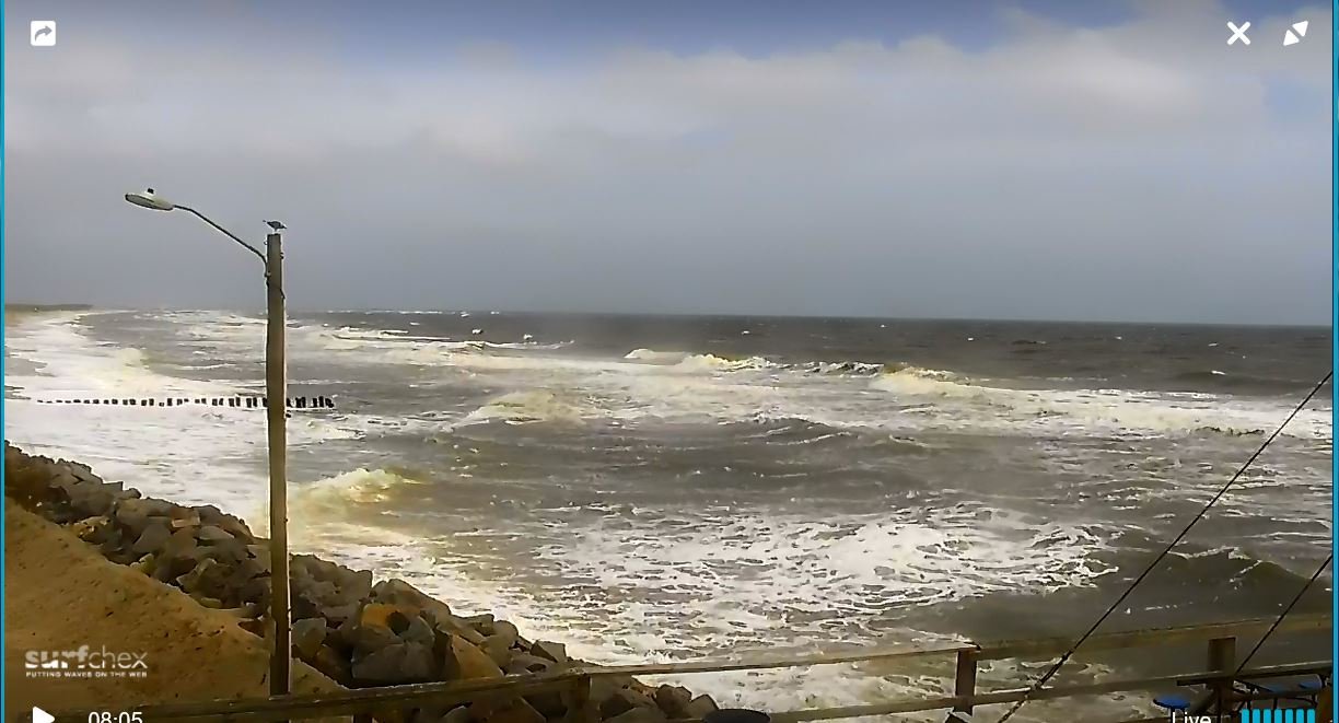
Good Morning Folks... Lets say, It's getting Breezy Down here in the Coast, Already.. "Michael" being,, Hours away, the Baroclinity is starting to have "Effects" up here.. This Snapshot I just took is @ LOW TIDE.. We have a ESE Flow and the water/fetch is Piling up already.. There are First Row Homes Directly behind this Rock Wall If you were to Pan back to the right 180.. (Cam won't Capture that far right).. Winds are SUSTAINED at 22~23 MPH peak gust @ 30mph When Michael comes up this way with US being on, (As some Folks like to say),, On the Dirty Side,, These Homes,,, First & Second Rows, what Florence didn't get,, Mikey will.. Conditions are pretty Sporty NOW.. Waves & Surf 6 to 8 footers Already.. Mind you this is LOW TIDE.. Next High Tide incoming will be interesting.. Heres a snapshot..

-
Alil humor Folks..
-
States of Emergency Issued Brunswick & Pender Counties.. Voluntary Evacuation Orders Issued for Low-Laying areas in Pender County.. state of emergency will go into effect at 8 a.m. Thursday. The Town of Burgaw in Pender County declared a state of emergency effective at noon Tuesday. “We urge our residents to secure tarps on their rooftops,” said Tom Collins, Pender County Emergency manager. “Secure lawn furniture and items that could become flying debris.” Collins warned residents whose homes were damaged in Hurricane Florence to be mindful of weakened structures. “When the ground is this saturated, trees fall. Power lines are taken down,” Collins said. “If you are sheltering in place, prepare for periods of being without power. Stock up on fresh water and refresh your emergency kits.” Tropical Storm Watch Coastal Pender Coastal Brunswick Robeson County Columbus County Bladen County New Hanover County Onslow County Duplin County Flash Flood Watch Bladen Inland Brunswick Inland Georgetown Columbus Coastal Horry Darlington Coastal Pender Williamsburg Coastal Georgetown Marlboro Dillon Northern Horry Inland New Hanover Robeson Coastal Brunswick Central Horry Marion Coastal New Hanover Inland Pender Florence Full list of *CURRENT* Weather Related alerts at link http://www.wect.com/weatheralerts/
-
LOL... Check out OUR Local NWS Statement.. Can you spot the Mistake????? Otherwise a very, Nasty Forecast on Tap.. I agree with with @Lookout, the Dews & Temps are going to be interesting afterwards.. Again as @downeastnc & @shaggy have pointed out Folks here in SENC are going to get "whacked" with Micheal, Blue Tarps scattered thoughout the CWA area(s), this is going to be added Misery, a TKO A-La McGregor fxus62 kilm 092009 afdilm Area forecast discussion National Weather Service Wilmington NC 409 PM EDT Tue Oct 9 2018 …... ------------------------------- Short term /Wednesday night through Thursday night/... as of 300 PM Tuesday...increasing deep tropical moisture feed ahead of micheal will produce periods of heavier rain and gusty showers leading into Thursday as Michael approaches from the south. Michael will weaken as it moves into our area from the south. The main effects will periods of strong gusty winds, heavy rain, coastal flooding or run up during times of high tides, and possible tornadoes. Pcp water reaches up near 2.5 inches Wed night into thurs as winds increase out of the south to southeast in the outer circulation of micheal. Expect gusty showers to move on shore through Wed night and then trop storm conditions spreading north on thurs as micheal reaches the area thurs morning. The center is still forecast to move up the I-95 corridor through the day on thurs exiting out just north of Hatteras Fri morning, with winds forecast to reach up to 40 to 50 mph. The strongest winds will be found in heavier rain showers and thunderstorms. The fast moving storm should produce up to 2 to 4 inches of rain in places with isolated higher amounts. Flash flooding in possible, especially inland where heavier rain should be focused. As the weakening storm moves toward and across eastern Carolinas on thurs, tornadoes will become a concern, especially as the increase in shear will be coincident with diurnal heating. The impacts across the local area will be worsened by the fact that the area may be much more vulnerable due to Florence, in terms of wet ground leading to fallen trees, tarps on roofs, etc... Florence will track off to the northeast with plenty of dry air wrapping around the back end heading into Fri morning. This will lead to clearing skies and overnight lows dropping into the 60s, still above normal but cooler than previous days. The tropical air mass will maintain warm and humid conditions through thurs with temps well above normal, 80s during the day on thurs.
-
Oh my, bad, bad, & MORE "Breaking Bad" for SENC.. What, (trees) #Florence didn't Finish off.. Mikey Will.. Many are back in Full "SPRING" bloom.. AND WEAK.. not counting the ground Saturation.. Still in place.. 4~6 inches of Rain,, ??? Flooding all over again..
-
This is BAD,, very Bad for My area( SENC) As @Shaggy & @Downeast mentioned We have Millions of "weakened" Trees here, STILL lotsa "leaners", and Live Oaks, that are, (I just don't want to think about this). Our Local NWS Has us 4~6 inch rain on TOP of very very SATURATED grounds... 40-60 MPH winds.. Folks this is .. Thousands of roofs here are tarped, Rivers are "Barley" in their Banks.. I don't even...
-
Elevation: 9m / 30feet
-
Masonborugh Island Which is between Wrightsville & Carolina beaches
-
After getting back on-line.. Stebo I believe you got a "Bingo" No cover all, though you got Landfall spot on,, Landfall ENE of ILM (MasonBorugh Island).. Landfall was Officially 958 Millibars 100 MPH sustained, (I believe).. I clocked 110 MPH on My Garage mounted Wind gauge & 957.5 Millibars Landfall,, l was about 7~10 miles as the crow flies to My ENE.. Eye came Right over Me.. For all you New York Sub-Forum Folks... Would you like a Nice plate of Carolina BBQ Crow? I opined that this would be a .. Fran + Floyd + Hugo Storm.. Well got 2 outta 3 right..
-
Feels like Fall is in the Air! 88/68 Currently 75.. Past Week It's been God-awful Rainy/Wet, Humid & HOT.. Air smells like a Rotting Jungle with Debris everywhere..
-
Hello folks,, back up here from Wilmington... What a Wild ride it's been.. Wilmington has been devastated... Lord Bless all those First Responders, Power crew Linemen (and women), and Cable Co. Crews! Some parts of the City are with-out power & will be for a couple weeks yet.. Some area(s) I been look pretty much there were Tornados embedded with-in the Eye-wall.. Damage I only can describe as being done by Tornados.. What I mean by this, you can notive trees snapped or pushed down one direction, While on the, say other side of a street it's a totally opposite direction.. Utility poles "snapped" in half. Transformers torn off poles & flung hundreds of yards like empty beer cans.. (same with stop lights).. As if someone grabbed power lines as if They were Noodles and tossed them out the car window.. I wish I could set here a bit, relating the "aftermath", looting, Gas lines & fights, armed guards & curfews.. Food in Short Supply, as Wilmington became a "Island".. As I understand there's only One Route, into Wilmington, through Jacksonville/Hampstead ATM.. We were watching the "Hype" on the Weather Channel & Local channel(s), until late.. I was watching Radar.. Watching the Eye Make Landfall.. Which I assume was on Masonborough Island.. As I opined upthread, We had light winds, & rain, making fun of the Weather Hype.. Then it got really quite... about sometime after 2AM or so.. All manners of Hell broke loose.. As I posted upthread, My digital Wind anemometer, read 110 MPH in a gust(s); right as a Live Oak took it out.. (Gust or Tornado?)…. The house shook for HOURS! I was chitting the bed thinking about these Mature live Oaks around the house crashing through the roof.. A couple barely missed the house thank the Lord.... Going outside, Light rain had turned into a FIRE hose spraying water sideways.... Limbs, leaves & debris was flying through the air, as I started My Generator.. Dern nearly breaking My leg in the process.. It rained nearly 3 Days straight afterwards... Flash flood alerts and Tornado warnings every Day & night.. As they say, the rest is History.. I would type more... I'm just plain tired after this past week... One LAST THING... I opined this would be a Fran + Floyd + Hugo.. Well I got 2 outta 3 right.. Fran & Floyd..
-
I,ll say this backside eyewall was BAD as Fran, it was no joke, a it was One HELL of a. Ride,My whole house shook for hours, still having high wind gusts heavy rain
-
Still heavy rains winds TS force FLOODING everything Everywhere. Everyone stay safe. Curfews in effect
-
Eyewall passed directly over me then it was quite then all hell broke loose my lil weather station measured 110mph wind gust before a oak tree took it off my garage roof,. HEAVY damage here at my house,, huge live oak down, lots of debris. Lucky to still be alive.lucky none took out the house On genator back up. Whole city without power I'm told.Bout broke my leg 4,am starting genator. Sry ty PP ing on little phone one handed. Internet is down here
- 189 replies
-
- 11
-

-

-

-
Major Hurricane Florence: STORM MODE THREAD
SENC replied to stormtracker's topic in Tropical Headquarters
I have lost power my house is shaking like a no-go jet sound outside -
Major Hurricane Florence: STORM MODE THREAD
SENC replied to stormtracker's topic in Tropical Headquarters
My lil house is SHAKING -
Major Hurricane Florence: STORM MODE THREAD
SENC replied to stormtracker's topic in Tropical Headquarters
It's here.. Winds have arrived with a vengence .. Low jet Engine sound..[/I] Sustained about 70~80 MPH.. Heavy Rain Looking at Radar, I'm In the Eyewall on the West Side.. -
Major Hurricane Florence: STORM MODE THREAD
SENC replied to stormtracker's topic in Tropical Headquarters
It appears Land Fall Will be Figure 8 Island to Scotts Hill/Hampstead, about 10 miles as the crow flies from Me, to My Northeast.. -
Major Hurricane Florence: STORM MODE THREAD
SENC replied to stormtracker's topic in Tropical Headquarters
Wilmington, isn't really Getting Hammered We are however, experiencing Light to Moderate Rains & "sustained" Winds just shy of TS Force... That said, I'm just inland over Snows Cut bridge.. I'm not "on the Island" at this time.. Still have power, NO "Transformer Flashes" I've seen or heard, thus far.. At this time.. Listening to the "scanner" for New Bern though... God Bless those "Swift Boat" Crews.. Appears they quite BUSY, listening to addresses broadcast for "rescue", & Cross-referencing with Google Maps, !Listening Seems MANY "rescues" are in the Vicinity Right on or extremely close to the Neuse River Bank! Listened to One rescue the Folks Went into the ATTIC A-la Katrina Style! GOD BLESS those First Responders Swift Boat Crews