


ma blizzard
-
Posts
3,081 -
Joined
-
Last visited
Content Type
Profiles
Blogs
Forums
American Weather
Media Demo
Store
Gallery
Everything posted by ma blizzard
-
through 36, I think GFS will better than 18z .. looks better IMO at 500 mb anyway
-
hate to see it
-
I don't doubt there is a spike after CAD mixes out, but some of the more meso guidance shows the low lvl cold hanging tough .. maybe even a weenie cold tuck for SE NH / NE MA tmrw midday?
-
its never easy to accept you wasted a week tracking whether it will ultimately be 34 and rain or 37 and rain lol what a dumpster fire performance from the models over the last couple days.
-
UKMET looks quite amped and warm ..
-
GFS has a decent amount of QPF on Monday .. ~.25" - .4" region wide. Could get interesting for those who are looking for ice .. shallow warm layer but not the deepest / coldest layer beneath. Might have to take the ice threat more seriously if we keep trending for bigger impact on Monday. Could be a zone that has a solid glazing going into Monday night and sees a decent chunk of QPF fall as ZR from round 2. CMC looks like ~1/3" QPF on Monday
-
hey man I would love nothing more than to see a big ice / mixed QPF event to seal in this pack, but the return rate is pretty rare.
-
you haven't come close to warning criteria ice since nov 2002 what are you talking about
-
KBOS def runs a couple degrees too cold as of late
-
rev and taunton blizz ensemble approach might be the best way to go going forward
-
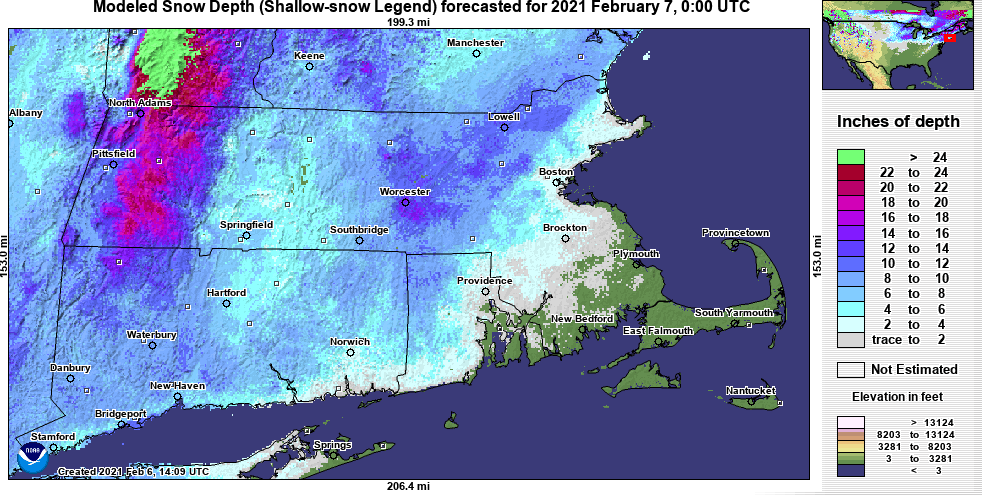
-
gotta love how it spits out 1"+ qpf in 6 hours
-
we lock in the 3km NAM?
-
should have gone back to metro west for this one .. ive never seen it rip this hard and have maybe like 4-5 to show for it
-
we gonna get pasted here, might have to make a snowman at powderhouse
-
radar actually doesn't look too bad for the next couple hours
-
whats going on with the KORH ASOS? I'm seeing 0.38, 0.24 in the bucket for the past 2 hours ..
-
yep
-
Was 2011 the last real big -NAO in January? Can't recall anything modeled like this in a long time
-
Dec (Edit: Jan1/..2 ) multi-faceted ptype mess potential...
ma blizzard replied to Typhoon Tip's topic in New England
chief nowhere to be found in this thread either today .... looks like classic nuisance glaze to rain NW of 90/495 after initial T-1" of snow / sleet -
Active mid December with multiple event potential
ma blizzard replied to Typhoon Tip's topic in New England
18z Euro less robust than 12z with the Monday deal, maybe 1" or so where cold enough -
May 8-9 mid-spring rain, snow, cold, wind obs
ma blizzard replied to CT Valley Snowman's topic in New England
happens every May KBGM 091953Z 30011G26KT 1/4SM SN FZFG SCT015 BKN023 OVC049 M02/M04 A2984 RMK AO2 PK WND 28028/1926 SNE04B37 SLP124 P0000 T10221044 RVRNO -
ORH: Big time gradient between BOS / ORH

-
March 12/13/14 Blizzard/Winter Storm/WWA etc
ma blizzard replied to Bostonseminole's topic in New England
28.9/27 s- 2.7" new since 4:15 pm .. total is up to 21.9" while snow depth (just from this storm) is closer to 18"-19" -
March 12/13/14 Blizzard/Winter Storm/WWA etc
ma blizzard replied to Bostonseminole's topic in New England
yeah not sure why the reports are so low in the PNS .. in the 13"-15" range in the area. As it is, my depth from just this storm is ~16"-17".


