downeastnc
-
Posts
9,343 -
Joined
-
Last visited
Content Type
Profiles
Blogs
Forums
American Weather
Media Demo
Store
Gallery
Everything posted by downeastnc
-
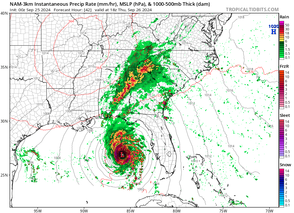
Run this loop is about to be lights out for most of western and central SC.... https://weather.cod.edu/satrad/?parms=subregional-Carolinas-13-24-0-100-1&checked=map&colorbar=data
-
So that would be pretty impressive....Valdosta 102 gusting 133 https://x.com/DavidKarnes3/status/1839528444440301678
-
I was in the SW eye of Isabel and the pressure was 970mb and peak wind gust for the event was 51 mph....though on the NE side of the huge eye they got absolutely hammered with gust into the 80-90 range at the same time...but in our case the pressure did not indicate our winds, in Fran for instance our pressure never got close to 970 but we gusted to 110..
-
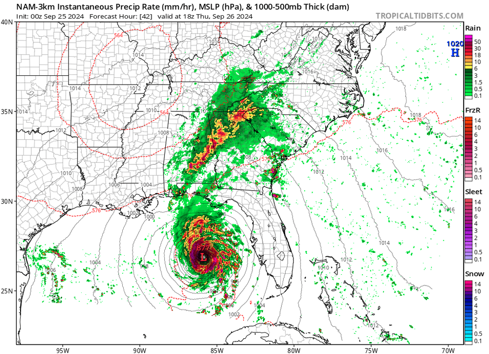
Peaked at 877
-

January 20-22 “bring the mojo” winter storm threat
downeastnc replied to lilj4425's topic in Southeastern States
Ukie....and this is 10:1 probably do better than that even..... -
January 20-22 “bring the mojo” winter storm threat
downeastnc replied to lilj4425's topic in Southeastern States
Need to see this slow down just a little bit more, the 6Z GFS spitting out insane ratios for PGV....we get 3" in 3 hrs with .11" QPF....just a few more hrs of that and we would be golden.... assuming of course the GFS has this right....the GFS is so close to this being a much bigger deal. 220122/0500Z 47 36011KT 24.0F SNOW 19:1| 1.1|| 0.00|| 0.00|| 0.057 10:1| 3.6|| 0.00|| 0.00|| 0.37 100| 0| 0 220122/0600Z 48 36010KT 23.8F SNOW 23:1| 1.4|| 0.00|| 0.00|| 0.061 12:1| 5.0|| 0.00|| 0.00|| 0.43 100| 0| 0 ----------------------------------------------+----++-----+-------------++--------------++-------------++-----------+---+--- 220122/0700Z 49 36012KT 23.6F SNOW 13:1| 0.7|| 0.00|| 0.00|| 0.053 12:1| 5.7|| 0.00|| 0.00|| 0.48 100| 0| 0 -
January 20-22 “bring the mojo” winter storm threat
downeastnc replied to lilj4425's topic in Southeastern States
While this sucks for a lot of people this is exactly what we down here in eastern NC like to see in this range.....better cold and not phased and hope for a late bloomer, than watching it amp up and cut and give us rain again....its how we snow big, a lot can still change between now and Friday, and the NAM is all alone right now with this big of a whiff. -
January 20-22 “bring the mojo” winter storm threat
downeastnc replied to lilj4425's topic in Southeastern States
Need that SN/IP line to drift another 50 miles south to really make me feel safe....insane 22 at the surface......
-
The models had Florence turning out well east of Bermuda.....every system is different but yeah models were very wrong with Florence even up to landfall there were fairly significant changes.....
-
This chaser looks to be trying to drive into the eye from Houma
-
-
-
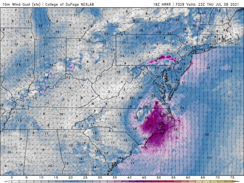
HRRR bullish on winds. usually I take these maps with a grain of salt but with the high offshore packing the gradient and dry air working in around the S and SE side who knows...maybe some 40-50 mph gust are possible for 3-4 hrs tomorrow....
-
Yeah might get some gust into the low 40's certainly nothing to extreme...nice that it seems to peak between 4-9 tomorrow afternoon and not 12-4 am like usual.
-
Well then
-
70/63 at PGV.....gonna be interesting to see how it plays out today.....had some filtered sun a hr ago back to overcast.....sat looks like some more filtered sun possible in a hr or two around peak heating.....
-
Looks like EF2-3 type damage.....some fairly new homes look to be wiped to the foundation almost....
-
This is pretty darn good agreement....


-
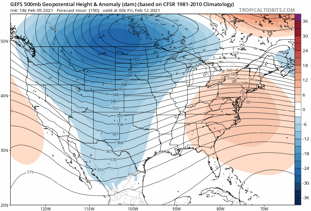
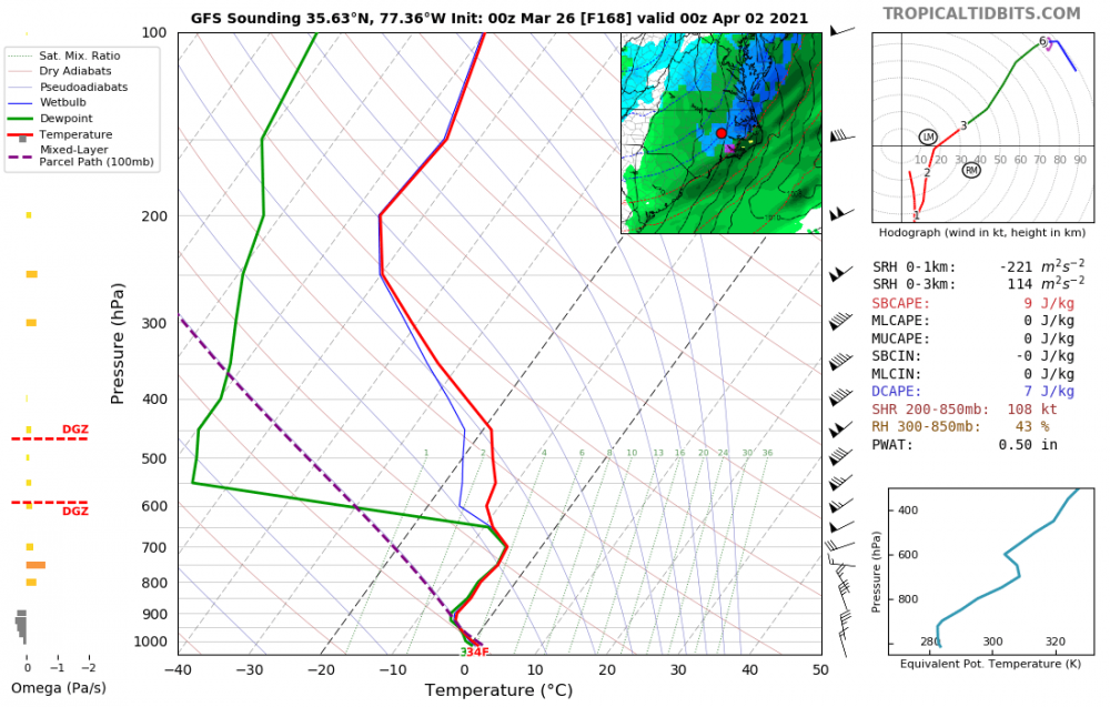
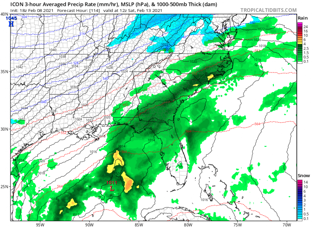
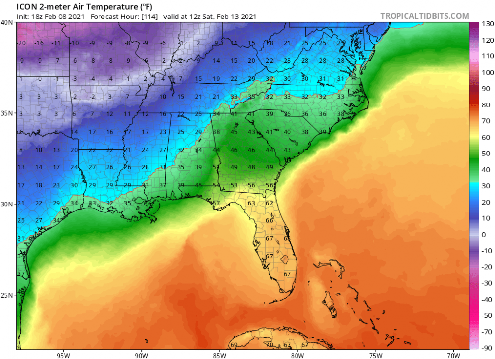
Yeah this is a insane panel.....with that low strength and placement you wouldnt think the warm nose is that strong.....its showing 23/24 IMBY with the snow/rain line slam back in the mts.....
-
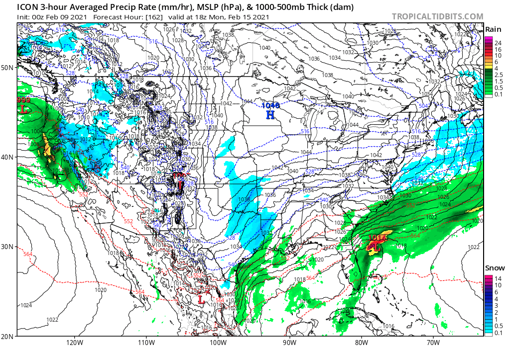
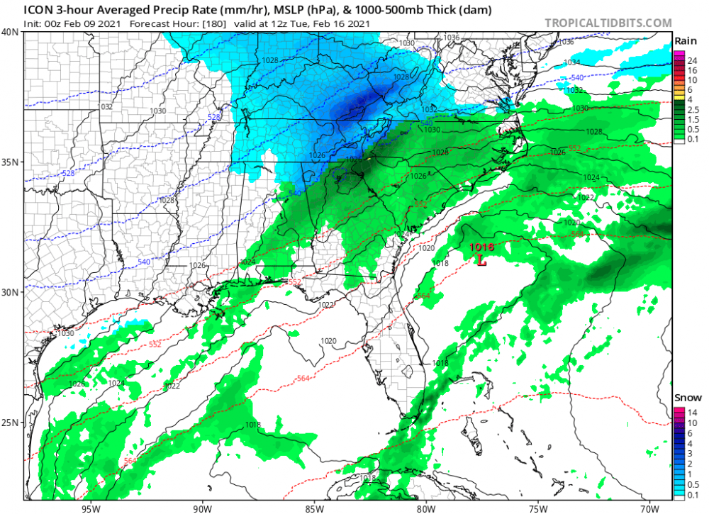
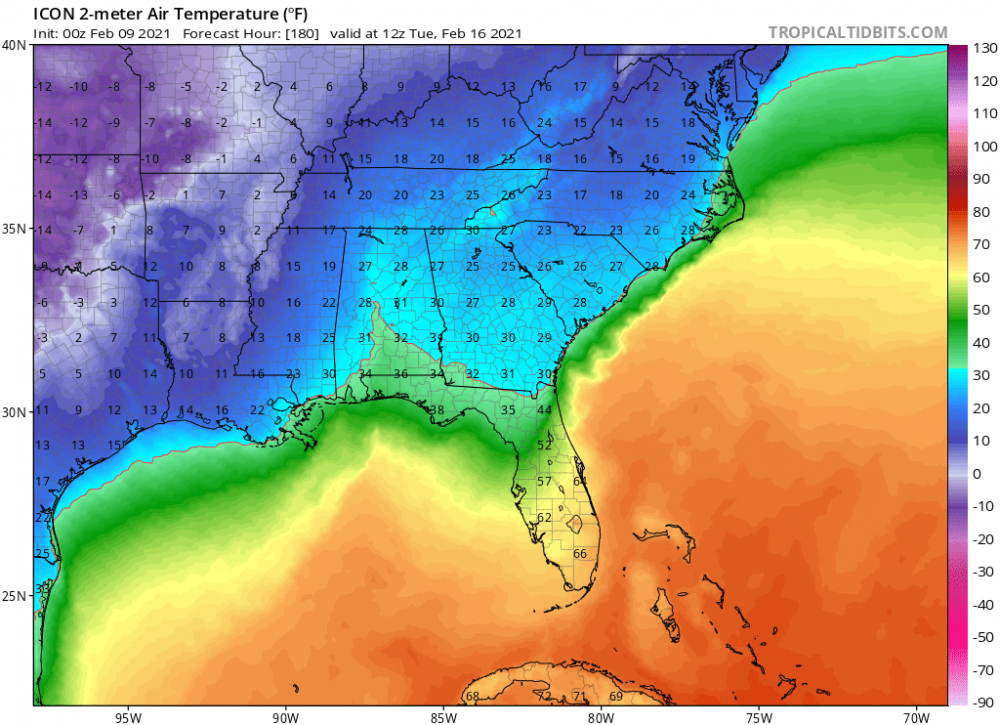
18Z Icon
-
Right we need the PV to either dive on down and give us a monster snow storm or hang up.....some runs have had epic ice storms with temps in the single digits and teens for DAYS afterwards which would be certainly life threatening with widespread power outages, and with that kind of bitter cold it would be very difficult for crews to begin to repair the damage....
-
Thats my hope, the chances the models have the location and timing of the S/W's in this range given the setup is pretty low and there is going to be a lot of changes run to run, it wont be till Tues/Wed once the players are better sampled modeled that we get a real idea....so while the monster big dog seems much less likely on most runs the potential for it to come back is certainly there.
-
If this trend were to continue the big dogs would come back.....

-
Seems like that was the case fairly close to the event as well, inside of 72 hrs either the Euro or the NAM was pasting us still.....was so frustrating watching heavy sleet for hours knowing it was costing me a lot of potential snow.
-
Much better than it was looking at 12Z...nice improvement....