downeastnc
-
Posts
9,343 -
Joined
-
Last visited
Content Type
Profiles
Blogs
Forums
American Weather
Media Demo
Store
Gallery
Everything posted by downeastnc
-
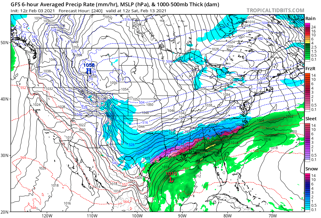
Was just texting Shaggy that this might be best GFS run ever lol.......seriously looked about to smack the SE again at the end of the run too....closest run to Mar 1980 I have ever seen.....only better.
-
....hopefully the Euro does tick north some.....but overall you wouldnt think there is much risk of a NW trend with a 1050ishmb high building into the upper midwest.....
-
With a big high like that you got a better chance of a SE trend than a NW one....
-
Got to take notice when these two agree like this in this range....


-
70/60 S wind gusting 35ish
-

Dec 16-17 Storm OBS Thread
downeastnc replied to BuffaloWeather's topic in Upstate New York/Pennsylvania
-
At least 6 deaths due to flood waters in NC now.... https://weather.com/news/news/2020-11-12-north-carolina-flooding-campsite-rescue-roads-bridges-washed-out
-
11" just east of Sims NC in WIlson Co.....lots of 8-11" totals running NE from there.
-
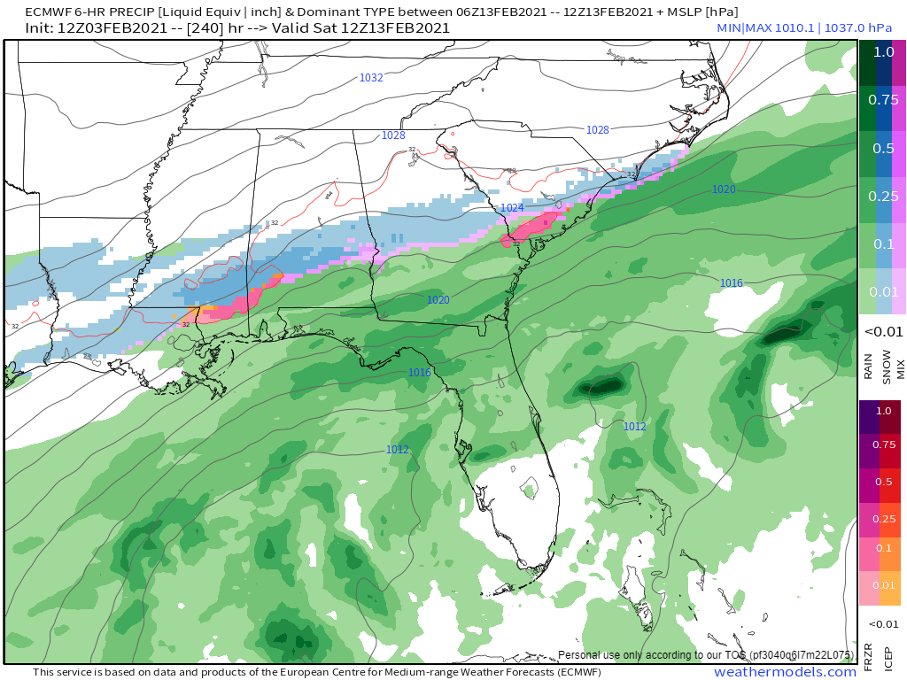
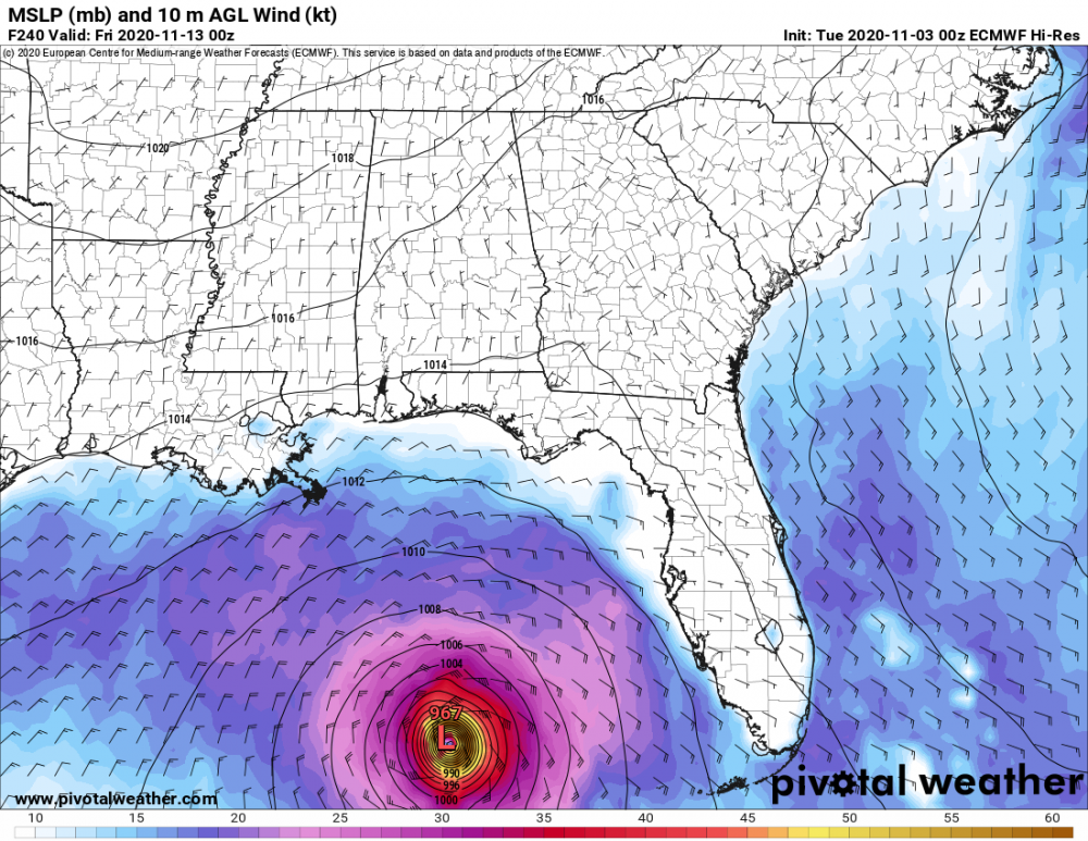
latest Euro has "Eta" redux headed for Tampa more or less.....assuming the course it was on the last few frames holds up that long
-
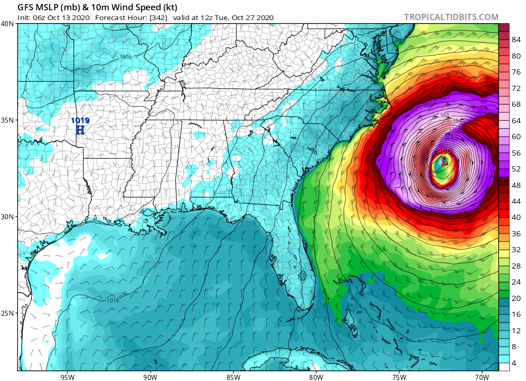
I am not sure what speed the plane is moving at when it makes these passes but at 250 mph it would takes them what 80-90 seconds to cross a 6 miles wide eye....
-
Crazy
-
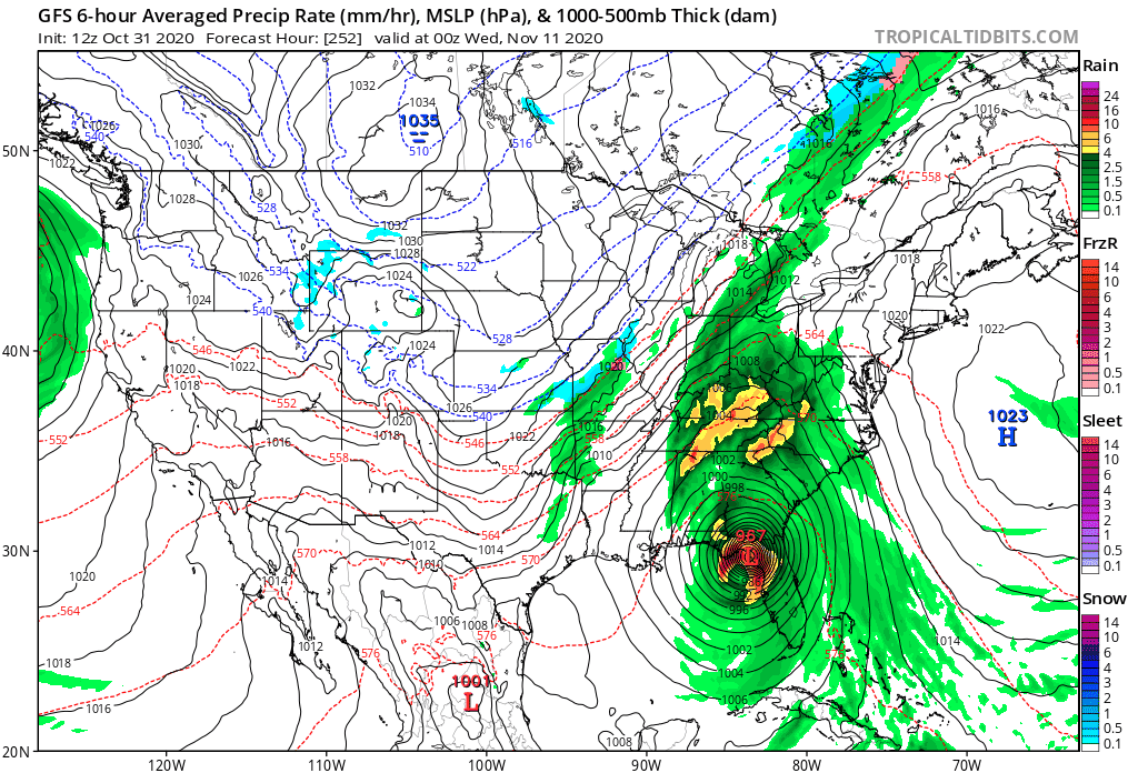
Yeah literally lights out to 10's of millions of people, wind field is just stupid on this thing....and the foothills and mts gets a PRE event that dumps a foot of rain....so the center and east side gets basically a 6-10 hr long 50-70 mph wind event all the way to NE and the west side gets a foot of rain along the entire spine of the Apps.....insanely crazy run, luckily its 10 days out and a weenie run, but this storm is going to form and eventually come north....so maybe its not so far fetched after all.
-
oof.....

-
Just saw a 100 mph gust there in or near Galliano according to this.... https://www.wunderground.com/weather/KGAO
-
This would be a massive issue for the beaches, this wind field is the size of Texas and I imagine the waves and beach erosion would be insane on NC coast.......the GFS has been pretty consistent with this storm the last day or so but it is admittedly way out in fantasy land.....though the GFS did pretty good with the notion of there being a Delta way out in fantasy land too.

-
Euro/GFS say it will be a bit windy next week when the big storm rides the Apps with the big high offshore, these are always over done but even if you knock off `15-20 mph from these numbers that still puts us in a wind advisory criteria day with gust to 50ish.....
-
Ukie similar as well.....
-
-
I am at work now and I actually got 1-2" more at my house than here (about 10 miles north of my house) but ground still covered, the wind was from behind the building so the ground closest to building was protected
-
Gonna call it 5" after compaction...
-
Flakes trying to get bigger and rates are still high if I had quarter size flakes this would be piling up fast...
-
My front porch a hr ago.....need them flakes bigger....
-
It should be noted that this is the last frame of the NAM so lots of snow still to go....so totals could be several inches higher than this...
-
I hope this one pans out, we have not had a single flake fall here since Dec 10th 2018....