StormchaserChuck!
-
Posts
2,274 -
Joined
-
Last visited
Content Type
Profiles
Blogs
Forums
American Weather
Media Demo
Store
Gallery
Everything posted by StormchaserChuck!
-
This is good, last Winter was -0.1, and we had some -NAO for the first time since 2013, ^I expect it to even out a little in the 2nd half. Could be some cold periods..
-
US didn't see a hurricane 11 years after Katrina.
-

2021-2022 ENSO
StormchaserChuck! replied to StormchaserChuck!'s topic in Weather Forecasting and Discussion
Nice cold pool developing now. We also have a break-trend here in the arctic.
-
The "Intersnowy" Periods (97-02, 04-09, 17-Present)
StormchaserChuck! replied to Cobalt's topic in Mid Atlantic
There was a nice storm in Jan 2000. -
Arctic Sea Ice Extent, Area, and Volume
StormchaserChuck! replied to ORH_wxman's topic in Climate Change
Check out the +AO Jun1-July 14 composite since Wester drought began in 1995.
-
I have a feeling the West will only get drier.. the monsoon this year seems like a +, +/-
-
La Nina watch issued.
-
Summer 2021
StormchaserChuck! replied to StormchaserChuck!'s topic in Weather Forecasting and Discussion
Yeah, I've been surprised how normal this Summer has been -
Summer 2021
StormchaserChuck! replied to StormchaserChuck!'s topic in Weather Forecasting and Discussion
Best matches to Jun1-July14 +AO, using Western drought 1995+ as a base. What a little signal here Following Winter fwiw (probably 0.30-0.40/1st point). I think the Winter will be +AO/+EPO/+-neutralNAO--Siberia anomaly different location
-
2021-2022 ENSO
StormchaserChuck! replied to StormchaserChuck!'s topic in Weather Forecasting and Discussion
I don't think it will be anything significant, it could be organic though, meaning not connected to subsurface. 95-96 is an example. The subsurface is better correlated to the N. Hemisphere 500mb pattern than the surface by a significant margin (It's like 0.90 vs 0.70). When surface is La Nina and subsurface is Neutral, it's a more random pattern. -
Summer 2021
StormchaserChuck! replied to StormchaserChuck!'s topic in Weather Forecasting and Discussion
-
It's not going to be a La Nina official, so we'll see something like this in the Pacific
-
A La Nina seems to be going into effect, or negative-ENSO. It certainly feels not-El Nino.
-
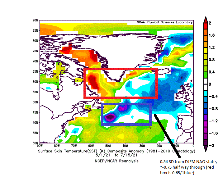
It's going to be quite warm-above average. I did a study last year that showed the -AO of 2 Winter's was so extreme, last Winter had to break it by at least 70% (-0.70), and that happened. Now it has to snap back to make it a perfect 3/4. (0.60-0.65). (A La Nina watch was issued by the CDC today.) My N. Atlantic NAO index which goes May-Sept is -0.80 so far, pointing to a -NAO, last Winter I was impressed because it came it negative, and that broke 32 straight months of +, but I have a feeling the index will go closer to neutral this year for it's total time of May-Sept.
-
Summer 2021
StormchaserChuck! replied to StormchaserChuck!'s topic in Weather Forecasting and Discussion
Strong Arctic PV June25-July20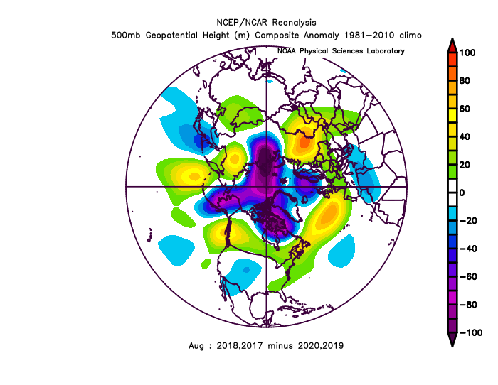
-
2021-2022 ENSO
StormchaserChuck! replied to StormchaserChuck!'s topic in Weather Forecasting and Discussion
Maybe a La Nina is coming... This is June rolled forward to December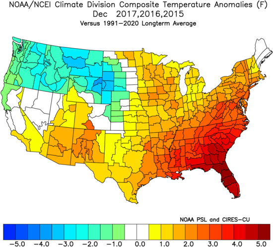
-
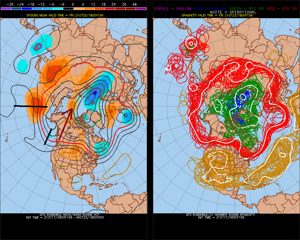
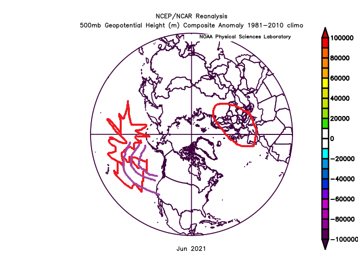
I'm interested to see if August plays out with big 500mb ridge over the Arctic.
-
2021-2022 ENSO
StormchaserChuck! replied to StormchaserChuck!'s topic in Weather Forecasting and Discussion
ENSO Neutral for a while... I think are having subsurface weak warm waves -
May - September Long Range Discussion
StormchaserChuck! replied to WinterWxLuvr's topic in Mid Atlantic
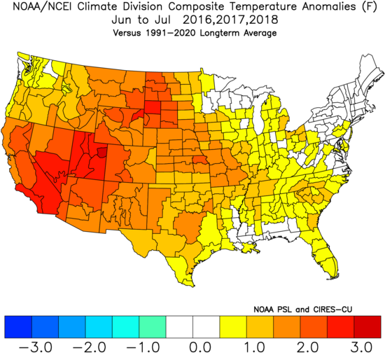
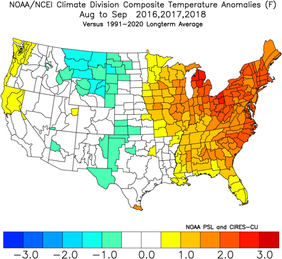
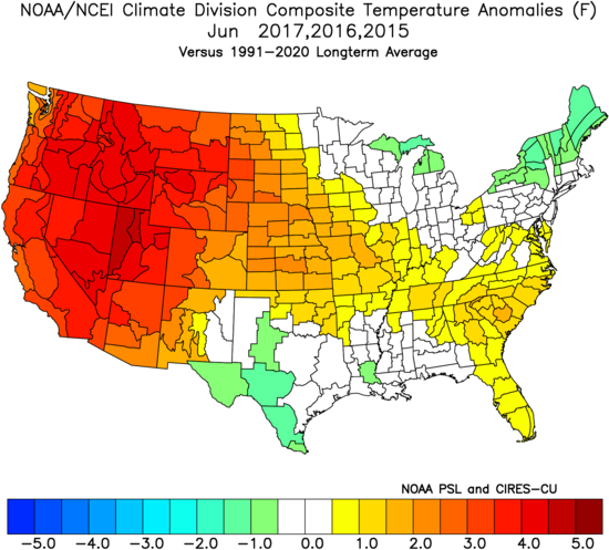
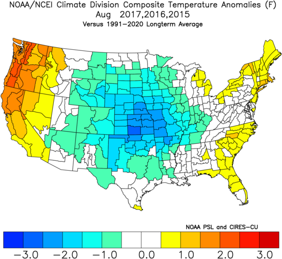
June heat waves in the West pour over to the eastern and northern 2/3's of the country for July and August, the average departure here was +2 to +3 average -
Arctic Sea Ice Extent, Area, and Volume
StormchaserChuck! replied to ORH_wxman's topic in Climate Change
Wow, that's a big +AO, I'd love to see how much the melt is this season with the upper levels so cold. -
2021-2022 ENSO
StormchaserChuck! replied to StormchaserChuck!'s topic in Weather Forecasting and Discussion
I'm just kidding about the no El Nino= +PNA, but there has been a pattern shift from the -PNA of 2015-2019, it seems. -
2021-2022 ENSO
StormchaserChuck! replied to StormchaserChuck!'s topic in Weather Forecasting and Discussion
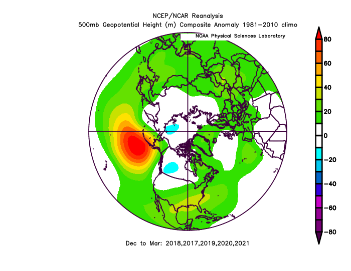
That's pretty cool, now that an El Nino's not happening, there's a big +PNA. -
May - September Long Range Discussion
StormchaserChuck! replied to WinterWxLuvr's topic in Mid Atlantic
I think the pulse/wave of things will give us a real nice heat wave in the heart of Summer, maybe not July 27 (highest avg temp of year), but potential energy for 100s is there. -
2020 Atlantic Hurricane Season
StormchaserChuck! replied to Windspeed's topic in Tropical Headquarters
^lol -
How about that ridge the GOA on long range models.. I think we are do for a 4-5 day heat wave in the 100s this Summer.