StormchaserChuck!
-
Posts
2,274 -
Joined
-
Last visited
Content Type
Profiles
Blogs
Forums
American Weather
Media Demo
Store
Gallery
Everything posted by StormchaserChuck!
-

What weather can we expect for May 2021?
StormchaserChuck! replied to Javon75's topic in Weather Forecasting and Discussion
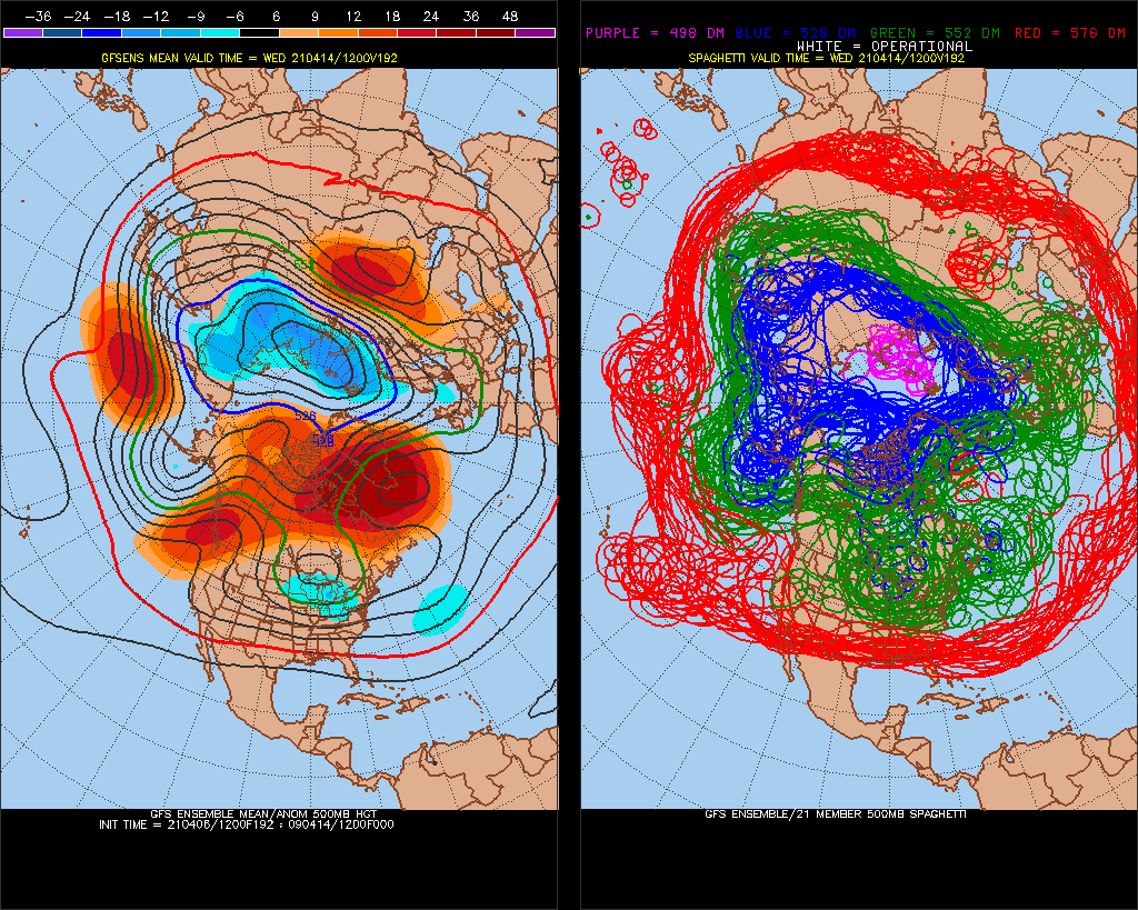
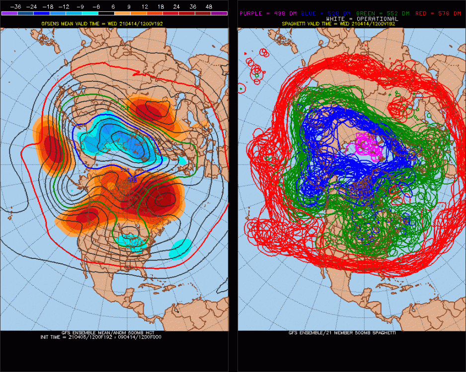
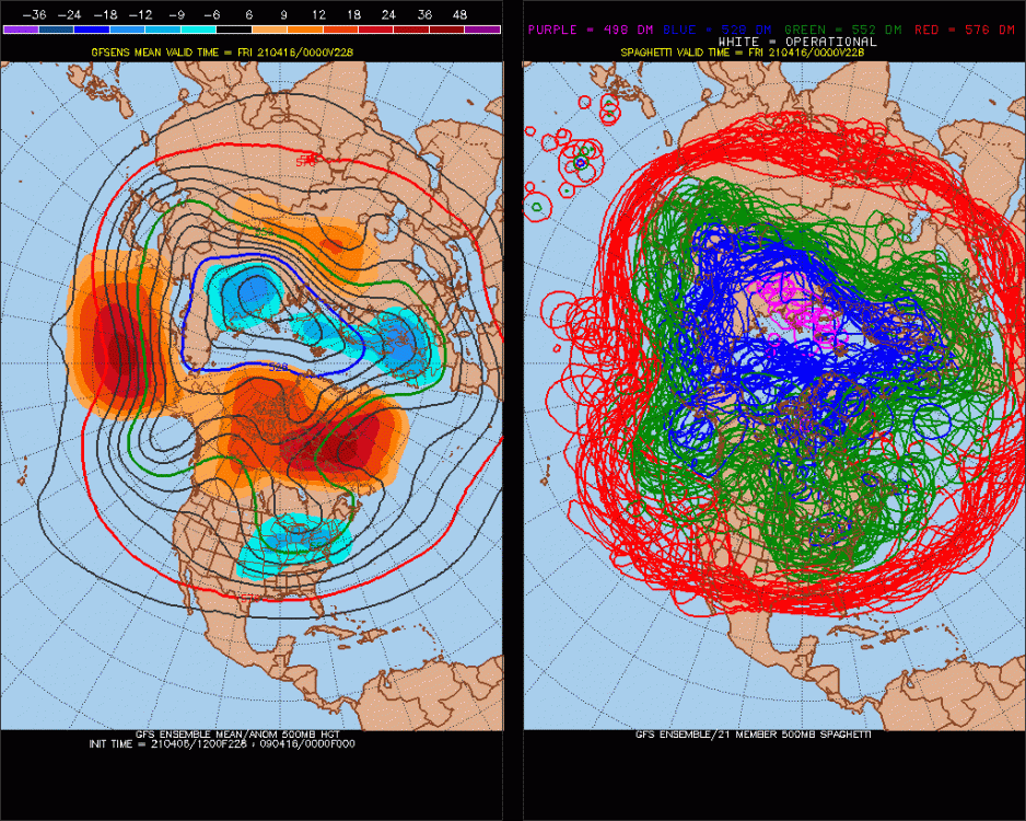
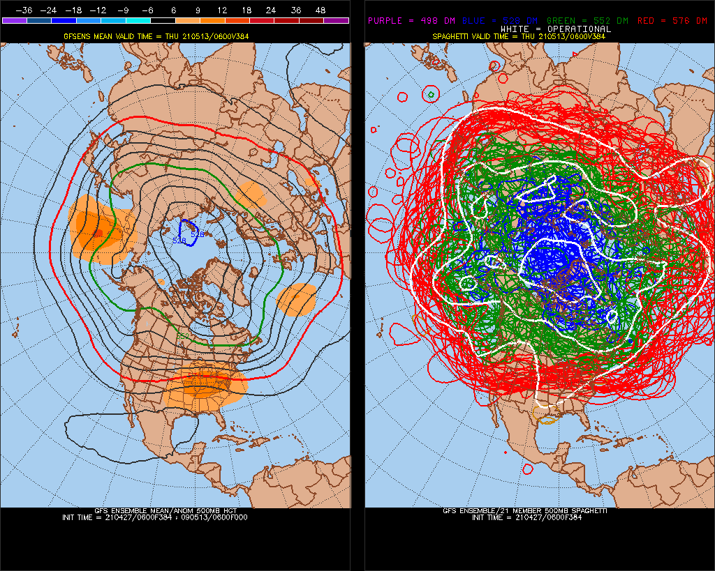
There's my -PNA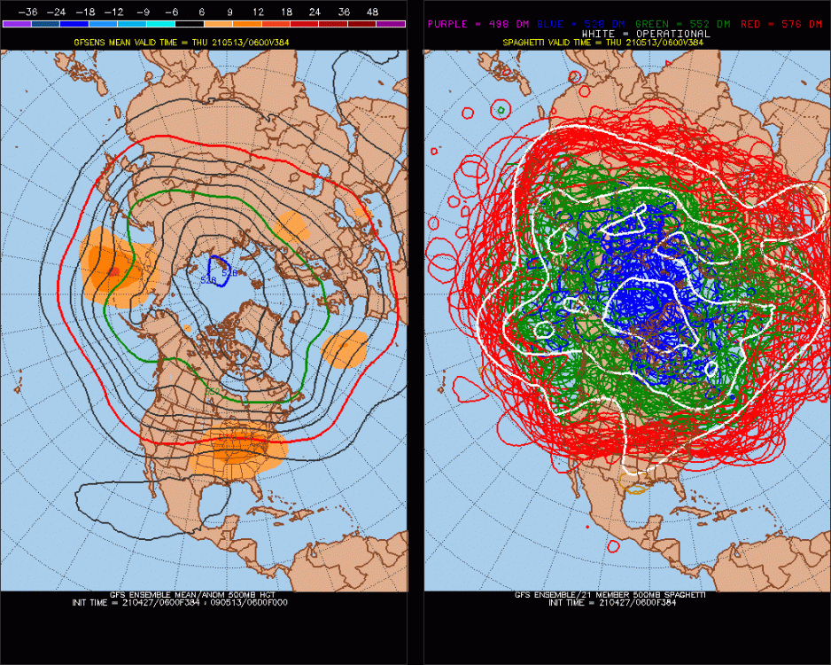
-
What weather can we expect for May 2021?
StormchaserChuck! replied to Javon75's topic in Weather Forecasting and Discussion
The ENSO subsurface configuration looks like a La Nina pattern will redevelop in the central subsurface, so that trend is usually associated with -PNA. I think the above map looks good. -
Winter 20-21 Discussion
StormchaserChuck! replied to griteater's topic in Weather Forecasting and Discussion
Yeah, you could see it was coming by March 2018 (wasted Jan) -
2021-2022 ENSO
StormchaserChuck! replied to StormchaserChuck!'s topic in Weather Forecasting and Discussion
Totally El Nino in Pacific +Day 8.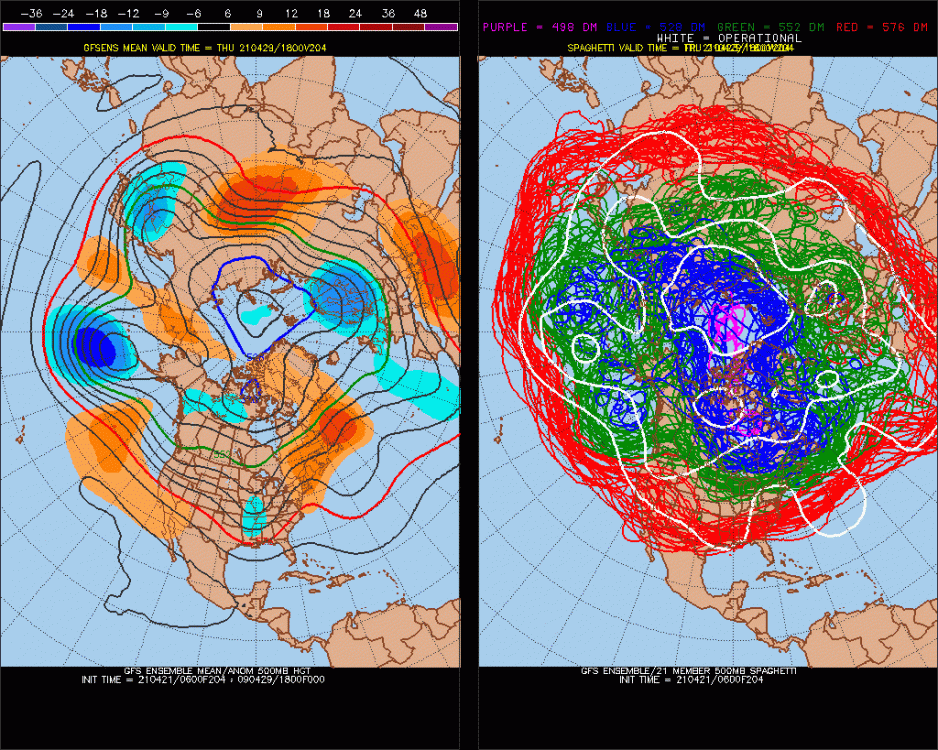
-
Well, we saw this kind of thing in 2018.
-
2021 Atlantic Hurricane season
StormchaserChuck! replied to StormchaserChuck!'s topic in Tropical Headquarters
110/-50 is about to hit +2c in mid-April. -
So with an El Nino next Winter, let's see in 2018 Oct-early Nov were favorable but it was warm.
-
Occasional Thoughts on Climate Change
StormchaserChuck! replied to donsutherland1's topic in Climate Change
No -
2021-2022 ENSO
StormchaserChuck! replied to StormchaserChuck!'s topic in Weather Forecasting and Discussion
The age of El Nino is over. -
2021 Atlantic Hurricane season
StormchaserChuck! replied to StormchaserChuck!'s topic in Tropical Headquarters
Looking like an El Nino, guys. -
Some good old +NAO Spring warming
-
2021-2022 ENSO
StormchaserChuck! replied to StormchaserChuck!'s topic in Weather Forecasting and Discussion
Yeah, we are in a pretty large -PNA/La Nina cycle though, the 2015s+ had a big +NOI off the West coast. -
-NAO is going to be hard to come by next Winter. El Nino progression is looking better, +0.5c readings coming in for the first time.
-
tada +NAO love the pattern shaping here
.thumb.gif.2692e6238a607332b90f90b116413b9c.gif)
-
2021-2022 ENSO
StormchaserChuck! replied to StormchaserChuck!'s topic in Weather Forecasting and Discussion
NOI blows up a little here (NPH) http://www.meteo.psu.edu/fxg1/ENSHGTAVGNH_12z/ensloopmref.html -NOI In April is a big deal for El Nino Apr-Jun, I think. -
Observational evidence of increasing global radiative forcing
StormchaserChuck! replied to bdgwx's topic in Climate Change
Yeah, anything democratic doesn't really work, unless you like to be ruled. -
2021 Atlantic Hurricane season
StormchaserChuck! replied to StormchaserChuck!'s topic in Tropical Headquarters
I'll tell you what, if it's Weak Nina it will be one heck of a hurricane season. That cold subsurface bubble at -200/170 today is interesting. -
I told you, arctic ice melt is lagging.
-
Observational evidence of increasing global radiative forcing
StormchaserChuck! replied to bdgwx's topic in Climate Change
Anything after 2018 is legit, really. -
Yeah, that's a good point. If the Earth's system were in natural climate, there would be less evil/lose of free will.
-
2021-2022 ENSO
StormchaserChuck! replied to StormchaserChuck!'s topic in Weather Forecasting and Discussion
Yeah, I don't know why IRI is calling for -0.2/3 warm peak. -
2021-2022 ENSO
StormchaserChuck! replied to StormchaserChuck!'s topic in Weather Forecasting and Discussion
Expect El Nino SSTs to really speed up in the next 2 weeks. -
2021-2022 ENSO
StormchaserChuck! replied to StormchaserChuck!'s topic in Weather Forecasting and Discussion
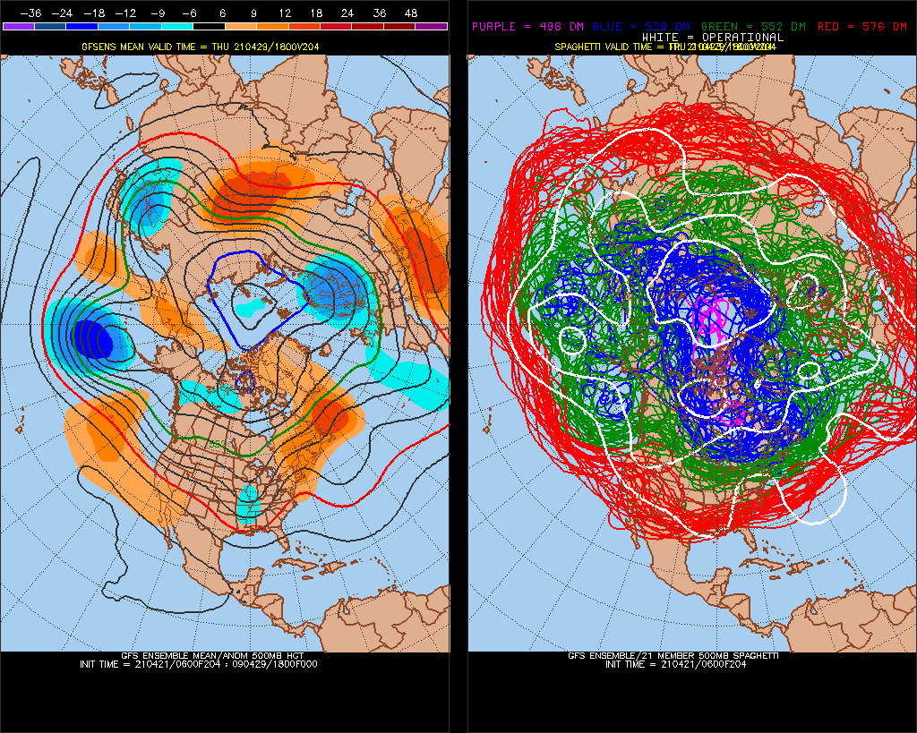
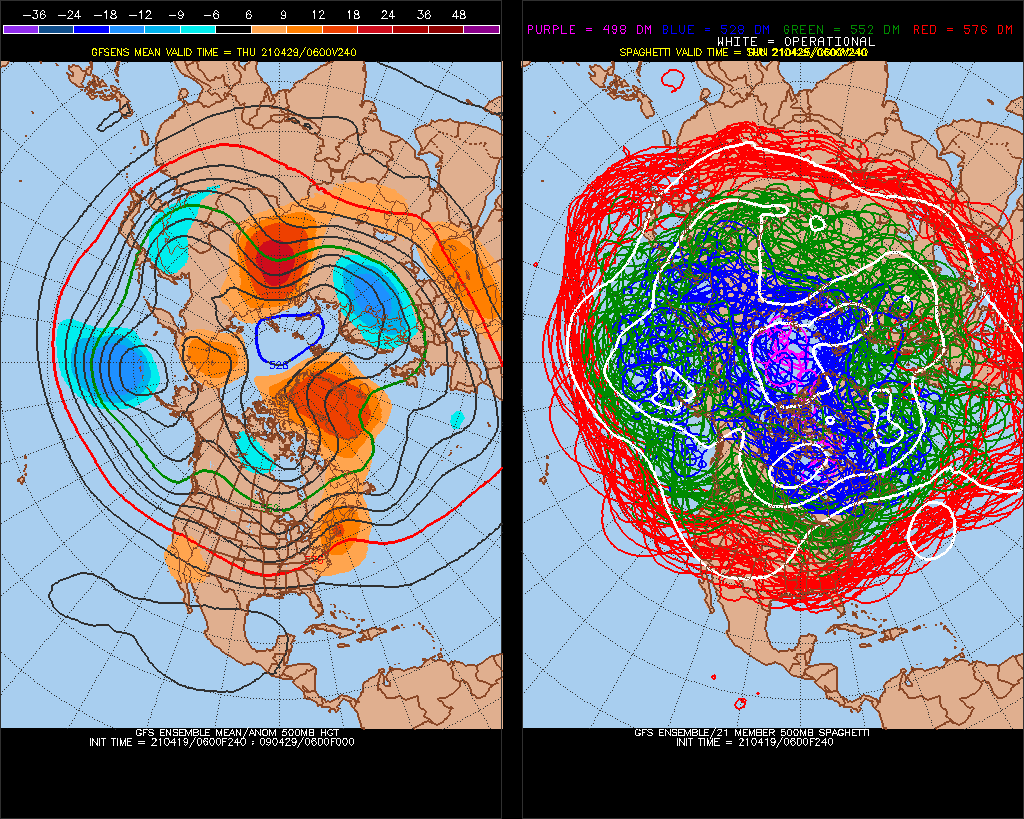
LR GFS ensembles tries to build +PNA finally toward the end -
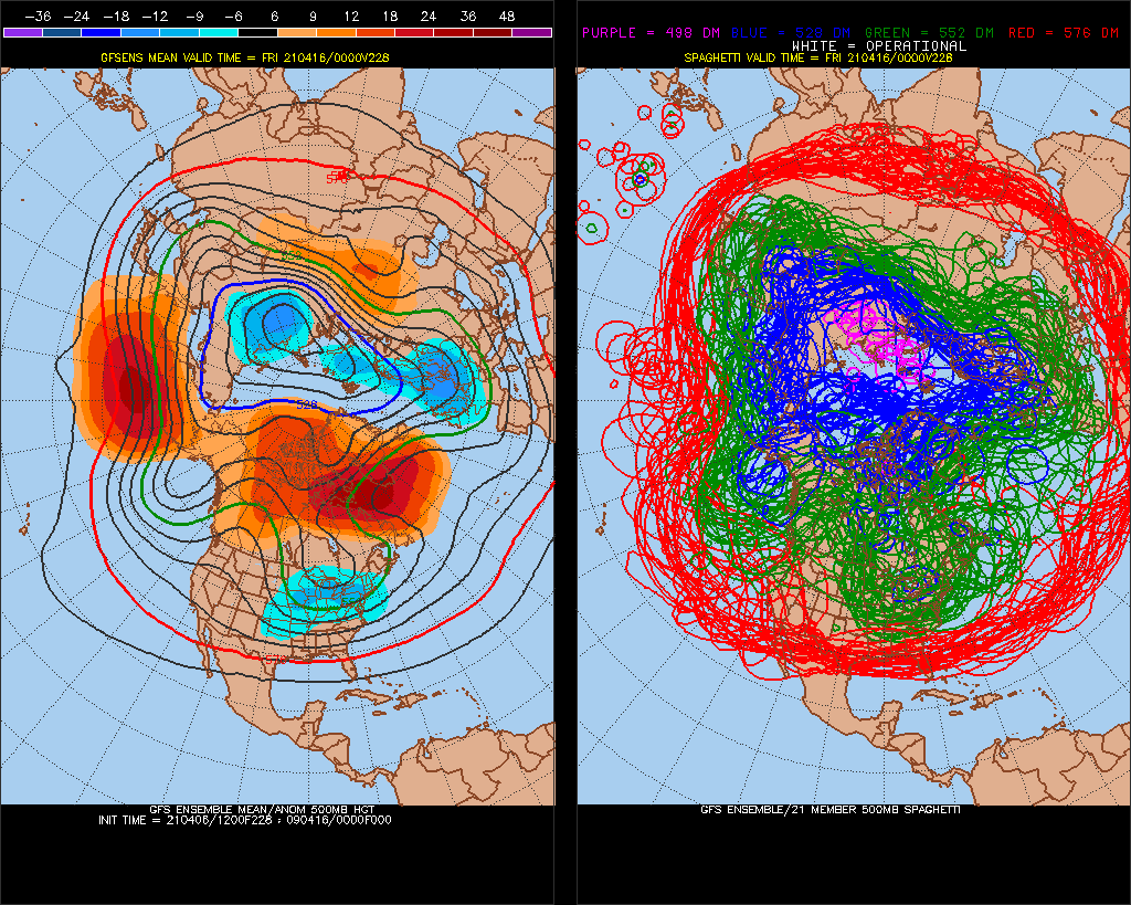
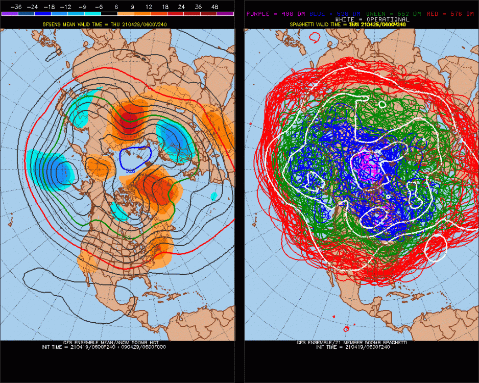
This is nice But look at how the -PNA builds in (Since Jan 1- April 18 we are going to have the most -PNA on record for the time period!) This is my forecast for next Winter, El Nino or not..
-
Winter 20-21 Discussion
StormchaserChuck! replied to griteater's topic in Weather Forecasting and Discussion
I think it's weird that the deep South doesn't historically get more snowstorms..


.gif.fc5139a8aa5cf764a97fb0ceed1d8c5b.gif)