dWave
-
Posts
1,955 -
Joined
-
Last visited
Content Type
Profiles
Blogs
Forums
American Weather
Media Demo
Store
Gallery
Everything posted by dWave
-
High 91 then slowly falling, now 89
-
Yeah I agree. I think it comes down to the NWS not wanting to create a headache for themselves. The status quo is fine for them. From their perspective it's not worth dealing with just to appease a community of weather enthusiasts. We have the typical airport stations if needed for high quality scientific purposes. I believe the media could do a better job emphasizing other reporting stations too. NYC does not begin and end with Central Park. I saw on TV someone saying how NYC averages 15 90+ days a year. It sounded so off to me. I can't remember the last time I was limited to 15 or less days. Weather apps tend to point me to LGA as the closest official station so that's the stats I see first. Then the Central Park stats quoted on TV sound disconnected from real life urban conditions.
-
Downpour of the year in Lower Manhattan
-
You don't even have to go that far for a nicer spring. There's so many days where it's dreary 50s here, meanwhile it's 75 - 85 Philly to DC. The proximity makes it feel worse. That doesn't help with the summers though, no escape that on the east coast.
-
I know Sun forecast isnt great but is Sunday looking like a steady moderate rain or more of light showers from time to time kind of day? The 5 boro bike tour is that day and I trying an idea how bad it will be. I see varying forecasts from around a tenth of an inch to nearly an inch of rain.
-
Don't onshore winds tend to push milder surface ocean temps closer to the coast?
- 1,603 replies
-
- 1
-

-
- spring
- cool temps
- (and 3 more)
-
The only time of year when Central Park tends to be the hot spot within NYC
-
Severe T storm warning? What the hell?
-
Raining in Lower Manhattan
-
Depends how you define "cool" at that point
-
Pleasantly surprised at all this sunshine, breezy 57
-
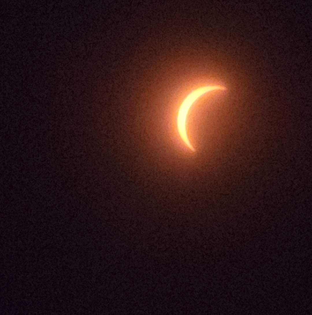
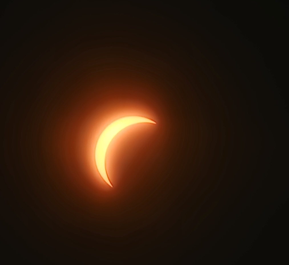
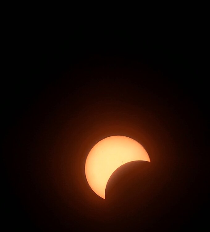
In Spain, and brushing Portugal too. Edge of the path of totality passes through northern parts of Madrid.
-
The dim haze look at the peak was unique. Didn't expect much perceiveable darkening so it was a little more than I anticipated.


-
I'm seeing the same with transformers blowing. Lights at home has been flikering for hrs, but power is holding on. Wind may not of verified for some, but it has here, maybe exceeded expectations.
-
Wild drive on Shore Rd thru Pelham Bay Pk. LI Sound with large crashing waves. Huge crashing waves crashing into Glen Island. Full on Atlantic Ocean look
-
From April 5th on, Amtrak heading upstate to path of totality is sold out by now. Only thing I saw available was 1 train the morning of, which is cutting it extremely close, like to the minute.
-
For real. I'm hoping against the odds and climatologal history for a clear sunny Apr 8th.
-
Yeah, I got down to 28. Trees etc in bloom look unscaved. Many of the cherry blossoms were past peak anyway, and the later blooming varieties haven't opened yet.
-
Thurs night/Fri AM a freeze looks likely even within NYC. Perhaps a hard freeze at that. We'll see how these cherry blossoms and magnolia blooms fare by next weekend.
-
Breaks of sun got me to 72, now light showers and 70
-
74 and sunny light breeze
-
Not complaining but..where the wind? Last night was windy but it's nearly calm now
-
I saw a lanternfly on Sunday, which I thought was way to early. It wasn't the little baby ones either. 40 degree winters will do that I guess. There's little sustained freezing temps, at least in urban areas. Back to back winters too.
-
This is very true..but it's worth noting the records for today were on the lower side. For Central Park today was one of the very few days this late with a record high below 70. Record highs in the 60s start fading away by late Feb, and they are just about gone by this point...but obviously there are couple hanging on, i.e today.
-
Bright sunshine..not a cloud in the sky and 60* already.