dWave
-
Posts
1,967 -
Joined
-
Last visited
Content Type
Profiles
Blogs
Forums
American Weather
Media Demo
Store
Gallery
Everything posted by dWave
-
High of 91 here. Now a muggy 85/72. Occasional dark clouds in the distance but no rain.
-
People will come out if it's 30% chance of late afternoon to evening shower/tstorm. But when the forecast shows threat of rain all day from morning, it scare them away. Even if the chances aren't that high. Plus when it's clear there smoke days too smh The NWS point and click for me leads with "Heavy Rain." When you look close it shows 30 - 40% chance of rain all day long.
-
LGA has a decent shot of estsblishing a heat wave. But it seems the forecast is turning to more wideapread storms tomorrow so maybe not? Sitting at 89 here, feels like 94.
-
a little surprised...got to 89 today with some mid 90s heat index values. Another day of no rain despite continued threats scaring people away. looks like some drizzle now though.
-
All this rain talk for a warm and humid partly sunny day
-
Outdoor graduation party here for this afternoon, moved inside for now but still can't call if outside is doable. Went from rain likely to 30 - 50% tops chance of a shower. Gonna be some upset ppl if cramped inside and the sun is shining at 430pm. A lot of tough calls at a busy time of yr. Friday am outdoor graduation intended to get ahead of heavy rain ended up being a soaker
-
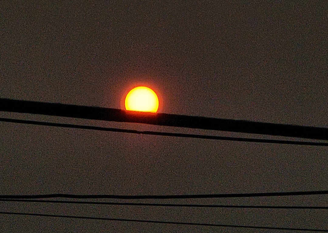
It hadn't been as sunny as I thought it'd be today. Hazy skies most the time. Is some smoke pushing back in or regular humid summer day haze/clouds? 79/dew 61. Still struggling to 80, forecasted 86 look tough.
-
Yeah, it is a little less thick but aqi is still upper 300s to mid 400s in around 5 boros. A lot of it isn't visible anyway.
-
Yeah it's crazy. Some parts here that have been remodeled with new modern construction and windows it's less but still there. The original parts of the bldg are smoke filled. It burns your eyes to stand there more than a few mins
-
Wait a volcano erupted in Hawaii now ?
-
Hudson Yards, where did you go?
-
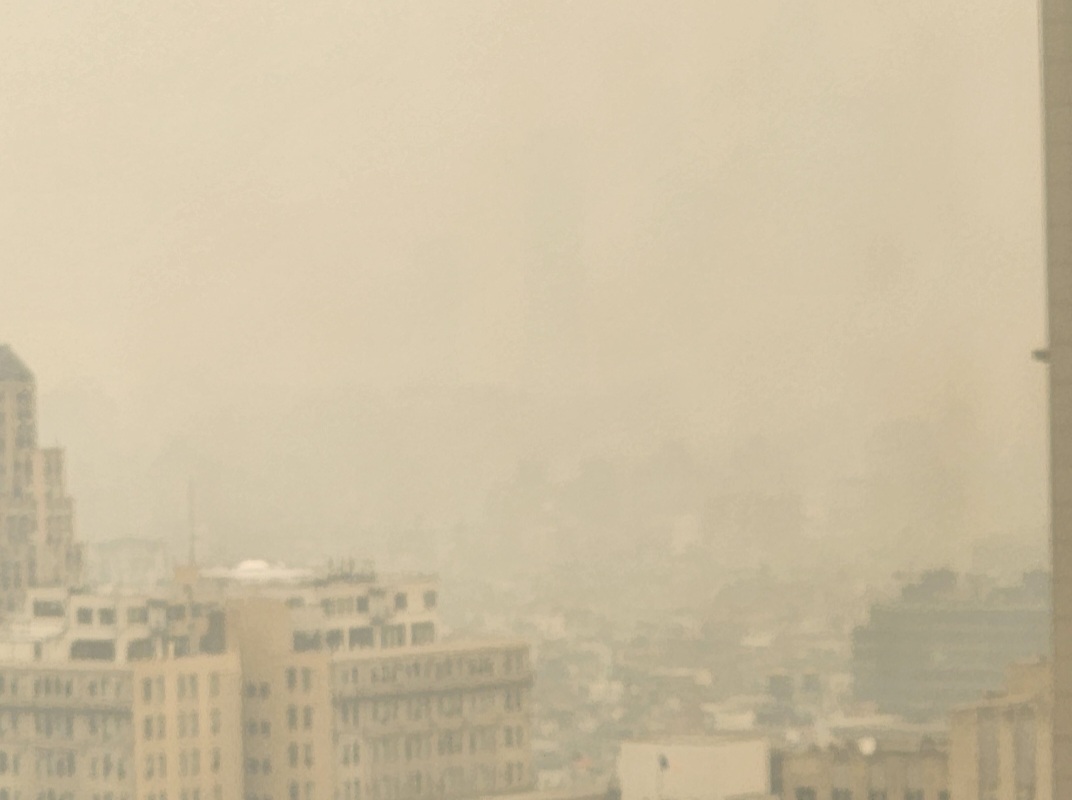
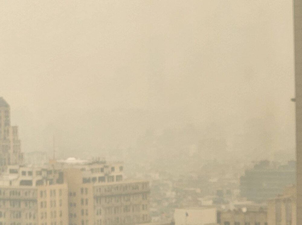
It got worse than last night. Rapidly too. The smell and smoke is inside office buildings now. Pretty shocking how hazy it is, even indoors
-
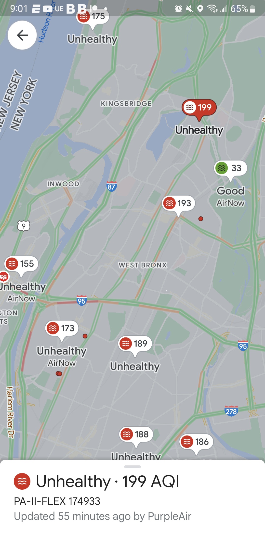
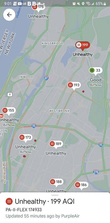
It updated. NYC air quality is now the worst of major cities in the world. 193 aqi
-
Still rising too. Except some sort of mystery fresh air bubble over the Botanical Garden
-
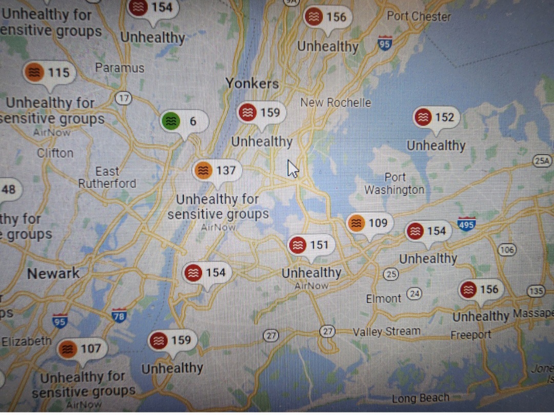
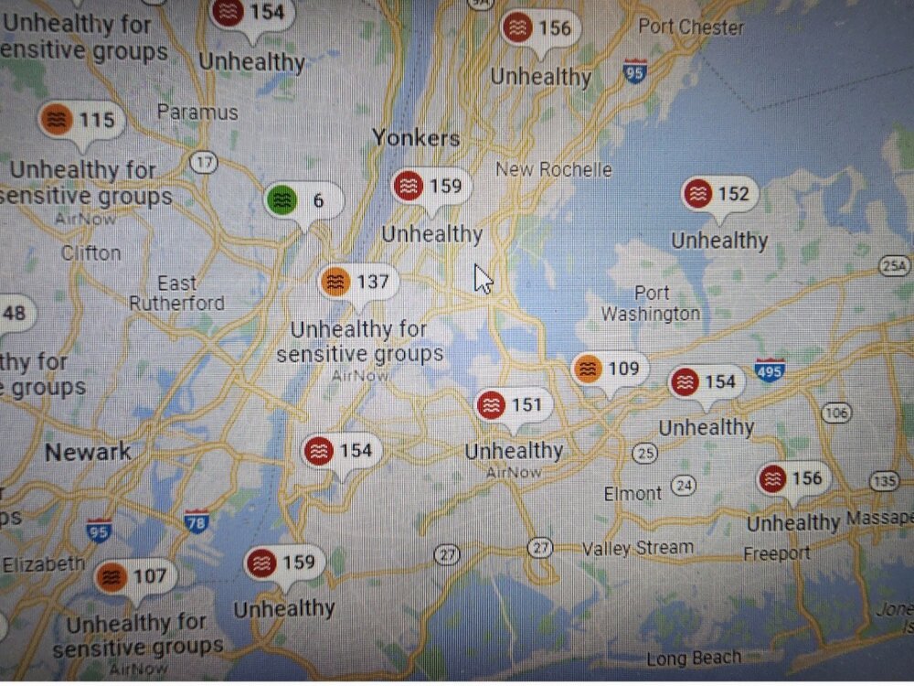
AQI levels have jumped this evening even higher than mid day levels. Lots of 170+. Nearing 200 in NW NJ and Orange county.
-
Some pretty high readings, into the unhealthy for all category, not just sensitive groups.
-
Got down to 50*. Coolest June low in recent memory. Can't say I'm a fan. Don't want to have to wonder..."will I need a jacket if I'm out late" by June.
-
At 91 3rd of the year
-
Its here now..burns my eyes actually
-
I go uptown to the Bx and the sky is blue and no perseivable smoke..but how if it's coming from the NE, or is it sweeping around from the south? Or is it because it more breezy here?
-
Took a walk outside and you def can smell it and see it from street level.
-
I heard some mets say it's possible, since this time it can mix down to the surface and affect air quality. I noticed the haze in the sky around 1pm. Sitting in a Manhattan high rise I can make out it lowering now to near ground level and in between buildings like fog.
-
Sunny 68 and windy. The NE wind is strong
-
Wasn't today supposed to be warmer? Instead of mid to upper 70s it remaining steady in the mid 60s, windy and mostly cloudy from time to time.