-
Posts
9,095 -
Joined
-
Last visited
Content Type
Profiles
Blogs
Forums
American Weather
Media Demo
Store
Gallery
Everything posted by EastonSN+
-
Two Mdt to high impact events NYC subforum; wknd Jan 6-7 Incl OBS, and mid week Jan 9-10 (incl OBS). Total water equiv by 00z/11 general 2", possibly 6" includes snow-ice mainly interior. RVR flood potential increases Jan 10 and beyond. Damaging wind.
EastonSN+ replied to wdrag's topic in New York City Metro
Lol coastal CT- 3,610 replies
-
- snow
- heavy rain
- (and 5 more)
-

Two Mdt to high impact events NYC subforum; wknd Jan 6-7 Incl OBS, and mid week Jan 9-10 (incl OBS). Total water equiv by 00z/11 general 2", possibly 6" includes snow-ice mainly interior. RVR flood potential increases Jan 10 and beyond. Damaging wind.
EastonSN+ replied to wdrag's topic in New York City Metro
Nice snow shower passing through!- 3,610 replies
-
- 1
-

-
- snow
- heavy rain
- (and 5 more)
-

Two Mdt to high impact events NYC subforum; wknd Jan 6-7 Incl OBS, and mid week Jan 9-10 (incl OBS). Total water equiv by 00z/11 general 2", possibly 6" includes snow-ice mainly interior. RVR flood potential increases Jan 10 and beyond. Damaging wind.
EastonSN+ replied to wdrag's topic in New York City Metro
Will be interesting to see the EPS. Especially for the burbs.- 3,610 replies
-
- snow
- heavy rain
- (and 5 more)
-
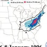
I think we are generally on the same page, difference is I see this current 5 year stretch as we are in a decadal RNA regime with a global warming background raising our temps by say whatever the current global departure is. 2000 through 2018 with a decadal PNA would still work. Also, 1996 where we were snowing at 18 degrees may be 21 degrees and snowing. Yes, we will lose our 33 and snow from 1972, but the blizzard of 1978 would still be snow IMO and maybe more given the added moisture. Where my view differs than some is I do not think our overall weather structure changed i.e. I do not think we are going to be in a mostly static RNA from here on our. I believe the same patterns persist just increasingly warmer.
-
Right if it was frigid and 20 degrees with suppression, we may be 22 now cause of GW and on the northern edge of the snowfall (think SE ridge help).
-

Two Mdt to high impact events NYC subforum; wknd Jan 6-7 Incl OBS, and mid week Jan 9-10 (incl OBS). Total water equiv by 00z/11 general 2", possibly 6" includes snow-ice mainly interior. RVR flood potential increases Jan 10 and beyond. Damaging wind.
EastonSN+ replied to wdrag's topic in New York City Metro
Yeah, GFS taken verbatim the CT coast never flips to mix, albeit an above freezing snowfall with low ratios.- 3,610 replies
-
- snow
- heavy rain
- (and 5 more)
-

Two Mdt to high impact events NYC subforum; wknd Jan 6-7 Incl OBS, and mid week Jan 9-10 (incl OBS). Total water equiv by 00z/11 general 2", possibly 6" includes snow-ice mainly interior. RVR flood potential increases Jan 10 and beyond. Damaging wind.
EastonSN+ replied to wdrag's topic in New York City Metro
Borrowed again.- 3,610 replies
-
- 1
-

-
- snow
- heavy rain
- (and 5 more)
-
Could work out a well, all those suppressed snowstorms of the past may be monster hits now. Also the records we have now are likely a combination of a normal warm pattern (decadal RNA now) and GW. If we get back into a general cooler pattern we can be in decent shape. For me as long as we keep seeing NC, Virginia and the Delmarva get snowstorms like they have been over the past few years we have tread on the tires.
-

Two Mdt to high impact events NYC subforum; wknd Jan 6-7 Incl OBS, and mid week Jan 9-10 (incl OBS). Total water equiv by 00z/11 general 2", possibly 6" includes snow-ice mainly interior. RVR flood potential increases Jan 10 and beyond. Damaging wind.
EastonSN+ replied to wdrag's topic in New York City Metro
Again borrowed from the NE forum. Enjoy- 3,610 replies
-
- 1
-

-
- snow
- heavy rain
- (and 5 more)
-
Completely agree. Our second window (this weekend was the first), then as Bluewave alluded to, phase 8 potential for February. All in all though this winter so far has been textbook strong El nino.
-
The cutter is a good thing, helps build/strengthen the NAO block.
-

Two Mdt to high impact events NYC subforum; wknd Jan 6-7 Incl OBS, and mid week Jan 9-10 (incl OBS). Total water equiv by 00z/11 general 2", possibly 6" includes snow-ice mainly interior. RVR flood potential increases Jan 10 and beyond. Damaging wind.
EastonSN+ replied to wdrag's topic in New York City Metro
Borrowed from the NE forum (I am technically coastal CT). Not New York but you see some of LI and Hudson river. 10 to 1 so you know the drill about lower ratios.- 3,610 replies
-
- 2
-

-

-
- snow
- heavy rain
- (and 5 more)
-

Two Mdt to high impact events NYC subforum; wknd Jan 6-7 Incl OBS, and mid week Jan 9-10 (incl OBS). Total water equiv by 00z/11 general 2", possibly 6" includes snow-ice mainly interior. RVR flood potential increases Jan 10 and beyond. Damaging wind.
EastonSN+ replied to wdrag's topic in New York City Metro
Yeah the northern areas of this sub forum will do good. The 6z euro came in a tad colder per NE forum.- 3,610 replies
-
- 2
-

-
- snow
- heavy rain
- (and 5 more)
-
It's too bad this next storm was JUST too far north, otherwise CPK had a good shot at an above average snowfall winter. Winter Storm Chuck keeps mentioning we are in a decadal RNA pattern. Until that breaks we will need to keep relying on late Jan, February and March to produce. I know Chuck stated decadal, however I think it usually lasts 2 to 3 decades (1970 through 1999), while PNA 1 to 2 decades (2000 through 2018).
-

Two Mdt to high impact events NYC subforum; wknd Jan 6-7 Incl OBS, and mid week Jan 9-10 (incl OBS). Total water equiv by 00z/11 general 2", possibly 6" includes snow-ice mainly interior. RVR flood potential increases Jan 10 and beyond. Damaging wind.
EastonSN+ replied to wdrag's topic in New York City Metro
Thanks Don, I noticed that the EPS intensity is deeper (low). If the high pressure in Canada remains at the current modeled level, would the old "storm makes its own cold air" scenario work here, or would the storm pressure need to be sub 992/rapidly drop?- 3,610 replies
-
- snow
- heavy rain
- (and 5 more)
-

Two Mdt to high impact events NYC subforum; wknd Jan 6-7 Incl OBS, and mid week Jan 9-10 (incl OBS). Total water equiv by 00z/11 general 2", possibly 6" includes snow-ice mainly interior. RVR flood potential increases Jan 10 and beyond. Damaging wind.
EastonSN+ replied to wdrag's topic in New York City Metro
This is a good point, and a reason why it is USUALLY hard to get an all snow event in this region and why our areas yearly average is only approx 30 inches. Look at all other years outside of 2000 through 2018 and 1955 through 1969, very hard to get all snow/KU events on a consistent basis. I remember getting amped up in February 1994 because I was FINALLY getting an all snow event without the risk of sleet! It was ALWAYS cutter, hugger or slider. Also, you can cut the country into three potential trough locations. East coast west coast and central/plains. That's a 1/3 chance right there. In addition, I believe that west coast troughing happens more often through history than east coast. We are in an RNA cycle unfortunately and we will have to thread the needle more often than not. On a positive note, when it does happen it makes it that much sweeter! Getting a 6 inch event in the 80s and 90s was like getting a foot 2000 through 2018. Leaving on another positive note. If it can snow in February 2018 in a sea of 60 and 70 degree days, it can snow this year.- 3,610 replies
-
- 1
-

-
- snow
- heavy rain
- (and 5 more)
-
Wow! Although kind of shocked that 1984 was the coldest! Would have thought it would have deteriorated YOY since 1950 since we have been warming steadily since before 1950. Could something else have driven the 1984 record? I think one of the METS stated that a way to increase the cold pool is to have a strong of years where the Polar Vortex is consolidated.
-

Two Mdt to high impact events NYC subforum; wknd Jan 6-7 Incl OBS, and mid week Jan 9-10 (incl OBS). Total water equiv by 00z/11 general 2", possibly 6" includes snow-ice mainly interior. RVR flood potential increases Jan 10 and beyond. Damaging wind.
EastonSN+ replied to wdrag's topic in New York City Metro
Look at trough digging into SW California, it's further west than the earlier run and is actually what ruined our neg NAO episodes from March, last December and two Decembers ago. Forky actually had a post a couple days ago pointing this out with "sorry don't like the trough here" or something to that effect. Like waves in a bathtub, dip in the west equals ridge in the east. Also I posted a post from orh_wxman a few weeks ago which explained that a deep trough in the SW only works when you have a piece of the PV driving south like in December 2002, which goes to show it's relatively rare to overcome and we do not have a piece of the PV to our north driving south this time.- 3,610 replies
-
- 1
-

-
- snow
- heavy rain
- (and 5 more)
-
I think the February 2021 blizzard was up and in too.
-

Two Mdt to high impact events NYC subforum; wknd Jan 6-7 Incl OBS, and mid week Jan 9-10 (incl OBS). Total water equiv by 00z/11 general 2", possibly 6" includes snow-ice mainly interior. RVR flood potential increases Jan 10 and beyond. Damaging wind.
EastonSN+ replied to wdrag's topic in New York City Metro
I personally think atm that it will be 1 to 3 for CPK. I don't think any of the METS will state it's a continuation of last year's pattern, as the trough was down to BAJA and further west during the Neg NAO periods of last March, last December and two Decembers ago, leading to outright cutters. This would be a track and high pressure position issue. As 1970 through 1999 showed, there are many different ways to fail.- 3,610 replies
-
- 1
-

-
- snow
- heavy rain
- (and 5 more)

