Chinook
-
Posts
10,933 -
Joined
-
Last visited
Content Type
Profiles
Blogs
Forums
American Weather
Media Demo
Store
Gallery
Everything posted by Chinook
-
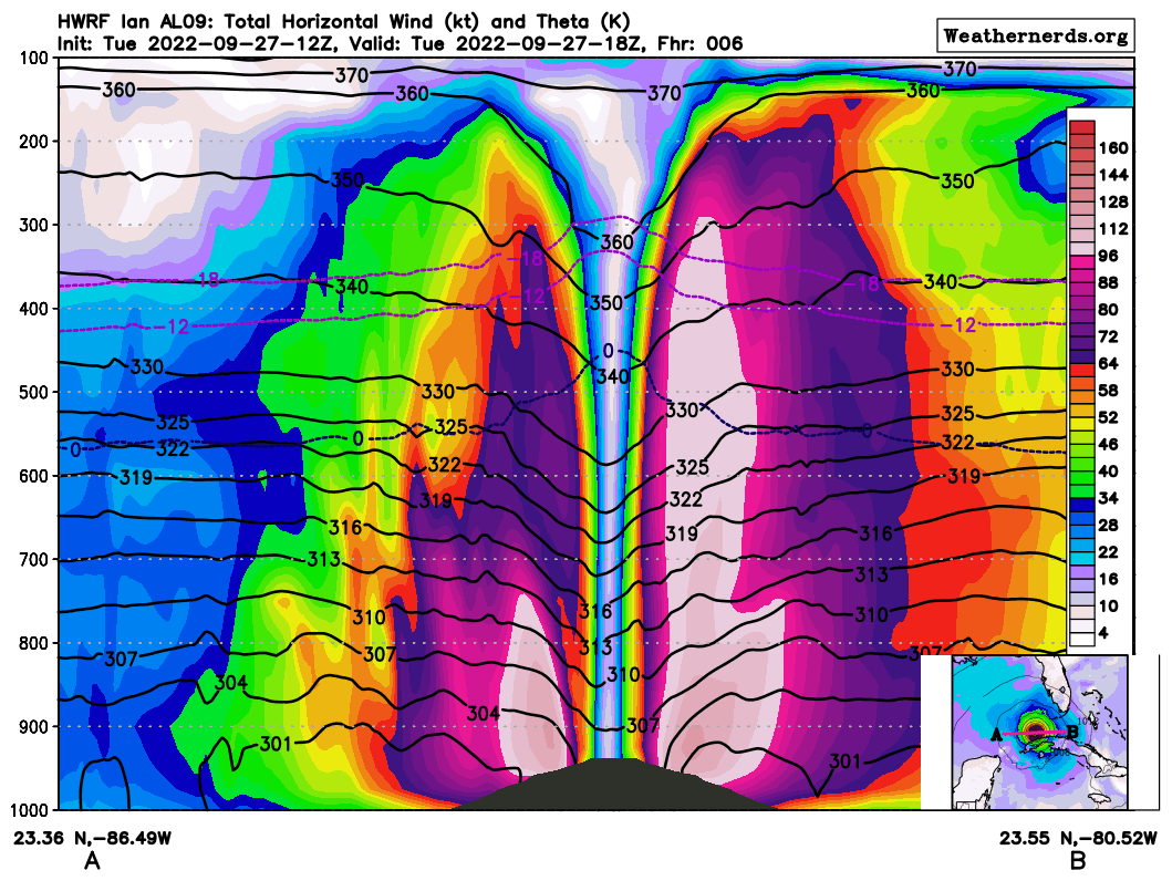
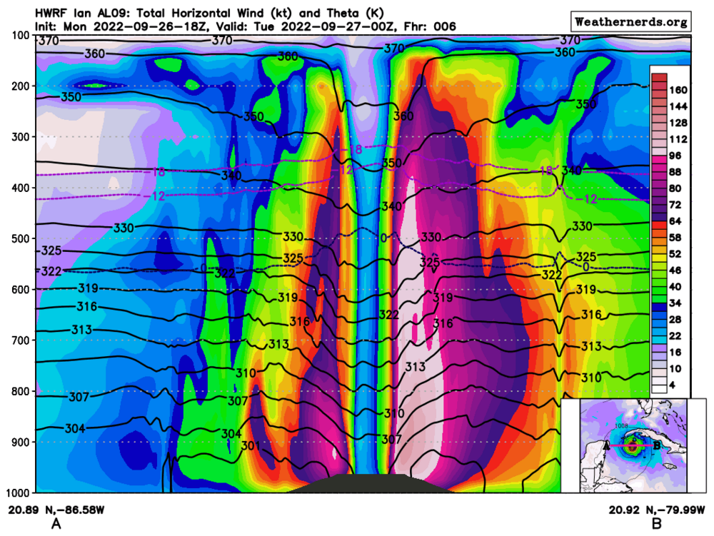
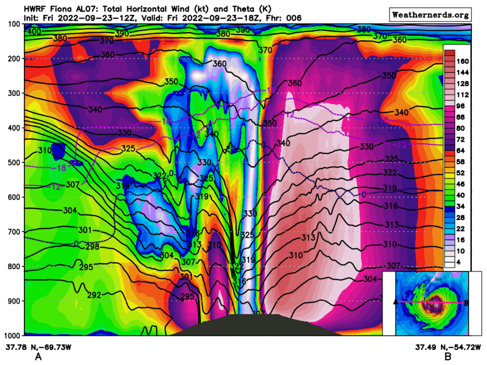
18z cross-section of this storm (HWRF)

-
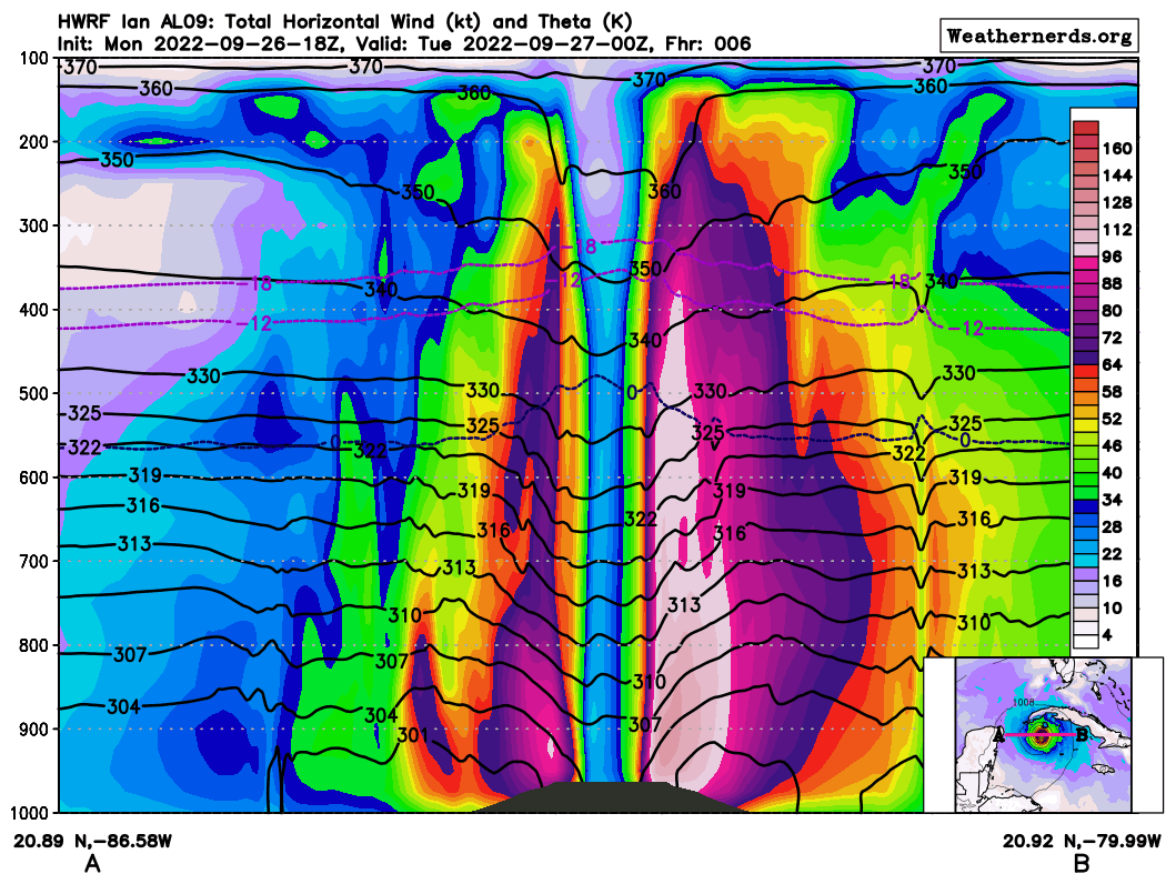
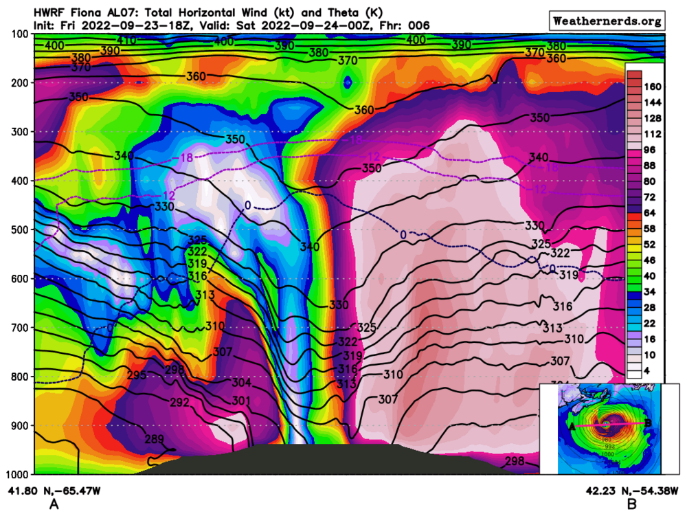
storm cross-section for tonight (00z)
-
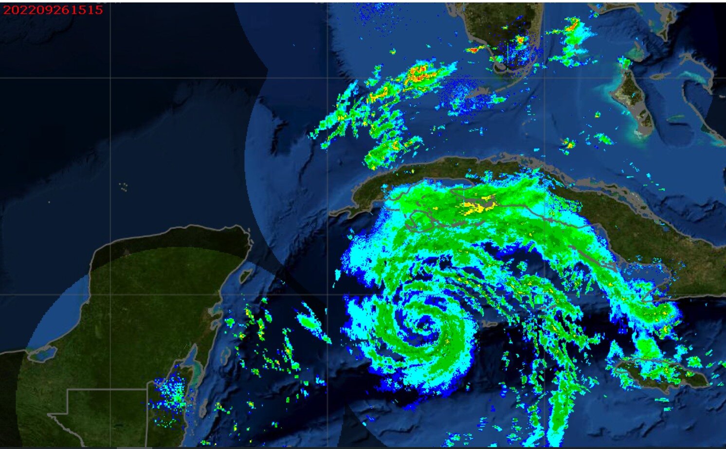
western Caribbean composite radar

-
Here is some info you didn't want to hear: #3 Hottest summer at Denver, #3 Fort Collins, #1 Cheyenne
-
 I hope this doesn't sound dumb, but Super Typhoon Haiyan set a record, I believe with satellite-estimated 195mph winds, (with 1-minute winds, JTWC-American style) and it directly affected Tacloban city, with a storm surge that came in almost as fast as a tsunami. So, yeah, I can't think of anything more devastating. according to Wikipedia: Syper Typhoon Noru--I don't believe I've ever heard of a storm that went from 50mph to 155mph in official (satellite) analysis in roughly 24 hours (correct?) I watched a 16-hour loop on Tropical Tidbits yesterday and that showed pretty much the entire development cycle.
 -
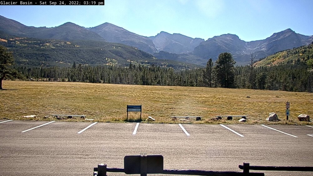
I think I see some yellow aspen trees
-
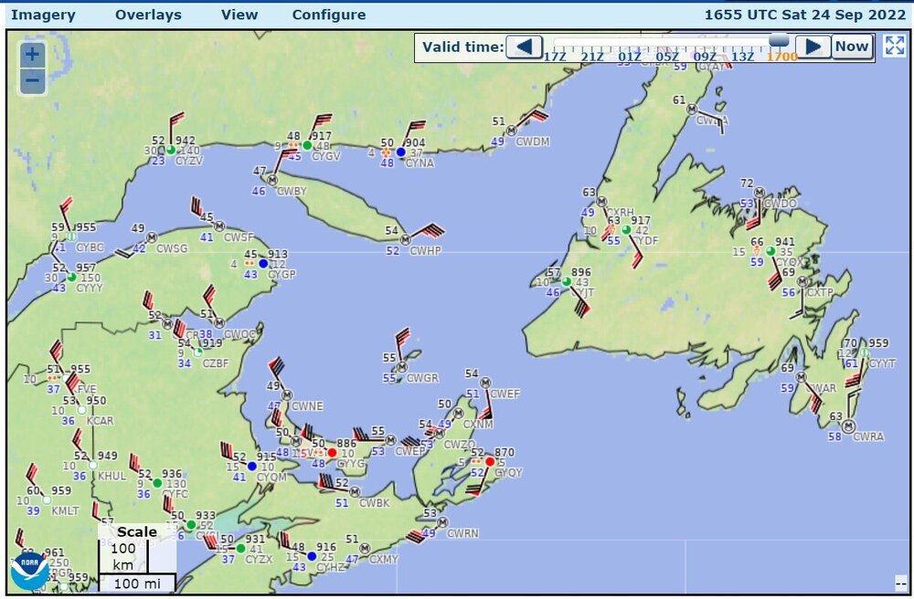
Observations now with post-tropical Hurricane Fiona
-
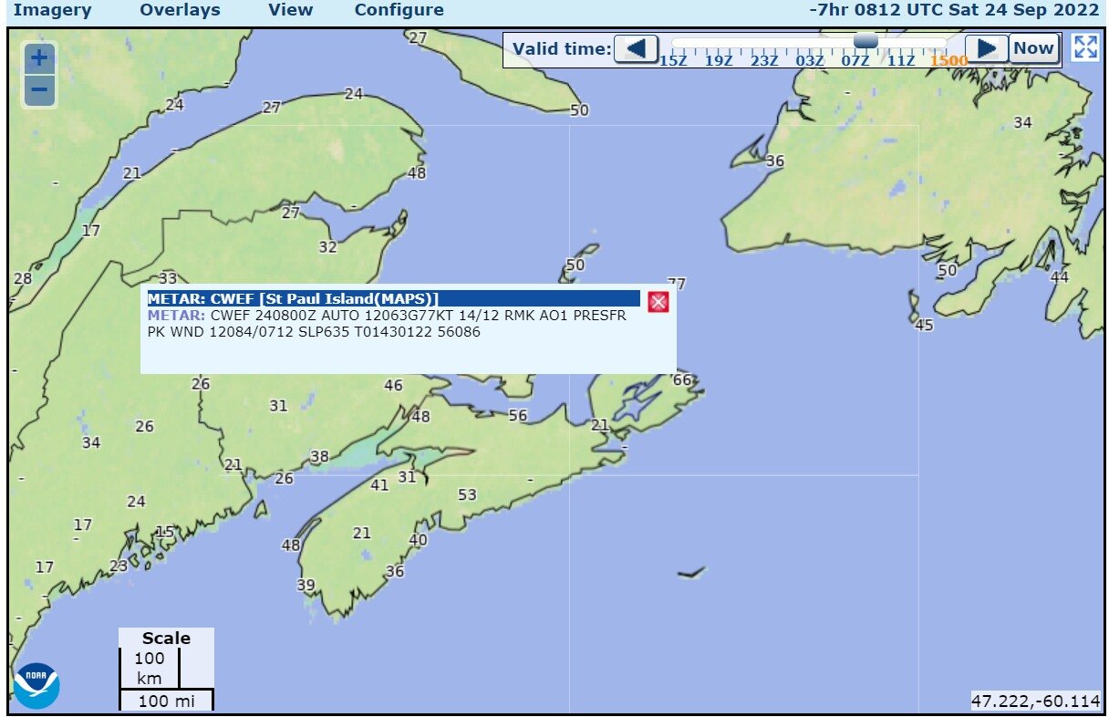
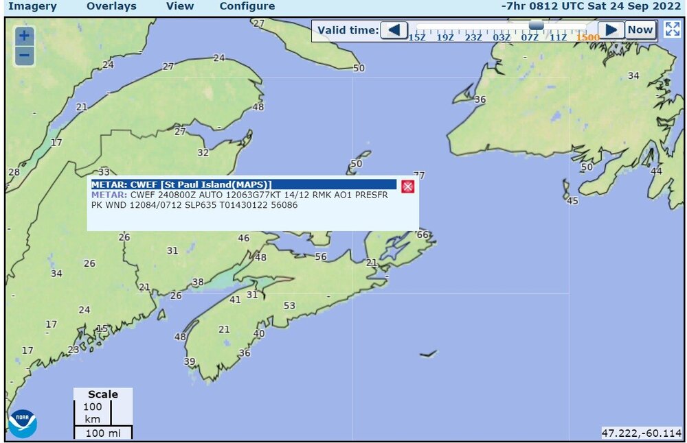
peak wind gust 84 at St Paul Island
-
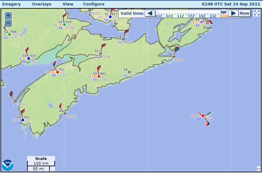
Hours ago, Sydney airport had to estimate the sea-level pressure to be 949.5mb edit: also 940.0 mb (Grand Etang, on the Cape Breton penninsula)
-
44 knots gusting to 65 knots now at Sydney East Point (CWEP): 010 degrees, 56 knots gusting to 71 knots
-
Sydney 967.2 mb, increased temperature to 66F (19C)
-
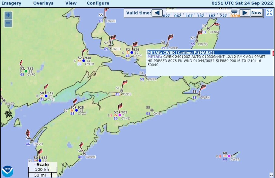
974.4mb at Halifax airport

-
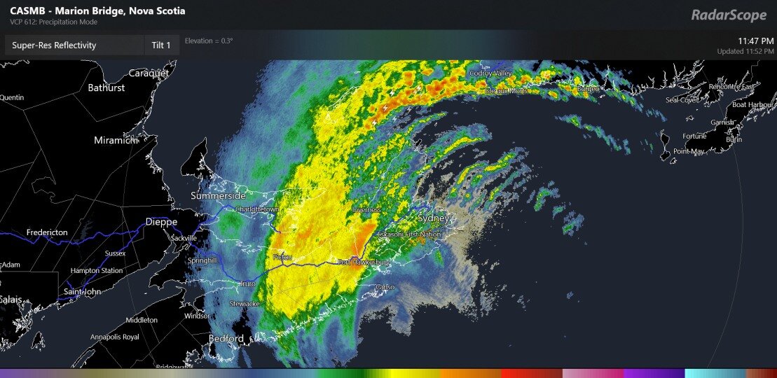
oh yeah, some times I completely forget that there are two ways for me to see Canadian radar data
-
Sable Island now back running, measures 69kt southeast wind gusts, so the lowest pressure must be close or past there
-
first wind gusts over 50 kts in Nova Scotia
-
Almost all stations in Nova Scotia are showing wind gusts over 30 knots
-
Sable Island Nova Scotia has wind sensors, pressure sensors not working
-
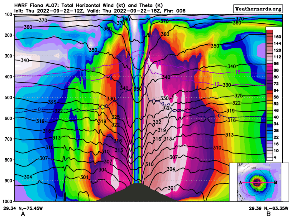
another storm cross section ( compare to my post from before)
-
Now I'm starting to see much more influence of the colder air, out to the west of the hurricane, on the cross section
-
Hurricane strength wind gusts directly measured this morning
-
E-W cross section of Hurricane Fiona, winds (colorized), isotherms of 0C, -12C, -18C, (blue, purple) isentropic surfaces (black), The thing that looks like a hill at the middle of the picture is a little confusing. The sea-level pressures of the storm are below 1000mb, with a strong gradient down to a recon-measured 937mb, I believe. 1000mb is the bottom of the image, so it must show the 937mb pressure as a hill shape. You can see the 0C, -12C, and -18C isotherms bump up in the middle, as well as the isentropic surfaces bump down. That means that the core of the hurricane is the location where the latent heat release has warmed the atmosphere the most. And then there's the 128kt wind in the eyewall, reducing to 20kt in the eye. It does show asymmetry.
-
There will be a combo of a monsoon moisture band and a cold front moisture band. Models and NWS-WPC agree that there could be over 2" of QPF in the form of rain (or snow) west of the Continental Divide in the next several days. Chances for rainfall over 0.4" of rain at Denver look good. Wednesday will be the day when the temperatures drop to the 50s and 60's for the cities.
-
2022 Short/Medium Range Severe Weather Discussion
Chinook replied to Chicago Storm's topic in Lakes/Ohio Valley
sort of a three-supercell complex. storms dropped 2.50" hail west of Walcott IA -
2022 Short/Medium Range Severe Weather Discussion
Chinook replied to Chicago Storm's topic in Lakes/Ohio Valley
This is an awesome effective-STP for September.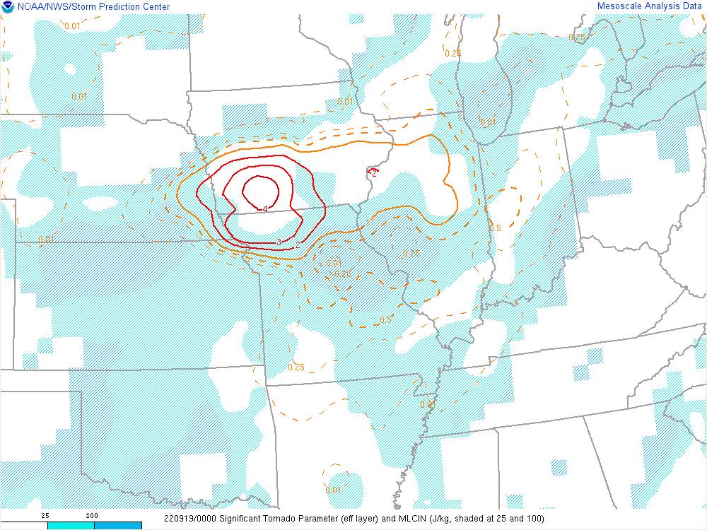
-
You can run a radar loop with this web site, even many days after the storm is done https://mrms.nssl.noaa.gov/qvs/product_viewer/