

Chinook
-
Posts
10,933 -
Joined
-
Last visited
Content Type
Profiles
Blogs
Forums
American Weather
Media Demo
Store
Gallery
Everything posted by Chinook
-
link: https://krdo.com/news/2022/08/08/almost-30-people-were-rescued-in-denver-after-severe-flash-flooding/
-
I have moved. I will keep posting sometimes. I've seen quite a bit of rain and some reasonable lightning/thunder in Ohio since I've been back. Funny thing. When the dew point is 75 and you are at sea level, your nose doesn't dry out. I keep looking for the 00z NAM data to be available at 8:00PM, but it's not done by 8:00PM Eastern time! since I left, Loveland got 1.26" of precipitation and Fort Collins got 2.98" of precipitation (I picked a couple of CoCoRAHS stations) my "secret" web sites in case you wanted to know For winter snowpack https://www.nrcs.usda.gov/wps/portal/wcc/home/quicklinks/imap https://www.wcc.nrcs.usda.gov/ftpref/gis/images/west_swepctnormal_update dot png (change that dot) https://www.nrcs.usda.gov/wps/portal/nrcs/detail/co/snow/products/?cid=nrcseprd1432263 other info (not winter) https://mesowest.utah.edu https://mrms.nssl.noaa.gov/qvs/product_viewer/ https://aviationweather.gov/metar This is my only view of the mountains now. picture of aspen trees near the upper end of the Poudre River
-
some rainfall amounts over 3.81" in Illinois/Iowa
-

2022 Mid-Atlantic Severe Wx Thread (General Discussion Etc)
Chinook replied to Kmlwx's topic in Mid Atlantic
This retweet from Reed Timmer is a little less dramatic. Same tornado, I think. -
Fort Collins had the 5th warmest July (tie). The value was 75.1 degrees, which is higher than any monthly temperature for June or August. With a couple of very rainy days, Fort Collins had 3.84" of rain, which is effectively about 2" above average. This value over 3" was pretty localized, as Loveland Co-op station got 1.46" Denver, 2nd warmest July (also, 2nd warmest month), only 0.99" of rain Boulder, 5th warmest July Greeley, possibly 2nd warmest July maybe 1"-2" for the general Denver area, which, I guess is not too bad if it is up near 2".
-
2022 Short/Medium Range Severe Weather Discussion
Chinook replied to Chicago Storm's topic in Lakes/Ohio Valley
48mph peak wind gust at O'Hare is sub-severe but pretty strong -
2022 Short/Medium Range Severe Weather Discussion
Chinook replied to Chicago Storm's topic in Lakes/Ohio Valley
they kind of went crazy with warning polygons -
Tomorrow night, CAM models show numerous thunderstorms will happen in the area from Chicago to lower Michigan. The 12km NAM shows 4000 J/kg of CAPE along with the 90 temperature, 76 dew point in Michigan before the storms. The shear values should be in the upper 20's knots or maybe a bit better. That's marginal for severe storms, unless the 500mb winds somehow get a little stronger.
-
flash flood warnings for Colorado Springs, Pueblo, Fountain, Woodland Park, east of Colorado Springs tonight.
-
This may have fulfilled the tornado report quota for one storm
-
For those interested in severe weather, you may be fascinated by this recent Youtube video about events in April 2022
-
Summer 2022 Medium/Long Range Discussion
Chinook replied to Chicago Storm's topic in Lakes/Ohio Valley
Hey, I posted that on the 20th, over in Central/Western states. Surprisingly, I'm not in -that- heat wave. -
this has got to have some impressive nighttime lightning and possibly 1" hail near the city of Fond Du Lac
-
This supercell dropped 1.25" hail near Janesville Wisconsin
-
that is a well developed rear-flank downdraft or hook echo, considering that's more typical for the Midwest
-
Texas/Oklahoma Discussion & Obs Thread 2022
Chinook replied to It's Always Sunny's topic in Central/Western States
high temperatures 6 to 10 degrees above normal for a week (although mean temperatures were less above normal) -
2022 Short/Medium Range Severe Weather Discussion
Chinook replied to Chicago Storm's topic in Lakes/Ohio Valley
There have been a few tornado warnings today in Michigan and Ohio, and also some severe warned storms in Ontario. This may have been a real tornado, east-southeast of Mansfield. (report of a tree down at this location.) -
-
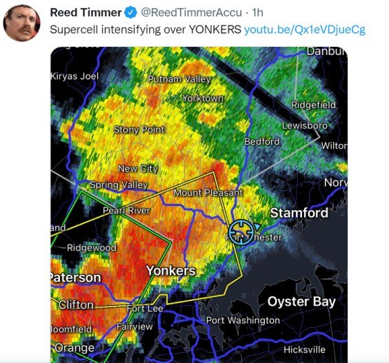
when Reed Timmer tweets about your area.
-
legitimately 101 degrees to 105 degrees in and near Loveland (July 9) Boulder and Fort Collins-CSU stations had a high of 99, both are records Today (July 10) is already 90 at Cheyenne and 98 at Denver, DIA.
-
Texas/Oklahoma Discussion & Obs Thread 2022
Chinook replied to It's Always Sunny's topic in Central/Western States
heat index of 116 at Shreveport with 104/73, and 117 at Texarkana with 107/70, Camden Arkansas, heat index of 126 with 99/82 -
edit: Fort Collins-CSU has broken their record of 97 degrees. Boulder most likely broke their record of 99 degrees.
-
2022 Short/Medium Range Severe Weather Discussion
Chinook replied to Chicago Storm's topic in Lakes/Ohio Valley
this is 21 miles NE of Cincinnati downtown more spread-out debris signature a few minutes later -
Woodstock Illinois
-
2022 Short/Medium Range Severe Weather Discussion
Chinook replied to Chicago Storm's topic in Lakes/Ohio Valley
Mitchell SD had max wind gust 65 kt (74.7 mph) possible tornado at Salem SD

