Chinook
-
Posts
10,674 -
Joined
-
Last visited
Content Type
Profiles
Blogs
Forums
American Weather
Media Demo
Store
Gallery
Everything posted by Chinook
-
ConvectiveChronicles did a 17min video on the surprise NC tornado
-

2023 Short/Medium Range Severe Weather Discussion
Chinook replied to Chicago Storm's topic in Lakes/Ohio Valley
Things could get stormy tomorrow. Today's 12km NAM had 3900 J/kg of CAPE in NW Ohio. The models seem to vary on the 0-6km shear of 30kt up to 45 kt (the 18z NAM), which is quite good for summer, but storm relative helicity should not be remarkable. 12km NAM has up to 73 dew points in Indiana..thumb.png.df63eb7c209fa9492405088894db7a9b.png)

-
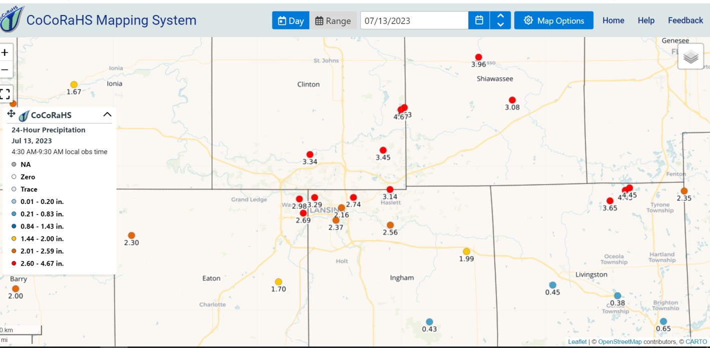
The CoCoRAHS station nearest me had 5.16" from June 20-July 19. It had 1.34" from May 21-June 20.
-
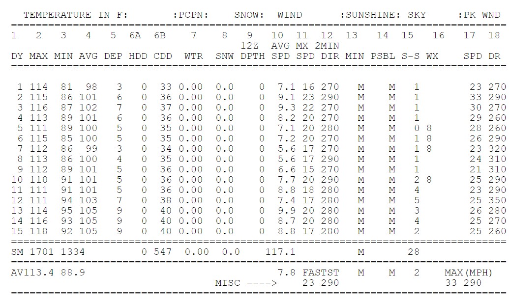
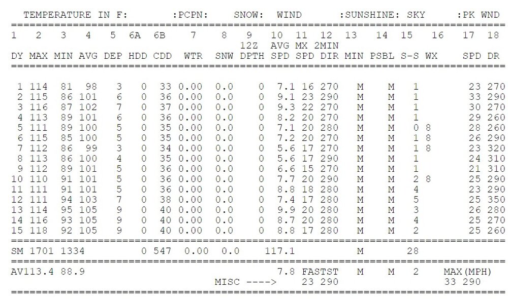
Now it was 128 at Death Valley CA climate station on the 16th. That's just some incredible heat. I wonder how many people drive there and realize their air conditioning can't keep up and have it 85-90 in the car.
-
compare to mars

-
This is a stretch of 110's that I seriously would not want to happen to me. Do you want to know something else that's crazy? If this month's Phoenix temperature of 101.2 was compared to Phoenix 1951-1980 data, it would be 8.9 degrees F above normal. Phoenix (Sky Harbor) Late June Phoenix (Sky Harbor) July
-
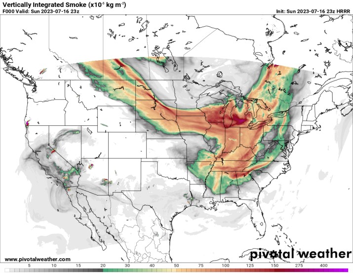
This is a swath of smokiness that rivals some of the ones from earlier this summer.
-
My place has had some late night warm-frontish showers last night at 10:30. Starting this morning, there was steady rain, some of which was moderate. That has mainly stopped. There still hasn't been lightning in these two days. It's just incredible, there's been like 2 days of lightning this summer. I guess Thor went elsewhere.
-
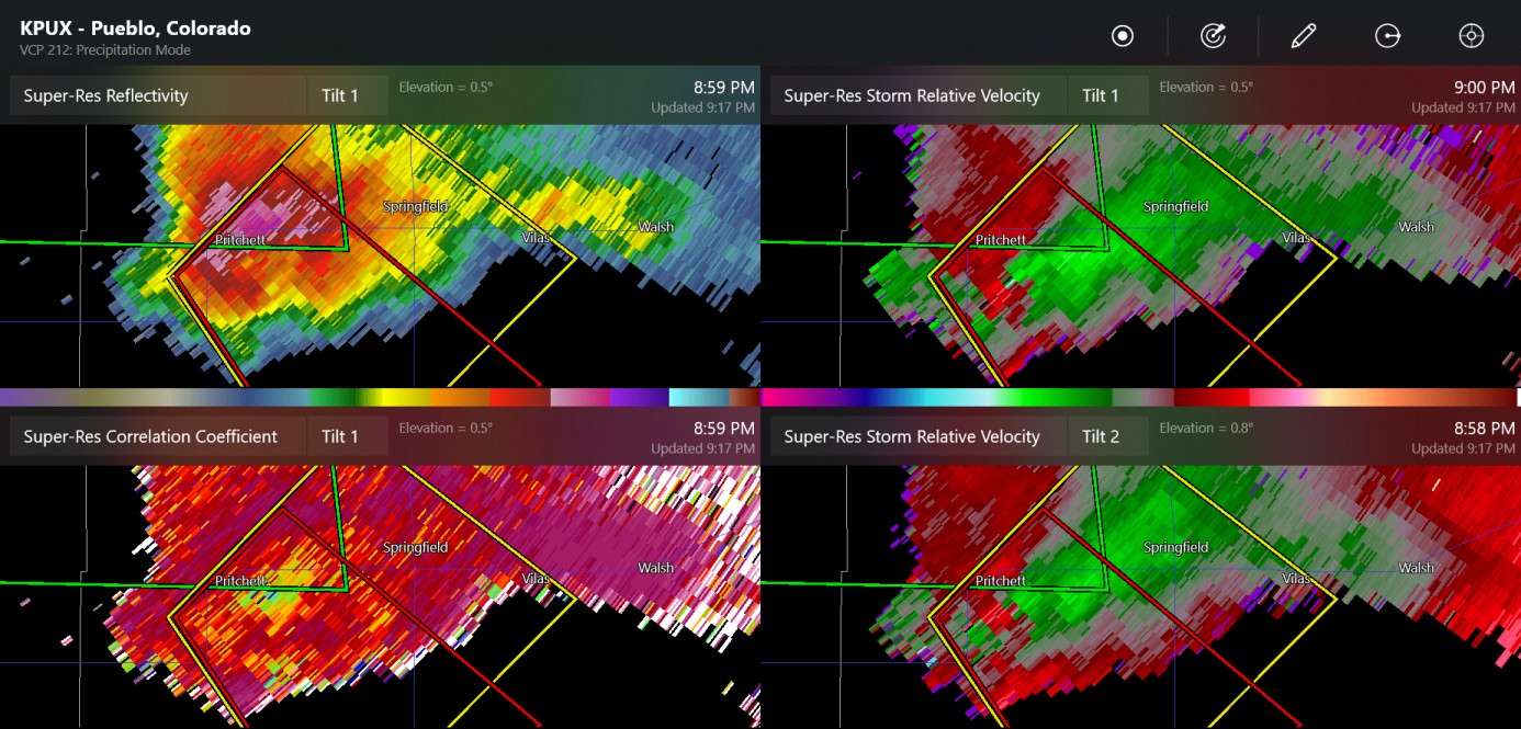
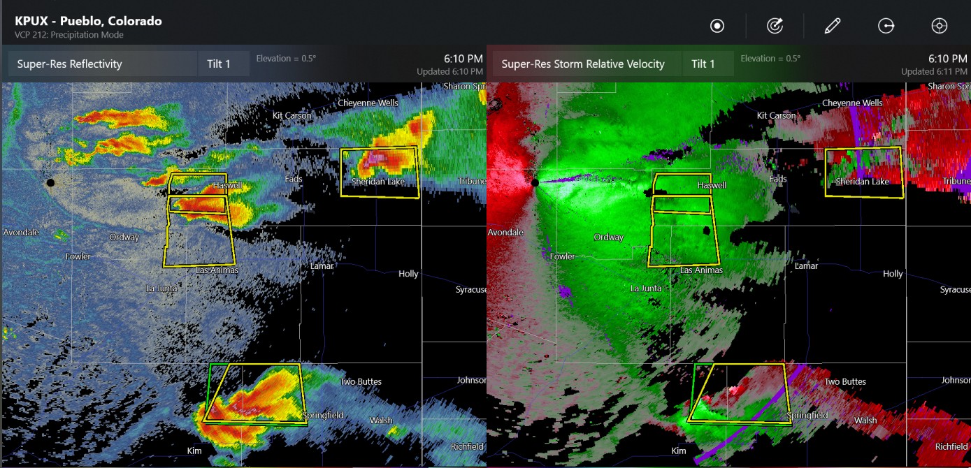
possible tornado way down southeast close to Springfield CO

-
2023 Short/Medium Range Severe Weather Discussion
Chinook replied to Chicago Storm's topic in Lakes/Ohio Valley
Here is the southern Michigan EF-1 tornado damage assessment. this isn't too far from where my Mom's home town is.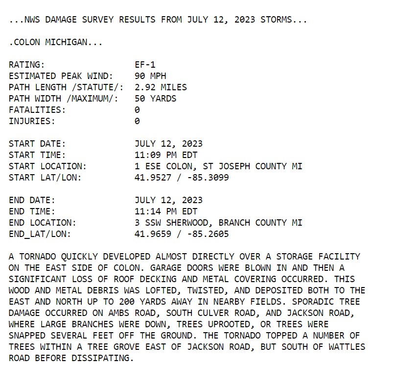
-
Mid-Michigan went from drought to 2-4" of rain yesterday, with, of course, more before that.

-
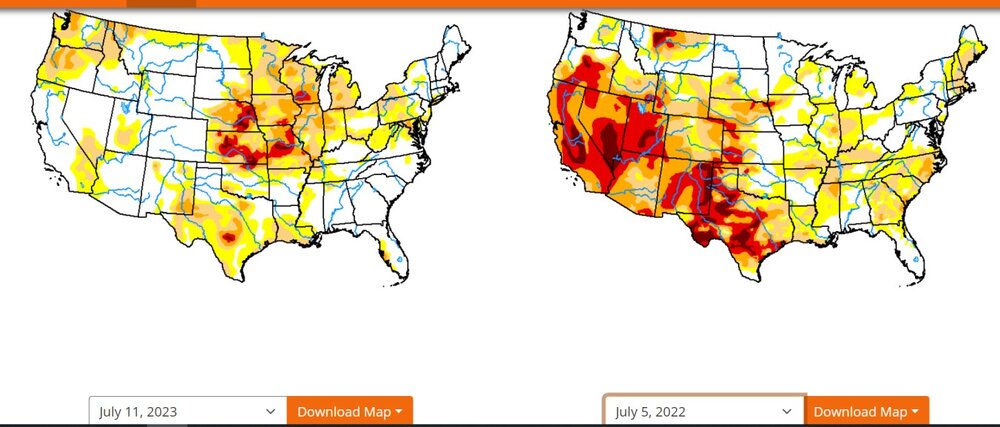
In the past 365 days since I've been gone, you guys scooped up all the drought in the West and mooshed it over to Missouri, Kansas, Iowa, Nebraska, Wisconsin
-
highly sheared cells
-
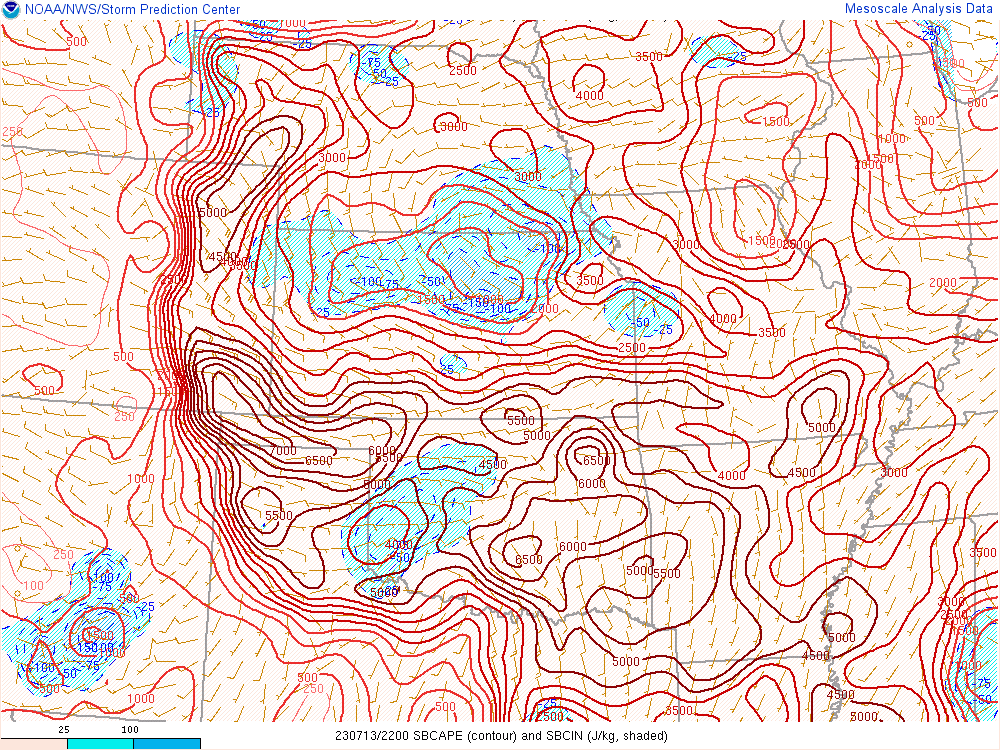
I've never seen 7000 J/kg CAPE so far west, that is, in Colorado right now.
-
2023 Short/Medium Range Severe Weather Discussion
Chinook replied to Chicago Storm's topic in Lakes/Ohio Valley
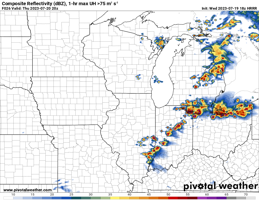
prelim tornado reports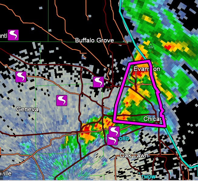
-
2023 Short/Medium Range Severe Weather Discussion
Chinook replied to Chicago Storm's topic in Lakes/Ohio Valley
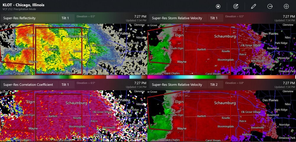
Huntley/Lake In The Hills and Elgin/South Elgin had preliminary tornado reports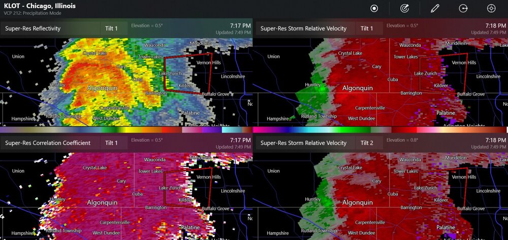
-
2023 Short/Medium Range Severe Weather Discussion
Chinook replied to Chicago Storm's topic in Lakes/Ohio Valley
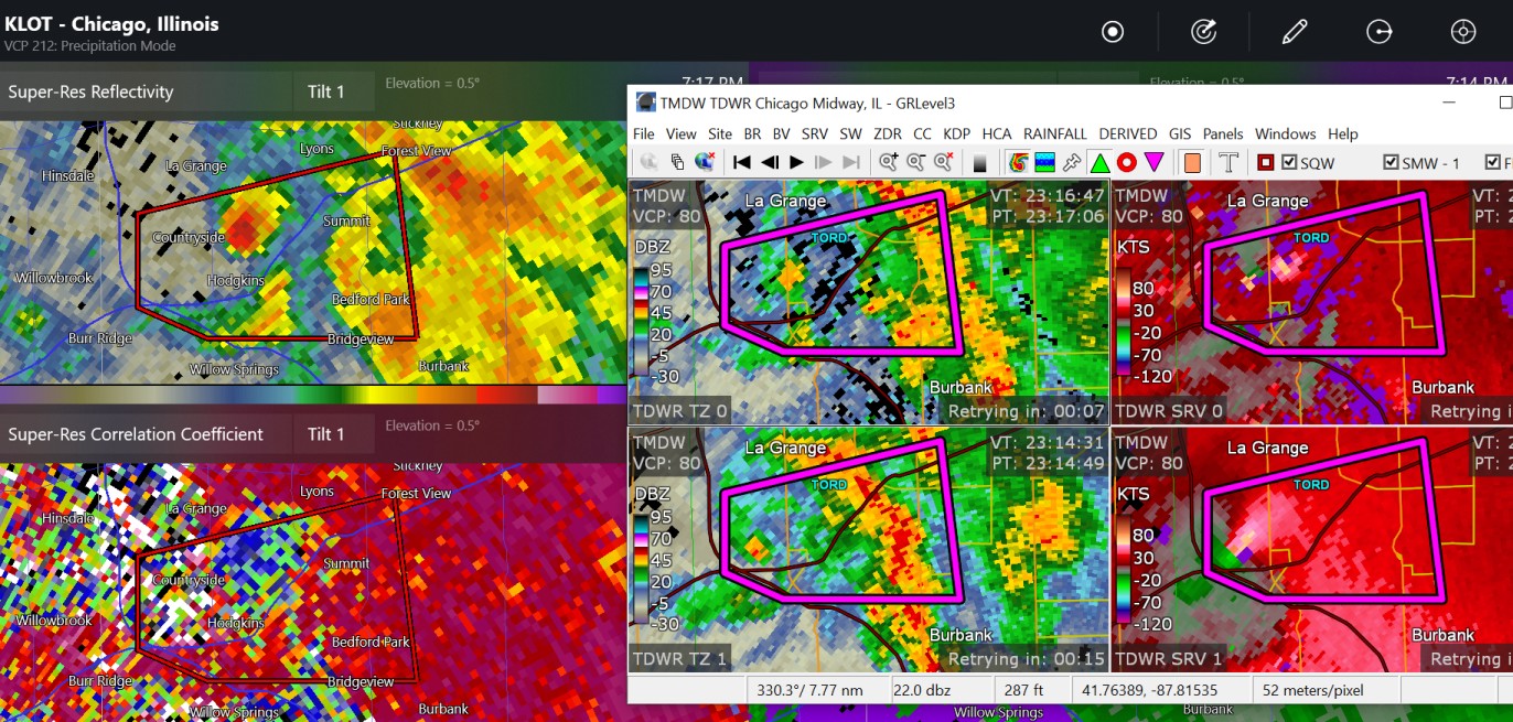
This is a confirmed tornado by Hodgkins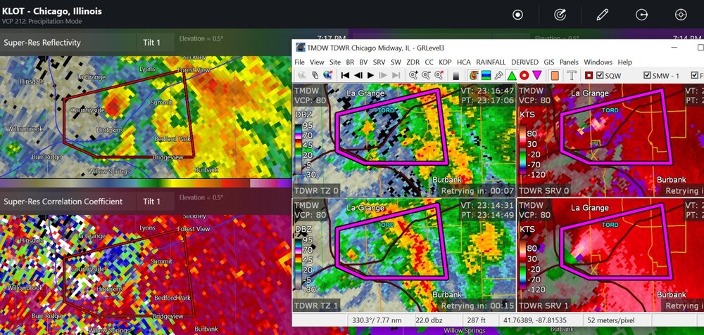
-
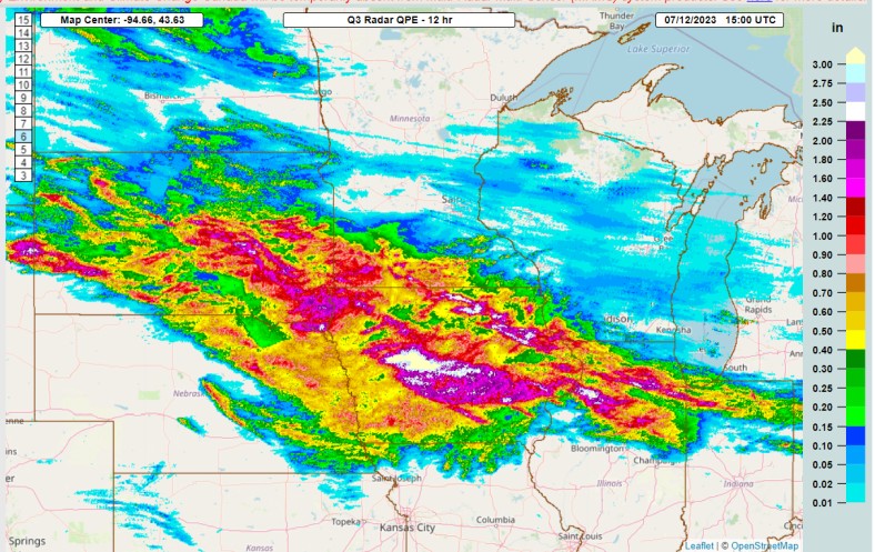
This 12-hour precipitation estimation shows the impact of the overnight MCS, starting in South Dakota and now in Iowa. There were severe wind reports in northeast Nebraska and around Sioux Falls, South Dakota. The big MCS right now appears to have been from two merged MCSs that were kind of separate at 12:50z. Otherwise, there were numerous areas of rain in IL, IN, and OH.
-
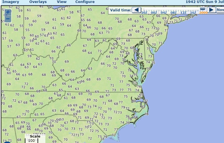
and, I might add, uncomfortable dew points along the coast, 77 dew point at Farmingdale NJ
-
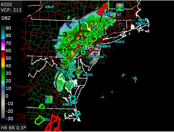
radar at 3:34 shows the flash floods are scattered from northern New Hampshire (not shown on map) to Raleigh-Durham with perhaps multiple dangerous situations in NY/PA
-
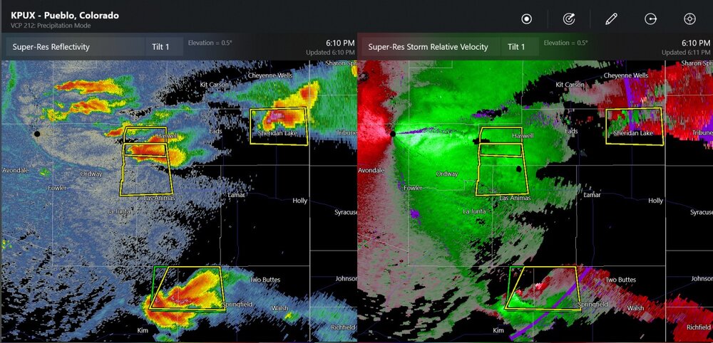
it makes you wonder about the human impact. The storm tracked through Karval (almost), Haswell, Wiley and Lamar. I wonder who was outside their homes or walking outside at 8PM-10PM in those places. Or, what livestock might have gotten injured.
-
The big storms of the night are probably getting going right now around Hugo, Colorado. Effective wind shear is pretty nuts right now.
-
Welcome to tropical Colorado!
-
The Wyoming weather indicator is just a standard chain, hanging downward, located at NWS Cheyenne. If chain is at 45 degree angle: Wyoming breeze. If chain is at 90 degrees to the vertical: Wyoming hurricane! If chain is white: snow.
-
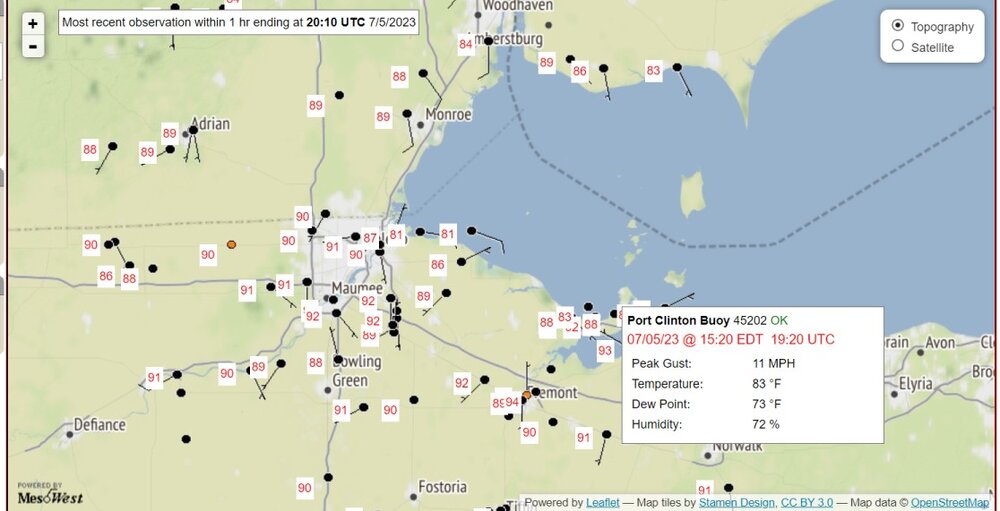
As some have said (ALEK?) Cooler by the lake! With a dew point of 73 over the water


.png.5eb3e539d50b9e233eacccf1a697b9d0.png)