Chinook
-
Posts
10,674 -
Joined
-
Last visited
Content Type
Profiles
Blogs
Forums
American Weather
Media Demo
Store
Gallery
Everything posted by Chinook
-
Here are my loops of the big storm system. The radar loop is for the snow in Denver. I knew this would be a big storm for Denver, so I started archiving maps. Then, a tornado almost hit my area! https://great-lakes-salsite.web.app/Mar_13_15_2024_radar_loop.html https://great-lakes-salsite.web.app/Mar_13_16_2024_surface_loop.html https://great-lakes-salsite.web.app/Mar_13_16_2024_satellite_loop.html https://great-lakes-salsite.web.app/Mar_13_16_2024_GFS_sfc_loop.html https://great-lakes-salsite.web.app/Mar_13_16_2024_500mb_loop.html
-

2024 Short/Medium Range Severe Weather Discussion
Chinook replied to Chicago Storm's topic in Lakes/Ohio Valley
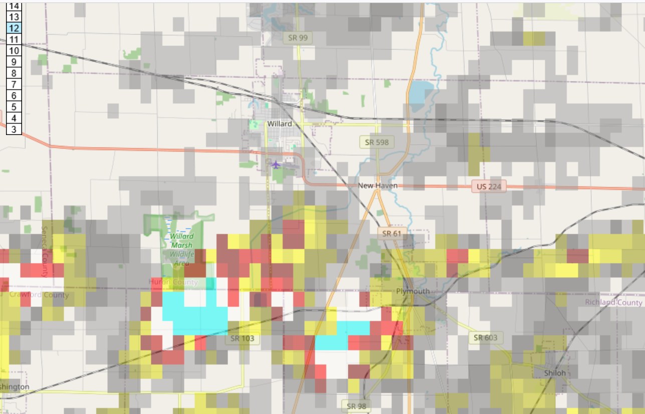
Maximum rotation at Willard/Plymouth/Plymouth Township lines up with the report that the EF-2 tornado was at Plymouth Township (Richland County/Crawford County)
-
2024 Short/Medium Range Severe Weather Discussion
Chinook replied to Chicago Storm's topic in Lakes/Ohio Valley
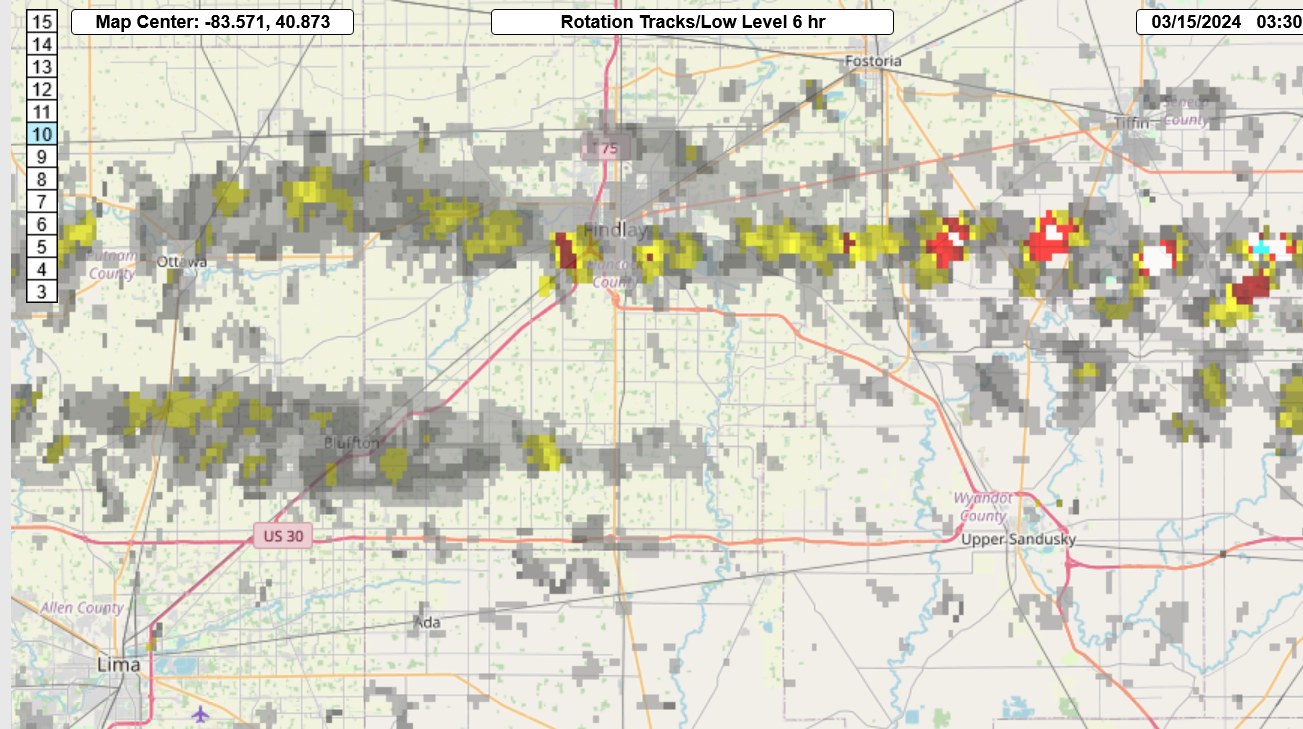
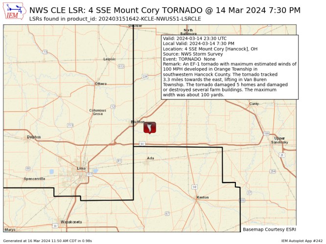
so the Hancock County tornado was southeast of Bluffton, rather than right next to Findlay or possibly towards Vanlue?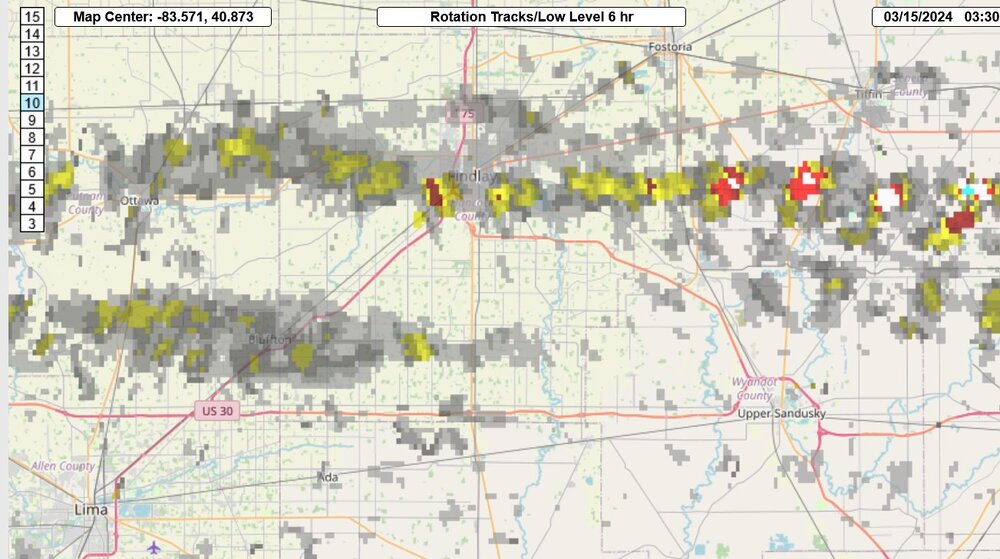
-
2024 Short/Medium Range Severe Weather Discussion
Chinook replied to Chicago Storm's topic in Lakes/Ohio Valley
My brother in law knows someone who was looking for survivors at Indian Lake. I got to see a few firsthand pictures of metal wrapped around trees and such. -
Mountain West Discussion- cool season '23-24
Chinook replied to mayjawintastawm's topic in Central/Western States
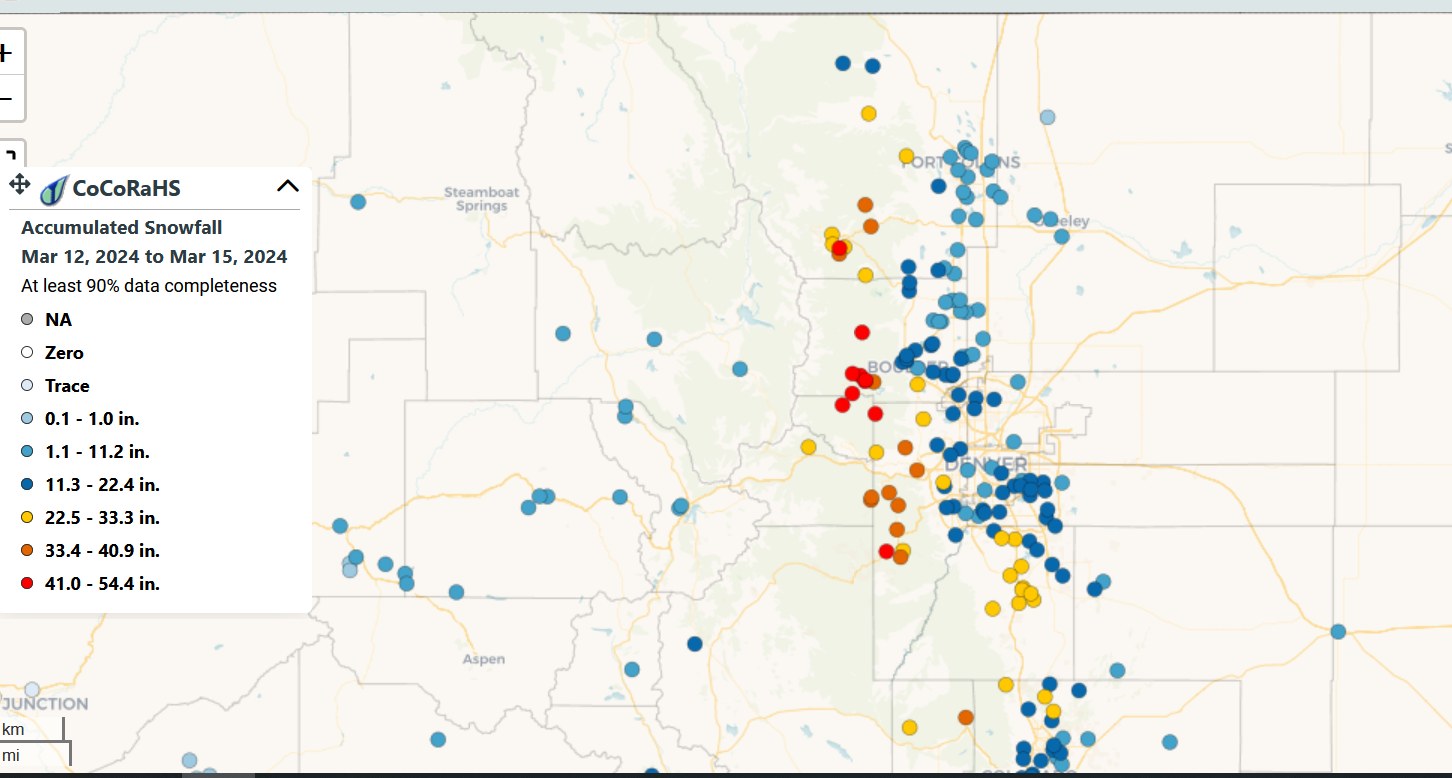
oh by the way, 41" is red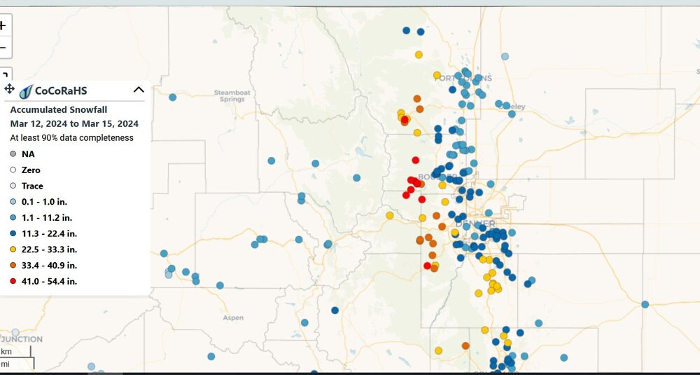
-
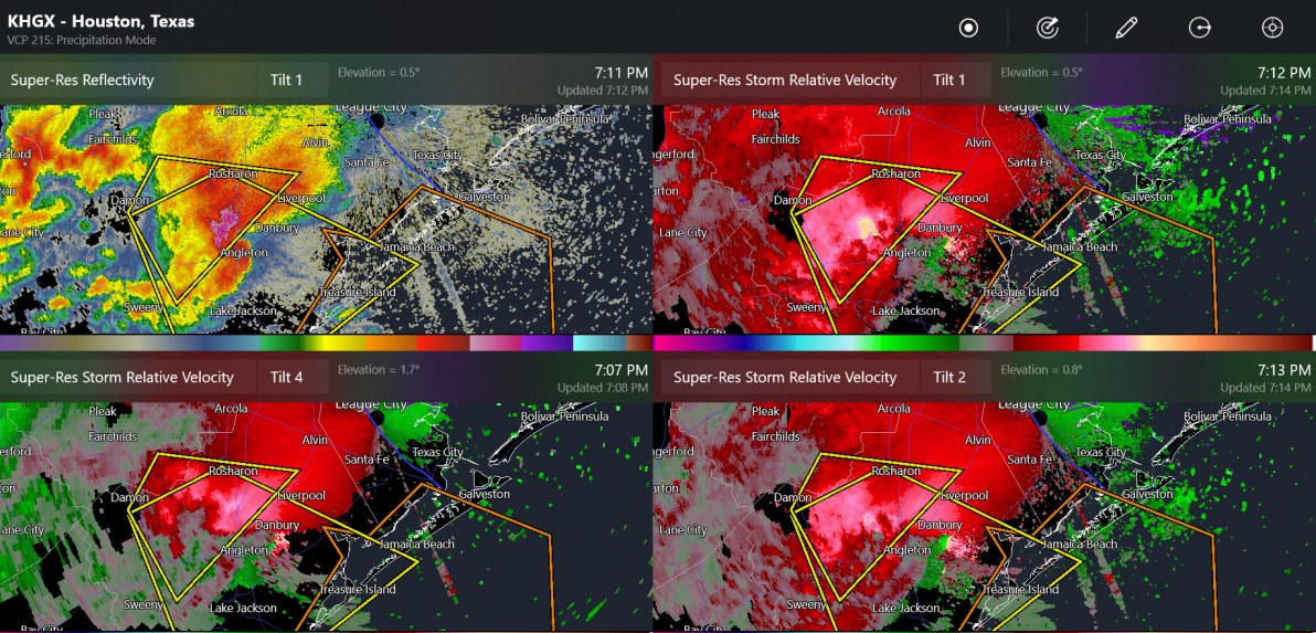
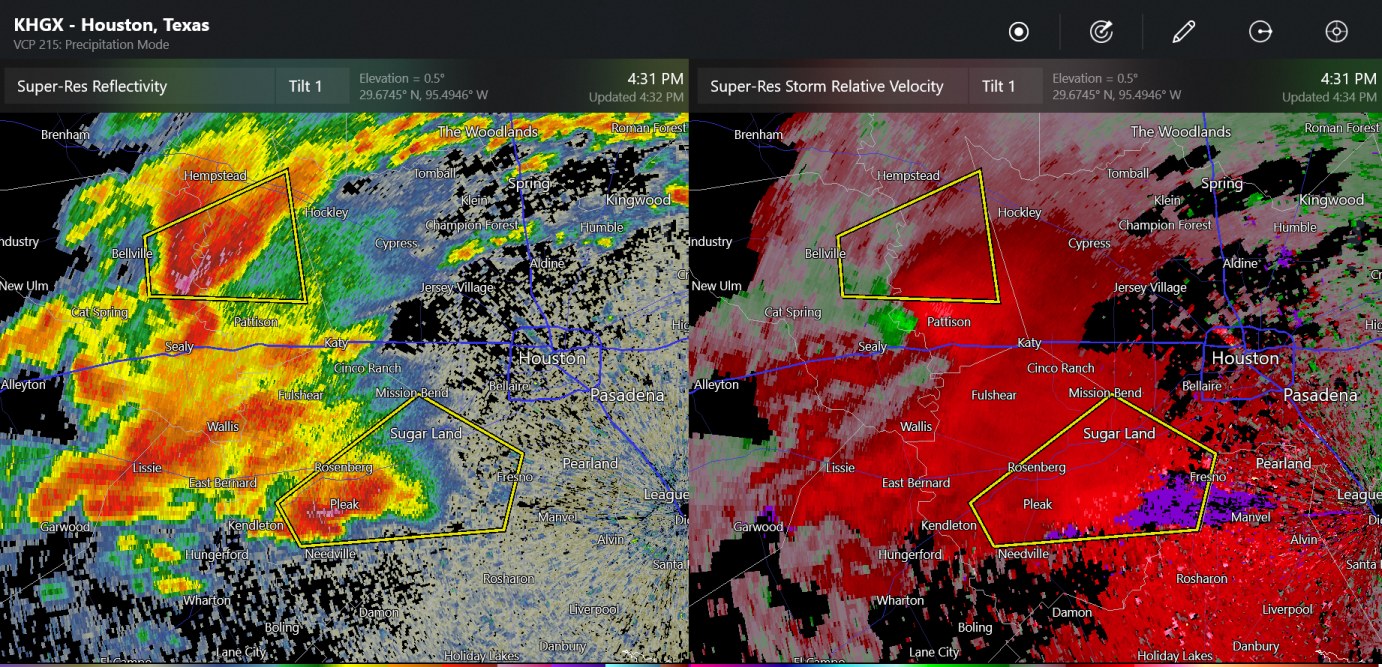
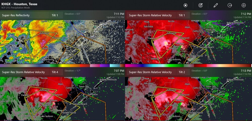
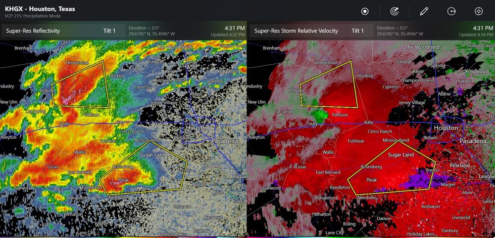
large high-precipitation, southwest of Houston
-
one significant wind report from the Houston area with, once again, a possibility of 1" to 3" hail
-
Mountain West Discussion- cool season '23-24
Chinook replied to mayjawintastawm's topic in Central/Western States
I made this radar loop for you guys https://great-lakes-salsite.web.app/Mar_13_15_2024_radar_loop.html -
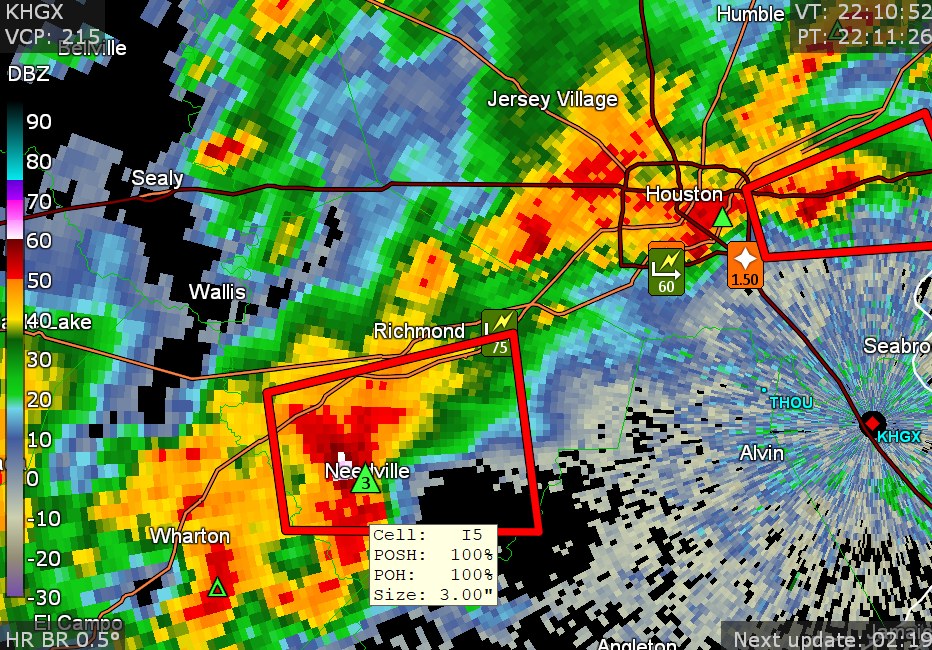
One of these storms may have maxed out with 2" hail west of Houston. Not sure if they can generate a tornado threat.
-
2024 Short/Medium Range Severe Weather Discussion
Chinook replied to Chicago Storm's topic in Lakes/Ohio Valley
This was close to my family member. I will eventually get some sort of update from the locals...
-
2024 Short/Medium Range Severe Weather Discussion
Chinook replied to Chicago Storm's topic in Lakes/Ohio Valley
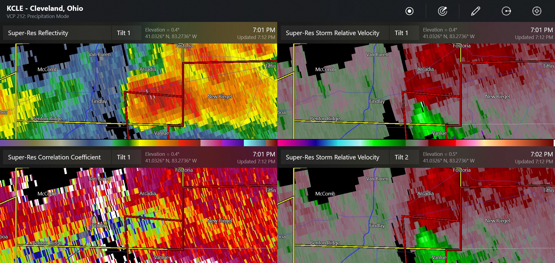
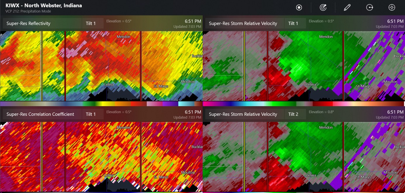
east of Celina OH now -
2024 Short/Medium Range Severe Weather Discussion
Chinook replied to Chicago Storm's topic in Lakes/Ohio Valley
this was a tornado W of Celina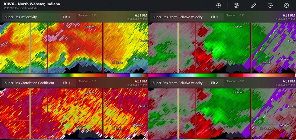
-
2024 Short/Medium Range Severe Weather Discussion
Chinook replied to Chicago Storm's topic in Lakes/Ohio Valley
One of my family members had to go to the basement. -
Toledo got 1.57" today with frequent lightning at times. I think I saw some small hail, but it didn't cover the ground much.
-
Mountain West Discussion- cool season '23-24
Chinook replied to mayjawintastawm's topic in Central/Western States
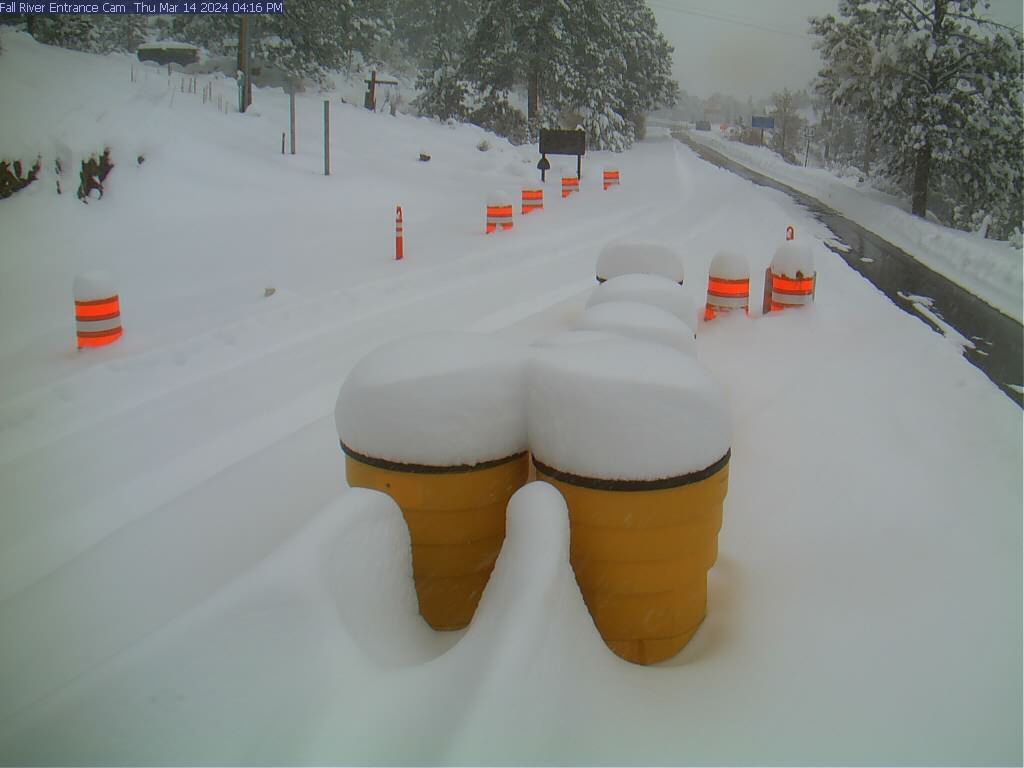
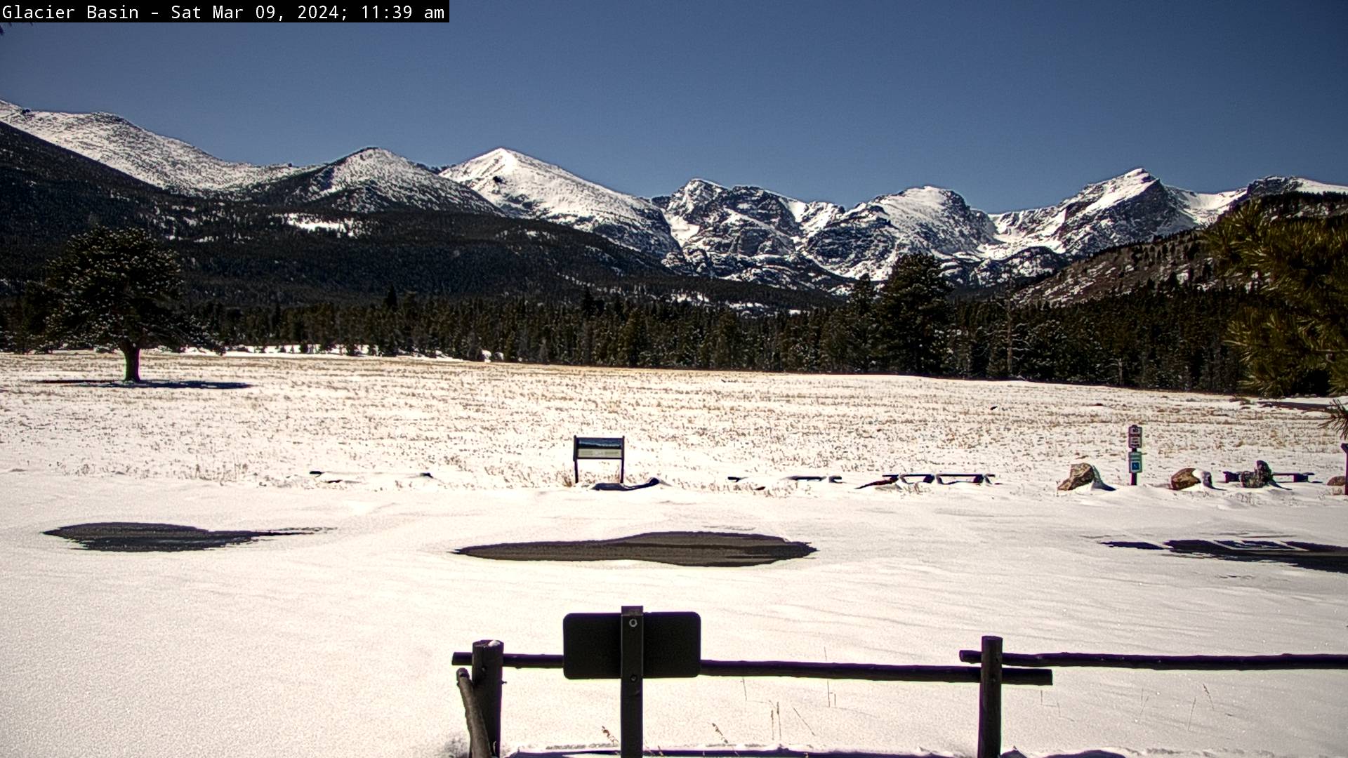
this webcam usually has no snow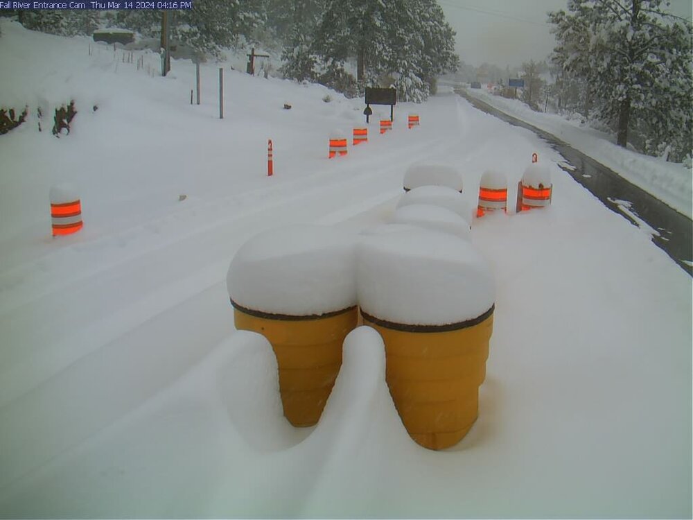
-
2024 Short/Medium Range Severe Weather Discussion
Chinook replied to Chicago Storm's topic in Lakes/Ohio Valley
tornado warning 2 counties south of Fort Wayne. Most indicators say 2"-3" hail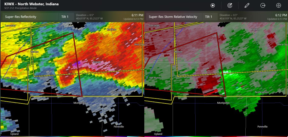
-
2024 Short/Medium Range Severe Weather Discussion
Chinook replied to Chicago Storm's topic in Lakes/Ohio Valley
I would have thought there would be a bit more discussion of tornado warnings near STL. Otherwise, one tornado warning south of Fort Wayne right now.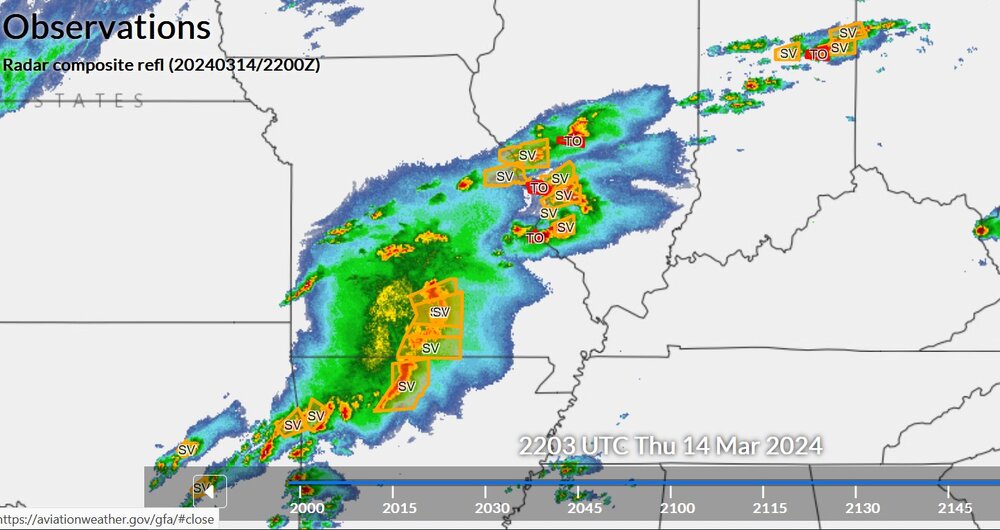
-
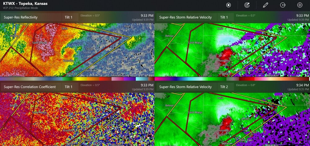
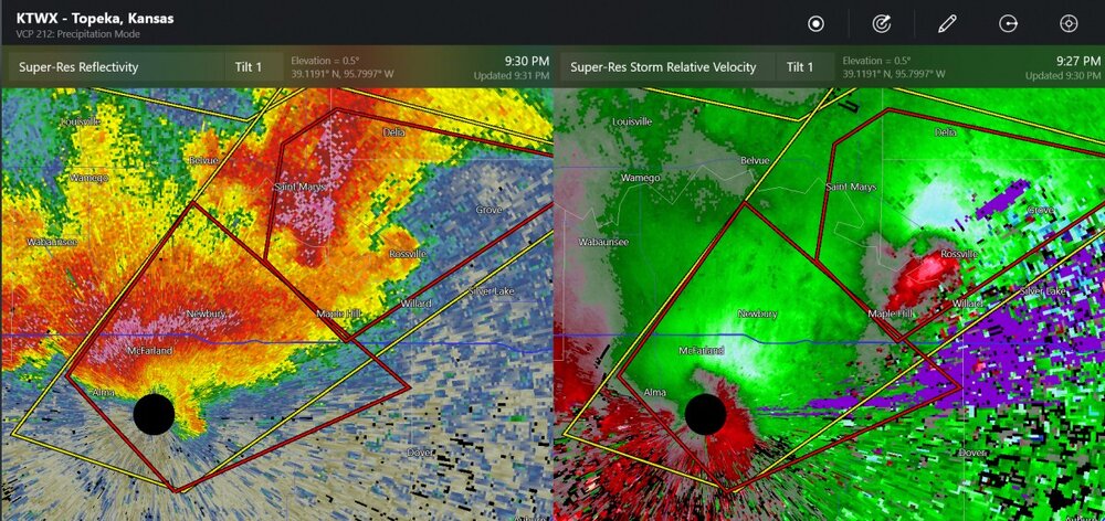
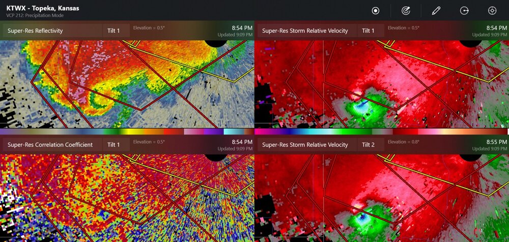
new confirmed tornado at Hoyt
-
this was a tornado by a spotter report
-
a couple of possible tornadoes now
-
I think this was the highest of the measured wind speeds
-
A few storms developing near Topeka's radar look like they could get going into supercell mode.
-
Mountain West Discussion- cool season '23-24
Chinook replied to mayjawintastawm's topic in Central/Western States
current NWS map
-
Mountain West Discussion- cool season '23-24
Chinook replied to mayjawintastawm's topic in Central/Western States
The NWS has 1" to 1.5" QPF for most of the area, and currently the temperatures at 5000 ft could be 32-40 degrees as it is snowing, or raining, and 32-34 degrees late at night on Thursday morning. Certainly some version of a winter storm watch will be incoming. -
Mountain West Discussion- cool season '23-24
Chinook replied to mayjawintastawm's topic in Central/Western States
I wonder how much snow is just under the trees, just beyond the meadow.