ROOSTA
-
Posts
3,146 -
Joined
-
Last visited
Content Type
Profiles
Blogs
Forums
American Weather
Media Demo
Store
Gallery
Everything posted by ROOSTA
-
OT I didn't know where to post this. Many people here are under-educated in this field of science. A new year, this URL is for those who would like to learn. I hope this helps some. Glossary of Meteorology
-
 The year I moved down here I missed the greatest stretch of SNE snowfall ever. I was so emotionally drained didn't even track any of it. ---- I would not give up on this yet. Only hope for a white xmas.
 -
AGREE! I got to move...LOL
-
It's always the next run or the other model. The "fix" is never satisfied. It all a tease. Could get a 3-footer and still looking for the next.... If you want to OD move to AK or the Canadian Rockies.
-
No complaints here. I get NOTHING Now let's get this to carve out a hole in the atmosphere, let's say at about 40/70. LOL
-
Sure would like to see the OP models come around and show it. Give a day or two then maybe get excited. Slowly evolving into a coastal but not close to the ensembles YET. A great LR observation and analysis! It gonna snow... maybe.
-
December 2024 - Best look to an early December pattern in many a year!
ROOSTA replied to FXWX's topic in New England
CC should be on a timescale much greater than the mesoscale seasonal effect of IMBY. The snap to warmer, wetter, stronger, never seen severity without question is occurring. The balance or unbalancing is precariously close to that scale tipping. I have no idea of what I'm talking about... all I know is it's happening in realtime. Honest! -
Just a little windy. I have a good feeling this snow season is going to be prolific. Pattern looks good i.e. locking in teleconnections in the N. Hemisphere. Best look in a long longtime.
-
Wild times ahead. Be safe y'all. 50/50 for a White Christmas.
-
SNE GTG Banter Thread: Funky Murphy's 1pm 12/14
ROOSTA replied to 40/70 Benchmark's topic in New England
When I first suggested Clarke's in Boston, must be over 15-20 years now. It was for members who worked in town, a spontaneous last-minute gathering to finally meet and celebrate the season. I know if I were still in New England the tradition would continue. My last outing before moving to Florida was a Clarke's gathering. The chasing Noel down the Cape...oh the memories. -
December 2024 - Best look to an early December pattern in many a year!
ROOSTA replied to FXWX's topic in New England
The never-ending search for the next big one has commenced. A sniff here and sniff there. It stinks so far. Somebody with a good sense of smell needs to chime in! -
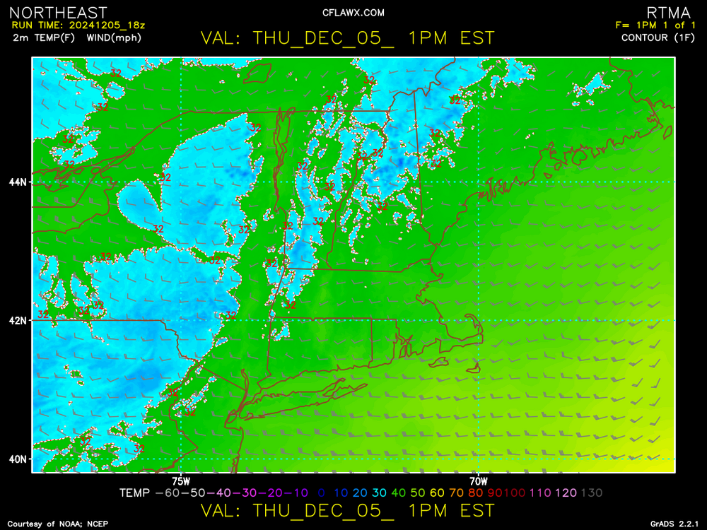
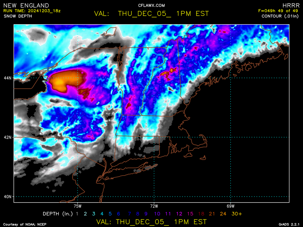
For early December having this event hopefully portends good things to follow. Latest RTMA for SNE.
-
You all are going to know when the front approaches and passes. Mucho instability involved. Wish I was there for it. Some areas will experience 10 minutes or so of whiteout conditions. After passing the winds... Oh, boy fun times.
-
An overachiever. Last minute flags come true for once. I'm happy for all. Windex event sweeping across NY. Hopefully a sign henceforth...
-
I'm thinking maps should go into a separate thread. No two maps are the same. As much as I like posting them anything less than 6" IS Bull Crap. I'll wait till it's worthy of note as in over a foot. ***That's what she said***
-
This looks about right.
-
John, aka Tip I want to state something in that most posters in here don't have a clue, re: Scientific explanations nor take the time to learn. It's always going to be inexact; no forecast or reasoning will be correct. I'm grateful for your logical explanations teaching this old dog on every post. Numerous posters like yourself are appreciated (we know which posters to believe and which to totally ignore) To many good posters have left the forum please don't even think about it.
-
I was hoping to see a modeled Blizzard. D10 or closer. Not so much for New England but anywhere in the CONUS. Clippers just don't seem to cut it. I've always wanted to see some flurries IMBY, maybe this year...hoping anyway!
-
Seems as though elevation will be a major player as in most early/late season events. Soundings are critical if one wants to know what type and how much in YBY.
-
Just so you know, any snow is good snow. First flakes are magical. Now hoping trillions fall upon y'all.
-
December 2024 - Best look to an early December pattern in many a year!
ROOSTA replied to FXWX's topic in New England
For the month? YES Numerous (4 or more) threats will be tracked. Oh, grasshopper just look at the pattern through the trees. -
December 2024 - Best look to an early December pattern in many a year!
ROOSTA replied to FXWX's topic in New England
Potential threats are numerous. Pattern looks good for early snows. Of course, the usual timing, phasing. moisture, air mass and track come into play. Also, any other variable one can think of. -
Blowvember - and not named for wind potential
ROOSTA replied to Go Kart Mozart's topic in New England
A post from my FB presence When trying to "sniff" out storms it's very difficult getting the timing correct. First thing to consider is the larger picture. Hemispheric and Continental patterns must align in general to create conditions that are conducive for just the formation of a storm. I might have jump on this threat to early. Models are not in agreement for a widespread snowstorm. That is a red flag of caution, usually resulting in no storm. The threat is still present but down to (1) Pattern recognition is crucial. This threat seems to be slipping away. Still must watch very closely if things change! Even when conditions are perfect, everything is in agreement the devil in the details on a meso-scale must be considered bringing all the variables into play. Extremely difficult to forecast! -
Blowvember - and not named for wind potential
ROOSTA replied to Go Kart Mozart's topic in New England
Looking very winter-esque. Potential for a few events over the next 2 weeks. Something to track and scrutinize is better than nothing. One at a time, awaiting the thread... AND SO, IT BEGINS -
Without question. Time to get the sharpener out for the upcoming Winter Season threats. Oh, FYI the flooding from Helene and Milton are still ongoing. Move and stop building in low-level areas. People will never learn but rather blame the government officials.