ROOSTA
-
Posts
3,146 -
Joined
-
Last visited
Content Type
Profiles
Blogs
Forums
American Weather
Media Demo
Store
Gallery
Everything posted by ROOSTA
-
"Time has come today." The Chamber Brothers
-
Speaking of waking up. First give thanks to seeing another day. Afib, and clots whatever. What no 10-15 pages of back-patting and congrats. A whiff? I can see why the consternation and lack of posts. It's going to change, on to the 12z. OR Live vicariously through the Mid-West Blizzard. Somewhere, somebody is getting some...LOL
-
My initial post was based on 18z GFS. / It was questioned, thus my reason for posting. Nothing more nothing less. Of course, it's wrong and so will every run up to go time. (no ill-will intended) We'll just hope for something similar.
-
The 00z run will still be there in the morning. I like running my own grib data. Watching football... Can always tell something up. Go away from the forum check back in, 20 pages later, JUST KNOW...
-
In the slot (tucked) Like I stated 4-6" would be generous per 18z OP Disagree to a raging E wind, can only imagine ML temps? Not imagining '78 walking through the door.
-
I'm still rooting for the 13th as originally thought a few days back.
-
As modeled now 18z would have precipitation type issues. Inside 495 down to C Ct. it would be a bummer. Instead of a 2' they'd only be looking at maybe 4-6" BRUTAL.
-
POSTING SNOW MAPS is a curse. I swear... Reverse the curse. No more maps for the love of God, no more unless it's Day After Stuff.
-
Guess it's good to be tracking something, anything even if it's approx. D10 threat.
-
I would be totally shocked if the Northeast corridor were to be "shoutout" during the next two week stretch. All this potential with all the moving pieces. Timing and placement are obviously not resolved. With all this negativity might be time to take a break.
-
Fireworks and GUNS going off. It be dangerous out there..., I'll never understand why people fire guns off on NYE. One can buy an AR at 18yrs. old. I need to move, was thinking NC up in the hills. SOON Rollin, Rollin, Rollin for the timing, severity of this predicted monster.
-
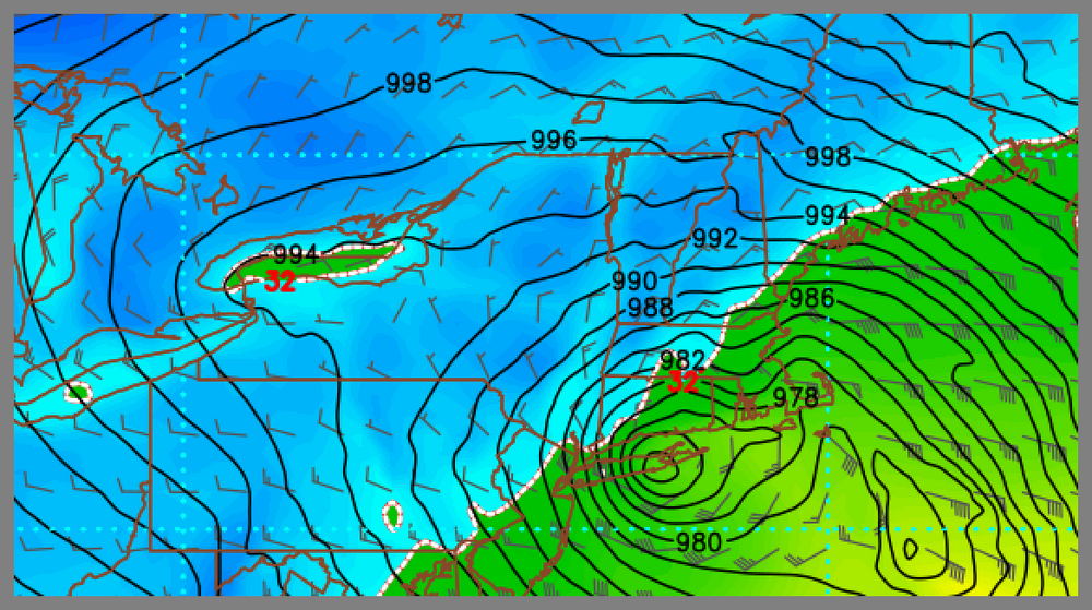
Bottoms out at 952MB just inland of PSM. Biggest 00z run this season so far HAPPY NEW YEAR. Might stay up not to ring in the new year.
-
There's the extreme event, (here this run, gone the next) To bad it's out in LA-LA land. Just shows how volatile the set-up is. Inside D5 and there would be a chance.
-
13TH. I'm just trying to get 3k posts.
-
It's really not that bad! Repeat after me... It's really not that bad! 18z will be out soon and then there's always the 00z run. So on and so forth...
-
The question of emotional attachment? Happens every year, every month, every storm threat. Like clockwork it's always the same posters who apply IMBY. Whether it's snow, tropical and or severe. Posts are the same instead of taking it as it comes. Nobody can control it, will never be a perfect forecast. Just have fun, interact civilly. Positive or negative what you see it what you get. The science has come a long way over just a decade but will never be perfected. I still like the look, and a change here or there (every model run) gives insight to the eventual outcome.
-
Sometimes the obvious must be stated. IT'S JUST (1) MODEL RUN. So many opportunities to hang a hat on... *********** Oh, forgot the age-old... TREND IS YOUR FRIEND.
-
Seems to me the whole evolution is slowing down. Delayed but not denied. Alot of moving pieces, blinded by the OP models. Holding out, hope for the 6th with some agreement to the E and G.
-
Full Moon on the 13th. Just sayin; Timing looking about right.
-
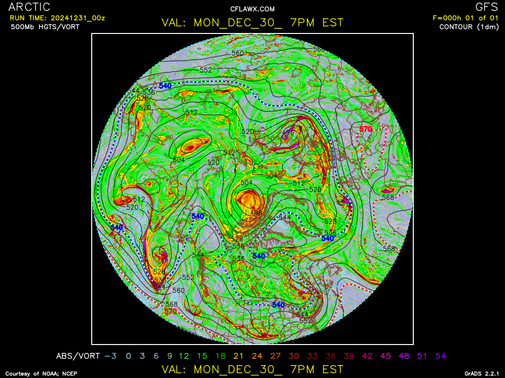
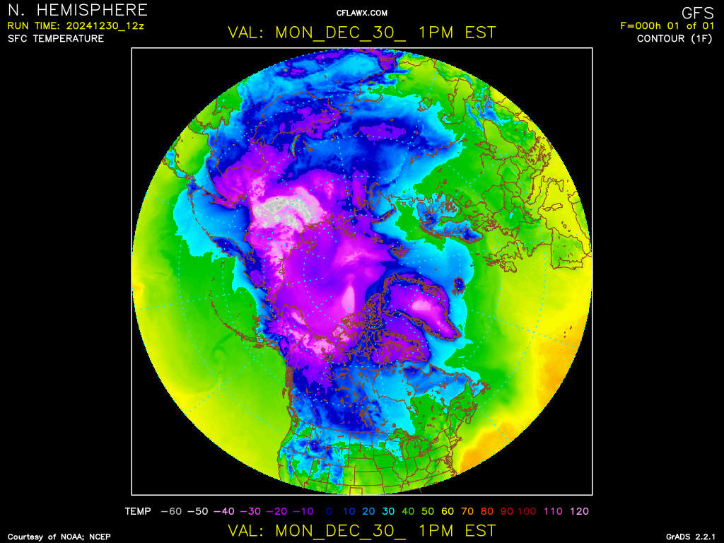
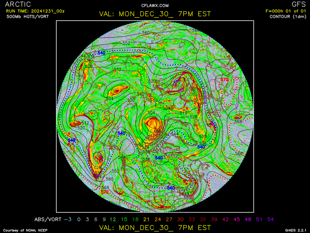
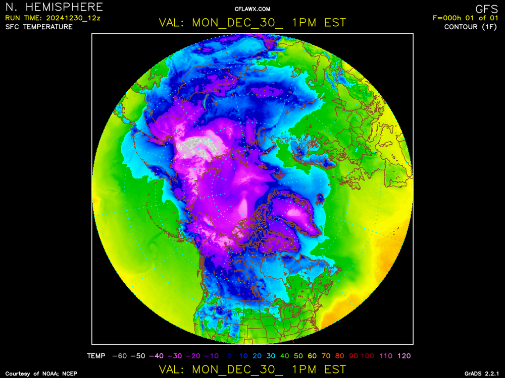
Now there is some brutal cold -75-80F. Watching very closely, should be fun to watch as it establishes itself on this side of the Pole. Nothing more needs to be said. Modified for sure... combine with 500MB HGTS and a PV.
-
Pattern sets in, let's say "dump, rinse, repeat." in a good way for once. Foresee (2) BIG storms. One around the Full Moon, the other probably bigger as the pattern breaks down. Just looks like E CONUS is on the cusp of something beautiful.
-
*Most* of New England come 3rd week of the month: "WILL BE UNDER A NICE BLANKET OF SNOW." Take that to the bank! *Ray will have 15" on the ground and think he's been screwed because Kev has 28"* I crack myself up sometimes. Of course I'm joking.
-
Please refrain from posting maps that have 0.00% chance of verifying. A D10 has 0.01%, even a D5 only has a 50/50 chance. A day after snow map is still only 99% accurate. LOL D10 Ensemble Temp is ok but be ready to explain reasoning. Wanna talk about nice weather? It's 75F with a dew of 68F. Talk abounds about the FRIGID Arctic outbreak down here.
-
Any s/w in that pseudo-omega block has the chance to develop. Late next week onward... Seatbelt time! *Based on Ensembles Mean* A good look.
-
Don't even look at the OP models. Go ensembles to keep insanity in check!