ROOSTA
-
Posts
3,146 -
Joined
-
Last visited
Content Type
Profiles
Blogs
Forums
American Weather
Media Demo
Store
Gallery
Everything posted by ROOSTA
-
DO NOT LOOK. GFS OP has formable Fernand. Well within believable range. Maybe get lucky in the tracking of having a storm on the grid till the end of October. Likely not given the phase of the MJO.
-
Flags of caution. Posts of certainty i.e.: ERIN is a landfall miss. There are no certainties, probabilities most assuredly certainly. With each update the models for the most part have been remarkably consistent. By no means am I stating a forecasted landfall. Consider the track has been South and West with a delay in intensification. The newer Hurricane Models show this. ECMWF, GFS ensembles wagons WEST. I enjoy tracking these suckers. A great diversion from life reality. Anybody ever fight with an Insurance Companies reluctance to pay on a claim? How does one get them to pay for work already performed? I ask because last Wed. A 100ft, 6ft wide trunked live oak fell and punctured 4 holes. Guilty until proven innocent. Invoice from Tree crew hired gave me a total of $8500.00 (reasonable considering the damage) The point contact stated "way over priced." The house was sold, well under contract and only 4hrs away from inspection. MOTHERTUCKERS!
-
Good Lord please. No more Westward trends! "Right when you think your out, they suck you right back in."
-
Now know the ICON is not a tropical model Ensembles are all in agreement. A swing and miss...no extra innings for this baby! NEXT
-
I'm never going to write off the threat of a tropical system especially given a week out. Watching like a hawk presently. Nice to wanting to experience a Major Hurricane, but once you do most I think most would never want to do it again. Not only protecting property and more importantly life. Erin has waffled a bit on the last few model runs. Concern is the general track W and S...weaker system? And will that overall trend continue? Many times, should say what's the elephant in the room? Until Erin tracks to the N and E of my location I won't write if off.
-
TC, here one run gone the next. In the GOM or off HAT. Consistency within a week then maybe... Personally: House (property) under contract with nowhere to go or move to.
-
I dream about the weather. Doesn't everyone? D'OH
-

July 2025 Obs/Disco ... possible historic month for heat
ROOSTA replied to Typhoon Tip's topic in New England
My max HI was 116F recorded at 11:53, then mixed out a bit. Hi temperature 101.5. Td 81.2F. Little to no relief in sight. St. Pete. did record a HI of 126F at 15:18 -
July 2025 Obs/Disco ... possible historic month for heat
ROOSTA replied to Typhoon Tip's topic in New England
Yous' guys.... Tp: 101F Td: 82F Records being broken all around down here. I'll never complain about New England heat ever again. It's a relative, sure would like to be atop the rockpile right about now. * Two weeks give or take a day or two the Atlantic should start tropicating. Waves are becoming stronger and more frequent* -
July 2025 Obs/Disco ... possible historic month for heat
ROOSTA replied to Typhoon Tip's topic in New England
It's friggin HOT!! Constant sweat, sticking to everything. I don't mind the heat it's the dewpoint 77-82F combine that with 95-100F temps. HEAT INDEX 110-115F Just awful. -
July 2025 Obs/Disco ... possible historic month for heat
ROOSTA replied to Typhoon Tip's topic in New England
Temp 96F, Dew 82F. Real feel - Heat Index 114F. -
This comment is not political in any way shape or form. Why is the General Public losing (already paid for) access to data? NOAA and the NWS is undergoing budget cuts. SAD, so sad the day might come that the Commerce Dept. is defunded, no research and thus weakening predicting lifesaving events. WTF is going on.
-
Bogus, ERROR, Sensor malfunction, bad data reading. My Davis recorded a "blipp" on wind speed once: GUST 238mph. I have a TWI-8000 in the carport, never assembled and put in the field. In the past it is the most accurate equipment I've ever used. Two Davis because of convenience is enough
-
It will be interesting to watch the evolution of the E wind with temps plummeting* (relative) with a sharp delineation of the actual front: 90F SW side with 65F NE side. I would pay to get that round these here parts. Looking like mid-July for any hints of the Tropical Atlantic becoming active.
-
Watch out for those Ridge Riders. Now developing in upstate NY/VT.
-
When all is said and done many a record will be broken.
-
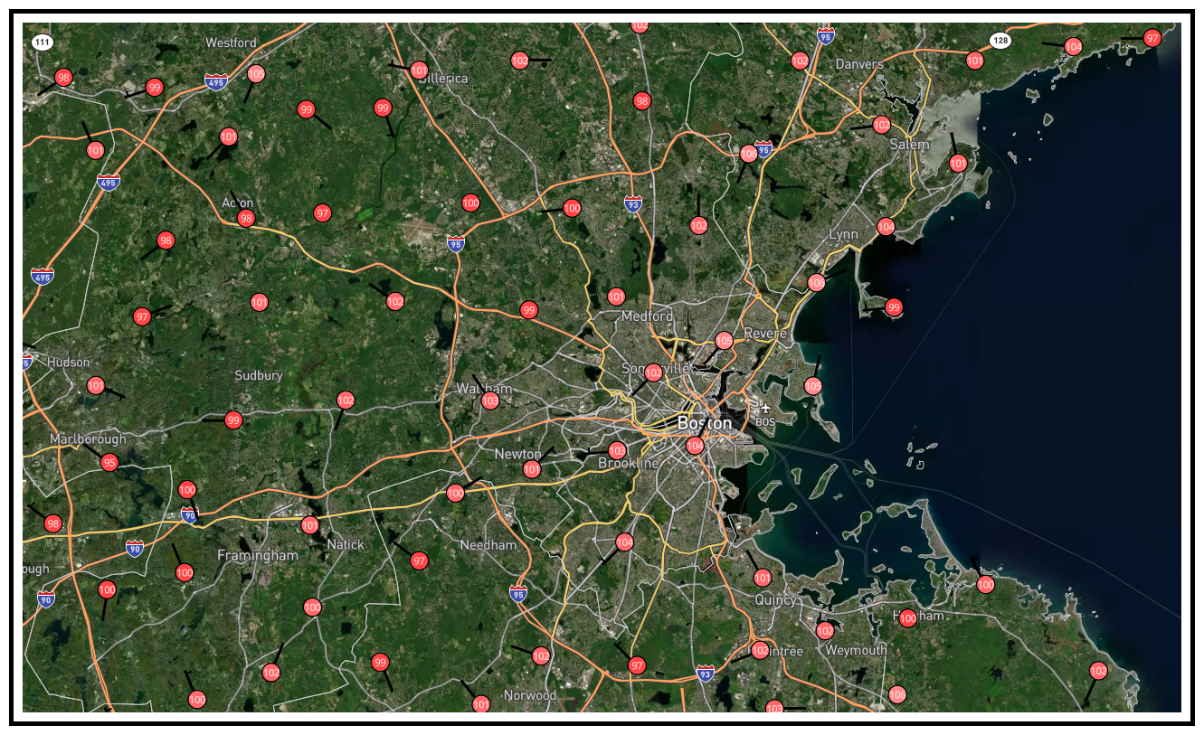
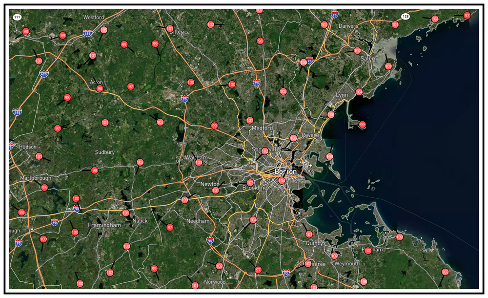
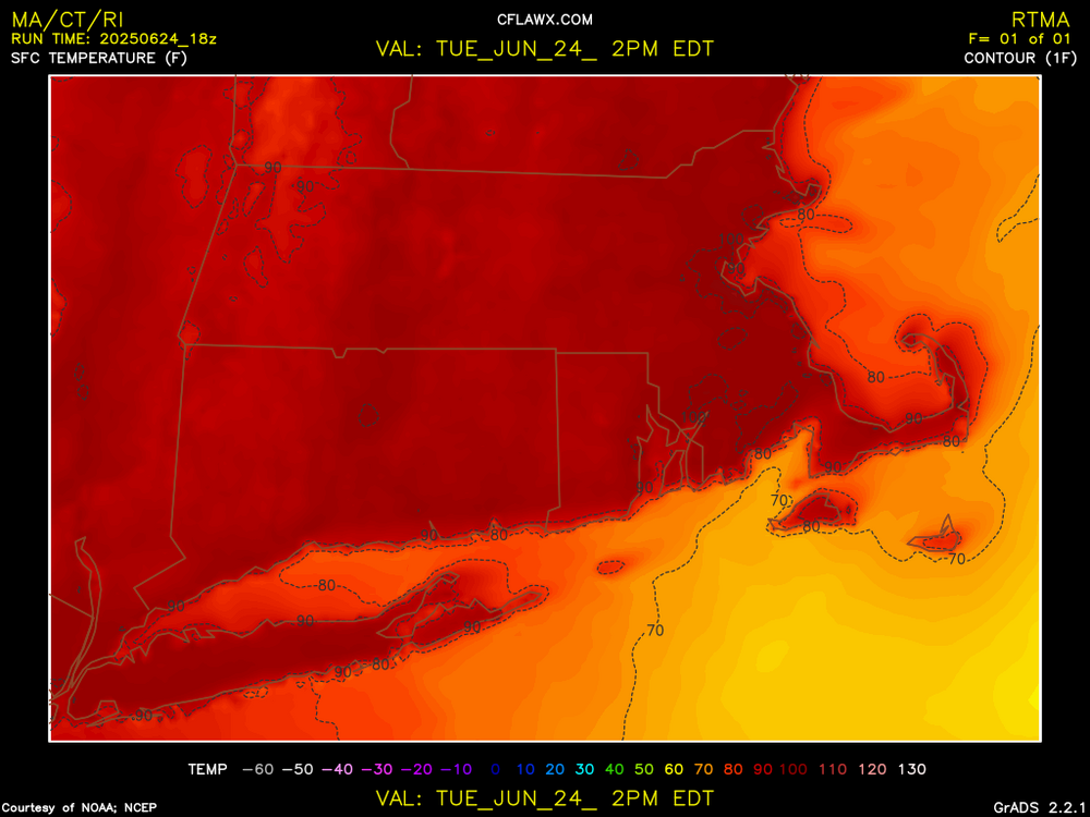
PWS in and around Metro Boston 100-105F range.
-
Live for extremes. Very impressive for June! 100F in many areas, the hottest part of the day yet to come.
-
Records are going to be "OBLIBERATED"
-
DEWS. It will be the Heat Index people will feel. The most uncomfortable, inescapable feeling is 90F+ with a dew of 75F or higher. Desert heat isn't the same because of the feel. Classic Heat Wave. "Welcome to the party pal."
-
Sorry for the delayed response, just a little too much unfolding. House goes under contract. Inspection failed, contract withdrawn. Close to foreclosure, vehicle just as close to repo... SAD but true. I'm literally going to be on the street soon. I have lost everything with no solution.
-
Actually both. About a year ago I was once again in the hospital for circulation blockage. A team of Doctor's gave me 6 months to live, so terminal and untreatable.
-
Got ya beat, I was struck in Aug. of 22. Three days in the hospital.
-
All HAIL golf-balls falling from the heavens.
-
Going to be a HAIL-OF-A-DAY.