ROOSTA
-
Posts
3,146 -
Joined
-
Last visited
Content Type
Profiles
Blogs
Forums
American Weather
Media Demo
Store
Gallery
Everything posted by ROOSTA
-
 Pattern recognition FTW Lookin through the trees you's guys, gals are far from being out of the woods i.e.: THREATS. locked and loaded...fasten your seat belts.
 -
Coastal now developing off HAT.
-
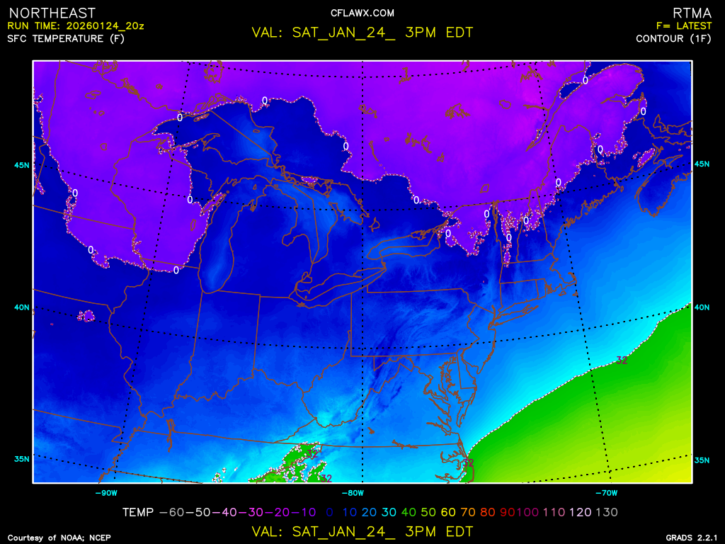
Some 40+ DBZ echoes now showing in SW CT. Latest RAP SFC TEMP tickles SEMASS with >32F slightly inland, 850's stay below freezing throughout event.
-
With all the "ICE" around. Calling out the National Guard will do no good. PUN INTENDED
-
How bad is your obsession? Power napping: check Wait on every post in the forum: check Once in front of (computer, laptop, phone...) time flies: check Loop model run with 300 windows open to compare: check Radar running in back-round: check My latest (ongoing for about 10yrs) running scripts in GrADS. CRAZY
-
A true weenie just can't sleep! MEEEE 85F today with thunderstorms later. WEEEE
-
Everytime I'm in the hospital, which lately has been quite often. First thing I do once settled in I tell my nurse "I'm looking into the eyes of an angel". Each visit is more dire then the previous. Attitude is everything. It's only friggin snow, I think a priority adjustment is in order.
-
For the records
-
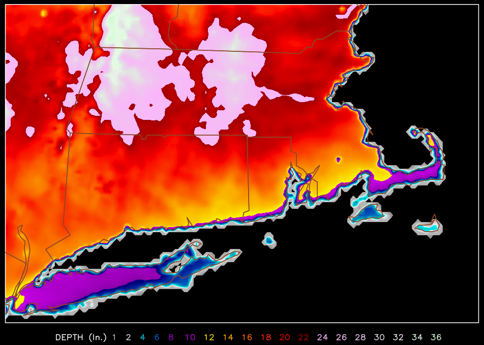
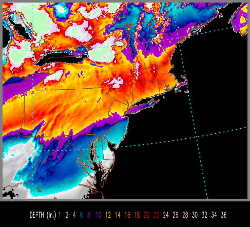
I've never experienced models increase snow amounts continuously run to run right up to the actual event. Q (quantitative) P (precipitation) F (forecast) QPF 1.25- 1.75 Being as cold as it is ratio's will be 15-20:1 EQUATES TO 30-40" My latest FB post HRRR 00z
-
QPF continues to increase. Break out the yardstick. Ah, to bust on the low side, that doesn't happen often.
-
HREF / HRRR FTW Nowcast RAP starting when the flakes start flying. On the precipice of one of those special 24hrs, I'm extremely jealous. PATS are favored.
-
Hounds released, Poodles not the Huskies. It's expansive, probably not the coldest outbreak this season.
-
Found this surfing... URL: DESI
-
85F here tomorrow. Down to a brutal of 65F Monday. Sleet is becoming a concern especially Pike south...
-
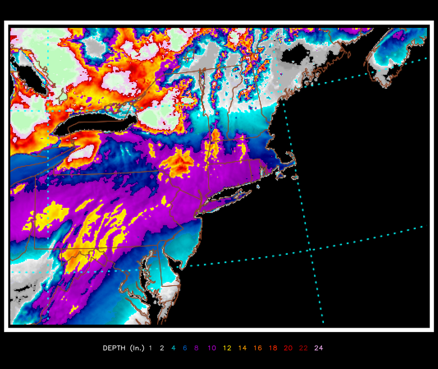
MIDNIGHT Monday HRRR keeps giving. Looking good.
-
Just playing with the HRRR 12am. Monday. Long way to go
-
I had someone ask me on FB when a realistic forecast would be posted? Responded "the day after it ends." Dissecting a model run is not forecasting. Maybe it is, with some better at it in accessing and describing. It's always been the lead time and not the event itself especially being afar.
-
A great event to get schooled. Some will learn and apply to future posts and thus improve the forum. Early call for JACK just NW of I95 to the SW of New England, subject to change based on model evolution.
-
Reeks of a CF. Soundings to pinpoint ratios. Start at a good foot att adjust accordingly.
-
Just awoke, Ensembles? Beuler For the win someone, anyone. Follow the coach.
-
Steady as she goes! Doesn't feel the same as say a few years ago, my ties to New England have faded. Priorities change, how precious time is!
-
No snow accumulation maps at least till 00z Friday. To many things can go wrong to even be close to accurate. As many comment and know QPF on the rise with high snow ratios.
-
I'm endorsing this 100%. I turn 68 on Monday. ALL IN!
-
Storm of the Winter Season?
-
Rise of the Machines: January 18-19 Winter Storm Obs Thread
ROOSTA replied to WxWatcher007's topic in New England
58F, dropping rapidly. Mid 70's just a few miles S. Sprinkles, winds gusting 25-30mph.