
Knoxtron
-
Posts
331 -
Joined
-
Last visited
Content Type
Profiles
Blogs
Forums
American Weather
Media Demo
Store
Gallery
Everything posted by Knoxtron
-
Sorry for the image dump! Let me know if I should take this down Definitely see the warmer scenarios/warmnose more in the ensemble than deterministic euro
-
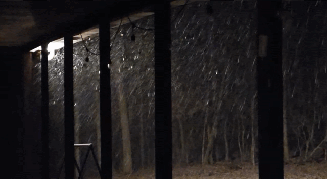
Just got a surprise heavy snow/sleet storm going on currenty, loud enough I could hear it inside. Currently 21 so maybe I can get some tweezers to collect enough for one tiny snowman Going to enjoy this like it's all I get this season
-
-
FWIW Let me know if this is to much of an image dump! As others have mentioned, maybe some snow signals around the 3rd and 7thish?
-

December 2025 Short/Medium Range Forecast Thread
Knoxtron replied to John1122's topic in Tennessee Valley
You guys weren't kidding on the winds, weather station recorded a 30 mph gust (only counts a 5 second avg for gust speed) and temp dropped 12 degrees in 5 mins from 1010 to 1015 last night Interesting that the winds were from the north all day and flipped 180 degrees to from the south in that time period. Whipping fog at 60 degrees in heavy wind is awesome weather haha -
Hahaha I probably will when we start chasing the next big snow storm. It's hilarious hearing a 4 year old correct other kids on meteorology, be on the lookout for a future James Spann in the coming years
-
Heaviest snow so far ongoing... eh flizzard is closer to accurate. Currently 30° with 0 radar returns. Incredibly fine flakes, nothing sticking yet
-
Been spitting sleet for the last 2 hours, nothing sticking but pretty nonetheless. Currently 33 after a high of 40 around 6am. My 4 year old is not impressed with the "snow" and had a mini meltdown as he assumed snow meant feet deep... lesson learned haha
-
-
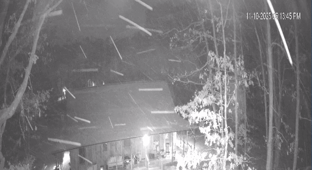
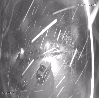
Big ol' fatties falling currently, heaviest snow so far.
-
Made it to 29° today, low of 22° and currently dropping fast at 23°. Had half inch at sunrise and sporadic snow showers till 10am. Started snowing again after sunset
-
Fall/Winter 2025-26 WX Discussion Thread
Knoxtron replied to Carvers Gap's topic in Tennessee Valley

-
Fall/Winter 2025-26 WX Discussion Thread
Knoxtron replied to Carvers Gap's topic in Tennessee Valley
Started tiny flurries about an hour ago, currenly lightly/moderately snowing and 34°. I'll try and post a pic in a min -
Wasn't expecting to wake up to moderate snowfall! I'm not sure how much more we have received
-
Got just over 1.5 inches and coming down strong! Currently 26
-
Sitting at 3" so far on the southern plateau. Definitely plan to make a trip to Fall Creek Falls this weekend! You can see waterfalls everywhere in the Sequatchie valley where the plateau dumps onto the bluff lines, its honestly magical haha
-
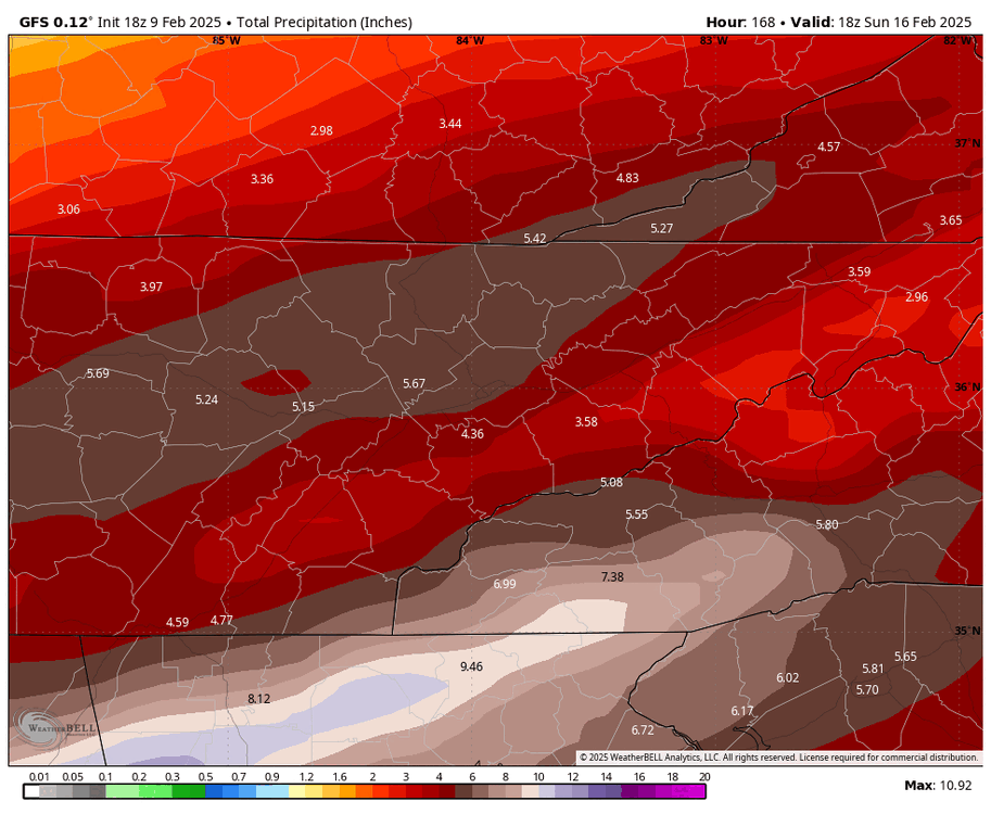
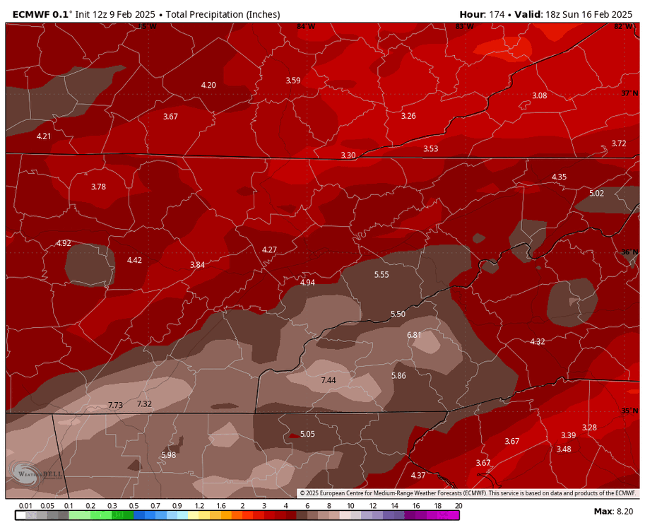
EURO and GFS Ensemble runs to 10 days. Most of this is the 19th system, but euro has a few hits for this Sunday that add to the totals.
-
GFS keeps shifting the heaviest axis north. Euro as well, albeit not as much movement The creeks are so low down here in SE tn, not sure if that has anything to do with MRX holding off. Nice soaking rains so hopeful for that initial entraption can keep it flooding under control.
-
Currently 36 up here, hoping to see a little sleet with this next batch coming thru.
-
Yeah not liking the look of this, though we are still super dry Current Conditions GFS/ECMWF 7 Day Ensembles 7 Day
-
Apologies for the overload gents. I disregard the GFS for reasons EURO Ensembles - 240 Hrs \ GFS Ensembles - 240 Hrs EURO Ensembles - 360 Hrs GFS Ensembles - 384 Hrs Euro 360 - 90th Percentile Euro 360 - 10th Percentile GFS 354hr- 90th Percentile GFS 354hr- 10th Percentile
-
In all seriousness, man the long range sure wants to load up the upstream/front range with extreme cold poised to dump our way again in Feb. Maybe we get a little SER to push against and slow down the stall line? idk what I'm talking about, but I stayed at a Holiday Inn last night so
-
MODIS Aqua 1-20-25 https://ge.ssec.wisc.edu/modis-today/index.php?satellite=a1&product=false_color&date=2025_01_20_020&overlay_sector=false&overlay_state=true&overlay_coastline=true§or=USA7&resolution=250m
-
Currently 3.9° with a windchill in the negative teens! Coldest it's been since the December 2022 cold snap Picked up a little more fine powder overnight for a grabd total of 1.5", roads are super slippery!
- 207 replies
-
- 4
-

-
- obs
- light snow
- (and 2 more)


