jjwxman
-
Posts
343 -
Joined
-
Last visited
Content Type
Profiles
Blogs
Forums
American Weather
Media Demo
Store
Gallery
Everything posted by jjwxman
-
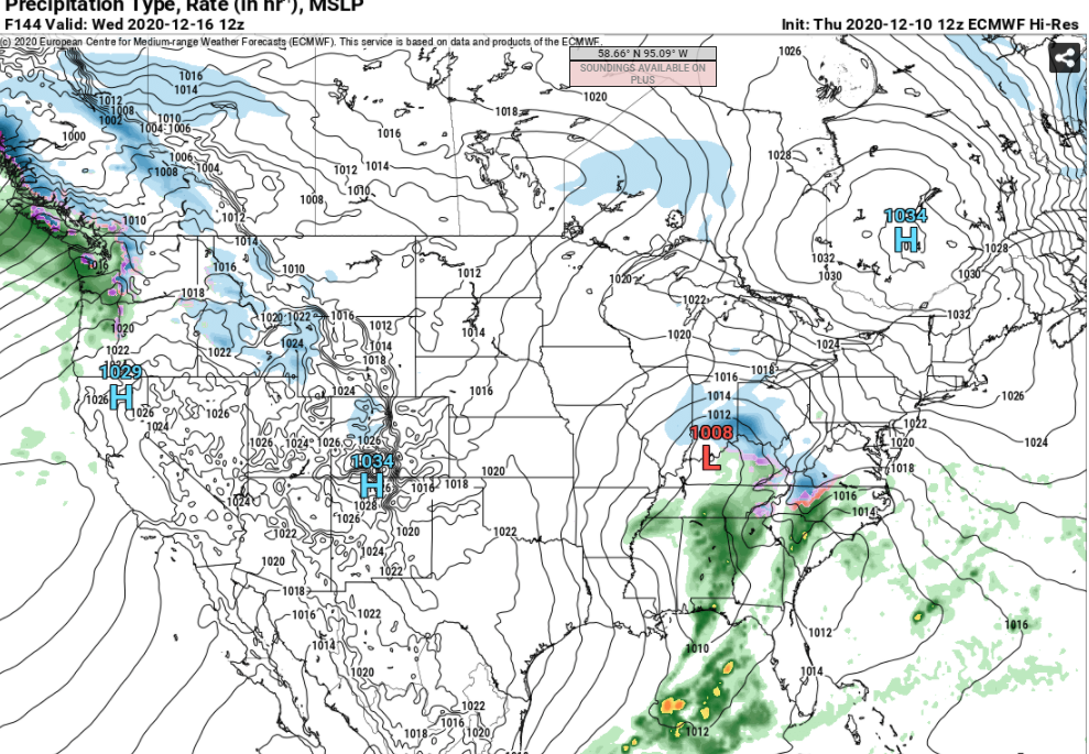
Ice Time? Dec. 16ish Possible CAD Event
jjwxman replied to Tar Heel Snow's topic in Southeastern States
Same here in the Triad. -
The 12z Euro is even less impressive than the 00z. It’s like, what CAD?
-
Ice Time? Dec. 16ish Possible CAD Event
jjwxman replied to Tar Heel Snow's topic in Southeastern States
The Euro remains the least impressive on the CAD setup. WAA overwhelms the CAD very quickly for all of NC. CLT and Upstate SC never even gets in the game and even GSO is on the edge. At this point it’s definitely a plausible outcome, but I’m not so sure the Euro has a good handle on the CAD. -
I do agree that the CAD is probably going to end up being stronger, but since a majority of this is occurring during the day the ice accrual could be inhibited due to run off. Temps have to be in the upper 20’s for these .50”+ totals were seeing to verify in my opinion.
-
Taken verbatim, the 12z Euro has me at 32+ and rain Wednesday morning... You're a mean one...
-
The 12z Euro is confirming my thoughts... for now. Wednesday looks like a better set up for something, particularly in the CAD favored areas.
-
The Monday setup doesn't look to be ideal to me with HP still over the Manitoba province. But as that HP system moves into a more somewhat favorable area we need to watch the S/W moving out of the Rockies on Tuesday. Right now the 12z GFS progresses this into a Miller B like storm system on Wednesday. However if the energy is able to dig further south that could yield something in the SE. We shall see.
-
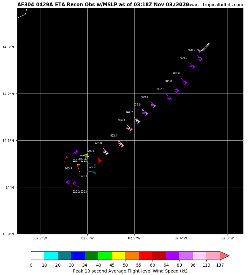
You might be right. Based on this plot map, it looks like they were apart of the circulation for a while traversing the pinhole eye. I’m sure that was a wild ride.

-
Finished with 2” in Randleman. (15 miles south of Greensboro)
-
Sticking nicely in Greensboro. Roads still wet.
-
Started as snow in GSO. Coming down pretty good now. 38 degrees and falling.
-
38/33 Randleman, NC
-
Glory hallelujah the European model finally throws us a fantasy bone.
-
More rain basically all next week...
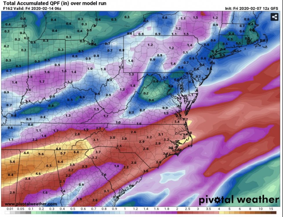
-
And not mention the severe threat, although probably limited due to the lack of instability, still that’s an absolutely insane boundary for Thursday evening. There will be elevated STP’s along and just south of that boundary. Possible triple point scenario over the I-85 corridor.

-
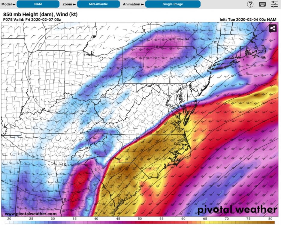
That’s one heck of a boundary for Thursday evening. Also there will be an elevated STP along the boundary. Absolutely Insane 850mb winds of 75 knots.
-
NAM’d!

-
Decent hit for the I-40 / I-85 Corridor.
-
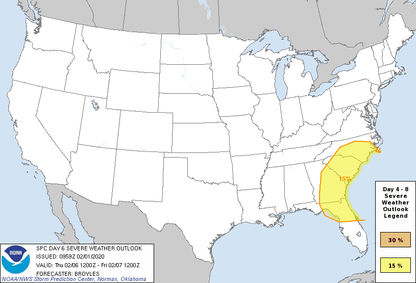
The SPC doesn’t throw out Day 6 outlooks that often. The wind shear parameters are off the charts over the region late next week.

-
Day 6 outlook from the SPC. It’s pretty rare to see the SE in a day 6 outlook, especially in February.
-
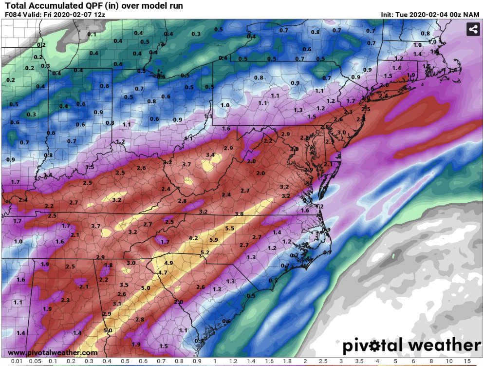
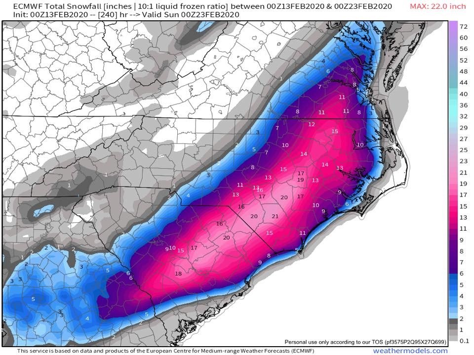
Haha... taken verbatim that’s over 2.5” of ice accrual for the I-95 corridor of NC. You guys might have power restored by... let’s say March?
-
It only takes one to forget everything around these parts!!
-
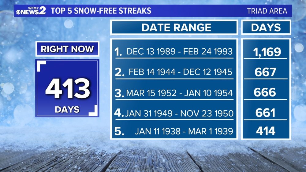
Credit: WFMY 2. This is for the GSO reporting location, we move into 5th place tomorrow. How in the heck did we survive the early 90’s... geez.
-
Here's Pivotal Weather's UKmet sounding for Saturday over GSO with total QPF of around 0.4"... so very close. This kills me.
-
Hey btw, Pivotal Weather now has UKmet maps... surface and upper air. I'm sure the free days are numbered... but maybe not?