CAPE
-
Posts
36,212 -
Joined
-
Last visited
Content Type
Profiles
Blogs
Forums
American Weather
Media Demo
Store
Gallery
Everything posted by CAPE
-

Best Mid-Atlantic winter storm of the last 50 years
CAPE replied to PrinceFrederickWx's topic in Mid Atlantic
1. Feb 2003- PDII 2. Feb 1983 3. Dec 2009 4. Feb 1979- PDI 5. Jan 1996(too much sleet) 6. Feb 5 2010 -
Best Mid-Atlantic winter storm of the last 50 years
CAPE replied to PrinceFrederickWx's topic in Mid Atlantic
LOL -
It wasn't a true blizzard, but given it was mid/late Dec. it was an awesome storm. I mean c'mon 20+ inches! That front end mega band gave me 6 inches in 2 hours. Great stuff.
-
Thanks. Yours is very cool as well. Is it a log home?
-
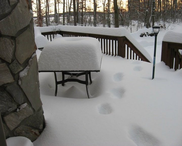
Dug up a couple photos from this event. In terms of snowfall that winter was truly Epic. Never see that again.

-
Nope. Once in a lifetime. Amazing and surreal winter. Near starvation since has produced rampant weenie-ism.
-
What I remember is that heavy snow band that developed on the front end here. Was supposed to be 1-2 inches by morning(I was planning to travel based on that) but the first 3 hours of the storm produced 6 inches of snow by 7 am...so I stayed home.