

CAPE
-
Posts
36,270 -
Joined
-
Last visited
Content Type
Profiles
Blogs
Forums
American Weather
Media Demo
Store
Gallery
Everything posted by CAPE
-
What is your cup of tea? Just curious.
-
LOL @X #SuperBowl Something went wrong. Try reloading.
-
Loved it. Apparently broke X lmao.
-
Their offense- Maye in particular- has sucked in every playoff game. Been luck and their D that has gotten them here.
-
He can make atrocious decisions under pressure. Kubiak has done an amazing job at preventing those situations. Thus why he is a genius and now going to be a head coach. He was my pick for the Ravens but I'm happy with Minter.
-
I can never fully trust Darnold. He can always revert back to what he has always been at any moment lol
-
Hawks need a TD here to take control
-
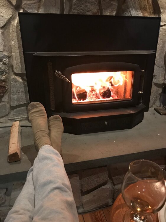
Regency. Its amazing. Crazy efficient. Never see any smoke coming out of the chimney.
-
Ready for football. Go Seahawks!
-
That's awesome.
-

February 2026 Medium/ Long Range Discussion: 150K Salary Needed to Post
CAPE replied to Weather Will's topic in Mid Atlantic
Good job Will! You may post in the other thread. Less snow map posts and more of this. -
High of 19 after a low of 9. Currently 17 Forecast low of 7 tonight. Got a fire going and sipping a stout and watching the mostly annoying SB pregame crap.
-
February 2026 Medium/ Long Range Discussion: 150K Salary Needed to Post
CAPE replied to Weather Will's topic in Mid Atlantic
Yeah why denigrate a nice area because some rando ass lives there. Love Slower Lower DE. And recent winters have been pretty fruitful there. The 2 chases I did in Rehoboth were a blast, esp da Bomb Cyclone. -
Winter Storm Threat *Technical* Discussion. No Op Run PBP or Snow maps
CAPE replied to CAPE's topic in Mid Atlantic
The storm after the storm potential is looking a bit better on the 12z EPS. Miller B-ish but further south. Not a strong signal at this point but a long way to go. Just something to keep an eye on, especially if next weekend fails. -
I just had a blast outside with the gas leaf blower blowing gumballs off the glacier and into the woods. Easy work now rather than waiting for the snow to go. They glide right across easily. Was fun as fuck actually. Stayed on top the whole time. Like being someplace else in the world when out there. Took a few measurements and pretty much everywhere there is still 5 inches of stuff otg, some places a bit more. Even with the cold, pure snow would not have survived 2 weeks without significant meltage.
-
Winter Storm Threat *Technical* Discussion. No Op Run PBP or Snow maps
CAPE replied to CAPE's topic in Mid Atlantic
Long way to go. Quite a spread as expected. Could easily see a track just off the coast. -
Winter Storm Threat *Technical* Discussion. No Op Run PBP or Snow maps
CAPE replied to CAPE's topic in Mid Atlantic
Nah. All whingy posts would be hidden, and the snow maps... -
February 2026 Medium/ Long Range Discussion: 150K Salary Needed to Post
CAPE replied to Weather Will's topic in Mid Atlantic
All we need is the surface low to exit the coast at Norfolk instead of tracking over the mouth of the bay to OC. Not a big ask. See what Chuck thinks. -
Also had snow otg for 2 weeks(more melting than this winter tho) and 2 significant all snow events here- both in the 6-9" range. Think I ended up right about average for here (18") or a bit under. This winter has been much colder and and still a bit under 12" at this point. Just gimmie one 6" snow event even if its gone 12 hours later.
-
Winter Storm Threat *Technical* Discussion. No Op Run PBP or Snow maps
CAPE replied to CAPE's topic in Mid Atlantic
Make me a mod for that thread only and I'll take care of it. -
Winter Storm Threat *Technical* Discussion. No Op Run PBP or Snow maps
CAPE replied to CAPE's topic in Mid Atlantic
If its still possible, this winter would be the one to make it happen. Cold has overwhelmed for 2 weeks and its been bone dry, so just maybe we can get something to work with some actual mositure and modest cold? -
Winter Storm Threat *Technical* Discussion. No Op Run PBP or Snow maps
CAPE replied to CAPE's topic in Mid Atlantic
Once I have had a couple bourbons I might pop in. I mainly just wanted a thread to escape all that shit. Takes the fun out of it weeding through all the meltdowns and entire pages of day 10 snow maps posted multiple times. -
Winter Storm Threat *Technical* Discussion. No Op Run PBP or Snow maps
CAPE replied to CAPE's topic in Mid Atlantic
-
Winter Storm Threat *Technical* Discussion. No Op Run PBP or Snow maps
CAPE replied to CAPE's topic in Mid Atlantic
Yes and much different than 6z when the primary went to Cleveland and the secondary formed over NJ. -
Winter Storm Threat *Technical* Discussion. No Op Run PBP or Snow maps
CAPE replied to CAPE's topic in Mid Atlantic
GEFS looks similar with the NS energy from the Midwest moving southeastward to reinforce the confluence.


