

CAPE
-
Posts
36,838 -
Joined
-
Last visited
Content Type
Profiles
Blogs
Forums
American Weather
Media Demo
Store
Gallery
Everything posted by CAPE
-
One is often better than many.
-
After mine burns to hell this summer I will reseed in November and by early January it should be looking pretty lush.
-
If we get a period of HL blocking, in a strong Nino a big winter storm is still possible-even the lowlands. So ofc the western highlands could get 'crushed'. They typically get impressive snow regardless of the overall pattern, unless cold air ingress from Canada is completely shut off.
-
El Nino is trending on the X. Lots of posts like this. We are doomed!!
-
80 here and windy, dry AF and Oak tree sperm flying all over the place. Those pollen strings are plied up on the roof. I keep the deck blown off. It's lessening compared to last week, but damn do we need some rain. Drinking a Margarita and trying to motivate myself to go out and water the poor plants.
-
Haven't been there yet. Hope to go on Sunday. Caroline's, which is an upscale restaurant in Denton, has a food truck there on weekends. Looking forward to getting some foodies in addition to the beer.
-
I need to find that. You would think around here more of their beers would be readily available, but mostly all I can find is the Nanticoke Nectar, which is mediocre to ok.
-
Been watering for a couple weeks. Going out in a few mins to turn on the sprinkler. Looks like another tenth or so from mother nature the next few days.
-
I'll finish this bourbon then headed out to turn on the sprinkler.
-
lol another tenth or so incoming through Friday. Repeating pattern with the guidance- juices up D4-5 then deteriorates to paltry useless rain that wets the top hundredth of soil.
-
This keeps happening, esp for eastern areas. Pretty soon rain chances will become dependent on convection, which is always hit and miss.
-
It has improved since my initial post(when you copy and paste it updates).
-
Long season, but sure looks like more of the same old crap. I was done with Elias a year ago. He doesnt know how to build a winning ML team, which is the actual job of a GM lol.
-
We are still in the mode of always missing the bigtime rain.
-
Perfect early May day imo. 59 and partly sunny. Getting lots of outside work done. Waaayyy better than 80s and humid, which we can easily get this time of year.
-
Not enough cold, especially recently, but we will get the STJ and moisture. 'Perfect track rainstorms'. Need a -AO or -EPO to bring colder air southward. Recent Ninas have been cold mainly due to a favorable configuration(poleward) of the Aleutian ridge.
-
Plenty of speculation, but its too early to know the character and strength of the event. Latest ENSO update from CPC indicates equal chances for very strong, strong or moderate El Nino for the upcoming winter.
-
Drinking a DFH 75 min IPA. I mixed a 60 and a 90 min.
-
Agree! I tried the new version in Rehoboth a couple weeks ago. Not as complex- kind of all hoppy start to finish. Sort of one dimensional, but still good. Just finished a 4 pack of last year's version. I think that one might be my absolute fave, with the dry hopping giving it a nice zing at the finish after the malty-sweet middle.
-
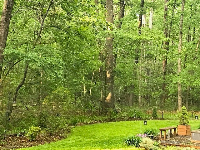
The clover/grass mixture I planted in the Fall is looking quite nice. Lots of watering with the lack of rainfall. Be interesting to see how it does from mid June forward.
-
Except the second game isnt going so well. When the pitcher is awful, its kind of tough. Looks like a split. This team needs to find some consistency, unless they are content with playing 500 ball.
-
Rainfall data from Easton site-
-
I set it for 5 min obs and picked the max hours(720). A bar graph shows each time it rained/amount, and at the top of the graph it displays total for the period.
-
Using Mesonet data via NWS, Goldsboro is 1.35" for the month and Ridgely 1.09". 1.15" here recorded on my station. Very dry in this area.
-
Just over an inch here for the month.


