All Activity
- Past hour
-
 this is going to get real interesting folks. Hope for the best but try not to drive in this stuff! Adrenaline will kick in!
 -
Unfortunate situation going on at the moment, but absolutely fascinating store motions and mergers today that i've never seen and all my years of watching the radar.

-
Light to mod rain started about 20 mins ago. It’s steady but not heavy at all thankfully. Any heavy stuff is SE.
-

July 2025 Obs/Disco ... possible historic month for heat
DavisStraight replied to Typhoon Tip's topic in New England
I got a quick sprinkle, missed to my north. -
 Strong storms to my east and west. Getting split here in Morristown but heck of a radar for the area
 -
 Yeah, your area looks like its getting nailed again. Already over 1.25" in spots. Saw a report of someone's gauge getting 5"/hr rates
 -
Videos on social media from this general area...holy moly.
-
 Does it have any chance to bring some rain across LI? SW Suffolk to be more precise.
 -
Rain here essentially stopped for about 40 minutes. It's now dark as night and raining like crazy. This is nuts.
-
 Light rain fell in Paramus. Nothing crazy.
 -

July 2025 Discussion-OBS - seasonable summer variability
Sundog replied to wdrag's topic in New York City Metro
Ironic with all the rain inland -

July 2025 Discussion-OBS - seasonable summer variability
Stormlover74 replied to wdrag's topic in New York City Metro
That's why we have a separate thread. Very concerned -
July 2025 Discussion-OBS - seasonable summer variability
Sundog replied to wdrag's topic in New York City Metro
Beautiful day at the shore right now: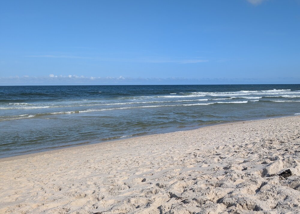
-
We might need to rely on the stuff nearing Hagerstown.
-
We’re getting a very heavy afternoon storm with a couple scary-close lightning strikes. Will probably end up close to an inch of rain but it’s still pouring
-
HEAVY rain driving home around Warrenton. Big boomers now as the storm intensifies to my east
-
Ended up barely raining here.
-
5.48 inches here and more building.
-
July 2025 Discussion-OBS - seasonable summer variability
WeatherGeek2025 replied to wdrag's topic in New York City Metro
anyone concerned about flooding here. These are slow moving thunderstorms, I mean this could be a disaster in some areas, maybe i'm panicking! -
This is just looney tunes.
-
Sounds like I got the same as amount of rain as you. Had some thunder and thought without looking at radar we might get a decent soak. 0.02” and just a lot of clouds.
-

July 2025 Discussion-OBS - seasonable summer variability
donsutherland1 replied to wdrag's topic in New York City Metro
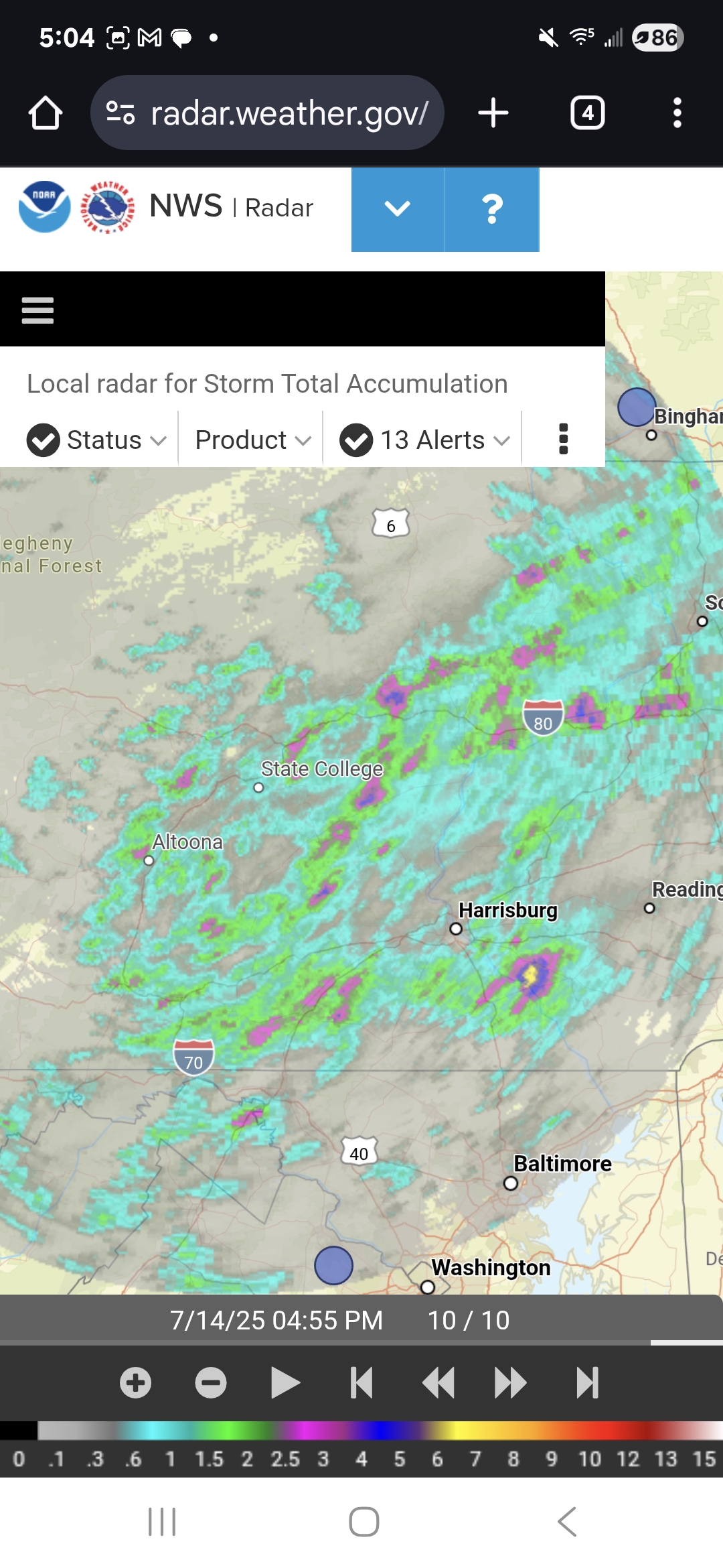
Showers and heavy thunderstorms will affect parts of the region into early tomorrow morning. North and west of New York City will likely see a general 1"-3" of rain with locally higher amounts exceeding 4". Already, Scranton has picked up 2.32" of rain through 4:41 pm today. That breaks the daily record of 1.69" from 2017. That is also the 20th highest daily rainfall for any day in July. Heavy rain was also falling at Newark with 0.43" over the past 41 minutes. It will turn somewhat warmer tomorrow with temperatures rising through Thursday or Friday. The heat will likely peak on Thursday and Friday with highs topping out in the upper 80s and perhaps lower 90s. A warm and mainly dry weekend will follow. No widespread and sustained excessive or record-challenging heat appears likely through the first three weeks of July. The ENSO Region 1+2 anomaly was +0.4°C and the Region 3.4 anomaly was 0.1°C for the week centered around July 9. For the past six weeks, the ENSO Region 1+2 anomaly has averaged +0.52°C and the ENSO Region 3.4 anomaly has averaged +0.07°C. Neutral ENSO conditions will likely continue through the summer. The SOI was +1.05 today. The preliminary Arctic Oscillation (AO) was +0.077 today. Based on sensitivity analysis applied to the latest guidance, there is an implied 74% probability that New York City will have a warmer than normal July (1991-2020 normal). July will likely finish with a mean temperature near 79.2° (1.7° above normal). -

July 2025 Obs/Disco ... possible historic month for heat
dendrite replied to Typhoon Tip's topic in New England
Quite a bit of drift the last few months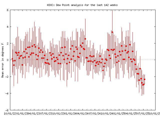
-
0.59" so far here. Radar looks juicy to the west and south though.
-
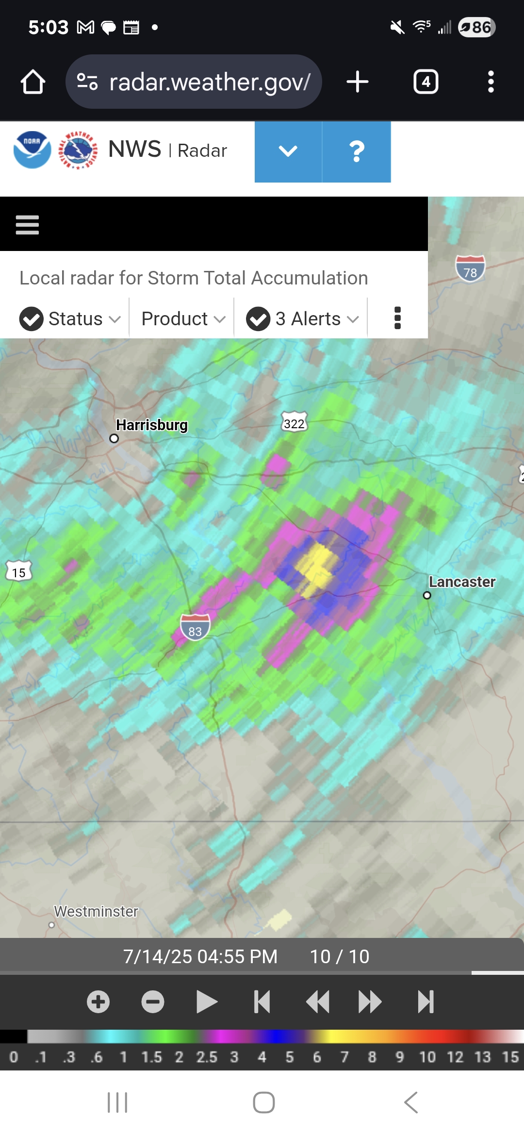
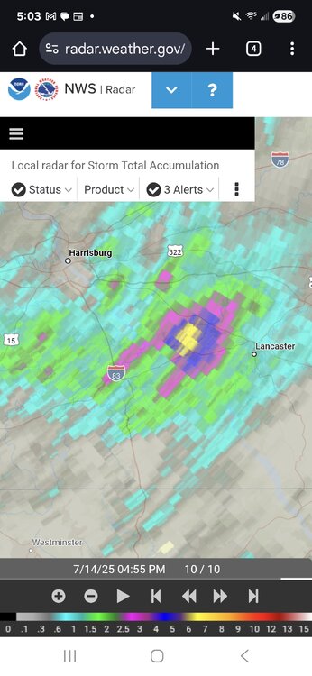
 we needed some rain but man this is ridiculous and the radar looks unforgiving
.thumb.jpg.6a4895b2a43f87359e4e7d04a6fa0d14.jpg)