All Activity
- Past hour
-

First Winter Storm to kickoff 2025-26 Winter season
WinterWolf replied to Baroclinic Zone's topic in New England
It’s beyond that. It’s infantile and ignorant. -
First Winter Storm to kickoff 2025-26 Winter season
dryslot replied to Baroclinic Zone's topic in New England
12z Euro is running now so let see if it holds serve or caves a bit. -

First Winter Storm to kickoff 2025-26 Winter season
WinterWolf replied to Baroclinic Zone's topic in New England
Ya, He’s another one…ridiculous. -
Wantage NJ at Noon. 0.1" from the snow showers since 9A. pavement wet...melting on pavement contact. 32.5 and still snowing at 1211PM 11/30/25. For those wondering where am located -- southern Wantage NJ which I consider part of i84 corridor-keeping posts simple.
-
First Winter Storm to kickoff 2025-26 Winter season
Kitz Craver replied to Baroclinic Zone's topic in New England
I mean, it’s only as dumb as you allow it to be. Just have fun with it -

First Winter Storm to kickoff 2025-26 Winter season
MJO812 replied to Baroclinic Zone's topic in New England
Dont feel bad I get a weenie emoji all the time from snowman19. -
First Winter Storm to kickoff 2025-26 Winter season
dryslot replied to Baroclinic Zone's topic in New England
Some people never graduated grade school. -
What’s your Dec MJO prediction? What’s your Jan PNA prediction? I expect a +PNA due to all -ENSO PNA Decs since 83 transitioning to Jan +PNAs.
-

First Winter Storm to kickoff 2025-26 Winter season
WinterWolf replied to Baroclinic Zone's topic in New England
Exactly. No matter what is posted it gets terds or wieners. I mean really? WTF? So dam dumb. -

First Winter Storm to kickoff 2025-26 Winter season
CoastalWx replied to Baroclinic Zone's topic in New England
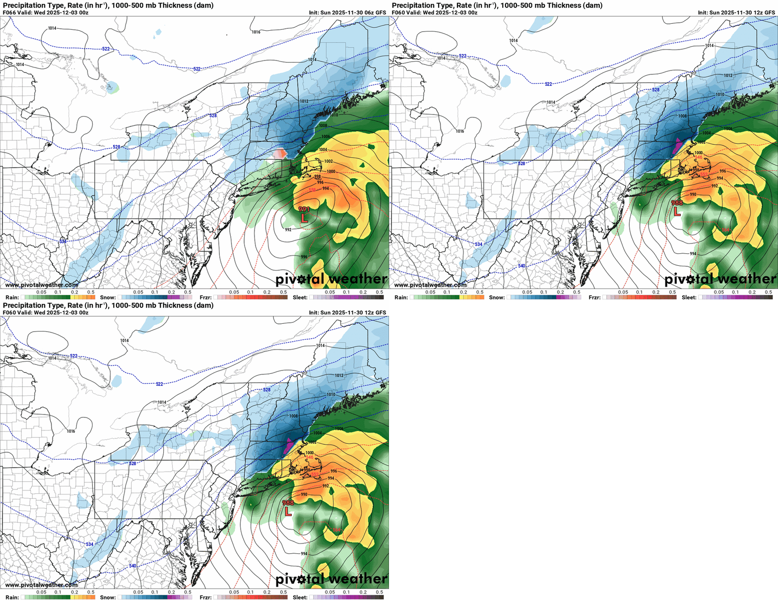
I will say on the gfs the H7 track is along south coast. I would look at that when 925-850 is 0 to near 1C like it is for Kevin because you’ll need big time VV to help get your isothermal bomb. That puts near Kev to BOS or so in that zone, although BOS is probably too warm lower 1500’. -
Sleet and rain now. But the surface temperature continues to drop. 34.7 now down from a morning high of 37.4.
-
BWI: 22.5" DCA: 15.6” IAD: 26.2” RIC: 11.8” Tie Breaker SBY: 9.4"
-
Sloatsburg will prob be the transition line between accumulating snow & white rain. I’ve seen this story many times before. Rockland especially with these gradient storms is a snow hole. To get into the 5” + amounts you prob want to be in northern Sussex/w Passaic into Orange County. Watches should be going up for Orange/Sussex in the next update
-
I live at like sea level and it's basically still fall here in the lowlands. But whatever lol. I'm off work until March 1. I'll be out in the Catoctins at daybreak gearing up for a hike up to 1800'.
-
First Winter Storm to kickoff 2025-26 Winter season
dryslot replied to Baroclinic Zone's topic in New England
Track is going to depend on the strength of the SLP, A weaker low will be SE. -

E PA/NJ/DE Winter 2025-26 Obs/Discussion
LVblizzard replied to LVblizzard's topic in Philadelphia Region
Starting to become interested in next Saturday. Models have a weak Miller B setup and some of them hit us with a moderate snow event. -
First Winter Storm to kickoff 2025-26 Winter season
dryslot replied to Baroclinic Zone's topic in New England
If its not that its a weenie one. -

First Winter Storm to kickoff 2025-26 Winter season
CoastalWx replied to Baroclinic Zone's topic in New England
You can with beer -

First Winter Storm to kickoff 2025-26 Winter season
WinterWolf replied to Baroclinic Zone's topic in New England
You do. It’s Unreal. Pathetic actually. -

First Winter Storm to kickoff 2025-26 Winter season
moneypitmike replied to Baroclinic Zone's topic in New England
You hate to see it. -

First Winter Storm to kickoff 2025-26 Winter season
WinterWolf replied to Baroclinic Zone's topic in New England
Every post gets a terd emoji from Tiger torch…what an insufferable poster that guy is. Just plain Sad. -

First Winter Storm to kickoff 2025-26 Winter season
moneypitmike replied to Baroclinic Zone's topic in New England
Unless there's a southern component to the winds, I'll be fine here. Further down the coast is a different story as due east is off the water there. -
First Winter Storm to kickoff 2025-26 Winter season
dryslot replied to Baroclinic Zone's topic in New England
-
It's a little unusual to see snow accumulation on trees, grass, and car tops in the middle of the day and snow fog/ low visibilities with surface temperatures between 35F and 37F. And outside of a few bursts, the intensity hasn't been all that great either. This is an overperforming airmass.
-

December 2025 regional war/obs/disco thread
WinterWolf replied to Torch Tiger's topic in New England
Really? Sometimes I wonder what you are really thinking? Why would you ever base any ideas on what may happen in the longer range on OP runs. That post deserves a 100 bun salute if there ever was one worthy of it. As Anthony says…are you new here?


