All Activity
- Past hour
-

-
yeah because it was deadly with the last storm with it is southern slider
-
it actually was
-
Def better aloft there. AI having such a strong signal for Monday makes me feel like we’ll trend that way but I’d like to figure out the first two systems first. They are all over the place. Friday especially has been all over the place. Wednesday is a hard forecast because of how narrow the heavier precip is…Friday night is literally like 0” to 12” for possible realistic totals.
-

Wednesday Feb 18 Mixed event. NoP refresher?
ineedsnow replied to HoarfrostHubb's topic in New England
yup get some meat in the pack -
My location lost all the new overnight snowfall today and an additional little dent out of what existed prior. Should lose a good deal more through the rest of the week. The huge mounds are losing height VERY VERY slowly. Anything on the level is showing much more noticeable progress.
-
Be nice or I would choose Steve D or DT over you as a better meteorologist.
-
The AI Euro has been deadly this year inside 5 days except when it shows something we want lol
-
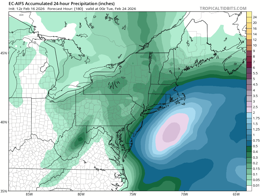
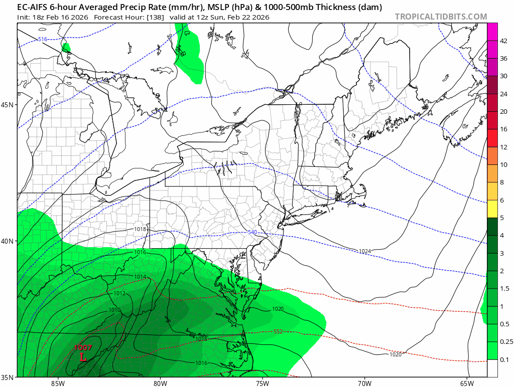
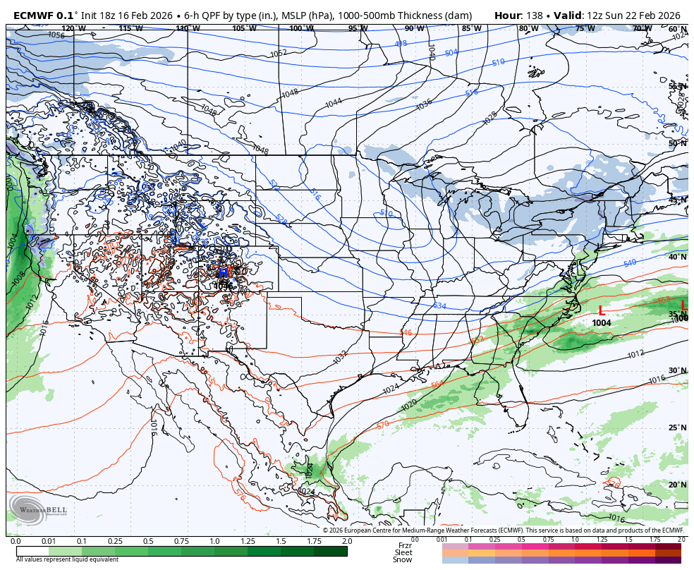
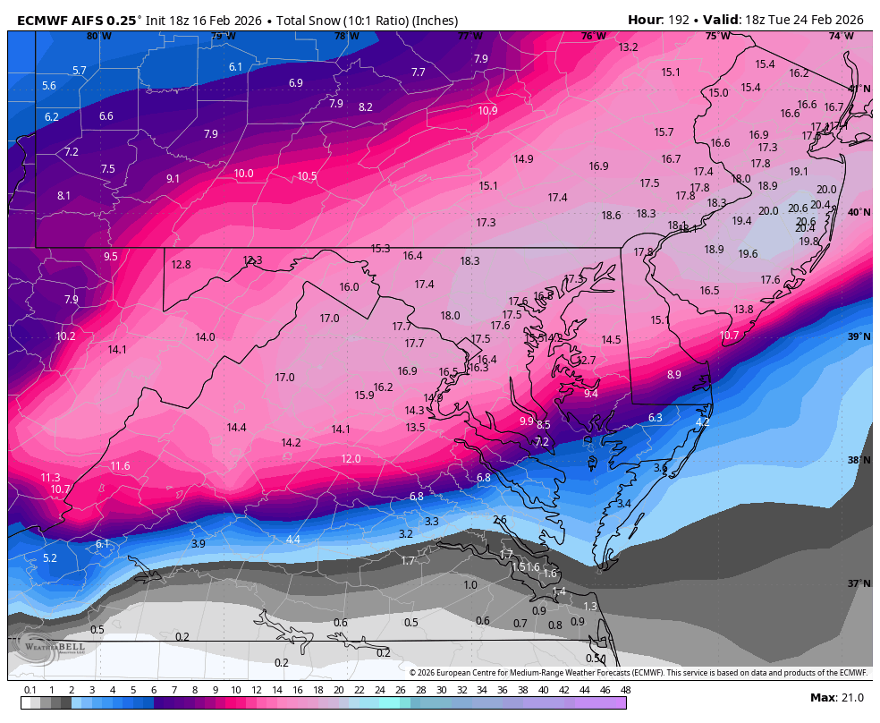
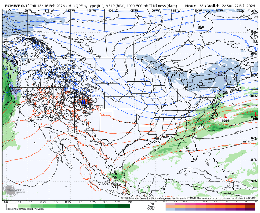
Closed 500mb low track is awesome on this run. CCB from DC to Boston.
-
South we can work with. We don’t want a coastal hugger at this range.
-

E PA/NJ/DE Winter 2025-26 Obs/Discussion
Ralph Wiggum replied to LVblizzard's topic in Philadelphia Region
A damn shame this will change before the weekend. But this is absolute perfection. Enjoy:
-

Late February/Early March 2026 Mid-Long Range
Weather Will replied to WxUSAF's topic in Mid Atlantic
We should know the drill by now....Lean on the ensembles until at least Thursday.... -
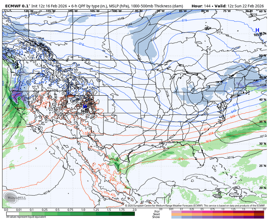
18z Euro vs 12z Euro — coastal low trying to pop vs nothing
-

Wednesday Feb 18 Mixed event. NoP refresher?
dendrite replied to HoarfrostHubb's topic in New England
Low level cold advects in after 00z…should be a nice ice up as temps drop into the 20s with snow. -
Euro getting better
-
-
Their turn in the barrel.
-
Better than 12z. Getting there.
-
Take all my money and just give me this!
-
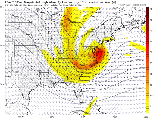
Euro has a storm this run but well south
-
Oh please. I enjoy Anthony's posts.
-
E PA/NJ/DE Winter 2025-26 Obs/Discussion
Ralph Wiggum replied to LVblizzard's topic in Philadelphia Region
18z aifs...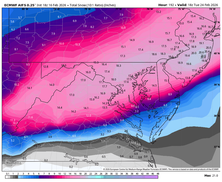
-

Wednesday Feb 18 Mixed event. NoP refresher?
WxWatcher007 replied to HoarfrostHubb's topic in New England
Ugh that sucks here -

Wednesday Feb 18 Mixed event. NoP refresher?
HoarfrostHubb replied to HoarfrostHubb's topic in New England
This should be the first sloppy stuff in a long time here. -
We will know by Sunday