All Activity
- Past hour
-
Let’s see
-
RGEM is nice
-
12 to 16 spot 20
-
 URGENT WEATHER STATEMENT NATIONAL WEATHER SERVICE – WINTER DISAPPOINTMENT DESK ISSUED: Immediately, because hope is fragile SUMMARY: A significant winter storm is expected to impact the region. Forecast confidence remains high for heavy snow potential, followed by a dangerous transition to sleet, freezing rain, or the ultimate betrayal: plain rain. ⸻ HAZARDS: • Initial excitement from model runs showing 18–30 inches • Rapid emotional destabilization as warm nose appears • Keyboard smashing, doom posting, and refresh-induced psychosis • Statements such as “this storm is dead” at T-72 hours ⸻ SUICIDE WATCH (METEOROLOGICAL): IN EFFECT A Snowlover Emotional Crisis Watch is in effect for the duration of the event. Residents are advised: • Do not do anything rash based on one model run • Step away from social media during the sleet phase • Remember: one band can still save the storm • Refrain from declaring winter “over” before March ⸻ TIMING: • Snow: Hope Phase • Sleet/Freezing Rain: Anger Phase • Rain: Acceptance (or complete meltdown) • Post-storm: “Next system looks promising” Phase ⸻ PRECAUTIONARY/PREPAREDNESS ACTIONS: • Touch grass (or snow, if available) • Hydrate • Do not fight family members over 850 mb temps • Seek professional help if you start trusting the GFS blindly ⸻ FORECAST CONFIDENCE: Low on precipitation type High on emotional damage .
 -
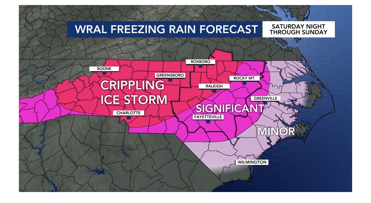
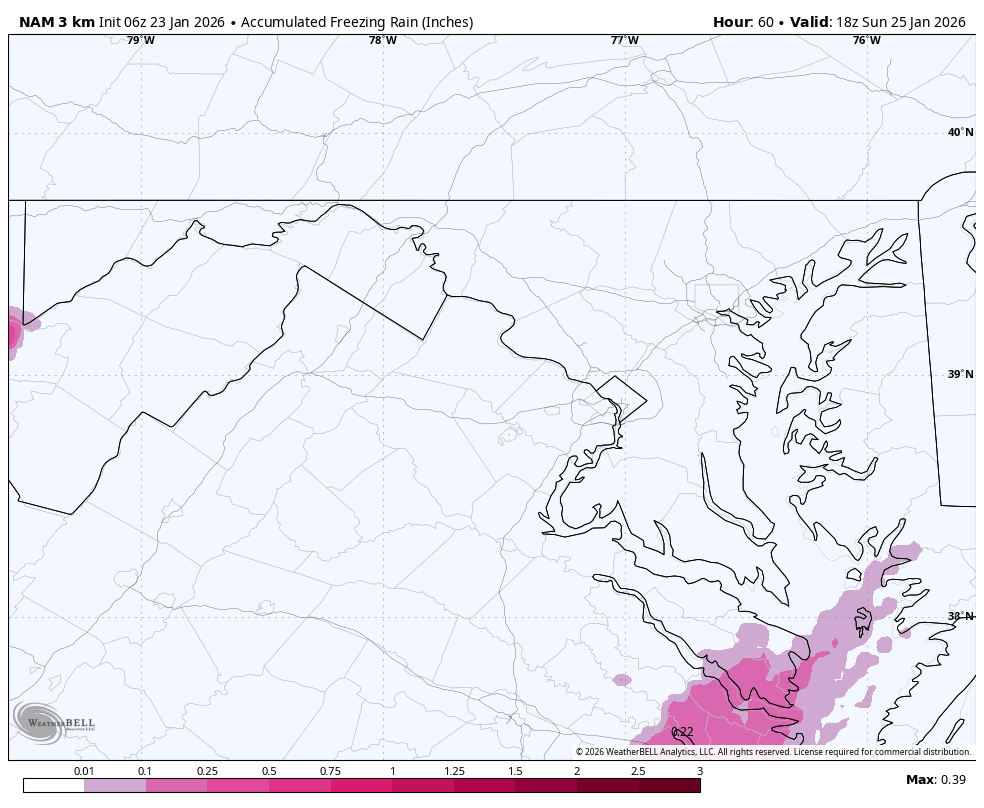
From WRAL. Forecasting 1 inch of freezing rain.

-
Damn, I needed that sleep. In reading seems like it’s a drift towards GFS, and models are finally pickup on the artic fronts strength.
-

Central PA Winter 25/26 Discussion and Obs
Caveman replied to MAG5035's topic in Upstate New York/Pennsylvania
From the National Weather Service... Blizzard Warning A Blizzard Warning means that the following conditions are occurring or expected within the next 12 to 18 hours. 1) Snow and/or blowing snow reducing visibility to 1/4 mile or less for 3 hours or longer AND 2) Sustained winds of 35 mph or greater or frequent gusts to 35 mph or greater. There is no temperature requirement that must be met to achieve blizzard conditions. -

“Cory’s in LA! Let’s MECS!” Jan. 24-26 Disco
Damage In Tolland replied to TheSnowman's topic in New England
Pretty much have to go 1-2 feet with lolli 30. That’s very likely now -

Possible Record Breaking Cold + Snow Sunday 1/25 - Tuesday 1/27
Noteaster101 replied to TriPol's topic in New York City Metro
Oh my goodness, this is pretty sick. Lol. I find this awesome, check this clip out… https://www.facebook.com/share/r/1MsezJwY1F/?mibextid=wwXIfr -

Possible Record Breaking Cold + Snow Sunday 1/25 - Tuesday 1/27
Snowlover11 replied to TriPol's topic in New York City Metro
ICON says who’s panicking!
-
Nice tick south compared to 0Z

-

“Cory’s in LA! Let’s MECS!” Jan. 24-26 Disco
SouthCoastMA replied to TheSnowman's topic in New England
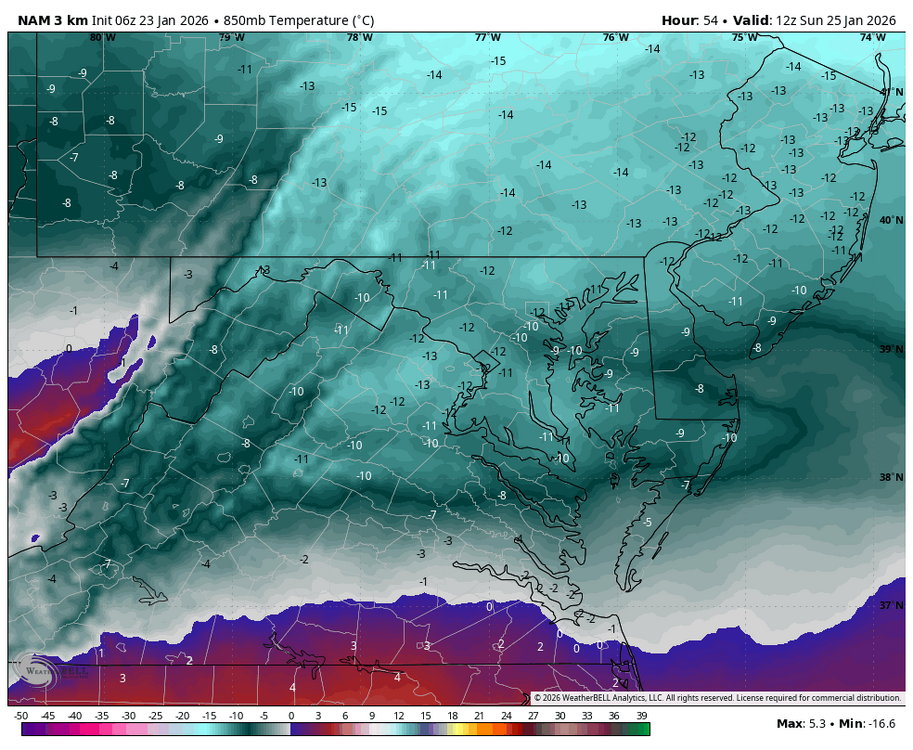
6z NAM still amped, but ICON shifted south. -
Icon is almost gfs like that run. Colder and snowier.
-
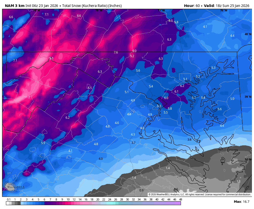
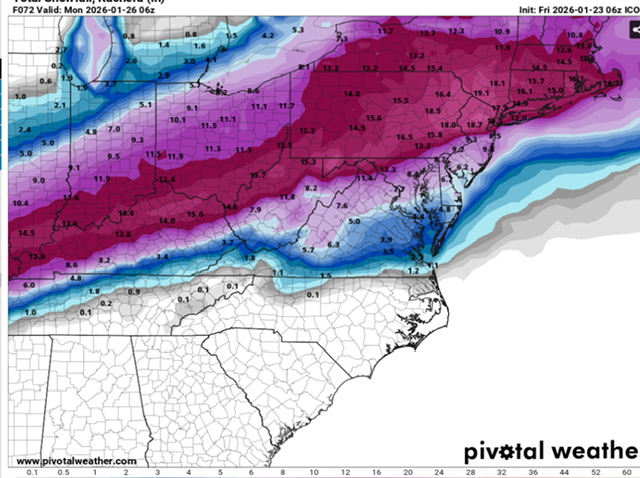
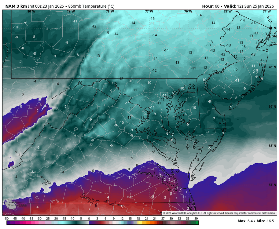
WB 3K NAM 850 comp. 6Z to 0Z.
-
Almost to a useful range and it improved each run.
-
WB 6Z 3K NAM HR 54 compared to 0Z HR 60 is colder.
-

“Cory’s in LA! Let’s MECS!” Jan. 24-26 Disco
Ginx snewx replied to TheSnowman's topic in New England
Man what a beast of qpf in the South -
Possible Record Breaking Cold + Snow Sunday 1/25 - Tuesday 1/27
Snowlover11 replied to TriPol's topic in New York City Metro

-
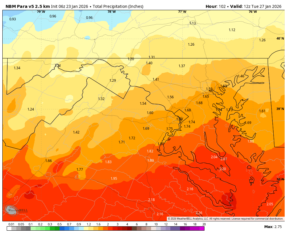
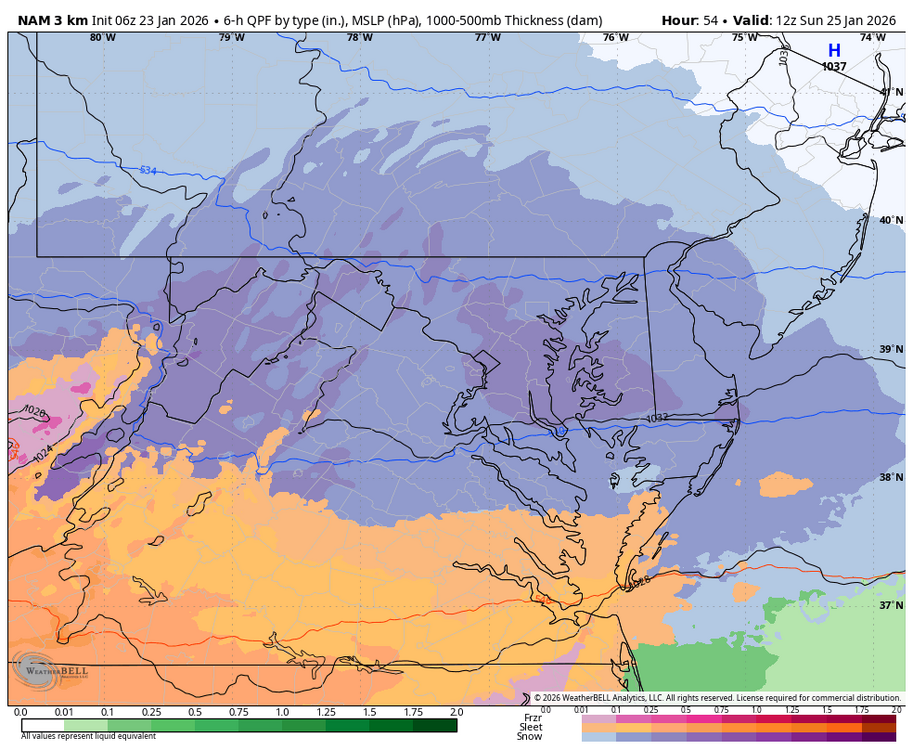
WB 6Z 3K NAM 1pm Sunday
-
Possible Record Breaking Cold + Snow Sunday 1/25 - Tuesday 1/27
Snowlover11 replied to TriPol's topic in New York City Metro
6z NAM pretty toasty after a thump. Shoots the mixing all the way to say Poughkeepsie, RT 17 and points east. -
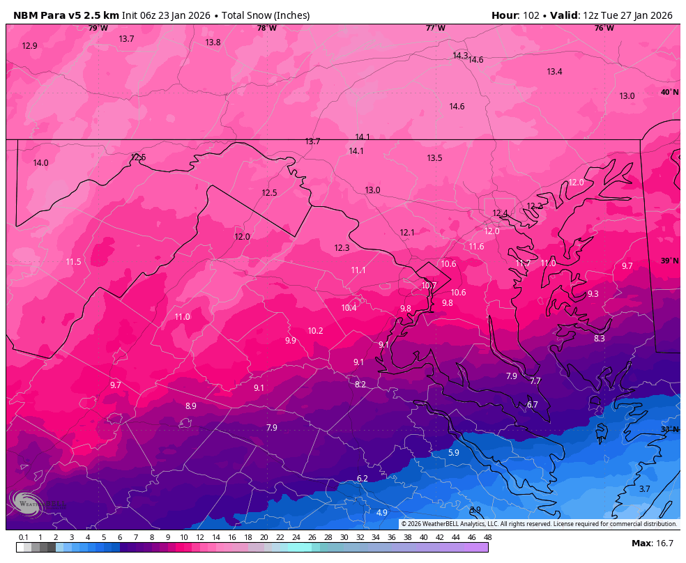
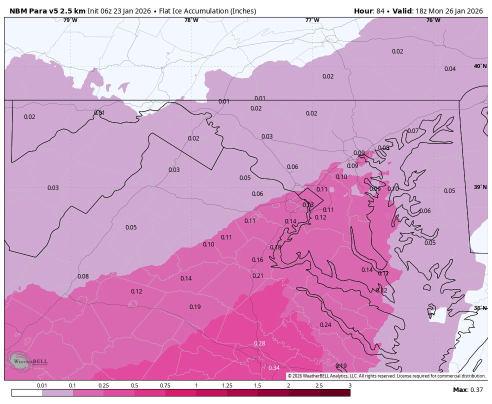
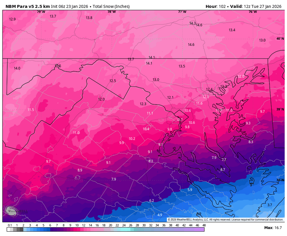
WB 6Z NBM Para
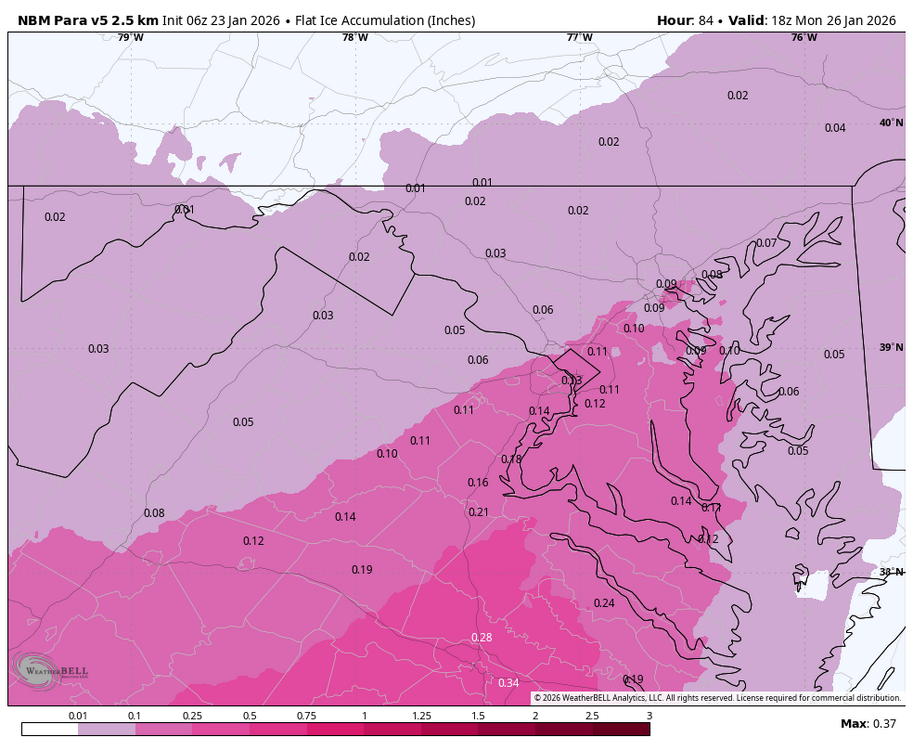

-
And that's what I'm scared of for us.
-

Central PA Winter 25/26 Discussion and Obs
Ruin replied to MAG5035's topic in Upstate New York/Pennsylvania
I know for a blizzard criteria temps in the teens and winds higher then 20 mph mostly it doesnt depend on heavy snow but high winds and temps in the teens. atm my high is now only 15 this would bring me to 20-1 ratio which during yesterday was said to be a stretch we would be in the mid teens during the snow they were looking at temps 18-20 yesterday but ty for the reply -
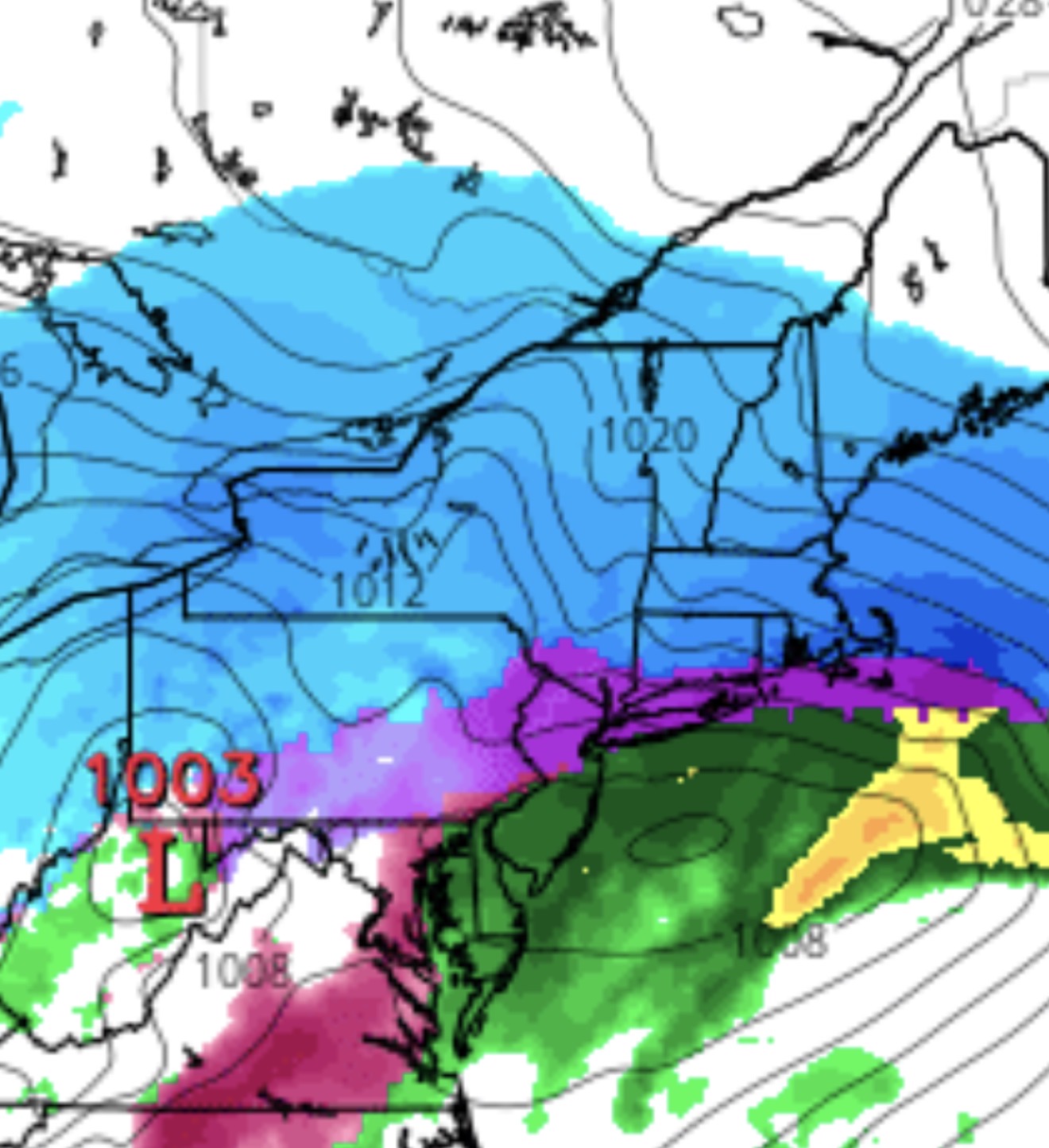
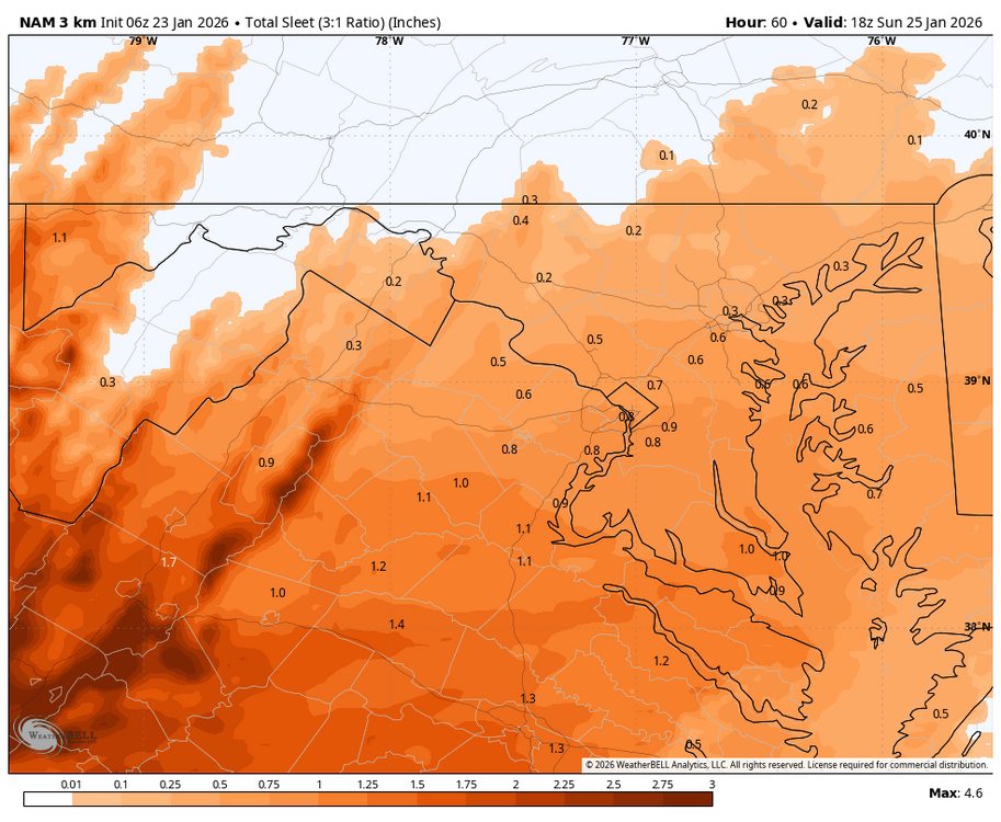
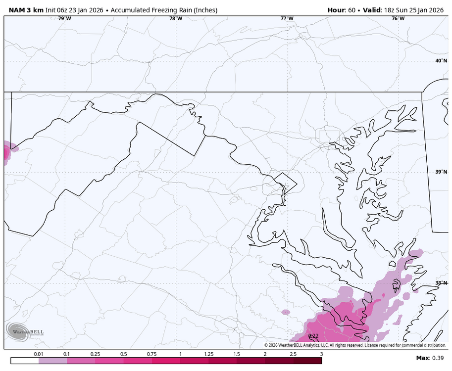
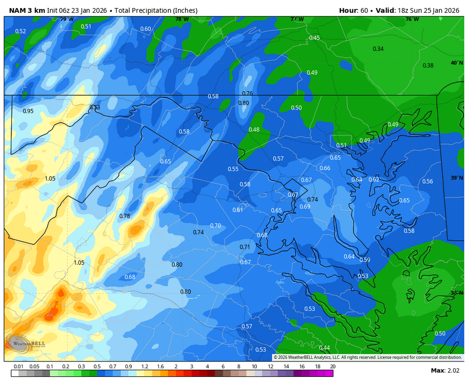
So the banana highs are just too wide and weaker and that's why the low cuts up through TN on higher res models? I'm trying to understand the basics here. Ending the event on rain and a squall line is just wild to me considering what we've been watching on the models all week. Granted, I'm glad the heavy rain can wash away all the ice and prevent hardships, even if it hurts my inner weenie. Edit: Looking at the 06z NAM.
-
“Cory’s in LA! Let’s MECS!” Jan. 24-26 Disco
SouthCoastMA replied to TheSnowman's topic in New England
yikes..not a great trend here at 0z.