All Activity
- Past hour
-

2025-2026 ENSO
40/70 Benchmark replied to 40/70 Benchmark's topic in Weather Forecasting and Discussion
Just as you argue the SSW is unlikely to be as impactful, I would also argue that February is unlikely to be as warm. -
Records: Highs: EWR: 75 (1979) NYC: 73 (1979) LGA: 68 (1989) JFK: 64 (2014) Lows: EWR: 20 (1989) NYC: 14 (1880) LGA: 22 (1956) JFK: 21 (2001) Historical: 1812 - Southwesterly winds of hurricane force sank ships and unroofed buildings at Philadelphia and New York City. (David Ludlum) 1863 - The battle above the clouds was fought on Lookout Mountain near Chattanooga. Pre-frontal clouds obscured the upper battle- field aiding a Union victory. (David Ludlum) 1931: A ridge of high pressure across the east and a trough out west brought a variety of record temperatures across the country. Record highs across the east included: Charleston, WV: 87°, Montgomery, AL: 79°-Tied, Athens, GA: 77°, Huntington, WV: 76°, Roanoke, VA: 75°, Tupelo, MS: 74°, Nashville, TN: 74°, Washington, DC: 73°, Asheville, NC: 73°, Boston, MA: 72°, Beckley, WV: 71°, Worcester, MA: 70°, Syracuse, NY: 70°, Lexington, KY: 70, Cincinnati, OH: 70, Cleveland, OH: 70, Allentown, PA: 69, Erie, PA: 69°, Harrisburg, PA: 69°, Providence, RI: 69°, Hartford, CT: 69°, Pittsburgh, PA: 69°, Newark, NJ: 69°, Elkins, WV: 69°, Concord, NH: 68°, Albany, NY: 68°, Buffalo, NY: 68°, New York (Central Park), NY: 68°, Philadelphia, PA: 68°, Akron, OH: 68°, Columbus, OH: 68°, Dayton, OH: 68°, Chicago, IL: 67°, Springfield, IL: 67°, Williamsport, PA: 66°, Wilmington, DE: 66°, Toledo, OH: 66°, Grand Rapids, MI: 66°, Peoria, IL: 66°, Mansfield, OH: 65°, Burlington, VT: 65°, Rockford, IL: 65°, South Bend, IN: 65°, Portland, ME: 64°, Lansing, MI: 64°, and Ste. St. Marie, MI: 62°. Chicago, IL had a morning low of 30°, their latest first freeze on record. (Ref. Wilson Wx. History) 1938: The low temperature of 15° at Las Vegas, NV set the all-time coldest temperature in November. (Ref. Wilson Wx. History) 1950 - The temperature at Chicago, IL, dipped to 2 below zero to equal their record for the month established on the 29th in 1872. On the first of the month that year Chicago established a record high for November with a reading of 81 degrees. (The Weather Channel) 1970: Strong Chinook winds struck the Colorado Rockies. The National Center for Atmospheric Research at Boulder reported a wind gust to 97 mph while downtown Boulder reported a peak gust to 69 mph. Some minor damage resulted. Record high temperatures followed the next day. (Ref. Wilson Wx. History) 1971: Snowfall for Thanksgiving (the following day), at Washington, DCA 1.4 inches, and Baltimore Maryland 1.0 inch caused a bad traffic snarl. (Ref. Washington Weather Records - KDCA) 1982 - Hurricane Iwa lashed the Hawaiian Islands of Niihau, Kauai, and Oahu with high winds and surf. Winds gusting to 120 mph caused extensive shoreline damage. Damage totalled 150 million dollars on Kauai, and fifty million dollars on Oahu. The peak storm surge on the south shore was six to eight feet. It marked the first time in 25 years that Hawaii had been affected by a hurricane. (The Weather Channel) 1983: The 24 hour snowfall record at Duluth, MN was broken with 16.5 inches and a storm total of 19.7 inches. This broke the old record of 15.7 inches, which occurred on 11/16-17/1968. (Ref. AccWeather Weather History) 1985: Many locations from the Pacific Northwest to the Plains reported record low temperatures for the date including: Grand Forks, ND: -28°, Bismarck, ND: -26°, Glasgow, MT: -19°, Aberdeen, SD: -16°, Huron, SD: -15°, Kalispell, MT: -13°, Yakima, WA: -11°, Pendleton, OR: -11°, Sheridan, WY: -11°, Spokane, WA: -9°, Sioux Falls, SD: -9°:Tied, Valentine, NE: -7°, Billings, MT: -2°, Rapid City, SD: -2°, Olympia, WA: 0°, Boise, ID: 5°, Denver, CO: 7°, Salem, OR: 11°, Portland, OR: 13°, Seattle, WA: 16°. (Ref. Wilson Wx. History) 1987 - Showers and thunderstorms produced heavy rain in southern Missouri, southeast Kansas and northeastern Oklahoma. Flooding was reported in Greene County of southwestern Missouri. Springfield MO was drenched with more than six inches of rain. Thunderstorms over southern Texas produced more than eight inches of rain in Caldwell County and Hayes County, and thunderstorms over south central Oklahoma produced one inch hail at Temple twice within an hour. (The National Weather Summary) (Storm Data) 1988 - Low pressure brought heavy snow and high winds to the Northern and Central Rockies. Snowfall totals in Colorado ranged up to 40 inches at Wolf Creek Pass, with 27 inches falling in 24 hours. Telluride CO received 32 inches of snow, and winds atop Mines Peak gusted to 95 mph. (The National Weather Summary) (Storm Data) 1992: A major winter storm was in progress across the Texas Panhandle, western Oklahoma, and western Kansas. Near blizzard conditions prevailed that contributed to a massive 200 car pile up on Interstate 40 in Amarillo, TX. All traffic was brought to a virtual standstill in the Texas and Oklahoma Panhandles. 19 inches of snow with drifts over 6 feet was reported at Laverne, OK. Heavy snow and blizzard conditions occurred across a large area of southwest Kansas. Snowfall amounts ranged from 17 inches at Liberal to 15 inches at Garden City and Dodge City, KS. This snow began a period that marked the snowiest winter on record for Dodge City. Most roads and highways in the Garden City, Dodge City, Meade, Greensburg, Coldwater, and Liberal, KS areas were closed with snowdrifts of 2 to 5 feet. Snow drifts as high as 15 feet were reported at Hugoton, KS. Widespread visibilities of a quarter of a mile and less were also reported from the early afternoon through early the next morning. There were two fatalities from the storm. Estimates from area farmers and feed lot owners indicated that as many as 5,000 head of cattle may have perished during the storm. Behind the storm, Pocatello, ID reported a record low of -6°. (Ref. Wilson Wx. History) 1993: Bismarck, ND was in the middle of a 5 day snowstorm, over which time 28.3 inches of snow fell on the city, their greatest snowstorm on record. Behind the storm many locations reported record low temperatures for the date including: Casper, WY: -19°, Cheyenne, WY: -16°, Sheridan, WY: -14°, Great Falls, MT: -13°, Burns, OR: -12°, Billings, MT: -11°, Denver, CO: -8°, Pueblo, CO: -7°, Rapid City, SD: -5°, Boise, ID: 0°, Medford, OR: 17°. (Ref. Wilson Wx. History) 2002: A winter storm across the northern Rockies beginning the previous day produced over a foot in some areas. Snowfall totals included: Burgess Junction, MT: 15 inches, Dayton, MT: 11 inches, Story, MT: 10 inches and Sheridan, WY: 7 inches.. (Ref. Wilson Wx. History)
-

Central PA Fall Discussions and Obs
pasnownut replied to ChescoWx's topic in Upstate New York/Pennsylvania
Fair and valid point, but Franklin checked many boxes out and how did it work for him? Mind you I liked JF, but Smith deserves a chance. Like TT suggested, give him a 2 yr deal, and fluff it up w/ bonuses for late season success and roll em. -
2025-2026 ENSO
40/70 Benchmark replied to 40/70 Benchmark's topic in Weather Forecasting and Discussion
Don't underestimate the ability of +TNH to linger into February. Here is a list provided by Lee at al (2019) of the most prominent reflection events of the past 45 years, including the primary analogs of 2001 and 2018. Courtesy Lee et al 2019 The mean length of the process is 20 days, with 10 days being the minimum, and 60 days the maximum, per Lee et al (2019). Considering the length of the 2001 (33 days) and 2018 (20) events, it as expected that a reflection event will begin between approximately January 13th and 16th 2026, and end between about February 2 and 18th. -
If I had to guess right now March would be the colder month if you end up being correct about a February SSWE. There would obviously be a lag (i.e. February, 2018). As of today I’m definitely on the canonical La Niña February thinking. That said, even if there is a February SSWE, I kind of doubt it would be as historic as 2018, since those are usually like a one in every 20 years event
-
Hell the 6Z GFS even has a December 5th reprise!
-
Seriously what the hell is wrong with everyone in this thread. It is November, we are tracking a pattern for a month from now, things will change, and either way it is for December.
-
2025-2026 ENSO
40/70 Benchmark replied to 40/70 Benchmark's topic in Weather Forecasting and Discussion
MJO doesn't look to be much of a factor for early January, as will probably enter the COD by Xmas, so we are going to be left with a consolidating PV and PT regime. -
Central PA Fall Discussions and Obs
pasnownut replied to ChescoWx's topic in Upstate New York/Pennsylvania
not that it means anything, but he just won me over. Mind you, i dont follow nearly as deeply as you guys do, but that was a great showing against a good team. -

Central PA Fall Discussions and Obs
Mount Joy Snowman replied to ChescoWx's topic in Upstate New York/Pennsylvania
Low of 36. So begins my week of gluttony. Tracking season is upon us. Cheers mates. -
2025-2026 ENSO
40/70 Benchmark replied to 40/70 Benchmark's topic in Weather Forecasting and Discussion
This is also supportive of a +PNA January. -
First half warmth ? I think its will be the opposite if the MJO goes into 8 next month.
-

2025-2026 ENSO
Stormchaserchuck1 replied to 40/70 Benchmark's topic in Weather Forecasting and Discussion
CPC said last Winter was the most +PNA Winter or record for a non-El Nino. Fwiw, there was a pretty -PNA period Jan 15 - Feb 10 that they were calling +PNA, but on these correlation maps what they say the index is what's used for correlations. I found it interesting that one year after most +PNA Winter's there isn't a +PNA signal the following Winter.. actually there is +NOI (+North Pacific High - the high pressure off the west coast), and that indicates more of a La Nina pattern... it was slightly predicting a la nina this winter. 1 December after last Dec +PNA... Fwiw, Jan +1 year doesn't reverse like December usually does -
It’s a function of the snow drought that we have been in over the last 7 years that the entire area hasn’t had a daily 4” snowfall. Load the dice for lower seasonal snowfall totals over time and it makes streaks like this more likely. If we had long term continuous snowfall observations at smaller sites than NYC and LGA, then I am sure other spots beyond NYC and LGA would be continuing their under 4” streak also.
-
44 / 32 - sunny and warm today mid 50s , upper 50s to 60 Tue with rain (0.50 - 0.75) and warmest day Wed upper 50s t0 low 60s. Down below normal Thursday - highs in the 40s Thu - Sat, hard freezes inland and perhaps the city/ other locations get to freezing. Back warmer by the 2nd - 5th before turning colder again. Strong ridging into the south and building cold to the north/west - could equal multiple chances of snow/mixes the first half of next month, being in the middle / battleground - either way it looks wetter than normal.
-
December 5th historically is an auspicious day for snow in NYC.
-
That's what makes it so incredible IMO. If the east coast was in a 2011/2012 multi year repeat then this would be expected.
-
2025-2026 ENSO
40/70 Benchmark replied to 40/70 Benchmark's topic in Weather Forecasting and Discussion
I don't think January will be cold in the mean because the second half cold will largely serve to negate the first half warmth. I think February and/or March will be colder. -
The record is a fluke. JFK went over 4 inches twice in 2024, one of them being over 6 inches.
-
Wait, you don't like the Henry runs up the middle for -2 to +2 yards on first down EVERY DAMN TIME?!!?!? We really only get two chances to get a first down.
-

November 2025 general discussions and probable topic derailings ...
UnitedWx replied to Typhoon Tip's topic in New England
We had several rounds of flurries in Westfield yesterday. I got to watch while repairing a bullshit "insulation" job under what used to be our front porch. SO much cold coming up through the floor already into the living room. Closed cell FTW -
Thanks Don! What makes this even more incredible IMO is the fact that during this time frame New Orleans had a bigger snowfall event of greater than 4 inches (and Ocean City Maryland had multiple events).
-
Same page, I'm still thinking January is the cold month for the east. Best chance for MA snows before Feb torch. Dec isn't really in play for us down here imho
-
2025-2026 ENSO
40/70 Benchmark replied to 40/70 Benchmark's topic in Weather Forecasting and Discussion
Yea, but the PV isn't stout, either....you don't need February 2010 blocking to slide just under neutral in the monthly mean (NAO). This will be a good snowfall pattern for NE, but not the mid atl...agree. No KUs, but rather a series of moderate snowfalls owed to WAA/SWFEs. January will be the +PNA mismatch month this season....take that to the bank. -
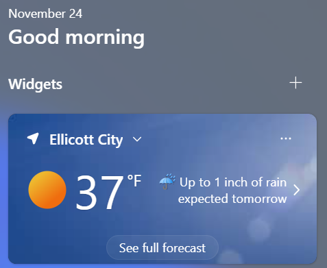
As someone with way too much insight in how these crappy things work, can you click on the weather and bring up the larger notification panel? See what city it is forecasting for. If you are using a VPN or your ISP gives you an IP that is registered somewhere else, the geolocation stuff isn't smart enough to figure it out. I also don't think EC is getting an inch of rain, but they really cover their bases with "up to". NWS has me .2-.5".