All Activity
- Past hour
-

Pittsburgh/Western PA WINTER ‘25/‘26
SteelCity87 replied to Burghblizz's topic in Upstate New York/Pennsylvania
Glad we can stop hearing about that now -
i will live vicariously thru you until my snow arrives
-
Down to 21 and just pouring snow. 9”
-
(002).thumb.png.6e3d9d46bca5fe41aab7a74871dd8af8.png)
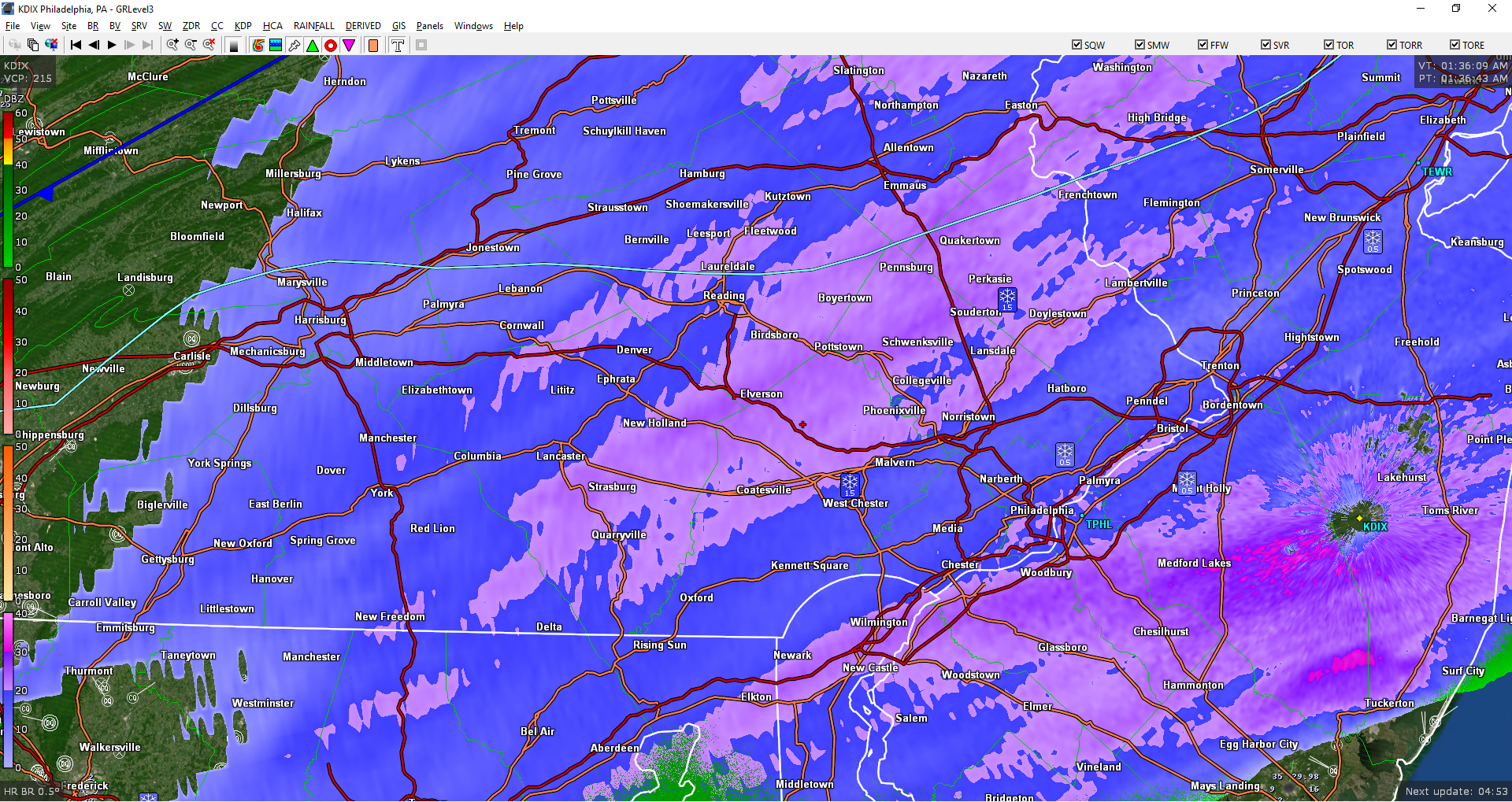
Saturday night/Sunday 12/13-12/14 Jawn
ChescoWx replied to Ralph Wiggum's topic in Philadelphia Region
Heaviest snow now starting to move into the area....Temp at 31.4 degrees. Will measure again at 2am
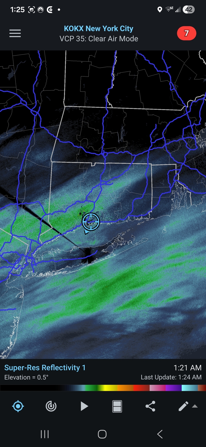
-
Light snow in bayside queens. Sticking to all surfaces 33 degrees. I’d exited most urban areas to pretty much just be wet, but it’s enough for the boards to measure at least
-

12/14: Sunday funday? Will the south win again?
Stormchaserchuck1 replied to TSSN+'s topic in Mid Atlantic
The storm over performed a little bit with radar, duration and all. The ratios were much lower than the snow maps posted leading up to the storm though. -
Far western death band setting up on radar. Just 10 more miles east please!!
-
Genuine question: what is implied here
-

12/14: Sunday funday? Will the south win again?
BTRWx's Thanks Giving replied to TSSN+'s topic in Mid Atlantic
Radar slowly blossoming just west of 95. -

Saturday night/Sunday 12/13-12/14 Jawn
Berks_SnowMan replied to Ralph Wiggum's topic in Philadelphia Region
1:30AM —- coating of snow on grass just north of Reading. disappointing . -
Cool thing is temps are just going to plunge from here. I might only end up with an inch or 2 here. But it isn't going anywhere tomorrow. High is right now at 31 degrees for the day.
-
.thumb.jpg.6a4895b2a43f87359e4e7d04a6fa0d14.jpg)
Central PA Winter 25/26 Discussion and Obs
Yardstickgozinya replied to MAG5035's topic in Upstate New York/Pennsylvania
Conditions are changing out here pretty rapidly. The temperature has dropped several degrees over the last twenty minutes, and a fog has also rolled in with the colder temperatures along with improved rates and flake quality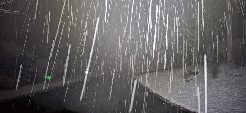
-
12/14: Sunday funday? Will the south win again?
Stormchaserchuck1 replied to TSSN+'s topic in Mid Atlantic
See why you don't use Kuchera maps when it's in the low to mid 30s? Radar is finally filling in over Baltimore city and DC. -
Light snow in great neck 32 degrees .
-

Central PA Winter 25/26 Discussion and Obs
MAG5035 replied to MAG5035's topic in Upstate New York/Pennsylvania
I can’t resist sharing this lol, 1pm Christmas Day GFS vs Euro 0z run tonight. Literally a 50 degree difference in temps.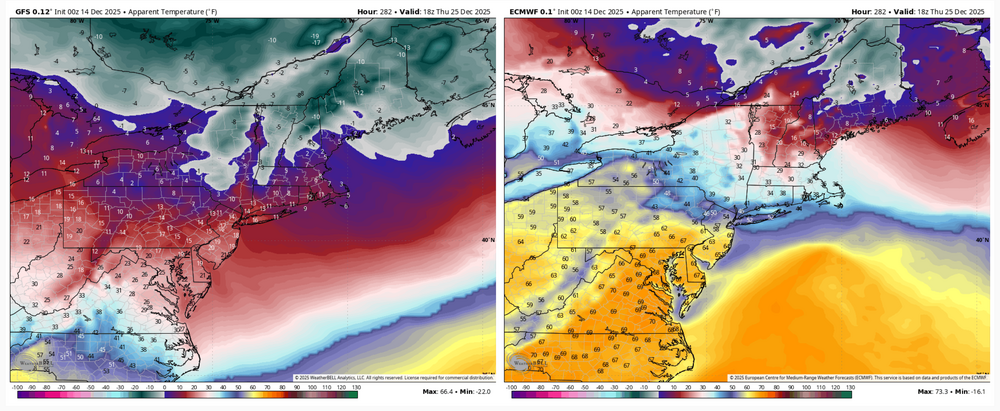
-
Got light snow here but of course we can't get below freezing still 34
-
Good things come to those who wait.
-

2025-2026 ENSO
40/70 Benchmark replied to 40/70 Benchmark's topic in Weather Forecasting and Discussion
I don't always see eye to eye with snowman, but he is reasonably pleasant for the most part. He can have an edge to him, though. -
12/14: Sunday funday? Will the south win again?
Another Field replied to TSSN+'s topic in Mid Atlantic
Flipped to snow in Bolton Hill, Baltimore City 33.6° -
3” in Damascus at 1:30 am. Heading off to bed now
-

12/14: Sunday funday? Will the south win again?
Skywalker03 replied to TSSN+'s topic in Mid Atlantic
Got a coating here in north Rockville. Hoping to see 2 inches here -

12/14: Sunday funday? Will the south win again?
stormtracker replied to TSSN+'s topic in Mid Atlantic
Getting impatient down here. -
Oh well, work is more important. I’ll enjoy it for you.
-

December 14th - Snow showers or Plowable snow?
BrianW replied to Sey-Mour Snow's topic in New England
Moderate snow here wirh a nice band setting up from HVN to BDR.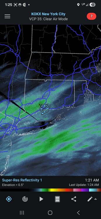
-
Got a dusting in Columbia. Snowing decently now.