All Activity
- Past hour
-
Not a cloud in the sky and its noon on Sept 17, can't say I've had that since Aug but for this time of year its very rare. Highs reaching 27C. Second amazing Sept in a row.
-
I experienced three drops of rain. It may have been owl piss. I can't confirm. I can; however, confirm it is drier than an old lady's snatch after an episode of "Touched By An Angel," and I fear there is little relief in sight.
-
I think the background states going into winter are starting to get set…..solar max (but descending slowly), high geomag, La Niña, -PDO, -IOD, -PMM, -QBO, below normal Atlantic ACE (looking likely), +AMO (*possibly* the very beginning of a -AMO flip with the cold pool in the North Atlantic?), non-volcanic stratosphere
-
Interesting article about housing construction since Hurricane Harvey. Apparently that biblical flooding event changed nothing. https://www.houstonchronicle.com/projects/2025/houston-metro-floodplain-construction/?noapp=true&utm_content=img&sid=6899cebb64b7fc37ca04ba24&ss=P&st_rid=null&utm_source=newsletter&utm_medium=email&utm_term=Business&utm_campaign=hcrn | editorial features
-
100%. Friend sent it to me from Daily Mail. Daily Mail but still !
-
All of your points lead me to think that perhaps we are entering another AMO Inactive period. If volcanic activity is in fact an influencing factor with AMO Inactive periods should we look at the 2022 Hunga Tonga–Hunga Haʻapai eruption as a possible catalyst that started another AMO Inactive period? "The Hunga-Tonga-Hunga-Ha'apai is a submarine volcano in Tonga that had a massive, explosive eruption on January 15, 2022, which produced a significant tsunami and a record-breaking volcanic plume that reached the mesosphere. This eruption, one of the largest in the past 300 years, generated shockwaves that propagated through the atmosphere and tsunamis across ocean basins, including the Americas and Japan."
-
.82 for the event. First time in a long time the wetter models verified....hopefully we are starting a new trend as we head toward the winter season.
-
12z GFS again shows this system unraveling into an open wave in a few days. CMC and EURO continue to be much more robust. Serious spread in hurricane models still but as a whole they have trended considerably downward with the vast majority keeping the system as a tropical storm or weakening back to TS at the end of the period, interesting
-
Is this real?
-
They could have left it a depression at 11:00. That would have been the better choice. Thing is a sloppy mess.
-
What garbage.

-

September 2025 OBS-Discussion centered NYC subforum
MANDA replied to wdrag's topic in New York City Metro
Not according to this ridiculous headline. What garbage.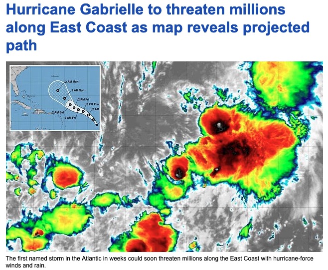
-

September 2025 OBS-Discussion centered NYC subforum
SACRUS replied to wdrag's topic in New York City Metro
Ocean storm -
I've been thinking about moving north.. it wouldn't be for atleast a few years though. I was thinking the Jackman Maine area or far northern NH..
-

September 2025 OBS-Discussion centered NYC subforum
LibertyBell replied to wdrag's topic in New York City Metro
Weren't those in November with all the warmth though? I do garden but it's mostly roses and some other flowers. -

September 2025 OBS-Discussion centered NYC subforum
winterwx21 replied to wdrag's topic in New York City Metro
Remember all the fires we had last fall. It was horrible. I don't know why anyone would want to see a severe drought. Obviously you don't garden lol. -
I would’ve named yesterday before this one and that Mid-Atlantic low wasn’t even tropical lol. I guess they had to go with continuity once they declared it a depression.
-
-
September 2025 OBS-Discussion centered NYC subforum
LibertyBell replied to wdrag's topic in New York City Metro
October of last year lol. We might repeat that next month except without that annoying phantom *.01* to end the month. I am a perfectionist and I want to see 0 one of these months.... -
September 2025 OBS-Discussion centered NYC subforum
LibertyBell replied to wdrag's topic in New York City Metro
Highs:EWR: 95 (1991)NYC: 93 (1991)LGA: 95 (1991)JFK: 90 (1991) a straight sweep for 1991! In our truly great summers, like 1983, 1991, 1993, 2002 and 2010 we had temperatures in the 90s well into September (mid September or later.) -
September 2025 OBS-Discussion centered NYC subforum
MANDA replied to wdrag's topic in New York City Metro
It is a good thing that event earlier in the month over performed. Think of where we would be without that for this month! -
September 2025 OBS-Discussion centered NYC subforum
SACRUS replied to wdrag's topic in New York City Metro
Highs: EWR: 95 (1991) NYC: 93 (1991) LGA: 95 (1991) JFK: 90 (1991) Lows: EWR: 44 (1950) NYC: 45 (1986) LGA: 48 (1986) JFK: 48 (1958) Historical: 1911: Pipestone, MN is hit with baseball-sized hail that smashes numerous windows at the Calumet Hotel and high school. The local observer measured hail three inches deep. People got their photos taken in automobiles surrounded by the icy white ground. (Ref. AccWeather Weather History) 1932 - Concord NH was drenched with 5.97 inches of rain in 24 hours to establish a record for that location (16th- 17th). (The Weather Channel) 1947: A Hurricane moved in from the Atlantic over Palm Beach and Broward Counties in Florida. Hurricane force winds were experienced along the Florida East Coast from Cape Canaveral to Carysfort Reef Light, south of Miami, while winds of over 100 mph were felt from the northern portion of Miami to north of Palm Beach, or about 70 miles. A 1-minute maximum wind speed of 155 mph was recorded at the Pompano Beach light station. Dozens of people were killed in this storm. It went on to hit the New Orleans, LA area. (Ref. Wilson Wx. History) 1957: Tropical Storm Ester hits the Louisiana Coast. (Ref. Daily News Record Newspaper - Harrisonburg, Virginia) 1960: 23 inches of snow at Rawlins, WY and over 20 inches at Lander set new early season snowfall records for both locations. (Ref. AccWeather Weather History) 1961: A powerful thunderstorm struck Las Vegas, NV with high winds and huge hailstones that racked up the community from one end to the other. The Strip was especially hit hard by the sudden fury of the storm, which blasted down virtually all of the big signs in the resort area and tore part of the roof off the Dunes Hotel. Dozens of homes and businesses had roofs ripped off and/or windows broken by the winds which had gusts to an estimated 80 mph and golf ball sized hail. (Ref. Wilson Wx. History) 1963 - Nearly two and a half inches of rain fell at Yuma AZ in 24 hours. It was the most intense rain for Yuma during the period between 19S09 and 1977. (The Weather Channel) 1965 - A storm produced a band of heavy snow across parts of Wyoming. Totals of 23 inches at Rawlins and 20.7 inches at Lander easily surpassed previous snowfall record totals for so early in the season. (15th-17th) (The Weather Channel) 1971: Boulder, CO was buried under 21 inches of snow and Denver recorded 15.6 inches. Damage to trees and power lines was extensive due to the snow being wet and heavy. Record breaking cold followed the early season snowstorm. Further north, 8 inches of snow fell at Red Lodge, MT beginning the day before ending on this date. Other totals included: Mystic Lake, MT: 5 inches, Livingston, MT: 1 inch and a trace reported at Billings, MT. (Ref. AccWeather Weather History) 1987 - Thunderstorms produced large hail, damaging winds, and heavy rain in the northeastern U.S. Heavy rain in southwestern Pennsylvania forced evacuation of twenty homes along Four Mile Run Creek, near Darlington. Harrisburg PA established a record for the date with 2.11 inches of rain. A cold front in the central U.S. brought freezing temperatures to parts of Montana and Wyoming. (The National Weather Summary) (Storm Data) 1988 - Early in the morning a tornado hit Kelly Air Force Base in San Antonio, TX, injuring three persons and causing twenty-eight million dollars damage. A second tornado on the northwest side of San Antonio caused six million dollars damage, and a third tornado in Bexar County killed one person and injured another. Thunderstorms associated with Hurricane Gilbert spawned a total of forty-seven tornadoes in a two day period, with forty of those tornadoes in central and south central Texas. (Storm Data) (The National Weather Summary) 1989 - Hurricane Hugo hit the Virgin Islands, producing wind gusts to 97 mph at Saint Croix. Hurricane Hugo passed directly over the island of Saint Croix causing complete devastation and essentially cutting off the island from communications. A storm surge of five to seven feet occurred at Saint Croix. The only rain gauge left operating, at Caneel Bay, indicated 9.40 inches in 24 hours. Hurricane Hugo claimed the lives of three persons at Saint Croix, and caused more than 500 million dollars damage. A ship, Nightcap, in the harbor of Culebra, measured wind gusts as high as 170 mph. A cold front brought high winds to the Great Basin and the Rocky Mountain Region, and thunderstorms along the cold front produced wind gusts to 66 mph at Yellowstone Park WY. (Storm Data) (The National Weather Summary) 2000: For the second straight day, the record high of 95° at Denver, Co set three records: 1.) New record high for the date. 2.) The warmest reading for this late in the year. 3.) It marked the 61st day during the year the temperature reached 90° or above, beating the record set the previous day and first set on 9/29/1994. Cheyenne reached a high of 91°, which is the latest day in history that Cheyenne reached at least 90°. Other daily record highs included: Rapid City, SD: 101°, Scottsbluff, NE: 99°, Bishop, CA: 97°-Tied, Pueblo, CO: 96°, Winslow, AZ: 96°-Tied, Clayton, NM: 95 °F. (Ref. Wilson Wx. History) 2004 - The remnants of Hurricane Ivan submerged Pittsburgh in 5.95 inches of rain in one day. That is the most rainfall Pittsburgh has seen in a 24-hour period since records began in 1876. -

September 2025 OBS-Discussion centered NYC subforum
jm1220 replied to wdrag's topic in New York City Metro
Or zero. Maybe one or two what I would call showers and that’s it. -
I have .91 so far just southeast of Fallston.
-

September 2025 OBS-Discussion centered NYC subforum
anthonymm replied to wdrag's topic in New York City Metro
80s type snowfall pattern too, but even less.


