All Activity
- Past hour
-

January 2026 regional war/obs/disco thread
WxWatcher007 replied to Baroclinic Zone's topic in New England
Yeah it looks like an outgrowth of the original system sliding off the coast. An outlier but interesting. The South better get ready though. They have an HECS on the way. -
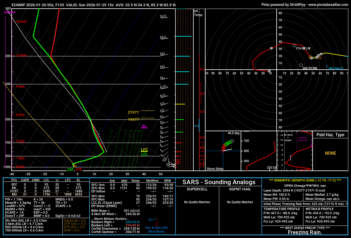
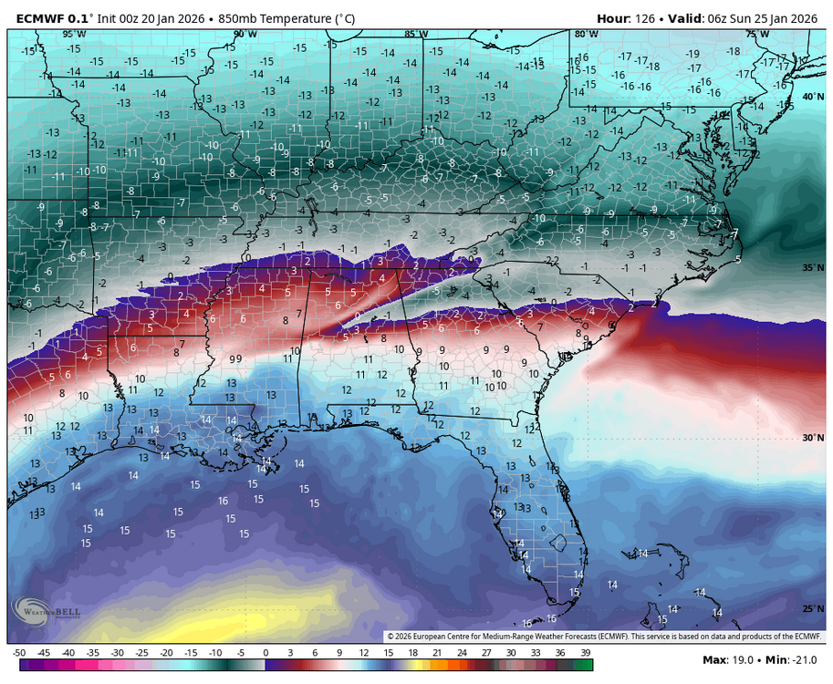
Yep depth of the cold is the key here. There will no doubt be a warm nose, but experience says the heart of the wedge will almost always verify with more SN/IP. Alluding to that, one thing that stuck out to me on that Euro was the wedge signature starting to show up even at 850mbar. That is deep cold. As a result the sn/ip line held south for longer than earlier runs despite being more amped. Not to mention the potential for dynamic cooling fighting against the warm nose with such high rates possible.
-
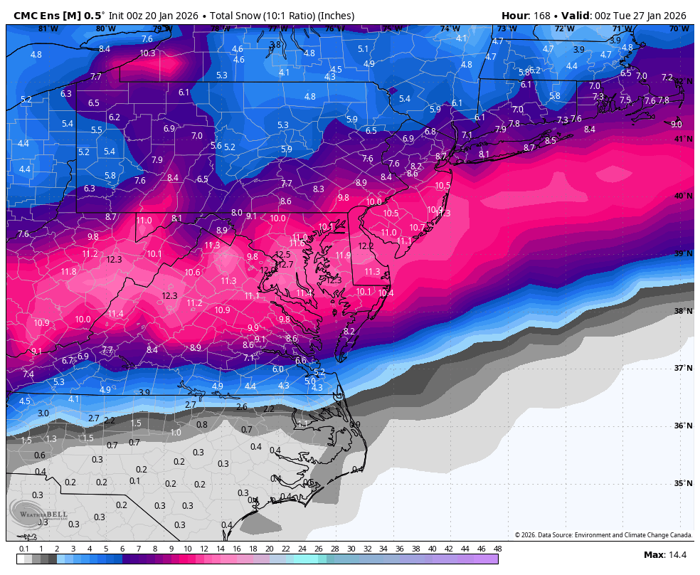
WB 0Z ensembles: GFS, Can., EURO AI, and EPS GN!


-
Yeah, hoping for sleet for y'all if it isn't going to be snow!
-
Behind the system at 12z vs 0z.
-
.
-
Dec. 2002 was like that here. We got the parfait... Snow, then sleet, then the 0.75" of ZR.
-
Yep. We had a good one in 2000, but it wasn't this big. I am just praying it all turns to sleet at this point. I don't want any part of that mess.
-
Euro just absorbs the Baja. Weird to see that big of a jump. .
-
Live in Norfolk, VA, now but I grew up in NE GA. Can't remember an ice storm looking like this since maybe the early to mid 2000s? I remember one where you could just hear tree limbs snapping continuously all through the night. No power, of course. Thank god we had a wood stove!
-

Possible Record Breaking Cold + Snow 1/25 - 1/26
Rjay replied to TriPol's topic in New York City Metro
-
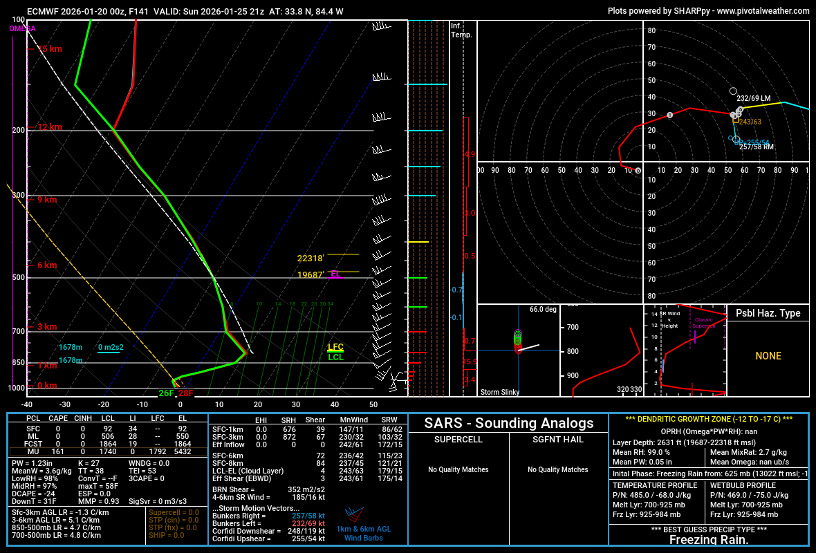
Not sure what happens that Euro run. It handles the cold bizarrely. At 12z the temperatures after the system passed were in the low 10s or colder Monday morning. Now they are in the lower 30s across eastern Tennessee. It's strange.
-
I'm telling you all what you don't want with this storm, and it's this centered over the Atlanta metro via the 00z Euro. Do not be in the ZR swath with this thing.
-

January 2026 regional war/obs/disco thread
WinterWolf replied to Baroclinic Zone's topic in New England
That Euro run is a full day or two later. -
Yeah. And realizing that the Euro is a long duration thing. Euro tends to (over) do that a lot.
-
Past events like this though it never grasps the depth of the cold layer in that area til inside 36-48. 2/2014 I was forecasting and at this range it also appeared to be FZRA, I think even until 48-72 it did
-
January 2026 regional war/obs/disco thread
WxWatcher007 replied to Baroclinic Zone's topic in New England
-

Possible Record Breaking Cold + Snow 1/25 - 1/26
SACRUS replied to TriPol's topic in New York City Metro
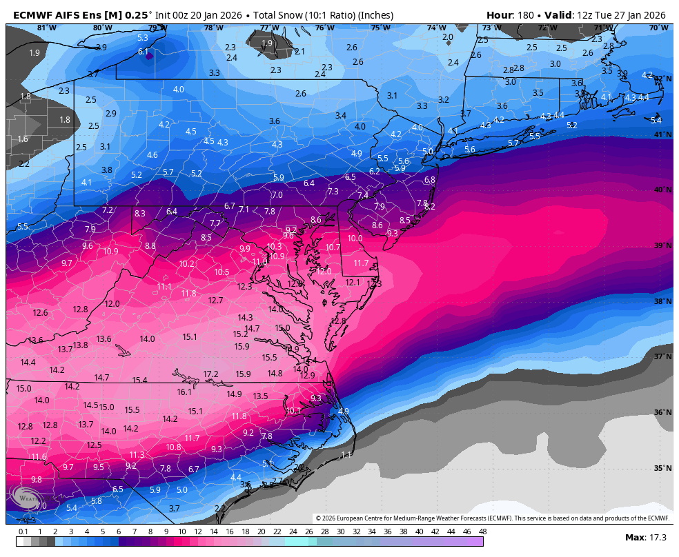
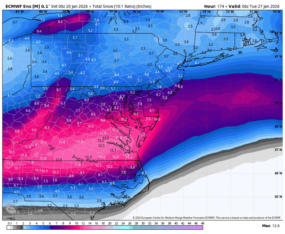
Euro total QPF long duration into Tue -
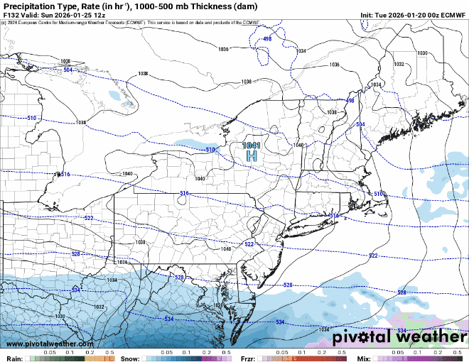
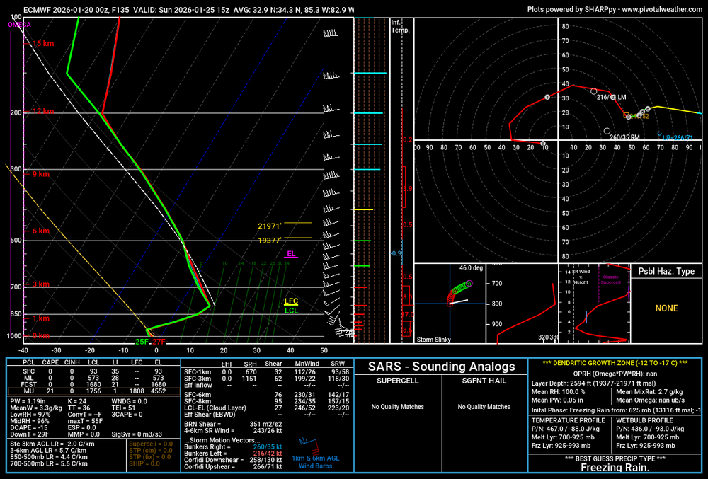
That is absolutely not sleet via the 00z Euro in the Atlanta metro during the peak of the event.

-
For GA folks, this starts on the EURO about 7AM Saturday morning and doesn't stop freezing rain / sleet until Sunday at midnight. Dare I say this will be the ice storm of the century as modeled? That just seems insane to type. I hope it's a raging sleet storm otherwise, we are in deep poo.
-
This is a 30+ hour event on the euro as well.
-
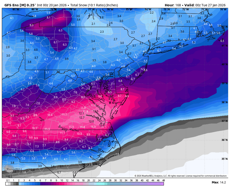
That is a ridiculous amount of sleet for VA. Shoveling 1 inch is bad enough…7 inches would be torturous.
-

Richmond Metro/Hampton Roads Area Discussion
chris624wx replied to RIC Airport's topic in Mid Atlantic
00Z Euro still good except it really gets mixing and change over to rain into NE NC/SE VA at the end of the event. -
January 2026 regional war/obs/disco thread
WxWatcher007 replied to Baroclinic Zone's topic in New England
Big cold still shows up Saturday and Sunday. A little more muted further north. -
Being in Greeneville and seeing that new Euro run. Here we go with the warm nose. It’s impossible for it not to happen in the last 8 years or so