All Activity
- Past hour
-

Wounded Duck Strikes Back: Dec 26 & 27th Winter Storm Obs
weathafella replied to WxWatcher007's topic in New England
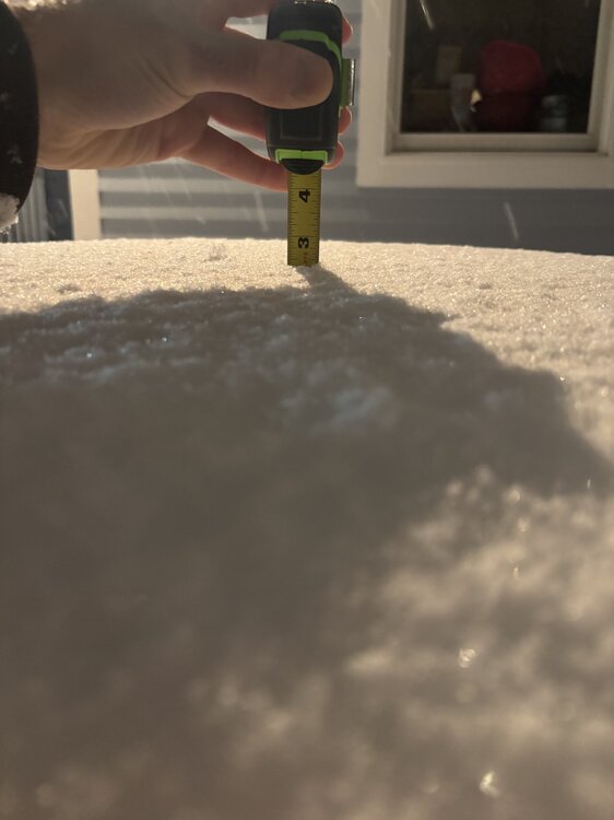
3” and still counting. -

Wounded Duck Strikes Back: Dec 26 & 27th Winter Storm Obs
CTSkywarn replied to WxWatcher007's topic in New England
North Madison, CT: 20°, SN, 7.1" as of 2 AM. Still coming down! -
yup, still light-mod snow here, measured 2.4” 10 mins ago… very happy to end up getting close to 3” when all is said and done given how the event began
-

Wounded Duck Strikes Back: Dec 26 & 27th Winter Storm Obs
WxWatcher007 replied to WxWatcher007's topic in New England
Snowing nicely here and at WXW1. Up here the radar has filled in nicely. -
Sorry to say but this storm was over before it start on the NYC/WLI area. And now....it's really over. Solid 1" here in North Western Nassau
-

Wounded Duck Strikes Back: Dec 26 & 27th Winter Storm Obs
RyRyB replied to WxWatcher007's topic in New England
Heavy batch coming thru Wallingford now Sent from my SM-G998U using Tapatalk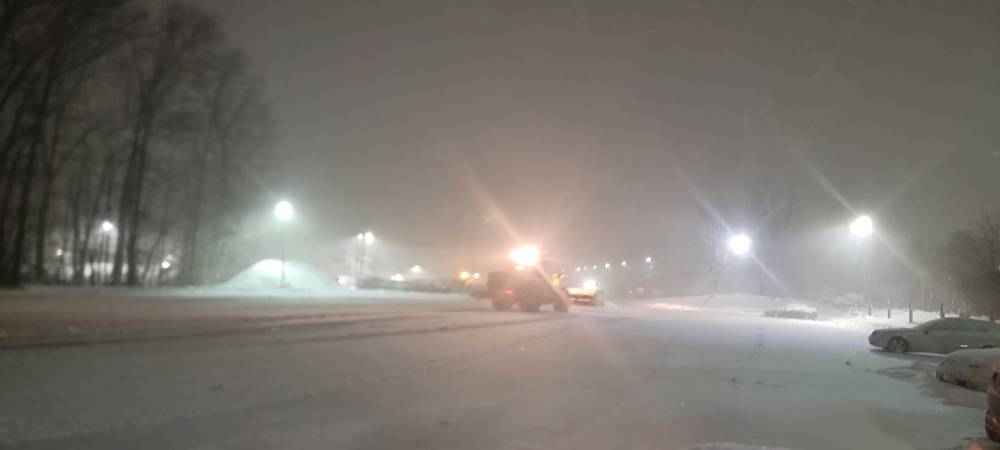
-
5.2 inches as of 1:30 in Highland Mills, Orange County NY, 16.8 inches for the season. Light snow and 20.1°. Maybe we can still eke out 6 inches by morning.
-
Still snowing steadily at my parents’ house in Lindenhurst (SW Suffolk). This latest band has delivered nicely. About 5.5 inches on the ground now.
-
Use jfk or ewr plenty of snow left
-
We did it!
-
Radar returns have moved east of Morris County, but it's still snowing steadily. Looks a bit like an inverted trof. I suspect it's low level stuff below the radar beam. Let's keep it going a few more hours!
-
The Central Park 1am measurement of 2.3 inches appears in line with the surrounding area for a change. Maybe enough people complained, however from experience, it rarely lasts.
-
4.5” on the table as of now. Final band may get me to 5”
-
Jersey City 1:00 AM
-

Wounded Duck Strikes Back: Dec 26 & 27th Winter Storm Obs
40/70 Benchmark replied to WxWatcher007's topic in New England
1/2" of sand...about as expected. Nice, wintry night. Congrats, CT. -
I measured 1.6" here. The snow on the back end of this storm prevented it from being a complete disaster, but still a pretty big bust. I thought we'd get at least 4 from this event. Pretty bad that it's a mighty struggle just to get to 2. I see the backbuilding on radar, but it's only very light snow. Definitely time for sleep.
-
That was at 5Z, the 6Z report is 2.3 inches.
-

Wounded Duck Strikes Back: Dec 26 & 27th Winter Storm Obs
TheSnowman replied to WxWatcher007's topic in New England
Radar over RI and Especially Western MA are FAR better than expected. And NYC actually got screwed! Haha -
There’s just bands riding the south shore crawling… belt parkway camera has been whiteout conditions for almost an hour
-
Which breaks the nearly five year string of below normal snowfall calendar months.
-
We got about 1/2" from that good band over the last hour or so and we're up to 1.7" as of about 1:15 am. Still snowing despite the radar looking weak; the short range models also don't show much after 2 am, so I might actually get some sleep. Not sure we'll make 2.0".
- Today
-

Central PA Winter 25/26 Discussion and Obs
MAG5035 replied to MAG5035's topic in Upstate New York/Pennsylvania
I’d just return back with this haha. It sure looks chilly the 7 days following the frontal passage Monday, which could bear some similarities to the strong frontal passage last Friday. In this case though, it looks like it will be reinforced holding colder temps for a longer period and perhaps setting up some kind of follow up wave later next week. We shall see. At any rate, things are pretty well wrapped up here. Still messy but winds have mixed down warmer temps and now i have KRUIN beat with a temp of 36ºF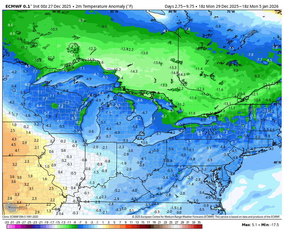
-

Boxing Night Snow/Sleet/Ice Dec 26-27 Storm Thread/Obs.
Albedoman replied to Mikeymac5306's topic in Philadelphia Region
Winter is going to take a brief break after this BS first of the year storm of only 1-3 inches if we are really lucky. I see no snowstorms until after the 15th and it will warm up into the upper 40's to 50's . I do think we will pay the piper for this brief warm up by Marin Luther Kings day-- seems to be the pattern the last 5 years. All I can say is the drought situation in our area is only going to worsen as the Gulf storm production is shut down for business. Believe me, dried up wells and sinkhole formation with dropping groundwater tables with waterline breaks galore will be the talk of the town in the next three weeks as the ground starts to thaw out with what little moisture is in it. The base flows of the creeks will begin to drop again too. We really need a 96 type of storm event asap. -
6” miller place. A little disappointed but I’m being greedy. If I can get to 7” that will give me 15” for December. I’ll take it!
-
ISP reporting 5"


