All Activity
- Past hour
-
Same here. We have seen so many modeled hits fizzle out.
-

September 2026 Medium/Long Range
Stormchaserchuck1 replied to JenkinsJinkies's topic in Mid Atlantic
I was 15, keeping a weather journal. Only year I ever did one. Picked one hell of a year for that huh! I was looking back and there was snow 4x in October, but it could have been flurries, or even just flakes -

Septorcher 2026 Discussion - Endless Summer
Great Snow 1717 replied to Damage In Tolland's topic in New England
Is the September torch happening today or tomorrow?? -
 discount ed pills and cheap ed pills best online ed medication https://www.google.pt/url?sa=t&url=https://apexmenmeds.com ed med online or https://act2day.eu/profile/kxoipgypsu/ online erectile dysfunction medication [url=https://www.google.gg/url?sa=t&url=https://apexmenmeds.com]buy erectile dysfunction medication[/url] cheapest ed medication or [url=http://asresin.cn/home.php?mod=space&uid=1246443]best ed medication online[/url] buy ed meds
 -
...Is it too early for me to come out of hibernation? How much snow will I see this year?
-
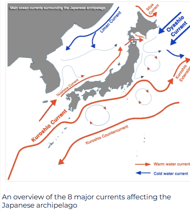
Starting to believe why we see it so warm in the West Pac is being caused by the Kuroshio Current. The Kuroshio is a feeding area for typhoons in which they can strengten SIG. as they track towards East Asia But the Kuroshio forms eddies and in which helps transport warm surface SSTS along it.Seen a couple papers i read in relationship to the ENSO when its a Central based NINO.The Kuroshio isnt as strong but also said more studies needed I believe its around the Kuroshio extension has the strongest currents in the world
-
I didn't think I was going crazy. BWI reported no snow in 10/02...not even a trace. For BWI, snow in November is a good (but not guaranteed since nothing in weather ever is) sign, but not October.
-

2026-2027 Record-breaking El Nino
40/70 Benchmark replied to Stormchaserchuck1's topic in Weather Forecasting and Discussion
I agree....they way I interpret that is some second half volatility. I don't see the season averaging -NAO. I think wave reflection is the path this year....like 1983. I don't think a reversal is in the cards. Guidance may try to flag one, and then back off. -
 8.27” final. Nice drink. Let’s see if we can get some sun out the rest of the week to green up that lawn.
 -

October Comes Early: Late September Multi-Hazard Hybrid Storm
CoastalWx replied to WxWatcher007's topic in New England
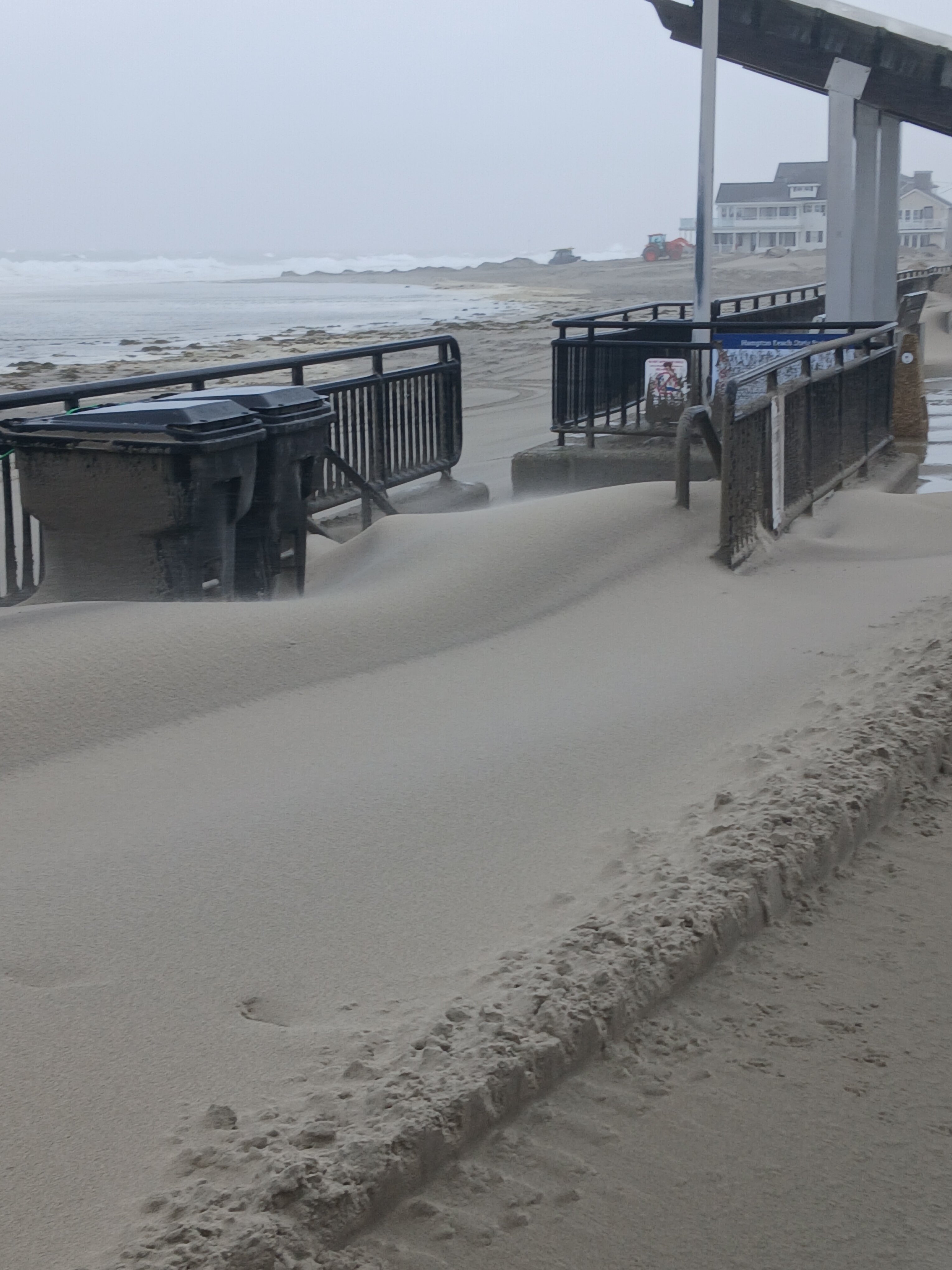
Ha that’s pretty cool. Haven’t seen sand drifts like that. -

October Comes Early: Late September Multi-Hazard Hybrid Storm
ineedsnow replied to WxWatcher007's topic in New England
We drift!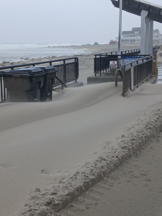
-
October Comes Early: Late September Multi-Hazard Hybrid Storm
ineedsnow replied to WxWatcher007's topic in New England
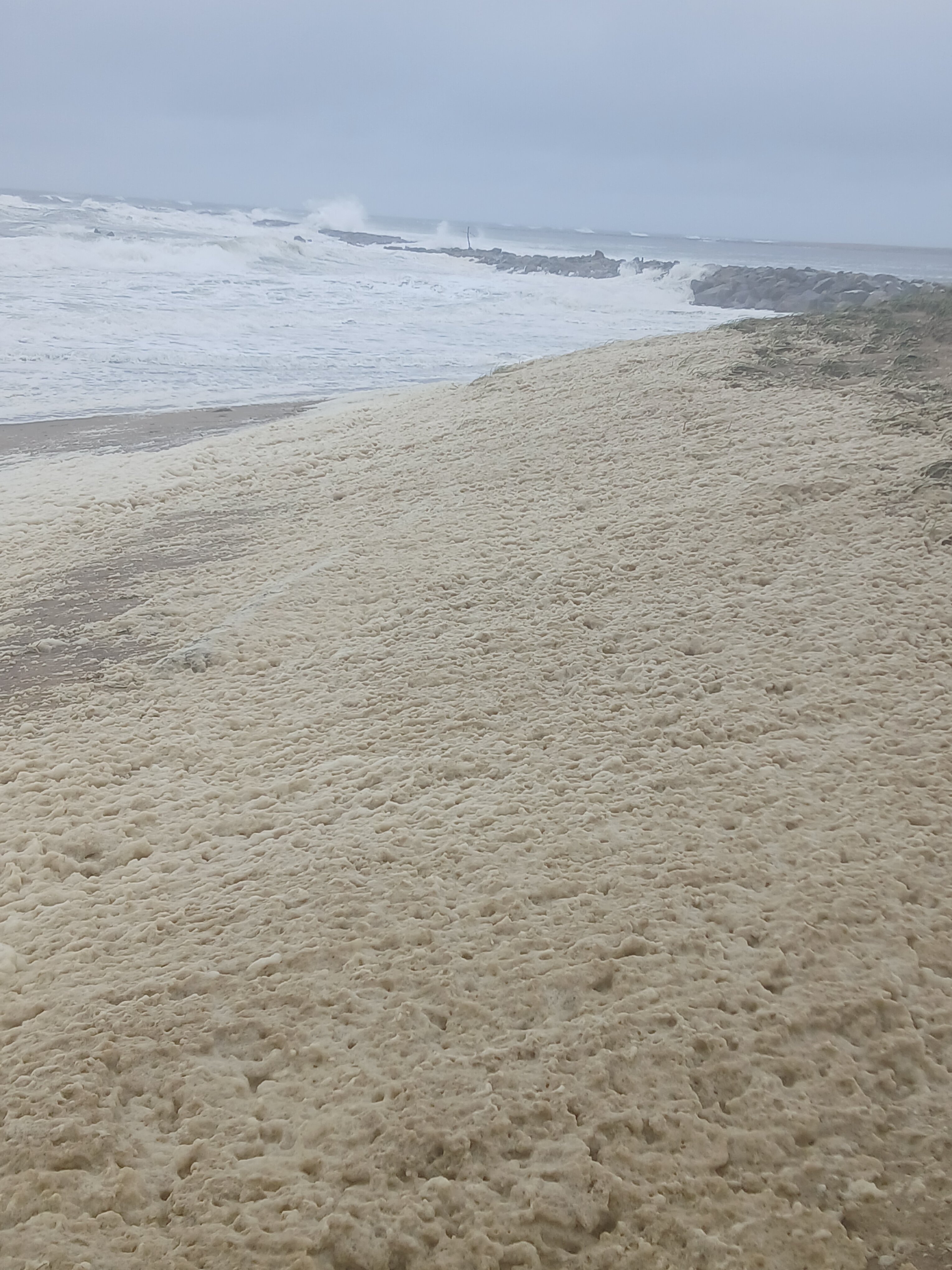
didn't stand in it but I did see a lady pick some up.. there was a ton of it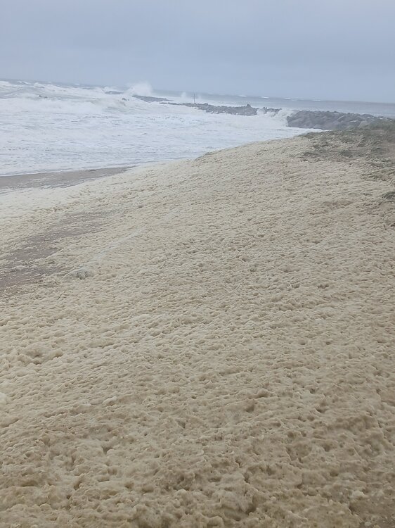
-

2026-2027 Record-breaking El Nino
LibertyBell replied to Stormchaserchuck1's topic in Weather Forecasting and Discussion
The summer of 1983 behaved like a la Nina though from June through September with the endless historic heat. I see the same thing for next summer. Same reason as 2015-16 with the Kara block added in? Did we have such a block in February 1983 too? -
Above normal is the not-so-new normal.
-
Looks slightly negative overall.. with seasonal models. I just don't know that I think we are in a -NAO time right now
-
Generic Cialis without a doctor prescription: TadaStream - Buy Tadalafil 20mg
-
2026-2027 Record-breaking El Nino
40/70 Benchmark replied to Stormchaserchuck1's topic in Weather Forecasting and Discussion
Both are elite polar analogs. -
2026-2027 Record-breaking El Nino
LibertyBell replied to Stormchaserchuck1's topic in Weather Forecasting and Discussion
Did you mean December 1992 Chris? That storm was far more historic than this one. Like 1983 it won't stop a historic hot summer for next year. Yes but 1983 had an exceptional endless hot summer from June through September so the el nino did not make the summer cooler. 1982-83 and 2015-16 had some similarities. If anything it would be less snow than 1997-98 as that late March event was a complete fluke and the airports got less snow. 2001-02 had even less snow. At the coast latitude doesn't really matter unless you're north of 42N you have the potential to be completely shut out of snow. Both 1982-83 and 2015-16 were far better for snow than 1997-98 was with much more late season blocking. In April 1983 JFK had their latest snowfall on record. -
2026-2027 Record-breaking El Nino
40/70 Benchmark replied to Stormchaserchuck1's topic in Weather Forecasting and Discussion
I was just thinking that this is likely our way out of the 2023-redux hell.....the EPO and WPO were both dreadful, and we seem to have seen a bit of a decadal shift in that respect after a several year stretch that was pretty bad. Your NAO period is about done....must have largely neutralized... -
October Comes Early: Late September Multi-Hazard Hybrid Storm
CoastalWx replied to WxWatcher007's topic in New England
It was highly anomalous for this time of year, and with weekends busy with activities, I don’t have an issue with it being a top story. I will say I was a little surprised at the lack of damage and power outages with winds near 50kts. Then again Mother Nature has done some good tree trimming around here since 2010 or so. -
October Comes Early: Late September Multi-Hazard Hybrid Storm
CoastalWx replied to WxWatcher007's topic in New England
I have no idea what he’s talking about. It was a top story, but the communication by local Mets looked on point. NWS called for minor CF with pockets of moderate potential and that’s what happened. Winds were correct and I think models did a good job with the NW-SE max QPF in SE MA to metro west. - Today
-
From 5AM EDT NHC discussion: Hurricane Polo Discussion Number 35...Corrected NWS National Hurricane Center Miami FL EP172026 200 AM MST Tue Sep 29 2026 Corrected for Key Message number 1. Polo made landfall around 06Z along the west coast of Baja California Sur, just south of the small town of Las Barrancas. Several microwave fixes received after the 03Z advisory went out (WSF-M, SAR, and two ASCAT passes) all indicated that center of Polo was a bit farther south than was estimated at 03Z.There is some uncertainty in what the intensity was at landfall, but given all the data we have received, it is likely that Polo was a category 2 hurricane at the time of landfall with maximum winds in the 90-95 kt range.
-
You got it with those correlation maps.. lack of a SE trough accentuates SE Canada ridge, or extends it south. The issue I think is - what is the Pacific pattern in that circumstance? It may favor a ridge NE of Japan or west-based -PNA with the NPH area off the West coast (most impacted region of east-based Nino) having a negative anomaly. I don't think the EPO and WPO are big parts of the ENSO/PDO, a little more random further north than what we are discussing. Negative EPO could come to our rescue this Winter but that index is the hardest to predict seasonally.
-
2026-2027 Record-breaking El Nino
40/70 Benchmark replied to Stormchaserchuck1's topic in Weather Forecasting and Discussion
Yep....no doubt. I don't dispute any of that...the neutralization of the PDO is a guess on my part. -

2026-2027 Record-breaking El Nino
bluewave replied to Stormchaserchuck1's topic in Weather Forecasting and Discussion
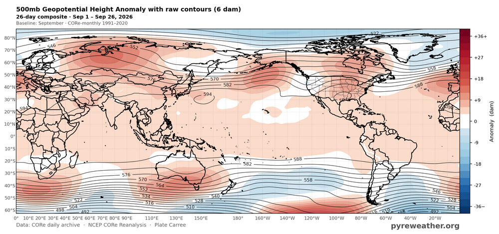
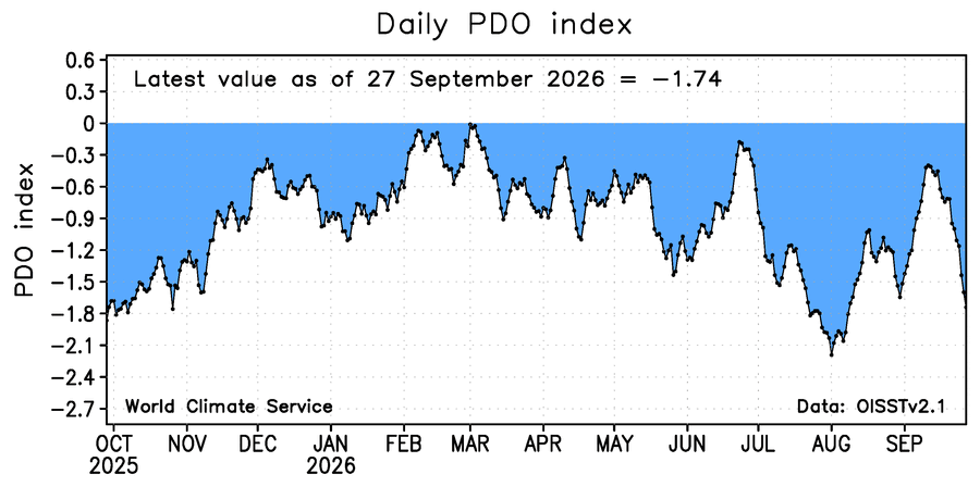
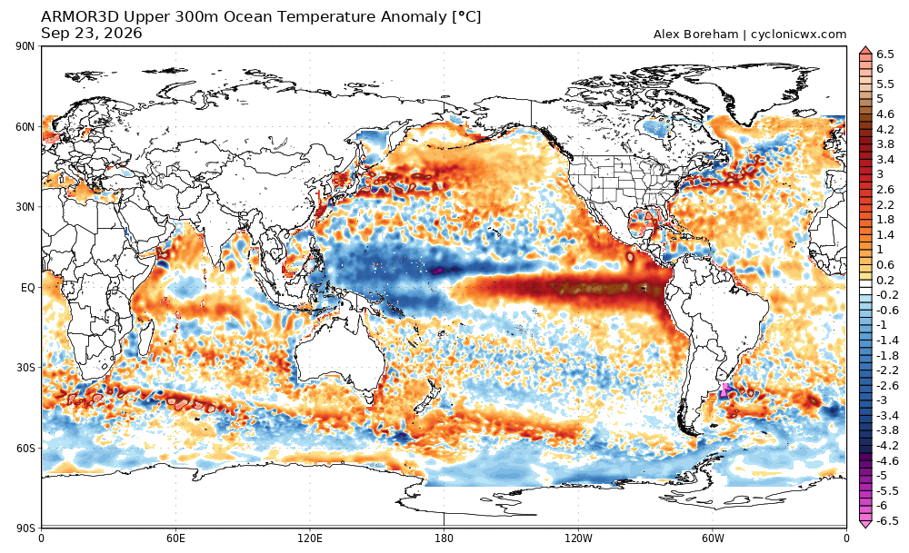
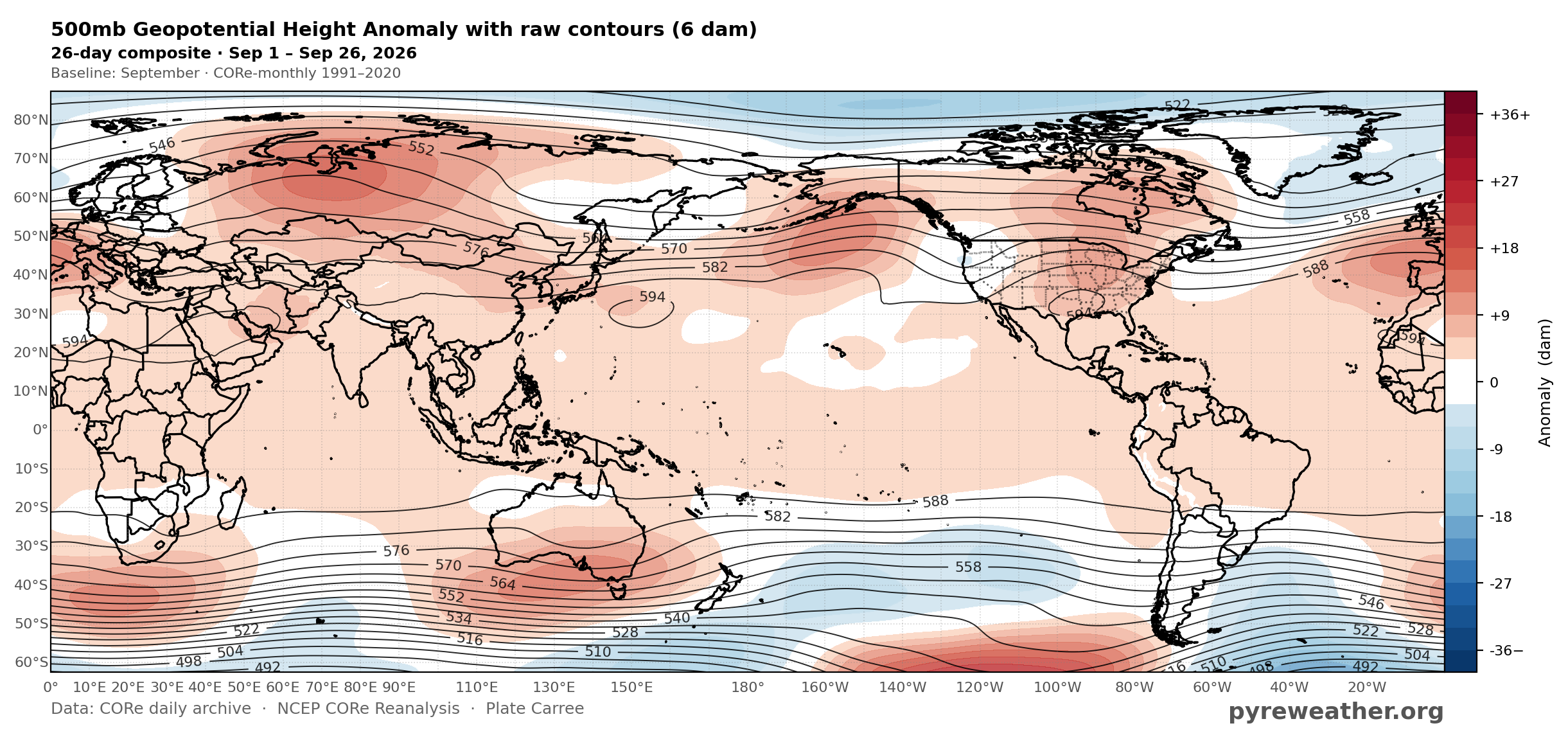
You can see a the continuous 500mb mid-latitude ridge from Japan across to the CONUS drove another big PDO drop in September. This has been a repeating theme during the 2020s. PDO attempts to go neutral than makes another big decline. The record warm subsurface east of Japan to south of the Aleutians tells the story.