All Activity
- Past hour
-
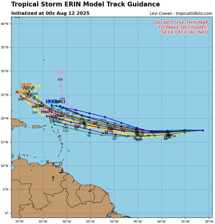
Remember that you need two huge changes to occur: 1) the Atlantic ridge is substantially stronger for longer to push Erin deeper into the SW Atlantic AND 2) A cutoff trough at the right time to pull it up the coast, which also requires that Canadian troughing showing up in the long range across guidance to essentially be replaced with a ridge or at least something that isn't screaming NW flow. Not impossible, but that is a very tall task. @CoastalWxwe go all winter and summer with ridges, SW flow, and trough de-amplification and as soon as there's a tropical system that all goes poof. San Diego
-
When even SLK at almost 1,700ft is hitting 90F… you know it’s hot.
-
Gorgeous night for a swim
-
First one is 12z Bozo
-
12z was wet too GFS is lol
-
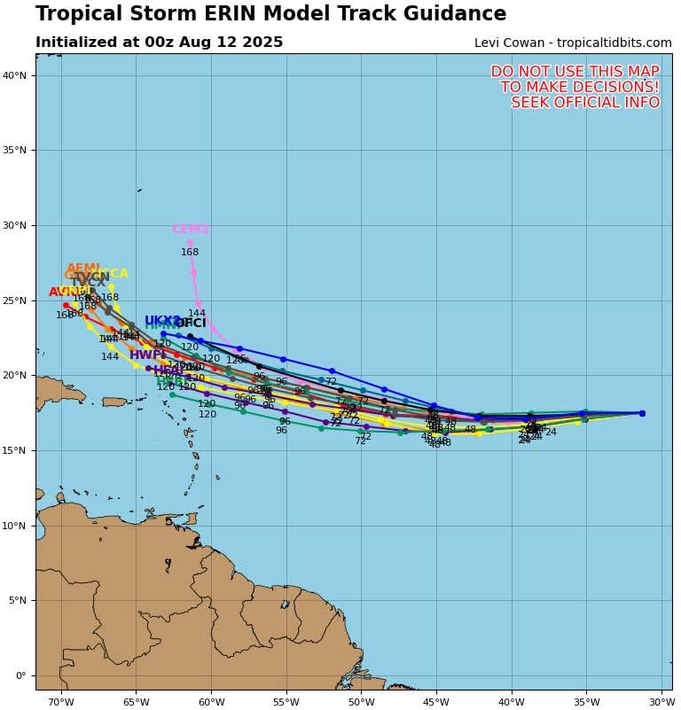
Keeps going south and later recurve

-
More flatter
-
Ah the 18z Euro when all else fails. Good luck and I’ll sell
-
 Some very impressive highs across the "Empire State" including 96 at Dansville, 95 at Massena, 95 at Ogdensburg, 94 at Fort Drum, 93 at Fulton and Syracuse. The Miramichi, NB reading was 37.6C BTW, or 99.68F (basically 100F if you use typical American temperature rounding)!
 -
 High of 93 here, same as yesterday. Very dry summer here, that July 31st event being the only exception.
 -
 The 18z GFS has a recurver off the coast next Friday, but with some high clouds and NE or easterly winds, it gets us to near 90 degrees? That's BS
 -
The last time this feat was met was July 6-8, 2010!
-
He didn't look
.png.25ef4f40b39616c7a006f16ea94557f3.png)
.png.003fe62153969d19768d9cb2c82d51f4.png)
-
Topped out at 95° at ORD and 94° at MDW on Saturday. On Sunday, MDW hit 92° (ORD 89°'d). ...2025 90°+ Day Tally... 26 - MDW 26 - PWK 25 - ORD 25 - DPA 23 - ARR 20 - RFD 20 - LOT 16 - UGN
-
-
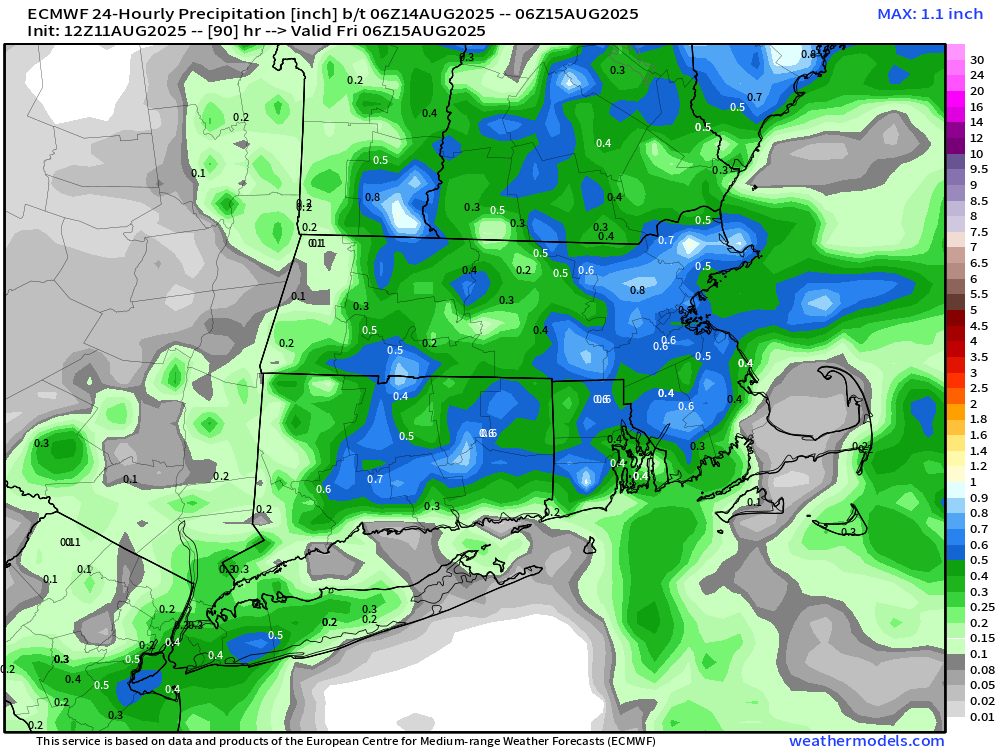
Looks like VT into NW MA.. but everything Steins heading SE as it’s at night
-
Too late Anthony, too late.
-
Lets see how far west it tracks before it heads north and how much strength it gains.
-
If this started out further south then maybe. But we're already at a disadvantage.
-
Some will get showers but certainly not widespread.
-
Nothing shows that
-
Well we did do historic last year with Beryl very far south and a Category 5 on July 1st so who knows.
-
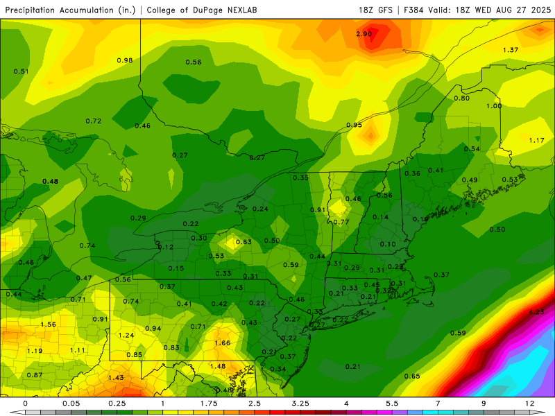
Good luck. 18z AI way west and still only my worst case scenario of breezy and a few showers on the cape. Yawn.
-
When I first saw this, I thought it was a @Jebmanpost.


.thumb.png.4150b06c63a21f61052e47a612bf1818.png)

